


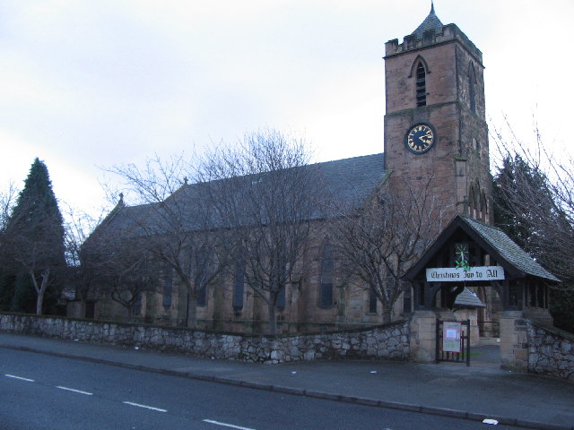

Why visit Deeside
Townapedia lists 6 museums and landmarks, 14 parks and trails, 73 places to eat, 1 place to stay and 4 attractions in and around town.
Highlights include Bretton Bridge, Flintshire Bridge, Connah's Quay War Memorial and Ewloe Castle.
Weather in Deeside
Forecast from MET Norway (CC BY 4.0). Full forecast
About Deeside
Deeside (Welsh: Glannau Dyfrdwy) is the name given to a predominantly industrial conurbation of towns and villages in Flintshire and Cheshire on the Wales–England border lying near the canalised stretch of the River Dee that flows from neighbouring Chester into the Dee Estuary. These include Connah's Quay, Shotton, Queensferry, Aston, Garden City, Sealand, Broughton, Bretton, Hawarden, Ewloe, Mancot, Pentre, Saltney and Sandycroft. The population is around 50,000, with a plurality (17,500) living in Connah's Quay.
From the Wikipedia article Deeside (this version), under CC BY-SA 4.0.
Travel tips from other travellers: Deeside on Wikivoyage (CC BY-SA 4.0).
Things to do4



Museums and landmarks6



Parks, trails and playgrounds14







2 more on the map.
Restaurants and cafes73



Indian Saffron
Restaurant · Indian · 0.8 mi
44 Station Road, Deeside
Mo-Th 17:00-22:00; Fr-Su 17:00-22:30

The Wepre Bar & Grill
Restaurant · British, Burger · 1.6 mi
Tu-Th 12:00-21:00; Fr-Sa 12:00-22:00; Su 12:00-21:00
61 more on the map.
History
Shotton's history dates back around 1000 years to Saxon times. Various settlements within the Deeside area are recorded in the Domesday book (1086) which list them within the Cheshire Hundred of Ati's Cross. They are Aston, Broughton, Clayton, Hawarden, Golftyn and Wepre. The largest of these was Hawarden with 14 households.
As a border region, the Deeside area was subject to frequent conflict between the Welsh and the English in the twelfth and thirteenth centuries. In the Battle of Ewloe in 1157, Owain Gwynedd inflicted a notable defeat on the forces of Henry II. Ewloe Castle was built by Llywelyn the Great in the early thirteenth century to secure the area. Llywelyn's son and successor, Dafydd ap Llywelyn, was born in nearby Coleshill in 1212.
Until industrialisation in the nineteenth century, Shotton remained a cluster of hamlets: a settlement comprising Shotton, Nine Houses and Shotton Hall, which itself dates back to 1637. Coal mining developed in the eighteenth century, then in 1889 the opening of the Hawarden Railway Bridge over the River Dee improved access to the reclaimed Dee Marshes. Following this, in 1895, the Summers family purchased 40 acres (160,000 m2) of Dee marshland, on which they established Shotton Steelworks.
Read more of the history
In September 1896, Shotton Steelworks began producing sheet steel. The development of this steelworks on the banks of the River Dee changed an area that was once mainly marshland, with Shotton – just across the Dee – previously little more than a hamlet. Shotton Steelworks led to the development of whole communities to house the influx of workers, estimated up to 13,000 at the height of the industry, with Shotton and Connah's Quay Jetty hubs of activity serving the steelworks. There were also brickworks and other industries in and around Shotton, and Connah's Quay developed as a town on the banks of the Dee Estuary, becoming known for its shipbuilding industry.
From the History section of Deeside on Wikipedia, under CC BY-SA 4.0.
More about Deeside
Education
Primary schools in the area include: Ewloe Green Primary, Well House Primary School, Bryn Deva Primary, Wepre Primary, Ysgol Cae'r Nant (Brookfield Primary), Golftyn Primary, Venerable Edward Morgan, Sealand County Primary, Sandycroft County Primary, St Ethelwold's Primary School, and most importantly, Queenferry County Primary School.
Secondary schools in the area include: Connah's Quay High Hawarden high School (Connah's Quay), Elfed School (Buckley), John Summers High School (Queensferry) which closed on 20 July 2017, and St David's High School (Saltney).
Coleg Cambria is a large and popular college in Connah's Quay. It offers a range of full and part-time courses as well as apprenticeships. In an inspection in 2007 the college gained the highest possible grade 1 inspection ratings for its work-based learning provision.
The college was formed in August 2013 through a merger between Deeside College and Yale College Wrexham; it is now one of the largest colleges in the UK and the largest in Wales.
From the Wikipedia article Deeside, under CC BY-SA 4.0.
Notable people from Deeside
- Darren WynneEnglish footballer (born 1970)
- Harry HollisWelsh footballer (1913-1982)
Born in Deeside, according to Wikidata (CC0). Each name links to its Wikipedia article.
Where to stay1
Churches and places of worship26
Shopping11
Gas and EV charging2
Schools, colleges and libraries18
Healthcare10
H.A. Crook Pharmacy
Clinic and pharmacy · 0.8 mi
23-25 Chester Road West, Deeside
Map of Deeside
165 places. The map loads OpenStreetMap tiles when you open it.
Getting there and nearby towns
Hawarden Airport (CEG) is the nearest airport with scheduled flights listed in OpenStreetMap, 3 miles away.
- Hawarden 1 mi southeast, about 2 min by car
- Buckley 3 mi southwest, about 5 min by car
- Blacon 5 mi east, about 8 min by car
- Flint 5 mi northwest, about 8 min by car
- Mold 5 mi southwest, about 8 min by car
- Chester 6 mi east, about 10 min by car
- Neston 6 mi north, about 9 min by car
- Ellesmere Port Town 8 mi northeast, about 13 min by car
- Heswall 9 mi north, about 15 min by car
- Brymbo 9 mi south, about 15 min by car
Drive times are estimates from straight-line distance, not routes.
Towns near Deeside


Keep exploring
Local news
Headlines from INDB.
Reviews, tips and questions
Loading what members have shared...
Sources and licences
- GeoNames (CC BY 4.0): population, coordinates, regions and time zone
- Mapillary (see each image): photos
- OpenStreetMap contributors (ODbL 1.0): places, airports, map data
- Wikidata (CC0 1.0): elevation, founding date, time zone, website, landmarks and historic places
- Wikimedia Commons (see each image): photos
- Wikipedia (CC BY-SA 4.0): overview and history text
Photo credits
- Deeside Power Station Amp Flintshire Bridge, Lauren, CC BY 3.0
- Bridge over Wepre Brook, Flintshire, Rept0n1x, CC BY-SA 2.0
- St Davids Church Connah's Quay, Steventattum, CC BY 3.0
- St Ethelwold's Church, Shotton (1), Rept0n1x, CC BY-SA 3.0
- Connahs Quay St Marks Church, Phil Williams, CC BY-SA 2.0
- Parish Church of St Matthew, Buckley, Phil Williams, CC BY-SA 2.0
- St Michael's Church, Shotwick 2, Rept0n1x, CC BY-SA 3.0
- St Deiniol's Church, Hawarden, Sue Adair, CC BY-SA 2.0
- Llyfrgell Sant Deiniol and Gladstone's Library Hawarden Penarlâg 10, Llywelyn2000, CC BY-SA 3.0
- Castell Ewlo, Sir y Fflint, Gorffennaf 2026 - Ewloe Castle, Flintshire, Wales; Built by the Welsh; July 2026 03, Llywelyn2000, CC BY-SA 4.0
- Hawarden Village Glynne Arms, Gammock, CC BY-SA 4.0
- Fox and Grapes, Hawarden, Dave.Dunford, CC BY-SA 4.0
- The War Memorial, Connahs Quay, Pete Rigby, CC BY-SA 4.0
- Blessed Trinity Church side, Queensferry, Pjposullivan, CC BY-SA 4.0
- Flintshire Bridge aerial view, DronePics.Wales, CC BY 4.0
- Hawarden Bridge Station, Dennis Turner, CC BY-SA 2.0
- Level Road Park, Stinkybifta, CC BY-SA 4.0
- Street-level photo, RyanBush, CC BY-SA 4.0
- Street-level photo, RyanBush, CC BY-SA 4.0


Page built November 10, 2026. Spotted a mistake? Tell us or suggest a place.