


Why visit Blacon
Townapedia lists 18 museums and landmarks, 13 parks and trails, 39 places to eat, 7 places to stay and 11 attractions in and around town.
Highlights include Bridge of Sighs, Bridgegate, Bretton Hall, Flintshire and Castra Deva Victrix.
Weather in Blacon
Forecast from MET Norway (CC BY 4.0). Full forecast
About Blacon
Blacon is a suburb of Chester, England. It is predominantly a council housing estate and was formerly regarded as one of the largest council estates in Europe.
From the Wikipedia article Blacon (this version), under CC BY-SA 4.0.
Things to do11


Chester Storyhouse
Cinema and theater · 1.7 mi
Arts centre (theatre, cinema, library) in Chester, England, incorporating the former Odeon Cinema

Chester Zoo
Zoo and aquarium · 2.1 mi
Zoological garden at Upton-by-Chester, in Cheshire, England

Grosvenor Bridge
Bridge · 2.1 mi
Grade I listed bridge in Chester, England

Newgate, Chester
Bridge · 2.0 mi
Grade II listed gateway in Chester, UK


Old Dee Bridge
Bridge · 2.2 mi
Grade I listed bridge in Chester, England

Watergate, Chester
Bridge · 1.7 mi
City gate and bridge in Chester, England

Gateway Theatre
Cinema and theater · 1.8 mi
Former theatre in Chester, England
Grosvenor Park Open Air Theatre
Cinema and theater · 2.2 mi
Open-air theatre in Chester, England
Museums and landmarks18
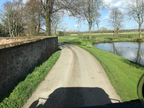
Bretton Hall, Flintshire
Monument and historic site · 3.0 mi
Former fortified manor house on the England/Wales border

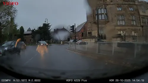
Cenotaph to Matthew Henry
Monument and historic site · 2.0 mi
Grade II listed memorial in Chester, UK

Cheshire Military Museum
Museum · 2.0 mi
Military museum in Chester, United Kingdom

Chester Roman Amphitheatre
Monument and historic site · 2.1 mi
Roman amphitheatre in Chester, Cheshire, England, UK
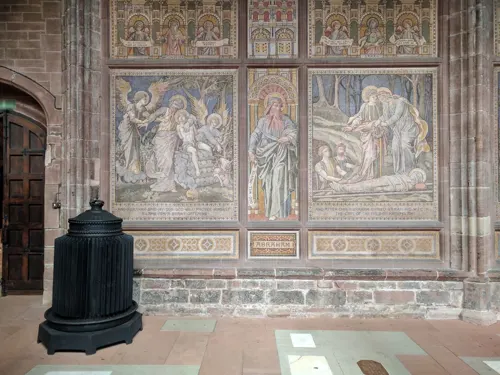
Chester War Memorial
Monument and historic site · 1.8 mi
War memorial in Chester, UK
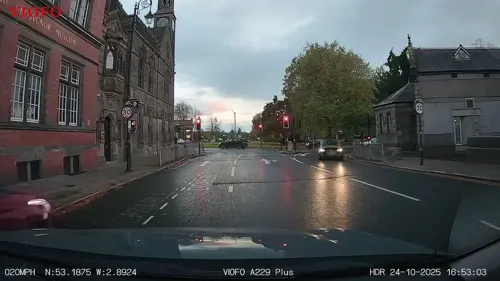
Grosvenor Museum
Museum · 2.0 mi
Natural history museum in Chester, UK

Heronbridge Roman Site
Monument and historic site · 3.3 mi
Archaeological site in Eaton and Eccleston, Cheshire West and Chester, England, UK

Minerva's Shrine, Chester
Monument and historic site · 2.2 mi
Grade I listed Roman carved shrine in Chester, United Kingdom

Sick To Death
Museum · 2.0 mi
Visitor attraction in Chester, England, UK

Phoenix Tower, Chester
Museum · 1.7 mi
Grade I listed building in Cheshire West and Chester, Cheshire, England, UK
6 more on the map.
Parks, trails and playgrounds13



Countess of Chester Country Park
Park · 1.0 mi
Country park in Upton, Cheshire, England


1 more on the map.
Restaurants and cafes39




27 more on the map.
History
Blacon was historically known as Blakon Hill and was owned by the Marquess of Crewe. The parish of Blacon cum Crabwall was formed in 1923. On 1 April 1936, under the Cheshire County Review Order 1936, most of the parish was transferred to Chester County Borough.
Blacon remained a small farming community until extensive housebuilding by Chester City Council began in the early 1950s. Much of the original estate was constructed during the decade to 1960. Further development took place on the former army camp site in South Blacon during the late 1960s, 1970s and 1980s.
'The Parade' shops, built in 1954 in North Blacon, are an example of municipal development. In 2015, the Parade Enterprise Centre opened as a joint venture between Avenue Services and Cheshire West and Chester Council. The centre accommodates Sanctuary Housing, Blacon Library, a community hall and offices for local businesses.
The British Army maintained a camp in South Blacon from shortly before until shortly after the Second World War. Wooden and Nissen hut structures were occupied by soldiers until the late 1950s. An army firing range remained in use until the construction of Chester City Council tower blocks in the mid-1960s. The camp housed various military operations, including aircraft and prisoners of war. The area continues to be referred to locally as 'The Camp'.
From the History section of Blacon on Wikipedia, under CC BY-SA 4.0.
More about Blacon
Geography
Blacon lies close to the England–Wales border, approximately 1 mile (1.6 km) north-west of Chester city centre, on elevated ground overlooking the city. The area was formerly farmland and remains bordered by open countryside. Views extend across Chester and towards the Welsh hills to the west.
Nearby settlements include Upton-by-Chester to the north, Saughall and Mollington to the north-west, Newtown to the north-east, and the border town of Saltney to the south. Blacon is approximately 6.5 miles (10.5 km) from Overpool on the Wirral.
From the Wikipedia article Blacon, under CC BY-SA 4.0.
Notable people from Blacon
- Stan BennionEnglish footballer (1938-2013)
Born in Blacon, according to Wikidata (CC0). Each name links to its Wikipedia article.
Where to stay7
Chester Crabwall Manor Hotel and Spa
Motel and hotel · 0.7 mi
Parkgate Road, Chester
Churches and places of worship41
Shopping12
Gas and EV charging4
Schools, colleges and libraries12
Chester Blue Coat Church of England Primary School
School · Anglican · 1.4 mi
Walpole Street, Chester
Healthcare5
Garrett Pharmacy & Western Avenue Post Office
Clinic and pharmacy · 0.6 mi
Western Avenue, Chester
Map of Blacon
162 places. The map loads OpenStreetMap tiles when you open it.
Getting there and nearby towns
Hawarden Airport (CEG) is the nearest airport with scheduled flights listed in OpenStreetMap, 3 miles away.
- Neston 7 mi northwest, about 12 min by car
- Speke 10 mi north, about 16 min by car
- Bromborough 10 mi north, about 16 min by car
- Heswall 11 mi northwest, about 17 min by car
- Halewood 11 mi north, about 18 min by car
- Woolton 12 mi north, about 19 min by car
- Dingle 12 mi north, about 19 min by car
- Prenton 12 mi northwest, about 20 min by car
- Birkenhead 13 mi north, about 21 min by car
- Liverpool 14 mi north, about 23 min by car
Drive times are estimates from straight-line distance, not routes.
Towns near Blacon


Keep exploring
Local news
Headlines from INDB.
Reviews, tips and questions
Loading what members have shared...
Sources and licences
- GeoNames (CC BY 4.0): population, coordinates, regions and time zone
- Mapillary (see each image): photos
- OpenStreetMap contributors (ODbL 1.0): places, airports, map data
- Wikidata (CC0 1.0): elevation, founding date, time zone, website, landmarks and historic places
- Wikimedia Commons (see each image): photos
- Wikipedia (CC BY-SA 4.0): overview and history text
Photo credits
- St Theresa's Catholic Church, Blacon (1), Rept0n1x, CC BY-SA 3.0
- Blacon railway station 1823495 febb5f91, Ben Brooksbank, CC BY-SA 2.0
- Bridge of Sighs Chester 392, RHaworth, CC BY 2.5
- Bridgegate, John S Turner, CC BY-SA 2.0
- Former Odeon Cinema, Chester, Rept0n1x, CC BY-SA 3.0
- Chester Zoo 2016 010 - Islands, Photograph by Mike Peel ( www.mikepeel.net )., CC BY-SA 4.0
- Grosvenor Bridge Chester4, Nabokov at English Wikipedia, CC BY-SA 3.0
- Newgate, Chester (2), Rept0n1x, CC BY-SA 3.0
- Northgate, Chester, chestertouristcom, CC BY-SA 2.0
- Dee bridge from Handbridge, Rodhullandemu, CC BY-SA 4.0
- Watergate, Chester, John S Turner, CC BY-SA 2.0
- DevaMinervaPlan(bq), Łukasz Nurczyński, CC BY-SA 4.0
- Chester Castle - outer bailey - A Block, Worm That Turned, CC BY-SA 3.0
- Chester amphitheatre, Nadia from Sydney, Australia, CC BY-SA 2.0
- Minerva's Shrine, John S Turner, CC BY-SA 2.0
- Sick-to-death-church, Jakc98, CC BY-SA 4.0
- ChesterGrosvPark1, Łukasz Nurczyński, CC BY-SA 4.0
- All Saints Church, Saughall, Jeff Buck, CC BY-SA 2.0
- Hoole, Chester (9), Rept0n1x, CC BY-SA 3.0
- Chapel at the Countess of Chester Hospital, Bugsybanana, CC BY-SA 4.0
- University of Chester Chapel, Georgemorris94, CC BY-SA 3.0
- English Presbyterian Church of Wales, Chester, Rodhullandemu, CC BY-SA 4.0
- Guildhall, Watergate Street, Chester (1), Rept0n1x, CC BY-SA 3.0
- The site of Heronbridge Roman settlement, Claverton near Chester, Dr John Wells, CC BY 4.0
- Former St Andrew's United Reformed Church, Newgate Street, Chester (NHLE Code 1376325) (September 2026) (3), User:Hassocks5489, CC0
- Deva Stadium, Ingy The Wingy from Lancashire, England, CC BY-SA 2.0
- Street-level photo, RyanBush, CC BY-SA 4.0
- Street-level photo, ricorico, CC BY-SA 4.0
- Street-level photo, RyanBush, CC BY-SA 4.0
- Street-level photo, RyanBush, CC BY-SA 4.0
- Street-level photo, RyanBush, CC BY-SA 4.0
- Street-level photo, davidsong, CC BY-SA 4.0
- Street-level photo, RyanBush, CC BY-SA 4.0
- Street-level photo, RyanBush, CC BY-SA 4.0
- Street-level photo, sk53_quint, CC BY-SA 4.0
- Street-level photo, coljay72, CC BY-SA 4.0
- Street-level photo, RyanBush, CC BY-SA 4.0
- Street-level photo, janvanbekkum, CC BY-SA 4.0
- Street-level photo, RyanBush, CC BY-SA 4.0


Page built November 10, 2026. Spotted a mistake? Tell us or suggest a place.