


Why visit Hawarden
Townapedia lists 6 museums and landmarks, 12 parks and trails, 42 places to eat, 1 place to stay and 4 attractions in and around town.
Highlights include Bretton Bridge, Hawarden Bridge, Bretton Hall, Flintshire and Hawarden Castle.
Weather in Hawarden
Forecast from MET Norway (CC BY 4.0). Full forecast
About Hawarden
Hawarden ( ; Welsh: Penarlâg) is a village and community in Flintshire, Wales. It is part of the Deeside conurbation on the Wales-England border and is home to Hawarden Castle. In the 2011 census the ward of the same name had a population of 1,887, whereas the community of the same name, which also includes Ewloe (which also has a castle) Mancot and Aston had a population of 13,920.
From the Wikipedia article Hawarden (this version), under CC BY-SA 4.0.
Photos of Hawarden


Things to do4
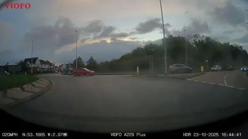



Museums and landmarks6
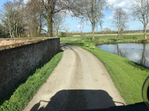
Bretton Hall, Flintshire
Monument and historic site · 3.4 mi
Former fortified manor house on the England/Wales border



Parks, trails and playgrounds12






Restaurants and cafes42
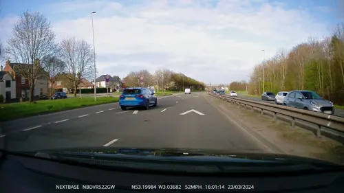
The Plough
Bar and pub · 1.2 mi
Aston Road, Deeside
Mo-Th 12:00-24:00; Fr-Sa 12:00-25:00; Su 12:00-11:00



Indian Saffron
Restaurant · Indian · 1.5 mi
44 Station Road, Deeside
Mo-Th 17:00-22:00; Fr-Su 17:00-22:30


30 more on the map.
History
The 1848 Topographical Dictionary of Wales led by Samuel Lewis states that Hawarden is of remote antiquity and was called 'Pennard Halawg', or more properly 'Pen-y-Llwch', the headland above the lake. The hill forts such as the huge remains next to the medieval Hawarden Castle and Trueman's Hill motte were - it records locally - believed to date to the time of fortifications against incursions of the Cornavii tribe and the Romans.
The Normans recorded that the Saxons called the place Haordine, where, east of today's village, was the principal manor of the Saxon Hundred of Atiscros. William the Conqueror granted the lands and manor to Hugh Lupus since it formed part of the County Palatine of Chester, whereupon Hawarden Castle was built and later proved key to Welsh history, at that time lived in by Roger Fitzvalerine, then the Montaults, or de Montaltos, barons of Mold, who held it as seneschal.
Read more of the history
1157, Henry II., having assembled a formidable army at Chester, advanced into Flintshire with a view to conquering Wales and camped on Saltney marsh, in the parish. To repel this attack, Owain Gwynedd, Prince of North Wales, marched his forces to Basingwerk near Holywell, where he took up his station within a few miles of the royal army. The boldness of Owain's movements inducing Henry to hope that the natives intended to risk a general engagement, in which he expected that the superior number and discipline of the English would ensure success, the king despatched a chosen body of troops, under the command of his principal barons, to bring the Welsh to action or to dislodge them from their position. This party, having to pass through the narrow defile of Coed-Eulo, in the parish of Hawarden, were suddenly attacked in that dangerous pass by Davydd and Cynan, sons of Owain, who, with a strong body of men, had set an ambush. Owing to the suddenness and impetuosity of the assault and the difficulties of the ground on which they had to contend, the English were routed with great slaughter and the few who escaped the carnage withdrew in the utmost disorder to the main body of the army. Exasperated by this unexpected discomfiture, Henry immediately collected the whole of his forces and marched along the coast into the heart of the enemy's country; and Owain, breaking up his camp, retired with his forces to St. Asaph.
Efforts to subdue north Welsh territory into a degree of fiefdom followed intermittently, with no great success. In the castle Llewellyn of Wales who was in possession negotiated peace in 1264 with Simon de Montford, who led a brief rebellion against Henry III of England and agreed to betroth his daughter to Llewellyn in exchange for restoring the de facto Welsh castle to Robert de Montault. The rebellion failed. Accordingly, by 1280 the castle became a crown asset, listed as a Castrum Regis. Later, following Edward's successful campaign imposing exacting terms on the Welsh, building Flint Castle and strengthening other castles, in 1282 Llewellyn's brother Dafydd took the castle back, killing the garrison and transferring Roger de Clifford to remote Snowdon. This second recapture of the castle triggered Edward's killing of Llewellyn and annexation of Wales. The castle became a prized possession: see Hawarden Castle.
The village of Saltney (next to Chester, but in Wales) was part of the parish.
The prime minister William Ewart Gladstone (1809–1898) spent his later life in Hawarden Castle, which had in the Glorious Revolution been acquired by his wife's family, the Glynne baronets. In 1847 water was brought into the place at an expense of upwards of £1000 to be recouped by the River Dee Company. In the nineteenth century the economy of the parish (about three times larger than the modern Community Council area) involved weekly markets, many seams of coal, the making of tiles, bricks and drainage pipes and chemicals such as Glauber salts and ivory black making.
In 1886 the curate of Hawarden, the Rev. Harry Drew, married Mary Gladstone, the second daughter of the Prime Minister, at St Margaret's Church, Westminster – a society wedding attended by the Prince of Wales.
In 1896, Hawarden was the location of prime minister William Ewart Gladstone's meeting with Li Hongzhang, a key reformer in the Qing dynasty's Self Strengthening Movement, on his diplomatic mission to the UK.
Gladstone bequeathed his library to the town under the name of St Deiniol's Library in honour of the patron saint of the parish church next door. It is the only residential library in Britain and was renamed Gladstone's Library in 2010.
From the History section of Hawarden on Wikipedia, under CC BY-SA 4.0.
More about Hawarden
Economy
Queensferry consists predominantly of industrial, commercial and storage businesses by the River Dee and is situated to immediately northeast of the community - the village is residential. moneysupermarket.com has significant premises at St David's Park by the main A55 road in nearby Ewloe.
Hawarden Airport, sometimes called Hawarden (Chester) Airport, with adjoining Hawarden Industrial Park is in nearby Broughton.
Education
Hawarden Village Church School (previously Rector Drew Primary School) is the junior school of the village. Hawarden High School is a high school which dates back to 1606 and was attended by Michael Owen and Gary Speed, the former manager of the Wales national football team.
In 1927, Knutsford Ordination Test School relocated to Hawarden — first to the Old Rectory, then to the new castle in 1939 before it closed the following year.
From the Wikipedia article Hawarden, under CC BY-SA 4.0.
Notable people from Hawarden
 Elise HughesWelsh association football playerPhoto: James Boyes, CC BY 2.0
 Honoratus Leigh ThomasWelsh surgeonPhoto: James Green, Public domain
- Jamie HewlettBritish comic book artist (born 1968)
- Tony MillingtonEnglish association footballer (1943-2015)
- Edith AustinBritish tennis player (1867-1953)
- William Henry GladstoneBritish politician (1840-1891)
- Ann KeenBritish politician (born 1948)
- Sir Stephen Glynne, 9th BaronetWelsh landowner, Conservative Party politician, and ecclesiastical antiquarian (1807-1874)
- Josiah BoydellBritish print publisher and seller (1752-1817)
- Nicholas HuntBritish Royal Navy admiral
- John RowlandsRoyal Air Force air marshals (1915-2006)
- Ernie BryanWelsh footballer (1926-2008)
Born in Hawarden, according to Wikidata (CC0). Each name links to its Wikipedia article.
Where to stay1
Churches and places of worship17
Shopping4
Gas and EV charging1
Schools, colleges and libraries11
Healthcare4
Map of Hawarden
102 places. The map loads OpenStreetMap tiles when you open it.
Getting there and nearby towns
Hawarden Airport (CEG) is the nearest airport with scheduled flights listed in OpenStreetMap, 2 miles away.
- Blacon 4 mi east, about 7 min by car
- Mold 5 mi west, about 8 min by car
- Chester 6 mi east, about 9 min by car
- Neston 7 mi north, about 11 min by car
- Ellesmere Port Town 8 mi northeast, about 13 min by car
- Wrexham 10 mi south, about 16 min by car
- Heswall 10 mi north, about 17 min by car
- Bebington 11 mi north, about 18 min by car
- Bromborough 11 mi north, about 18 min by car
- Rhosllannerchrugog 12 mi south, about 20 min by car
Drive times are estimates from straight-line distance, not routes.
Towns near Hawarden


Keep exploring
Local news
Headlines from INDB.
Reviews, tips and questions
Loading what members have shared...
Sources and licences
- GeoNames (CC BY 4.0): population, coordinates, regions and time zone
- Mapillary (see each image): photos
- OpenStreetMap contributors (ODbL 1.0): places, airports, map data
- Wikidata (CC0 1.0): elevation, founding date, time zone, website, landmarks and historic places
- Wikimedia Commons (see each image): photos
- Wikipedia (CC BY-SA 4.0): overview and history text
Photo credits
- Hawarden Castle, Colin Smith, CC BY-SA 2.0
- Fox and Grapes, Hawarden, Dave.Dunford, CC BY-SA 4.0
- Kentigern, Hawarden, Dave.Dunford, CC BY-SA 4.0
- Former Lloyds Bank, Hawarden, Dave.Dunford, CC BY-SA 4.0
- Hawarden, the Old Castle (3611555768), Cornell University Library, No restrictions
- Mr. Gladstone's Study, Hawarden Castle. "The Temple of Peace" (3611649950), Cornell University Library, No restrictions
- Surgery House, Hawarden, Dave.Dunford, CC BY-SA 4.0
- Former Bank Manager's House, Hawarden, Dave.Dunford, CC BY-SA 4.0
- Bridge over Wepre Brook, Flintshire, Rept0n1x, CC BY-SA 2.0
- St Davids Church Connah's Quay, Steventattum, CC BY 3.0
- St Ethelwold's Church, Shotton (1), Rept0n1x, CC BY-SA 3.0
- Connahs Quay St Marks Church, Phil Williams, CC BY-SA 2.0
- Parish Church of St Matthew, Buckley, Phil Williams, CC BY-SA 2.0
- St Matthew's Church, Saltney, John S Turner, CC BY-SA 2.0
- St Deiniol's Church, Hawarden, Sue Adair, CC BY-SA 2.0
- Hawarden Castle from the Old Castle 01, Dave.Dunford, CC BY-SA 4.0
- Llyfrgell Sant Deiniol and Gladstone's Library Hawarden Penarlâg 10, Llywelyn2000, CC BY-SA 3.0
- Hawarden Castle Estate (24), Rept0n1x, CC BY-SA 3.0
- Hawarden Village Glynne Arms, Gammock, CC BY-SA 4.0
- Blessed Trinity Church side, Queensferry, Pjposullivan, CC BY-SA 4.0
- The corner, marin nikolov, CC BY 2.0
- Harwarden Castle, Bond, H. W., fl. 1827-1849, engraver. Neale, John Preston, 1780-1847, Public domain
- Gladstone Memorial Fountain, The Highway (S Side), Pete Rigby, CC BY-SA 4.0
- Hawarden Bridge Station, Dennis Turner, CC BY-SA 2.0
- Level Road Park, Stinkybifta, CC BY-SA 4.0
- Street-level photo, RyanBush, CC BY-SA 4.0
- Street-level photo, RyanBush, CC BY-SA 4.0
- Street-level photo, davidsong, CC BY-SA 4.0
- Street-level photo, ricorico, CC BY-SA 4.0
- Street-level photo, RyanBush, CC BY-SA 4.0


Page built November 10, 2026. Spotted a mistake? Tell us or suggest a place.