


Chester, United Kingdom
Chester is a town of 90,524 people in England, United Kingdom, founded in 79.
Why visit Chester
Townapedia lists 98 museums and landmarks, 73 parks and trails, 172 places to eat, 44 places to stay and 19 attractions in and around town.
Highlights include Chester Zoo, Aldford Iron Bridge, Grosvenor Museum and Cheshire Military Museum.
Weather in Chester
Forecast from MET Norway (CC BY 4.0). Full forecast
About Chester
Chester is a cathedral city in Cheshire, England, on the River Dee, very close to the England–Wales border. It had a built-up area population of 92,760 in 2021, it is the most populous settlement in the borough of Cheshire West and Chester. It is the historic county town of Cheshire and the second-largest settlement in Cheshire after Warrington.
From the Wikipedia article Chester (this version), under CC BY-SA 4.0.
Travel tips from other travellers: Chester on Wikivoyage (CC BY-SA 4.0).
Photos of Chester


Things to do19


Aldford Iron Bridge
Bridge · 4.0 mi
Bridge crossing the River Dee north of the village of Aldford, Cheshire, England, UK


Chester Storyhouse
Cinema and theater
Arts centre (theatre, cinema, library) in Chester, England, incorporating the former Odeon Cinema

Grosvenor Bridge
Bridge · 0.5 mi
Grade I listed bridge in Chester, England


Old Dee Bridge
Bridge · 0.4 mi
Grade I listed bridge in Chester, England



Gateway Theatre
Cinema and theater
Former theatre in Chester, England
Grosvenor Park Open Air Theatre
Cinema and theater · 0.4 mi
Open-air theatre in Chester, England
7 more on the map.
Museums and landmarks98
Grosvenor Museum
Museum
Natural history museum in Chester, UK
27 Grosvenor Street, Chester
Tu-Sa 10:30-17:00; Su 13:00-16:00; Mo off; PH 10:30-17:00


Northgate
Monument and historic site
Bridge and city gate in Chester, England


Chester Roman Amphitheatre
Monument and historic site
Roman amphitheatre in Chester, Cheshire, England, UK

Heronbridge Roman Site
Monument and historic site · 1.7 mi
Archaeological site in Eaton and Eccleston, Cheshire West and Chester, England, UK


Bretton Hall, Flintshire
Monument and historic site · 2.9 mi
Former fortified manor house on the England/Wales border
Cenotaph to Matthew Henry
Monument and historic site
Grade II listed memorial in Chester, UK
Chester War Memorial
Monument and historic site
War memorial in Chester, UK

86 more on the map.
Parks, trails and playgrounds73


Hockenhull Platts
Park · 4.4 mi
Nature reserve and group of bridges in Cheshire, UK



Countess of Chester Country Park
Park · 1.2 mi
Country park in Upton, Cheshire, England

61 more on the map.
Restaurants and cafes172
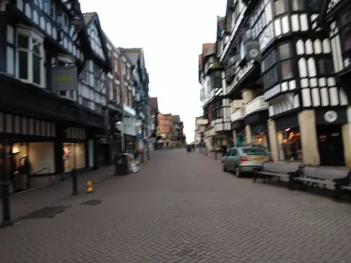
Caffè Nero
Cafe · Coffee Shop
Eastgate Street, Chester
Mo-Fr 07:00-19:00; Sa 07:30-19:00; Su 08:30-18:30
Moules a go-go
Restaurant · Bistro
Independant Bar & Bistro
6-12 Cuppin Street, Chester
Mo-Su 09:00-23:00
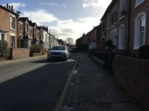
Little Yellow Pig
Cafe · Breakfast, Brunch · 0.9 mi
31 Westminster Road, Chester
Mo-Sa 09:00-17:00; Su 10:00-15:00
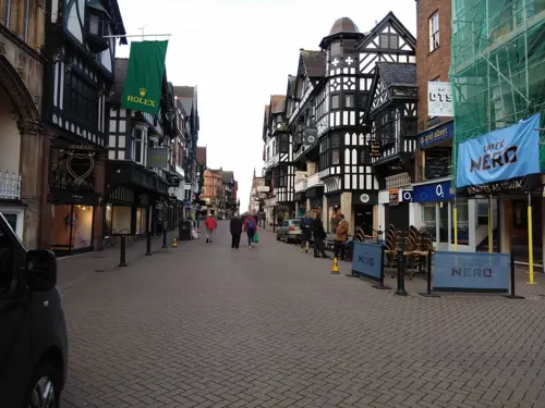
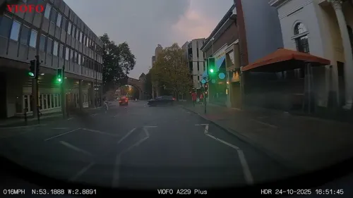
The Ivy
Restaurant · British
32-36 Newgate Street, Chester
Mo-We 08:30-24:00; Th-Fr 08:30-24:30; Sa 09:00-24:30; Su 09:00-23:00
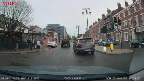


Brook Street Cafe & Bistro
Cafe · British, Breakfast, Sandwich, Burger · 0.4 mi
71 Brook Street, Chester
Mo-Su 08:00-16:30
Istanbul BBQ
Restaurant · Turkish · 0.4 mi
85 Brook Street, Chester
Mo-Th 16:00-22:30, Fr-Su 11:30-22:30
Tansishq
Restaurant · Indian · 1.4 mi
1 Coniston Road, Chester
PH, Mo-Th 17:30-22:30; Fr-Sa 17:00-23:00, Su 15:30-19:30
160 more on the map.
History
Charles Leigh concluded in 1701 that there was probably a British city called Genuina (or Gunia) before the arrival of the Romans.
The Roman Legio II Adiutrix during the reign of the Emperor Vespasian founded Chester around 75 AD as a "castrum" or Roman fort with the name Deva Victrix. It was established in the land of the Celtic Cornovii, according to the ancient cartographer Ptolemy, as a fortress during the Roman expansion northward, and was named Deva either after the goddess of the Dee, or directly from the British name for the river. The 'victrix' part of the name was taken from the title of the Legio XX Valeria Victrix which was based at Deva. Central Chester's four main roads, Eastgate, Northgate, Watergate and Bridge Street, follow routes laid out at this time.
Read more of the history
A civilian settlement grew around the military base, which probably originated from trade with the fortress. The fortress was 20% larger than other fortresses in the Roman province of Britannia built around the same time at York (Eboracum) and Caerleon (Isca Augusta); this has led to the suggestion that the fortress, rather than London (Londinium), was intended to become the capital of the Roman province of Britannia Superior. The civilian amphitheatre, which was built in the 1st century, could seat between 8,000 and 10,000 people. It is the largest known military amphitheatre in Britain, and is also a Scheduled Monument. The Minerva Shrine in the Roman quarry is the only rock-cut Roman shrine still in situ in Britain.
The fortress was garrisoned by the legion until at least the late 4th century. Although the army had abandoned the fortress by 410 when the Romans retreated from Britannia, the Romano-British civilian settlement continued (probably with some Roman veterans staying behind with their wives and children) and its occupants probably continued to use the fortress and its defences as protection from raiders from the Irish Sea.
After the Roman troops withdrew, the Romano-British established several petty kingdoms. Chester is thought to have become part of the kingdom of Powys. Deverdoeu was a Welsh name for Chester as late as the 12th century (cf Dyfrdwy, Welsh for the river Dee). Another, attested in the 9th-century History of the Britons traditionally attributed to Nennius, is Cair Legion ("Fort" or "City of the Legion"); this later developed into Caerlleon and then the modern Welsh Caer. (The town's importance is noted by its taking the simpler form in each case, while Isca Augusta in Monmouthshire, another important legionary base, was known first as Caerleon on the Usk, and now as Caerleon). King Arthur is said to have fought his ninth battle at the "city of the legions" (Caerlleon) and later St Augustine came to the city to try to unite the church, and held his synod with the Welsh Bishops.
In 616, Æthelfrith of Northumbria defeated a Welsh army at the brutal and decisive Battle of Chester and probably established the Anglo-Saxon position in the area from then on. The Northumbrian Anglo-Saxons used an Old English equivalent of the British name, Legacæstir, which was current until the 11th century, when, in a further parallel with Welsh usage, the first element fell out of use and the simple name Chester emerged. In 689, King Æthelred of Mercia founded the Minster Church of West Mercia on what is considered to be an early Christian site: it is known as the Minster of St John the Baptist, Chester (now St John's Church) which later became the first cathedral. Much later, the body of Æthelred's niece, St Werburgh, was removed from Hanbury in Staffordshire in the 9th century and, to save it from desecration by Danish marauders was reburied in the Church of SS Peter & Paul – later to become the Abbey Church (the present cathedral). Her name is still remembered in St Werburgh's Street, which passes alongside the cathedral, and near the city walls, and in St Werburgh's Roman Catholic church in Grosvenor Park Road.
The Anglo-Saxons extended and strengthened the walls of Chester to protect the city against the Danes, who occupied it for a short time until Alfred seized all the cattle and laid waste on the surrounding land to drive them out. It was Alfred's daughter Æthelflæd, Lady of the Mercians, that built the new Anglo-Saxon burh. A new Church dedicated to St Peter alone was founded in AD 907 by the Lady Æthelfleda at what was to become the Cross. In around 907, the Vikings laid siege to Chester, but the Anglo-Saxon defenders, led by Æthelfleda, successfully fought them off. In 973, the Anglo-Saxon Chronicle records that, two years after his coronation at Bath, King Edgar of England came to Chester where he held his court in a palace in a place now known as Edgar's Field near the old Dee bridge in Handbridge. Taking the helm of a barge, he was rowed the short distance up the River Dee from Edgar's Field to the great Minster Church of St John the Baptist by six (the monk Henry Bradshaw records he was rowed by eight kings) tributary kings called reguli.
In 1071, King William the Conqueror made Hugh d'Avranches, who built Chester Castle, the first Earl of Chester (second creation). From the 14th to the 18th century, the city's prominent position in North West England meant it was commonly known as Westchester. This name was used by Celia Fiennes when she visited the city in 1698. and is also used in Moll Flanders.
In the English Civil War, Chester sided with the royalist cause of King Charles I but was subdued by the Parliamentarians in 1643. The Mayor of Chester, Charles Walley, was removed from office and replaced by Alderman William Edwards. Another alderman, Francis Gamull, a royalist MP and former Mayor, was ordered to surrender Dee Mills: they were to be demolished, and new mills built on city land.
From the History section of Chester on Wikipedia, under CC BY-SA 4.0.
More about Chester
Geography
Chester lies at the southern end of a 2-mile (3.2 km) Triassic sandstone ridge, rising to a height of 42 m within a natural S-bend in the River Dee (before the course was altered in the 18th century). The bedrock, also known as the Chester Pebble Beds, is notable for the many small stones trapped within its strata. Retreating glacial sheet ice also deposited quantities of sand and marl across the area where boulder clay was absent.
The eastern and northern parts of Chester consisted of heathland and forest. The western side towards the Dee Estuary was marsh and wetland habitats.
Chester has an oceanic climate (Köppen: Cfb), typical of the British Isles but more susceptible to cold than the extreme south. Despite its proximity to the Irish Sea, the temperature regime is similar to areas further inland, owing to the shelter provided by the Pennines to the northeast and the Welsh Mountains to the southwest. The nearest official weather station is at Hawarden Airport, about 4 miles (6.4 km) west of the city centre.
Economy
Chester's primary industries are now the service industries, which are tourism, retail, public administration, and financial services. Many domestic and international tourists visit to view the city's landmarks and heritage, with a complementary benefit to hotels and restaurants.
The city's central shopping area includes its unique Rows or galleries (two levels of shops), which date from medieval times and are believed to include the oldest shop front in England. The city has many chain stores. Also, it features an indoor market and two main indoor shopping centres: The Grosvenor Shopping Centre and the Forum (a reference to the city's Roman past). There are retail parks to the west and south. Cheshire Oaks Designer Outlet and Broughton Retail Park are near the city.
Chester has a relatively large financial sector including Bank of America, NFU Mutual, Lloyds Bank, Virgin Money, Quilter, and M&S Bank. The price comparison website moneysupermarket.com is based over the Welsh border in Ewloe. Chester has its own university, the University of Chester, and a major hospital, the Countess of Chester Hospital, named after Diana, Princess of Wales and Countess of Chester.
The restaurant chain Hickory's Smokehouse started in Chester, with its first location on The Groves opening in 2010.
Arts and culture
The major museum in Chester is the Grosvenor Museum, which includes a collection of Roman tombstones and an art gallery. Associated with the museum is a building on 20 Castle Street that has rooms furnished in different historical styles. The Dewa Roman Experience has hands-on exhibits and a reconstructed Roman street. One of the blocks in the forecourt of Chester Castle houses the Cheshire Military Museum.
The £37m Storyhouse arts centre opened in the city centre in 2017. It includes a theatre, cinema, restaurant and the city's main library. It is housed in the city's remodelled 1936 Odeon Cinema and replaces the Gateway Theatre and the former library on Northgate Street.
Chester Little Theatre is based in Newtown and run by Chester Theatre Club. It generally stages 5 or 6 plays each year. Chester Music Theatre is based in a converted church in Boughton. There was a multiplex cinema and a ten-pin bowling alley at Greyhound Retail Park on the city's edge, but these have closed. The cinema has moved to Broughton, just over the border in North Wales. A Picturehouse multi-screen cinema was built in the city centre as part of the Northgate Project. Chester has its own film society, several amateur dramatic societies and theatre schools.
Education
The city is home to the University of Chester. Formerly a teacher training college, it gained full university status in 2005 and is the county's main provider of tertiary education.
Cheshire College – South & West is a vocational college with campuses in Handbridge as well as Ellesmere Port and Crewe.
The King's School, a private school, was established by King Henry VIII in 1541. The girls-only Queen's School, another independent school, was founded in 1878.
From the Wikipedia article Chester, under CC BY-SA 4.0.
Notable people from Chester
 Daniel CraigEnglish actor (born 1968)Photo: Max Surprenant, CC BY 4.0
 Michael OwenEnglish association football playerPhoto: David Seow, CC BY-SA 4.0
 Tom HeatonEnglish association football playerPhoto: Kelvin Stuttard, CC BY-SA 4.0
 Matt HancockBritish politician (born 1978)Photo: Richard Townshend, CC BY 3.0
 Ricky WaldenEnglish snooker playerPhoto: Benutzer:Bill da Flute, CC BY-SA 3.0
 John SteinerBritish actor (1941–2022)Photo: Screenshot autoprodotto, Public domain
 Vincent DensonEnglish cyclistPhoto: Cs-wolves, CC BY-SA 4.0
- Beatrice TinsleyNew Zealand astronomer (1941–1981)
- Danny MurphyEnglish association football player (born 1977)
- Adrian BoultBritish conductor (1889–1983)
- Ronald PickupBritish actor (1940–2021)
- John MarshallBritish archaeologist (1876–1958)
Born in Chester, according to Wikidata (CC0). Each name links to its Wikipedia article.
Where to stay44
Churches and places of worship85
Catholic Church of Saint Francis of Assisi
Church · Catholic
Cuppin Street, Chester
City Road Presbyterian Church
Church · Presbyterian · 0.4 mi
City Road, Chester
Shopping69
Gas and EV charging12
Schools, colleges and libraries45
Healthcare19
Map of Chester
250 places. The map loads OpenStreetMap tiles when you open it.
Getting there and nearby towns
Hawarden Airport (CEG) is the nearest airport with scheduled flights listed in OpenStreetMap, 4 miles away.
- Blacon 2 mi northwest, about 3 min by car
- Ellesmere Port Town 6 mi north, about 10 min by car
- Neston 9 mi northwest, about 15 min by car
- Speke 11 mi north, about 17 min by car
- Bromborough 11 mi north, about 19 min by car
- Runcorn 12 mi northeast, about 20 min by car
- Halewood 12 mi north, about 19 min by car
- Allerton 12 mi north, about 20 min by car
- Heswall 13 mi northwest, about 20 min by car
- Widnes 14 mi northeast, about 22 min by car
Drive times are estimates from straight-line distance, not routes.
Towns near Chester


Keep exploring
Local news
Headlines from INDB.
Reviews, tips and questions
Loading what members have shared...
Sources and licences
- GeoNames (CC BY 4.0): population, coordinates, regions and time zone
- Mapillary (see each image): photos
- OpenStreetMap contributors (ODbL 1.0): places, airports, map data
- Wikidata (CC0 1.0): elevation, founding date, time zone, website, landmarks and historic places
- Wikimedia Commons (see each image): photos
- Wikipedia (CC BY-SA 4.0): overview and history text
Photo credits
- Eastgate Street from the City Wall, Nessy-Pic, CC BY-SA 4.0
- 6 & 8, Watergate Street, Chester 02, Dave.Dunford, CC BY-SA 4.0
- 6 & 8, Watergate Street, Chester 01, Dave.Dunford, CC BY-SA 4.0
- Victoria pub, Chester 02, Dave.Dunford, CC BY-SA 4.0
- Victoria pub, Chester 01, Dave.Dunford, CC BY-SA 4.0
- Chester Zoo 2016 010 - Islands, Photograph by Mike Peel ( www.mikepeel.net )., CC BY-SA 4.0
- Aldford Iron Bridge, David Kitching, CC BY-SA 2.0
- Bridge of Sighs Chester 392, RHaworth, CC BY 2.5
- Bridgegate, John S Turner, CC BY-SA 2.0
- Former Odeon Cinema, Chester, Rept0n1x, CC BY-SA 3.0
- Grosvenor Bridge Chester4, Nabokov at English Wikipedia, CC BY-SA 3.0
- Newgate, Chester (2), Rept0n1x, CC BY-SA 3.0
- Old Dee Bridge 2019-2, Rodhullandemu, CC BY-SA 4.0
- Watergate, Chester, John S Turner, CC BY-SA 2.0
- Chester Castle - outer bailey - A Block, Worm That Turned, CC BY-SA 3.0
- Northgate, Chester, chestertouristcom, CC BY-SA 2.0
- Sick-to-death-church, Jakc98, CC BY-SA 4.0
- DevaMinervaPlan(bq), Łukasz Nurczyński, CC BY-SA 4.0
- Chester amphitheatre, Nadia from Sydney, Australia, CC BY-SA 2.0
- ChesterGrosvPark1, Łukasz Nurczyński, CC BY-SA 4.0
- Hockenhull Platts EM, Peter I. Vardy, Public domain
- All Saints Church, Saughall, Jeff Buck, CC BY-SA 2.0
- Chapel at the Countess of Chester Hospital, Bugsybanana, CC BY-SA 4.0
- University of Chester Chapel, Georgemorris94, CC BY-SA 3.0
- Hoole, Chester (9), Rept0n1x, CC BY-SA 3.0
- Chester Cathedral ext Hamilton 005, Stephen Hamilton, CC BY-SA 3.0
- Chester shot tower, Espresso Addict, CC BY-SA 4.0
- English Presbyterian Church of Wales, Chester, Rodhullandemu, CC BY-SA 4.0
- Queen Hotel, Chester - DSC08237, Rept0n1x, CC BY-SA 3.0
- St Francis Church, Chester, Andrew Kerr, CC BY-SA 2.0 uk
- Eccleston school, Peter I. Vardy, CC0
- Kings Chester 2012 07 07, David Kilburn, Public domain
- Wesley Methodist Church, Chester (3), Rept0n1x, CC BY-SA 3.0
- Cheshire Regiment Memorial, Clint Heacock en:User:Clintheacock66, CC BY-SA 3.0
- Chester Cathedral ext Hamilton 001, Stephen Hamilton, CC BY-SA 3.0
- St Peter's Church, Chester-2, BrianP, CC BY-SA 2.0
- The site of Heronbridge Roman settlement, Claverton near Chester, Dr John Wells, CC BY 4.0
- Northgate Street 5-9, Dennis Turner, CC BY-SA 2.0
- St Peter's Exterior, Stepped, CC BY-SA 3.0
- Deva Stadium, Ingy The Wingy from Lancashire, England, CC BY-SA 2.0
- Street-level photo, RyanBush, CC BY-SA 4.0
- Street-level photo, sk53_quint, CC BY-SA 4.0
- Street-level photo, RyanBush, CC BY-SA 4.0
- Street-level photo, RyanBush, CC BY-SA 4.0
- Street-level photo, RyanBush, CC BY-SA 4.0
- Street-level photo, RyanBush, CC BY-SA 4.0
- Street-level photo, gness, CC BY-SA 4.0
- Street-level photo, gness, CC BY-SA 4.0
- Street-level photo, gness, CC BY-SA 4.0
- Street-level photo, badger666, CC BY-SA 4.0
- Street-level photo, sk53_quint, CC BY-SA 4.0
- Street-level photo, RyanBush, CC BY-SA 4.0
- Street-level photo, RyanBush, CC BY-SA 4.0
- Street-level photo, sk53_quint, CC BY-SA 4.0
- Street-level photo, coljay72, CC BY-SA 4.0
- Street-level photo, sk53_quint, CC BY-SA 4.0
- Street-level photo, janvanbekkum, CC BY-SA 4.0
- Street-level photo, sk53_quint, CC BY-SA 4.0
- Street-level photo, sk53_quint, CC BY-SA 4.0
- Street-level photo, RyanBush, CC BY-SA 4.0
- Street-level photo, RyanBush, CC BY-SA 4.0


Page built November 10, 2026. Spotted a mistake? Tell us or suggest a place.