


Why visit Farndon
Townapedia lists 4 museums and landmarks, 3 parks and trails, 6 places to eat and 2 attractions in and around town.
Highlights include Trent Bridge, Newark, Palace Theatre, Newark, Newark Castle and Town Hall.
Weather in Farndon
Forecast from MET Norway (CC BY 4.0). Full forecast
About Farndon
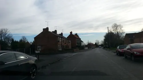
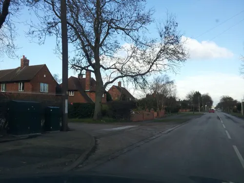
Farndon is a small village and civil parish in the Newark and Sherwood district of Nottinghamshire, England. It lies along the historic Fosse road on the banks of the River Trent and is 3 miles (4 km) south-west of Newark-on-Trent. The population of the civil parish as of the 2011 census was 2,405, this increased to 2,479 at the 2021 census. The A46 road previously ran through the village until the development of a new dual carriageway bypass.
From the Wikipedia article Farndon, Nottinghamshire (this version), under CC BY-SA 4.0.
Things to do2
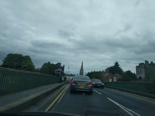
Trent Bridge, Newark
Bridge · 2.5 mi
Bridge in Newark, Nottinghamshire, England

Palace Theatre, Newark
Cinema and theater · 2.6 mi
Theatre and cinema in Newark-on-Trent, Nottinghamshire, England, UK
Museums and landmarks4

Newark Castle
Monument and historic site · 2.5 mi
Grade I listed castle in Newark-on-Trent, United Kingdom
Town Hall
Museum · 2.5 mi
Listed structure in Newark, Nottinghamshire, United Kingdom, used as museum

Parks, trails and playgrounds3

Sconce and Devon Park
Park · 1.7 mi
Park and listed ancient monument in Newark, Nottinghamshire


Restaurants and cafes6

History
The name Farndon means "Fern Hill". It was once thought to be the site of the Roman fort Ad Pontem or "the place by the bridges." However, this site is now known to be further south near East Stoke.
The village played a small part in the English Civil War. During the Siege of Newark in 1646, Farndon was occupied by a Parliamentarian regiment led by Sydnam Poyntz. In the same year, partially as a result of Poyntz inviting local people to dismantle Newark's Royalist defences and slight the castle, a plague which had previously been contained in the town ended up killing an estimated 25% of Farndon's population.
Read more of the history
In the 19th century, farming, malting, willow growing and basket making were the main source of employment for men and women. There was also a village blacksmith, butcher, baker, a general store, and a cobbler. Francis White's Directory of Nottinghamshire described Farndon in 1853 as follows: "Farndon is a well built village and parish on the Trent, 2 miles (3 km) west-south-west of Newark, and contains 590 inhabitants and 1,710 acres (690 ha) of land, mostly freehold, a small part copyhold and leasehold. The principal proprietors are William Buck Esq. and W.R. Brockton Esq. There are also several smaller owners. The Duke of Newcastle is lord of the manor, but owns only a small portion of the land. The church, dedicated to St Peter, is a large and lofty edifice, with two side aisles, chancel and tower, in which are 4 bells. A good organ was put up in the church in 1851...on the Trent side in this parish are several malt kilns, also steam and wind mills. The Wesleyans and Primitive Methodists each have a chapel here."
In the 1930s sand and gravel was needed to build aerodrome runways at RAF Syerston and RAF Newton. Excavations on parts of the river bank revealed ample supplies. Today, those worked gravel pits have been transformed into a marina, the river widened and the marshy fields alongside drained.
The parish church of St. Peter was built in Elizabethan times, and is thought to be the third such church built on the same site since Saxon times.
Until 1974, "there used to be a ferry across the Trent from Farndon to Rolleston."
In August 1948, "the title of Little Hero of Farndon was bestowed on 12-year-old Ronnie Ward, of Northgate, Newark, after he rescued a child from the River Devon by the Farndon Ferry on Thursday. Seeing the four-year-old boy in deep water, Ronnie swam out to him and pulled him to the landing ste from where he was carried back to his mother. Amazingly, Ronnie's parents knew nothing about the rescue until they heard the story from eye-witnesses, because their son was too modest to tell them."
During site investigations for the A46 road improvements in the area to the east of the existing Fosse road (the former Roman Fosse Way), a significant Late Upper Palaeolithic archaeological site was identified, and later excavated at Farndon fields.
The site contained a flint scatter, a spread of waste flakes produced by the working of stone using flint knapping to produce sharp edged tools. Dated by the use of Optically stimulated luminescence, it confirmed that the archaeology dated back some 13,000 years making it a rare open field site, as finds from this age were usually only found in caves, such as Gough's Cave and more locally at Creswell Crags, some 20 miles away. It is thought plausible that the same people who used this site also visited the caves at Creswell, and that the repeated visits to Farndon were part of their nomadic subsistence circuit during the year.
The finds at Creswell, showed that these hunters were also artists decorating both the caves and animal bone with depictions of horses, Ibex and other animals, the Robin Hood Cave Horse being one of the notable discoveries of this Creswellian culture.
Describing the finds at Farndon, as "the dream scenario" archaeologist Phil Harding, who is also an expert in shaping stone tools, said "As a flint knapper, you were there with them". It has been imagined that the hunters who produced the scatter, needed to use the new flint tools to flense animal carcasses at this seasonal camp, situated on a river terrace overlooking the River Devon near to its confluence with the River Trent.
There are a number of sites in Farndon dedicated to nature conservation. Most notable amongst these is the Willow Holt, which is one of the few remaining survivors of the working willow holts that were a feature of many Trentside villages. The site is especially important because it houses an internationally known collection of willows and hybrid species. Part of the riverbank is raised and forms a flood bank, either side of which is an interesting selection of cricket bat willows and hybrid balasam poplars. Wild flowers include meadow cranesbill, comfrey, angelica and meadowsweet and the water meadows host species such as Yorkshire fog, brown bent and cocksfoot. The site is now in the ownership of the Nottinghamshire Wildlife Trust, and is open to the public. Prior to this, the Holt was in the care of Brenda and Lever Howitt, two renowned Willow conservationists.
From the History section of Farndon, Nottinghamshire on Wikipedia, under CC BY-SA 4.0.
Notable people from Farndon
- Patrick HuskinsonBritish flying ace (1897-1966)
Born in Farndon, according to Wikidata (CC0). Each name links to its Wikipedia article.
Churches and places of worship18
Shopping1
Gas and EV charging1
Schools, colleges and libraries1
Map of Farndon
36 places. The map loads OpenStreetMap tiles when you open it.
Getting there and nearby towns
Nottingham City Airport (NQT) is the nearest airport with scheduled flights listed in OpenStreetMap, 13 miles away.
- Newark on Trent 2 mi northeast, about 3 min by car
- East Bridgford 7 mi southwest, about 11 min by car
- Lowdham 7 mi west, about 11 min by car
- North Collingham 8 mi northeast, about 13 min by car
- Sutton on Trent 9 mi north, about 15 min by car
- Cropwell Bishop 11 mi southwest, about 18 min by car
- Arnold 12 mi west, about 20 min by car
- Boughton 12 mi northwest, about 19 min by car
- Grantham 13 mi southeast, about 21 min by car
- Nottingham 14 mi southwest, about 23 min by car
Drive times are estimates from straight-line distance, not routes.
Towns near Farndon


Keep exploring
Local news
Headlines from INDB.
Reviews, tips and questions
Loading what members have shared...
Sources and licences
- GeoNames (CC BY 4.0): population, coordinates, regions and time zone
- Mapillary (see each image): photos
- OpenStreetMap contributors (ODbL 1.0): places, airports, map data
- Wikidata (CC0 1.0): elevation, founding date, time zone, website, landmarks and historic places
- Wikimedia Commons (see each image): photos
- Wikipedia (CC BY-SA 4.0): overview and history text
Photo credits
- A picture of 3 and 3a School Lane in Farndon, Newark UK. Taken on 2023-07-18, Simon Inns, CC BY-SA 4.0
- Newark Castle, 2008, David Ingham from Lancashire, England, CC BY-SA 2.0
- Queen's Sconce, Richard Croft, CC BY-SA 2.0
- Street-level photo, cleder, CC BY-SA 4.0
- Street-level photo, adam2, CC BY-SA 4.0
- Street-level photo, adam2, CC BY-SA 4.0
- Street-level photo, adam2, CC BY-SA 4.0
- Street-level photo, adam2, CC BY-SA 4.0
- Street-level photo, adam2, CC BY-SA 4.0
- Street-level photo, adam2, CC BY-SA 4.0
- Street-level photo, adam2, CC BY-SA 4.0
- Street-level photo, cleder, CC BY-SA 4.0
- Street-level photo, adam2, CC BY-SA 4.0
- Street-level photo, adam2, CC BY-SA 4.0
- Street-level photo, adam2, CC BY-SA 4.0
- Street-level photo, adam2, CC BY-SA 4.0
- Street-level photo, adam2, CC BY-SA 4.0
- Street-level photo, adam2, CC BY-SA 4.0
Page built November 10, 2026. Spotted a mistake? Tell us or suggest a place.