
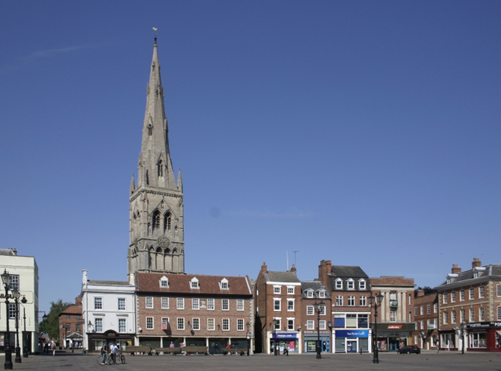


Newark on Trent, United Kingdom
Newark on Trent is a town of 43,363 people in England, United Kingdom.
Why visit Newark on Trent
Townapedia lists 13 museums and landmarks, 12 parks and trails, 71 places to eat, 8 places to stay and 6 attractions in and around town.
Highlights include Trent Bridge, Newark, Winthorpe Bridge, National Civil War Centre and Newark Castle.
Weather in Newark on Trent
Forecast from MET Norway (CC BY 4.0). Full forecast
About Newark on Trent
Newark-on-Trent () or Newark is a market town and civil parish in the Newark and Sherwood district, in Nottinghamshire, England. It lies on the river Trent and was historically a major inland port. The A1 road bypasses the town on the line of the ancient Great North Road. The population of the parish was recorded at 30,345 at the 2021 census.
From the Wikipedia article Newark-on-Trent (this version), under CC BY-SA 4.0.
Travel tips from other travellers: Newark on Trent on Wikivoyage (CC BY-SA 4.0).
Photos of Newark on Trent


Things to do6
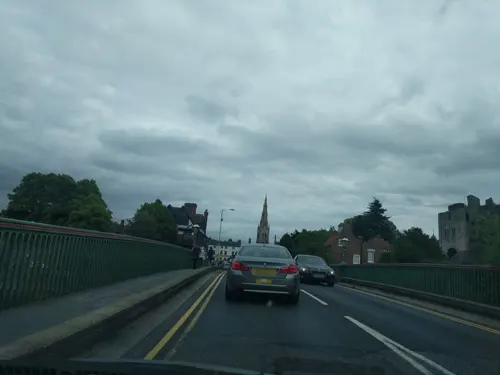
Trent Bridge, Newark
Bridge · 0.8 mi
Bridge in Newark, Nottinghamshire, England
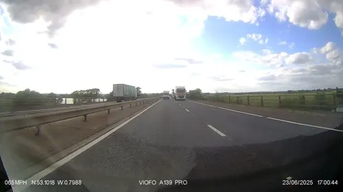
Winthorpe Bridge
Bridge · 2.5 mi
Bridge in Winthorpe, Newark and Sherwood, Nottinghamshire, England, UK

Palace Theatre, Newark
Cinema and theater · 0.8 mi
Theatre and cinema in Newark-on-Trent, Nottinghamshire, England, UK

Museums and landmarks13

National Civil War Centre
Museum · 0.8 mi
14 Appleton Gate, Newark
Tu-Sa 10:00-16:00; Dec 25 off; Jan 01 off

Newark Castle
Monument and historic site · 0.8 mi
Grade I listed castle in Newark-on-Trent, United Kingdom

Newark Air Museum
Museum · 3.2 mi
Aviation museum in Newark on Trent, Nottinghamshire, United Kingdom
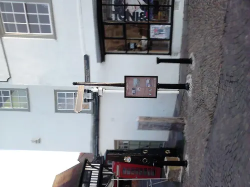
Town Hall
Museum · 0.7 mi
Listed structure in Newark, Nottinghamshire, United Kingdom, used as museum



1 more on the map.
Parks, trails and playgrounds12

Sconce and Devon Park
Park
Park and listed ancient monument in Newark, Nottinghamshire



Restaurants and cafes71
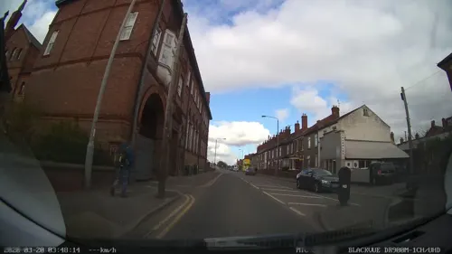
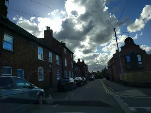


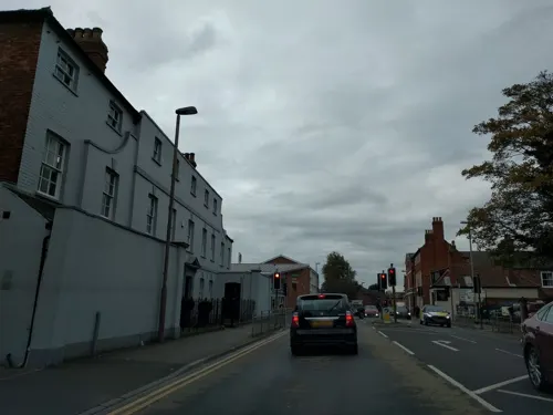
Koinonia
Restaurant · 0.6 mi
19-20 St Mark's Lane, Newark
Mo-Fr 11:30-15:00,18:00-22:00; Fr 18:00-23:00; Sa 11:30-23:00; Su...
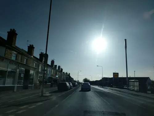
Victoria Fish Bar
Restaurant · Fish And Chips · 0.4 mi
62 Victoria Street, Newark

Castle Barge
Bar and pub · Burger, Local, Pizza, Sausage · 0.9 mi
The Wharf, Newark
Mo 11:00-19:00; Tu 11:00-21:00; We 11:00-23:00; Th 11:00-19:00;...

New Island
Restaurant · Chinese · 1.5 mi
204 London Road, Newark
Tu-Su 17:00-22:00
59 more on the map.
History
The town's origins are likely to be Roman, as it lies on a major Roman road, the Fosse Way. It grew up around Newark Castle and St Mary Magdalene church; it was later developed as a centre for the wool and cloth trades.
The origins of the town are possibly Roman, from its position on an important Roman road, the Fosse Way. In a document which purports to be a charter of 664 AD, Newark is mentioned as having been granted to the Abbey of Peterborough by King Wulfhere of Mercia. An Anglo-Saxon pagan cemetery used from the early fifth to early seventh centuries has been found in Millgate, close to the Fosse Way and the river Trent; cremated remains were buried there in pottery urns.
In the reign of Edward the Confessor, Newark belonged to Godiva and her husband Leofric, Earl of Mercia, who granted it to Stow Minster in 1055. After the Norman Conquest, Stow Minster retained the revenues of Newark, but it came under the control of the Norman Bishop Remigius de Fécamp, after whose death control passed to the Bishops of Lincoln from 1092 until the reign of Edward VI. There were burgesses in Newark at the time of the Domesday survey. The reign of Edward III shows evidence that it had long been a borough by prescription. The Newark wapentake (hundred) in the east of Nottinghamshire was established in the period of Anglo-Saxon rule (10th–11th centuries).
Read more of the history
Newark Castle was originally a fortified manor house founded by the Anglo-Saxon King Edward the Elder. In 1073, Remigius de Fécamp, Bishop of Lincoln, put up an earthwork motte-and-bailey fortress on the site. The river bridge was built about this time under a charter from Henry I, as was St Leonard's Hospital. The bishopric also gained from the king a charter to hold a five-day fair at the castle each year, and under King Stephen to establish a mint. King John died of dysentery in Newark Castle in 1216.
The town became a local centre for the wool and cloth trade – by the time of Henry II a major market was held there. Wednesday and Saturday markets in the town were founded in the period 1156–1329, under a series of charters from the Bishop of Lincoln. After his death, Henry III tried to bring order to the country, but the mercenary Robert de Gaugy refused to yield Newark Castle to the Bishop of Lincoln, its rightful owner. This led to the Dauphin of France (later King Louis VIII of France) laying an eight-day siege on behalf of the king, ended by an agreement to pay the mercenary to leave. Around the time of Edward III's death in 1377, "Poll tax records show an adult population of 1,178, excluding beggars and clergy, making Newark one of the largest 25 or so towns in England."
In 1457, a flood swept away the bridge over the Trent. Although there was no legal requirement to do so, the Bishop of Lincoln, John Chadworth, funded a new bridge of oak with stone defensive towers at either end. In January 1571 or 1572, the composer Robert Parsons fell into the swollen Trent at Newark and drowned.
After the break with Rome in the 16th century, the establishment of the Church of England, and the dissolution of the monasteries, Henry VIII had the Vicar of Newark, Henry Lytherland, executed for refusing to acknowledge the King as head of the Church. The dissolution affected Newark's political landscape. Even more radical changes came in 1547, when the Bishop of Lincoln exchanged ownership of the town with the Crown. Newark was incorporated under an alderman and twelve assistants in 1549; the charter was confirmed and extended by Elizabeth I.
Charles I reincorporated the town under a mayor and aldermen, owing to its increasing commercial prosperity. This charter, except for a temporary surrender under James II, continued to govern the corporation until the Municipal Corporations Act 1835.
In the English Civil War, it was besieged by Parliamentary forces and relieved by Royalist forces under Prince Rupert. Newark was a Royalist stronghold, with Charles I having raised his standard in nearby Nottingham. "Newark was besieged on three occasions and finally surrendered only when ordered to do so by the King after his own surrender." It was attacked in February 1643 by two troops of horsemen, but beat them back. The town fielded at times as many as 600 soldiers and raided Nottingham, Grantham, Northampton, Gainsborough and other places with mixed success, but enough to cause it to rise to national notice. In 1644, Newark was besieged by forces from Nottingham, Lincoln and Derby, until relieved in March by Prince Rupert.
Parliament commenced a new siege towards the end of January 1645 after more raiding, but this was relieved about a month later by Sir Marmaduke Langdale. Newark cavalry fought with the king's forces, which were decisively defeated in the Battle of Naseby, near Leicester, in June 1645.
The final siege began in November 1645, by which time the town's defences had been much strengthened. Two major forts had been built just outside the town, one called the Queen's Sconce to the south-west, and another, the King's Sconce, to the north-east; both were close to the river, with defensive walls and a water-filled ditch of 2.25 miles (3.6 km) around the town. The King's May 1646 order to surrender was only accepted under protest by the town's garrison. After that, much of the defences was destroyed, including the castle, which was left in essentially the state it can be seen today. The Queen's Sconce was left largely untouched; its remains are in Sconce and Devon Park.
From the History section of Newark-on-Trent on Wikipedia, under CC BY-SA 4.0.
More about Newark on Trent
Geography
By road, Newark is 21 miles (34 km) from Nottingham, 19 miles (31 km) from Lincoln and 40 miles (64 km) from Leicester. Locally, the town lies 11 miles (18 km) from Bingham, 14 miles (23 km) from Grantham, 20 miles (32 km) from Mansfield, 19 miles (31 km) from Retford, 19 miles (31 km) from Sleaford and 9 miles (14 km) from Southwell.
Newark lies on the bank of the river Trent, with the river Devon running as a tributary through the town. Standing at the intersection of the Great North Road and the Fosse Way, Newark originally grew around the castle, now ruined, and a large market place now lined with historic buildings. It forms a single built-up area with the neighbouring parish of Balderton to the south-east; Farndon lies to the south, on the A46 road, and Winthorpe is to the north.
Newark's growth and development have been enhanced by one of few bridges over the Trent, by the navigability of the river, by the presence of the Great North Road and later by the advance of the railways, bringing a junction between the East Coast Main Line and the Nottingham to Lincoln line. "Newark became a substantial inland port, particularly for the wool trade," though it industrialised somewhat in the Victorian era and later had an ironworks, engineering, brewing and a sugar refinery.
Economy
British Sugar runs a mill on the outskirts that opened in 1921. It has 130 permanent employees and processes 1.6 million tonnes of sugar beet produced by about 800 UK growers, at an average distance of 28 miles (45 km) from the factory. Of the output, 250,000 tonnes are processed and supplied to food and drink manufacturers in the UK and across Europe. At the heart of the Newark factory's operations is a combined heat and power (CHP) plant, with boilers fuelled by natural gas to meet the site's steam and electricity requirements and contribute to the grid enough power for 800 homes. The installation is rated under the government CHP environmental quality-assurance scheme.
Laurens Patisseries, part of the food group Bakkavör since May 2006, which bought it for £130 million; it employs over 1,000
Currys opened a £30 million national distribution centre, next to the A17 near the A46 roundabout, in 2007; it moved its national distribution centre there in 2005, with over 1,400 staff employed at the site at peak times
Flowserve, formerly Ingersoll Dresser Pumps, has a manufacturing facility in the town
Project Telecom in Brunel Drive was bought by Vodafone in 2003 for a reported £163 million.
Arts and culture
Newark and Sherwood Concert Band, with over 50 regular players, has performed at numerous area events in the last few years. Also based in Newark are the Royal Air Force Music Charitable Trust and Lincolnshire Chamber Orchestra.
The Palace Theatre in Appletongate is Newark's main entertainment venue, offering drama, live music, dance and film.
The National Civil War Centre and Newark Museum, next to the Palace Theatre in Appletongate in the town centre, opened in 2015 to interpret Newark's part in the English Civil War in the 17th century and explore its wider implications.
The district was ranked in a survey reported in 2020 as one of the best places to live in the UK.
Education
The oldest, Magnus Church of England Academy, founded in 1531 by the diplomat Thomas Magnus, lies close to the town centre.
The Newark Academy is in neighbouring Balderton (previously The Grove School). It underwent a £25 million rebuild in 2016 after a long campaign.
The town's several primary schools include a new school in the Middlebeck development on the town's southern edge, opened in September 2021.
Newark College, part of the Lincoln College Group, is situated on Friary Road where it is home to the School of Musical Instrument Crafts. This school, which opened in 1972, has courses to train craftspeople to make and repair guitars, violins and woodwind instruments, and to tune and restore pianos.
From the Wikipedia article Newark-on-Trent, under CC BY-SA 4.0.
Notable people from Newark on Trent
 Rupert SheldrakeEnglish biochemist, author and parapsychological researcher (*1942)Photo: Zereshk, CC BY 3.0
 John BlowEnglish composerPhoto: Charles Grignion the Elder / After..., Public domain
 Shona McCallinBritish field hockey player (1992-)Photo: fourthandfifteen, CC BY 2.0
 Mary KingBritish equestrian sportswomanPhoto: Henry Bucklow/Lazy Photography ( Sffubs ), CC BY-SA 3.0
 William WarburtonBishop of Gloucester (1698-1779)Photo: Edward Kilvert (active 1836–1840)..., Public domain
 Nick BourneBritish politician (born 1952)Photo: ©House of Lords / photography by Roger Harris, CC BY 3.0
 Henry ConstableEnglish poetPhoto: Johan Blaeu, Public domain
 Abi TitmussEnglish actress, television personality, poker player, and former glamour modelPhoto: Gene Bromberg, CC BY-SA 2.0
 Aiden AslinBritish foreign volunteer fighterPhoto: Lance Cpl. Jacqueline Arre Parsons,..., Public domain
- William NicholsonBritish painter, engraver and illustrator (1872-1949)
- Donald WolfitEnglish actor (1902–1968)
- Thomas William RobertsonEnglish dramatist and innovative stage director (1829–1871)
Born in Newark on Trent, according to Wikidata (CC0). Each name links to its Wikipedia article.
Where to stay8
Churches and places of worship26
Shopping23
Gas and EV charging5
Schools, colleges and libraries16
Healthcare2
Map of Newark on Trent
182 places. The map loads OpenStreetMap tiles when you open it.
Getting there and nearby towns
RAF Waddington (WTN) is the nearest airport with scheduled flights listed in OpenStreetMap, 14 miles away.
- Boughton 12 mi northwest, about 19 min by car
- Nottingham 16 mi southwest, about 26 min by car
- Lincoln 16 mi northeast, about 26 min by car
- West Bridgford 16 mi southwest, about 26 min by car
- Hucknall 16 mi west, about 26 min by car
- Mansfield 17 mi west, about 27 min by car
- Basford 17 mi southwest, about 27 min by car
- Mansfield Woodhouse 17 mi northwest, about 27 min by car
- Kirkby in Ashfield 18 mi west, about 29 min by car
- Sleaford 18 mi east, about 28 min by car
Drive times are estimates from straight-line distance, not routes.
Towns near Newark on Trent


Keep exploring
Local news
Headlines from INDB.
Reviews, tips and questions
Loading what members have shared...
Sources and licences
- GeoNames (CC BY 4.0): population, coordinates, regions and time zone
- Mapillary (see each image): photos
- OpenStreetMap contributors (ODbL 1.0): places, airports, map data
- Wikidata (CC0 1.0): elevation, founding date, time zone, website, landmarks and historic places
- Wikimedia Commons (see each image): photos
- Wikipedia (CC BY-SA 4.0): overview and history text
Photo credits
- Newark on Trent UK Market Square, Marcin Floryan, CC BY 2.5
- Newark Castle, 2008, David Ingham from Lancashire, England, CC BY-SA 2.0
- HPHastingT5-TG517, MilborneOne, CC BY-SA 3.0
- Ram Hotel, Newark, Jonathan Thacker, CC BY-SA 2.0
- Queen's Head Public House, Victuallers, CC BY-SA 4.0
- Newark Orchard School, Victuallers, CC BY-SA 4.0
- Queen's Sconce, Richard Croft, CC BY-SA 2.0
- Michal Kwiatkowski (37289513086), Steve. from Louth Lincolnshire, England., CC BY-SA 2.0
- Geraint Thomas (37101259700), Steve. from Louth Lincolnshire, England., CC BY-SA 2.0
- Team Sky (37379393386), Steve. from Louth Lincolnshire, England., CC BY-SA 2.0
- Team Sky bus (37379393446), Steve. from Louth Lincolnshire, England., CC BY-SA 2.0
- Victories (36740983544), Steve. from Louth Lincolnshire, England., CC BY-SA 2.0
- Dimension Data Team Bus (37379393496), Steve. from Louth Lincolnshire, England., CC BY-SA 2.0
- 30 Degrees (36740983504), Steve. from Louth Lincolnshire, England., CC BY-SA 2.0
- Geraint Thomas (37101259610), Steve. from Louth Lincolnshire, England., CC BY-SA 2.0
- Wanty Team Bus Back Window (36740983474), Steve. from Louth Lincolnshire, England., CC BY-SA 2.0
- Dimension Data Team Bus (37379393506), Steve. from Louth Lincolnshire, England., CC BY-SA 2.0
- Dimension Data Team Bus (37379393486), Steve. from Louth Lincolnshire, England., CC BY-SA 2.0
- BMC Back Window (37379393436), Steve. from Louth Lincolnshire, England., CC BY-SA 2.0
- Tao Geoghegan Hart Team Sky (37454624911), Steve. from Louth Lincolnshire, England., CC BY-SA 2.0
- Vasil Kiryienka Team Sky (37450814121), Steve. from Louth Lincolnshire, England., CC BY-SA 2.0
- Floris Gerts BMC Racing (37451067671), Steve. from Louth Lincolnshire, England., CC BY-SA 2.0
- Vasil Kiryienka Team Sky (37450814081), Steve. from Louth Lincolnshire, England., CC BY-SA 2.0
- Quickstep Bus (36740983584), Steve. from Louth Lincolnshire, England., CC BY-SA 2.0
- Dogma F10 (37421378036), Steve. from Louth Lincolnshire, England., CC BY-SA 2.0
- Vasil Kiryienka Team Sky (37450814021), Steve. from Louth Lincolnshire, England., CC BY-SA 2.0
- Tao Geoghegan Hart Team Sky (37454624731), Steve. from Louth Lincolnshire, England., CC BY-SA 2.0
- Owain Doull (23616684788), Steve. from Louth Lincolnshire, England., CC BY-SA 2.0
- National Civil War Centre inside cafe, Victuallers, CC BY-SA 4.0
- Open-lot bowtop vardo Newark, Notts (Bar Gate), David Hallam-Jones, CC BY-SA 2.0
- Street-level photo, adam2, CC BY-SA 4.0
- Street-level photo, adam2, CC BY-SA 4.0
- Street-level photo, adam2, CC BY-SA 4.0
- Street-level photo, adam2, CC BY-SA 4.0
- Street-level photo, adam2, CC BY-SA 4.0
- Street-level photo, adam2, CC BY-SA 4.0
- Street-level photo, adam2, CC BY-SA 4.0
- Street-level photo, adam2, CC BY-SA 4.0
- Street-level photo, adam2, CC BY-SA 4.0
- Street-level photo, cleder, CC BY-SA 4.0
- Street-level photo, adam2, CC BY-SA 4.0
- Street-level photo, adam2, CC BY-SA 4.0
- Street-level photo, adam2, CC BY-SA 4.0
- Street-level photo, adam2, CC BY-SA 4.0
- Street-level photo, cleder, CC BY-SA 4.0
- Street-level photo, adam2, CC BY-SA 4.0
- Street-level photo, adam2, CC BY-SA 4.0
- Street-level photo, adam2, CC BY-SA 4.0
- Street-level photo, IpswichEdits, CC BY-SA 4.0
- Street-level photo, adam2, CC BY-SA 4.0
- Street-level photo, adam2, CC BY-SA 4.0


Page built November 10, 2026. Spotted a mistake? Tell us or suggest a place.