


Why visit Lowdham
Townapedia lists 2 parks and trails, 11 places to eat and 1 attraction in and around town.
Highlights include Gunthorpe Bridge.
Weather in Lowdham
Forecast from MET Norway (CC BY 4.0). Full forecast
About Lowdham
Lowdham is a village and civil parish in the Newark and Sherwood district of Nottinghamshire between Nottingham and Southwell. According to the 2021 census, it had a population of 3,247. Two main roads slicing through the village are the A6097 south-east to north-west and the A612 between Nottingham and Southwell.
From the Wikipedia article Lowdham (this version), under CC BY-SA 4.0.
Things to do1
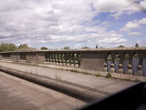
Parks, trails and playgrounds2


Restaurants and cafes11


The Springfield Inn
Bar and pub · 1.2 mi
Mo-We 07:00-22:00; Th-Fr 07:00-23:00; Sa 08:00-23:00; Su 08:00-22:30
The Black Horse
Bar and pub · 1.4 mi
29 Main Street, Nottingham
Tu-Sa 12:00-14:30,18:00-23:30; Su 12:00-17:00,20:00-23:30


Churches and places of worship21

Holy Cross Church, Epperstone
Church · 1.7 mi
Church in Newark and Sherwood, Nottinghamshire, England, UK
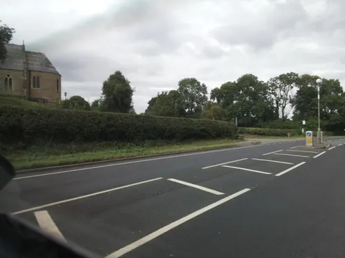
Holy Trinity Church, Bulcote
Church · 1.3 mi
Grade II listed church in Bulcote, Newark and Sherwood, Nottinghamshire, England, UK
St Helen's Church, Burton Joyce
Church · 2.2 mi
Grade I listed church in Burton Joyce, Gedling, Nottinghamshire, England, UK

Holy Trinity Church, Lambley
Church · 2.4 mi
Grade I listed church in Lambley, Gedling, Nottinghamshire, England, UK
Priory Church of St. Peter, Thurgarton
Church · 2.2 mi
Church in Thurgarton, Nottinghamshire, England, UK
St Aidan's Church, Caythorpe
Church · 1.2 mi
Church in Caythorpe, Newark and Sherwood, Nottinghamshire, England, UK
St Helen's Church, Kneeton
Church · 2.6 mi
Grade II listed church in Kneeton, Rushcliffe, Nottinghamshire, England, UK
St Laurence's Church, Gonalston
Church · 1.0 mi
Grade II listed church in Gonalston, Newark and Sherwood, Nottinghamshire, England, UK
St Luke's Church, Stoke Bardolph
Church · 3.4 mi
Church in United Kingdom
St Mary's Church, Lowdham
Church · 0.4 mi
Church in Newark and Sherwood, Nottinghamshire, England, UK
St Michael's Church, Hoveringham
Church · 1.8 mi
Grade II listed church in Hoveringham, Newark and Sherwood, Nottinghamshire, England, UK
St Peter's Church, East Bridgford
Church · 2.5 mi
Grade I listed church in East Bridgford, Rushcliffe, Nottinghamshire, England, UK
9 more on the map.
History
The name Lowdham seems to be derived from the Old English masculine personal nickname Hluda, combined with "hām," meaning village, community, manor, estate, or homestead, resulting in "Hluda's homestead or village." However, the name Lowdham also suggests a Danish origin, with earlier forms such as Ludham and Ludholme.
Relics from the Middle Ages include an alabaster slab and a figure of a knight in armour, located in the chancel of St Mary's Church and inscribed in memory of Sir John de Loudham. The dog at the feet of the effigy indicates that Loudham was a warrior. According to one source, "Many of the Crusaders are represented with their feet on a dog, to show that they followed the standard of the Lord as faithfully as a dog follows the footsteps of his master."
The old church and the castle mound are located to the west of the bypass. St Mary's Church dates back to before the 14th century. In 1826 a Wesleyan Methodist chapel (Top Chapel) was built on Ton Lane, and in 1844 an Independent Primitive Methodist chapel (Bottom Chapel) was established on Main Street. The Top Chapel closed in 1986, but the Bottom Chapel continues to be used as an Independent Methodist church.
Read more of the history
To the northeast of the bypass is Lowdham Mill. There is now little evidence of the frame knitting industry that was significant in this area during the 19th century. In 1844 there were 94 stocking frames operating in Lowdham.
From the History section of Lowdham on Wikipedia, under CC BY-SA 4.0.
Notable people from Lowdham
- Betty Beltoncricketer (1916-1989)
Born in Lowdham, according to Wikidata (CC0). Each name links to its Wikipedia article.
Shopping2
Gas and EV charging1
Schools, colleges and libraries2
Healthcare1
Map of Lowdham
41 places. The map loads OpenStreetMap tiles when you open it.
Getting there and nearby towns
Nottingham City Airport (NQT) is the nearest airport with scheduled flights listed in OpenStreetMap, 7 miles away.
- East Bridgford 3 mi southeast, about 4 min by car
- Arnold 5 mi west, about 9 min by car
- Nottingham 7 mi southwest, about 12 min by car
- Cropwell Bishop 7 mi south, about 11 min by car
- West Bridgford 8 mi southwest, about 12 min by car
- Hucknall 8 mi west, about 13 min by car
- Basford 8 mi southwest, about 13 min by car
- Newark on Trent 9 mi northeast, about 14 min by car
- Mansfield 12 mi northwest, about 19 min by car
- Kirkby in Ashfield 12 mi northwest, about 19 min by car
Drive times are estimates from straight-line distance, not routes.
Towns near Lowdham


Keep exploring
Local news
Headlines from INDB.
Reviews, tips and questions
Loading what members have shared...
Sources and licences
- GeoNames (CC BY 4.0): population, coordinates, regions and time zone
- Mapillary (see each image): photos
- OpenStreetMap contributors (ODbL 1.0): places, airports, map data
- Wikidata (CC0 1.0): elevation, founding date, time zone, website, landmarks and historic places
- Wikimedia Commons (see each image): photos
- Wikipedia (CC BY-SA 4.0): overview and history text
Photo credits
- Lowdham library (24446091153), JuliaC2006 from Rochester, UK, CC BY 2.0
- Old Ship Inn Lowdham (5), Enchufla Con Clave, CC BY-SA 4.0
- Framework Knitters Workshop (south), Lowdham, Alan Murray-Rust, CC BY-SA 2.0
- Framework Knitters Workshop (north), Lowdham, Alan Murray-Rust, CC BY-SA 2.0
- Holy Cross Church, Epperstone, Nottinghamshire (4), Enchufla Con Clave, CC BY-SA 4.0
- View of the blue plaque on "The Old Ship Inn", Eddie.winder, CC BY-SA 4.0
- Old Ship Inn Lowdham (4), Enchufla Con Clave, CC BY-SA 4.0
- Street-level photo, southglos, CC BY-SA 4.0
- Street-level photo, southglos, CC BY-SA 4.0
- Street-level photo, southglos, CC BY-SA 4.0
- Street-level photo, southglos, CC BY-SA 4.0

Page built November 10, 2026. Spotted a mistake? Tell us or suggest a place.