


Ormskirk, United Kingdom
Ormskirk is a town of 24,073 people in England, United Kingdom.
Why visit Ormskirk
Townapedia lists 8 museums and landmarks, 6 parks and trails, 80 places to eat, 1 place to stay and 2 attractions in and around town.
Highlights include Buck 'i'th Vine and Burscough Priory.
Weather in Ormskirk
Forecast from MET Norway (CC BY 4.0). Full forecast
About Ormskirk
Ormskirk is a market town in the West Lancashire district of Lancashire, England. It is located approximately 13 miles (21 km) northeast of Liverpool and forms part of the wider Liverpool urban and commuting area. Ormskirk is known for its historic market, which dates from 1286, and for Ormskirk gingerbread. The town is served by Ormskirk railway station, with regular Merseyrail services to Liverpool Central and Northern Trains services to Preston.
From the Wikipedia article Ormskirk (this version), under CC BY-SA 4.0.
Travel tips from other travellers: Ormskirk on Wikivoyage (CC BY-SA 4.0).
Things to do2


Museums and landmarks8
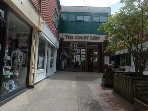

Burscough Priory
Monument and historic site · 1.5 mi
Grade I listed priory in West Lancashire, Lancashire, England, UK

Halton Castle
Monument and historic site · 1.7 mi
Moated site in Lathom, West Lancashire, UK; possibly site of fortified house

Lathom House
Monument and historic site · 2.7 mi
Country house in Lancashire, England, UK


Parks, trails and playgrounds6

Restaurants and cafes80
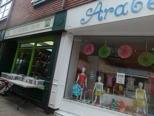
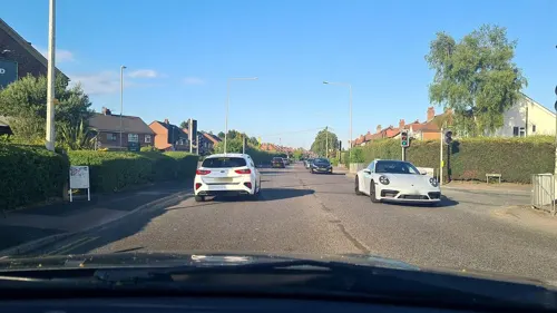
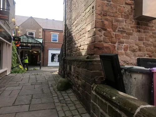
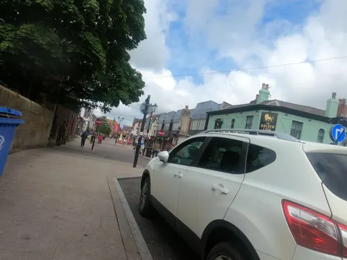



68 more on the map.
History
The name Ormskirk is Scandinavian in origin and is derived from Old Norse Ormres kirkja: Ormr (which means snake in Old Norse), a personal name, and kirkja, church. Ormr may have been a Viking who settled here, became a Christian and founded the church but there are no other records or archaeological evidence to support this and Ormr's identity is unknown.
There is no reference to Ormskirk in the Domesday Book of 1086, but it has been suggested that it may have been part of Lathom at that time. In about 1189, the lord of Lathom granted the church of Ormskirk to Burscough Priory, which does suggest that Ormskirk had been subordinate to Lathom before that date.
An open market is held twice weekly, on Thursdays and Saturdays, in the pedestrianised centre of Ormskirk. The location was originally the junction of the main roads to Preston, Liverpool and Wigan, and was marked by a market cross going back to medieval times. During the 18th and 19th centuries the Cross, as the junction was known, was the location of a large lamp mounted on an obelisk with a circular drinking fountain for both people and animals around the base. This was moved to the junction of St Helens Road and Moor Street to make room for the erection of the clock tower in 1876.
Read more of the history
The fountain was then moved again to opposite the Drill Hall down Southport Road in the 1890s when space was needed to site the Disraeli statue. The market was established by a royal charter that was granted by Edward I in 1286 to the monks of Burscough Priory. Thursday has been market day in Ormskirk since at least 1292. The King also granted a borough charter to Ormskirk at about the same time, but this seems to have become extinct by the end of the 15th century.
The Ormskirk Poor Law Union was established in 1837, covering 21 parishes and townships from Tarleton to Simonswood, and from Birkdale to Skelmersdale. Ormskirk Union Workhouse was built in 1853 on Wigan Road and later became Ormskirk District General Hospital.
With its weekly markets, the town became a focal point for local farmers and their agricultural workers, cottagers, cow-keepers etc. to trade their goods and obtain necessities from the markets and from the retail establishments which were established along with public houses and inns. An engineering industry, based on making and mending agricultural machinery also developed.
The town became known for its gingerbread over the years when local women would bake the gingerbread in their own homes and then take it to the staging inns to sell to passengers. When the railway arrived in the mid 19th century, the local gingerbread sellers found a new market. They were allowed to sell their product to passengers travelling through the railway station. One particular customer Edward, Prince of Wales, later Edward VII, enjoyed the local gingerbread so much he sent orders to the town. The baking of gingerbread became part of the retail history of the town, with several local bakers claiming to have the original gingerbread recipe. A well known local woman, Sally Woods, was a recognisable figure on the market selling her gingerbread.
The Parish Church of St Peter and St Paul is believed to be on the site of the original kirk, on a sandstone outcrop, and is the oldest building in the town. Its exact age is unknown; the building does contain some fragments of Norman architecture.
The parish church has many connections with the Earls of Derby and the Stanley family. Many family members are buried in the church's Derby Chapel, including Thomas Stanley, the first Earl, who caused Richard III to lose his crown by changing sides at the Battle of Bosworth in 1485, and the Royalist James Stanley, the seventh Earl, who was beheaded at Bolton in 1651 after the Civil War. His body is buried in one coffin and his head in a separate casket.
This is one of only three parish churches in England to have a tower and a separate spire, and is unique in that it has both at the same end of the building. (The other two are St Mary's Church, Purton and St Andrew's Church, Wanborough, both near Swindon, in Wiltshire). Legend has it that Orme had two sisters, one who wanted a tower, and one who wanted a spire, and to please them he built both.
The 'steeple' in fact dates from the early 15th century, but the original blew down in 1731 and was rebuilt between 1790 and 1832. The large west tower was added to the church around 1548 to house the bells of nearby Burscough Priory following the dissolution of the monasteries. One of these bells can still be seen in the church.
From the History section of Ormskirk on Wikipedia, under CC BY-SA 4.0.
More about Ormskirk
Geography
Ormskirk is approximately 13 miles (21 km) northeast of Liverpool and is situated in the West Lancashire district of Lancashire. The town is surrounded by a number of nearby towns and villages, with Burscough to the north, Skelmersdale to the east and Southport to the northwest. Aughton, Lathom and Scarisbrick are among the villages immediately surrounding Ormskirk, while Maghull and Formby lie to the southwest towards Liverpool.
Although administratively part of Lancashire, Ormskirk has strong links with Merseyside and the wider Liverpool City Region, particularly through employment, education, retail and transport. The town forms part of the wider economic area influenced by Liverpool and its surrounding towns, with commuting links between West Lancashire and Liverpool and neighbouring Sefton being significant. Ormskirk is also closely connected with the other principal settlements of West Lancashire, particularly Burscough and Skelmersdale, and serves as an important centre for the surrounding communities.
Education
Ormskirk School (ages 11–18) is on Wigan Road in the east of the town, situated on a site formerly home to the demolished Cross Hall High School. The school is now part of the Endeavour Learning Trust. Ormskirk School is the result of a merger between Ormskirk Grammar School and Cross Hall High School. St Bede's Catholic High School (ages 11–16) is on St Anne's Road next to the A59 and Prescot Road, and opposite St Anne's Church. Edge Hill University is on the A570 St Helens Road heading east. West Lancashire College, a further education college, used to have a site in the town centre on Hants Lane but its students now have to travel to Skelmersdale. Ormskirk is also home to a public library.
From the Wikipedia article Ormskirk, under CC BY-SA 4.0.
Notable people from Ormskirk
 Kieran DowellEnglish association football playerPhoto: Mattythewhite, CC BY-SA 4.0
 Robbie SlaterAustralian association football playerPhoto: Camw, CC BY-SA 3.0
 William Moorcroft18th/19th-century English travelerPhoto: Hyder Young Hearsey, Public domain
 Ben WigginsBritish cyclistPhoto: Nicola, CC BY-SA 4.0
 Michael Jonescricketer (born 1998)Photo: Dave Morton, Public domain
 Mayumi PachecoEnglish footballerPhoto: James Boyes from UK, CC BY 2.0
 Euphemia LambBritish artist's modelPhoto: Ambrose McEvoy, Public domain
 Tom HartleyEnglish cricketerPhoto: Dave Morton, Public domain
- James Hopwood JeansBritish mathematician and astronomer (1877 – 1946)
- Stephen WarnockEnglish association football player
- John RimmerBritish athlete (1878-1962)
- Tony MorleyEnglish footballer (born 1954)
Born in Ormskirk, according to Wikidata (CC0). Each name links to its Wikipedia article.
Where to stay1
Churches and places of worship11
Shopping15
Gas and EV charging2
Schools, colleges and libraries13
Healthcare11
Ormskirk District General Hospital
Hospital · 0.4 mi
Wigan Road, Lancashire
Map of Ormskirk
149 places. The map loads OpenStreetMap tiles when you open it.
Getting there and nearby towns
Warton Aerodrome (WRT) is the nearest airport with scheduled flights listed in OpenStreetMap, 12 miles away.
- West Derby 9 mi south, about 15 min by car
- St Helens 10 mi southeast, about 16 min by car
- Wigan 10 mi east, about 16 min by car
- Liverpool 11 mi south, about 19 min by car
- Rainhill 11 mi southeast, about 18 min by car
- Birkenhead 13 mi southwest, about 21 min by car
- Woolton 13 mi south, about 21 min by car
- Preston 15 mi northeast, about 25 min by car
- Westhoughton 15 mi east, about 24 min by car
- Warrington 17 mi southeast, about 28 min by car
Drive times are estimates from straight-line distance, not routes.
Towns near Ormskirk


Keep exploring
Local news
Headlines from INDB.
Reviews, tips and questions
Loading what members have shared...
Sources and licences
- GeoNames (CC BY 4.0): population, coordinates, regions and time zone
- Mapillary (see each image): photos
- OpenStreetMap contributors (ODbL 1.0): places, airports, map data
- Wikidata (CC0 1.0): elevation, founding date, time zone, website, landmarks and historic places
- Wikimedia Commons (see each image): photos
- Wikipedia (CC BY-SA 4.0): overview and history text
Photo credits
- Ormskirk market, Small-town hero, Public domain
- Ruins of Burscough Priory, Small-town hero, Public domain
- Lathom House West Wing, Small-town hero, Public domain
- St Cuthbert's Church, Halsall, Small-town hero, Public domain
- Burscough Parish Church, Small-town hero, Public domain
- St Michael's Parish Church, Aughton, Small-town hero, Public domain
- Faculty of Health and Social Care, Edge Hill University, CC BY-SA 2.0
- Ormskirk Parish Church, Small-town hero, Public domain
- St James' Church, Vicarage Lane, Westhead, Gary Rogers, CC BY-SA 2.0
- Lune Halton village 6105, Photograph by Clem Rutter, Rochester, Kent. ( www.clemrutter.net )., CC BY-SA 3.0
- Street-level photo, davidsong, CC BY-SA 4.0
- Street-level photo, tonys999, CC BY-SA 4.0
- Street-level photo, mappo2, CC BY-SA 4.0
- Street-level photo, davidsong, CC BY-SA 4.0
- Street-level photo, mappo2, CC BY-SA 4.0
- Street-level photo, tonys999, CC BY-SA 4.0
- Street-level photo, tonys999, CC BY-SA 4.0
- Street-level photo, tonys999, CC BY-SA 4.0
- Street-level photo, mappo2, CC BY-SA 4.0
- Street-level photo, davidsong, CC BY-SA 4.0
- Street-level photo, tonys999, CC BY-SA 4.0
- Street-level photo, mappo2, CC BY-SA 4.0
- Street-level photo, mappo2, CC BY-SA 4.0
- Street-level photo, tonys999, CC BY-SA 4.0
- Street-level photo, davidsong, CC BY-SA 4.0
- Street-level photo, tonys999, CC BY-SA 4.0
- Street-level photo, tonys999, CC BY-SA 4.0
- Street-level photo, tonys999, CC BY-SA 4.0
- Street-level photo, tonys999, CC BY-SA 4.0
- Street-level photo, davidsong, CC BY-SA 4.0
- Street-level photo, tonys999, CC BY-SA 4.0
- Street-level photo, mappo2, CC BY-SA 4.0


Page built November 10, 2026. Spotted a mistake? Tell us or suggest a place.