


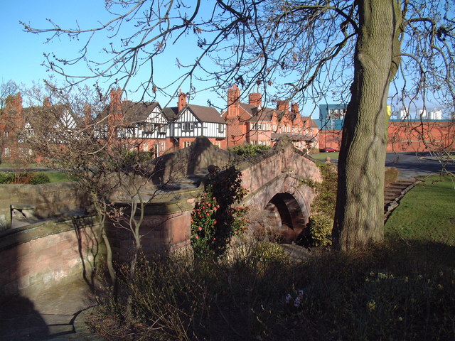


Why visit Prenton
Townapedia lists 14 museums and landmarks, 18 parks and trails, 56 places to eat, 1 place to stay and 4 attractions in and around town.
Highlights include Bidston Lighthouse, Dell Bridge, Port Sunlight, Birkenhead Priory and Birkenhead War Memorial.
Weather in Prenton
Forecast from MET Norway (CC BY 4.0). Full forecast
About Prenton
Prenton is a suburb of Birkenhead, Merseyside, England. Administratively, it is also a ward of the Metropolitan Borough of Wirral. Before local government reorganisation on 1 April 1974, it was part of the County Borough of Birkenhead, within the county of Cheshire. Situated in the east of the Wirral Peninsula, the area is contiguous with Oxton to the north, Tranmere and Rock Ferry to the east and Higher Bebington to the south east.
From the Wikipedia article Prenton (this version), under CC BY-SA 4.0.
Photos of Prenton


Things to do4

Bidston Lighthouse
Lighthouse · 2.4 mi
Lighthouse in Wirral, Merseyside, England, UK

Dell Bridge, Port Sunlight
Bridge · 2.7 mi
Grade II listed bridge in Wirral

Argyle Theatre
Cinema and theater · 2.1 mi
Former theatre, music hall and cinema in Birkenhead, England

Museums and landmarks14

Birkenhead Priory
Museum · 2.3 mi
Monastery and musem in Wirral, United Kingdom

Birkenhead War Memorial
Monument and historic site · 2.4 mi
Grade II listed war memorial in Wirral, Merseyside, England, UK

John Lennon Peace Monument
Monument and historic site · 3.3 mi
Monument dedicated to the memory of John Lennon in Liverpool

Lady Lever Art Gallery
Museum · 2.4 mi
Art museum in Wirral, Merseyside, England, UK

Leverhulme Memorial
Monument and historic site · 2.4 mi
Memorial in Port Sunlight, Merseyside, England, UK

Monument to the Mersey Tunnel
Monument and historic site · 2.2 mi
Monument in Birkenhead, Merseyside, England, UK

Port Sunlight War Memorial
Monument and historic site · 2.6 mi
Grade I listed war memorial in Wirral, Merseyside, England, UK

Queen Victoria Monument, Birkenhead
Monument and historic site · 2.4 mi
Monument in Birkenhead, Merseyside, England, UK

Tate Liverpool
Museum · 3.4 mi
Modern art gallery and museum in Liverpool, Merseyside, England

Williamson Art Gallery and Museum
Museum · 1.3 mi
Art museum in Wirral, Merseyside, England, UK

Eureka! Science + Discovery
Museum · 3.3 mi
Tourist attraction in Seacombe, Wallasey, Merseyside, North West England
2 more on the map.
Parks, trails and playgrounds18


Birkenhead Park
Park · 1.8 mi
Public park in Birkenhead, Wirral, Merseyside, England, UK

Central Park, Wallasey
Park · 3.3 mi
Public park in Liscard, Wirral, England
Dock Branch Park
Park · 2.2 mi
Proposed public park in Birkenhead, Merseyside, England, UK, due to open in 2023

Port Sunlight River Park
Park · 3.0 mi
Park in Port Sunlight, United Kingdom




6 more on the map.
Restaurants and cafes56



44 more on the map.
History
Prenton appears as Prestune in the Domesday Book of 1086, with the name Pren-ton persisting despite the Norman-French accented spelling. Domesday records the presence of a water mill at Prenton, and this has been provisionally identified at Prenton Dell. The Domesday survey also describes Prenton as having a one-league square woodland - which is 9 sq mi (23 km2), if the league is taken in its old English measurement of 3 mi (4.8 km).
The size and importance of the wood may reflect the name of the settlement. Pren is Welsh (British) for the material 'wood' and in the name Prenton there is the Saxon suffix tún for a settlement, which suggests a settlement in a wood. The Welsh/British name for Prenton would thus be Prentre which could easily have changed into Prenton following Anglian penetration of the area in the early seventh century. Note that Landican (one mile distant from Prenton) retained its Welsh/British name even through Anglian and subsequent Norse occupation.
Another explanation for the origins of the name is Praen is an Old English personal noun, with Praen-tún meaning "Praen's farm/settlement".
The name has been variously spelt over time as Prenton (1260), Prempton (1620) and Printon (1642).
Read more of the history
Until significant residential development from the beginning of the twentieth century, Prenton remained a rural hamlet centred around Prenton Hall, in the south west of the current suburban area.
This was the seat of the former lords of the manor, a title which has passed through several families since the reign of Edward III. It was described as being "in a sheltered dingle, surrounded with trees of large growth". The former Prenton Hall was eventually abandoned and replaced by a large farmhouse of the same name in the seventeenth century.
In August 1940, during the Second World War, a house maid working in Prenton became the first fatality of a bombing raid on the Merseyside area.
Previously a township in Woodchurch parish, Wirral Hundred, Prenton was a civil parish from 1866 to 1 April 1933 when it was added to Birkenhead civil parish. The population was recorded at 81 in 1801, 99 in 1851, 412 in 1901 and 2032 in 1931.
By 1928 local government responsibility for Prenton changed from Wirral Rural District to the County Borough of Birkenhead.
On 1 April 1974, local government reorganisation in England and Wales resulted in most of the Wirral Peninsula, including Prenton, transfer from Cheshire to the nascent county of Merseyside.
From the History section of Prenton on Wikipedia, under CC BY-SA 4.0.
More about Prenton
Geography
Prenton is situated on the eastern side of the Wirral Peninsula, about 2.5 km (1.6 mi) west of the River Mersey at Tranmere Oil Terminal. The area is approximately 6.5 km (4 mi) south-south-east of the Irish Sea at Wallasey and about 7.5 km (5 mi) east-north-east of the Dee Estuary at Thurstaston. Prenton is at an elevation of between 17–80 m (56–262 ft) above sea level; the highest point being near the junction of Pine Walks and Burrell Road, with the Halfway House crossroads at an elevation of 50 m (160 ft) above sea level.
Prenton Brook merges with the River Fender, at Prenton, within the North Cheshire Trading Estate.
From the Wikipedia article Prenton, under CC BY-SA 4.0.
Where to stay1
Churches and places of worship40
Church of Our Lady of the Immaculate Conception, Birkenhead
Church · 2.3 mi
Shopping6
Gas and EV charging2
Schools, colleges and libraries23
St Joseph's Catholic Primary School, Birkenhead
School · Roman Catholic · 0.9 mi
Woodchurch Road, Prenton
Healthcare7
Map of Prenton
171 places. The map loads OpenStreetMap tiles when you open it.
Getting there and nearby towns
Liverpool John Lennon Airport (LPL) is the nearest airport with scheduled flights listed in OpenStreetMap, 9 miles away.
- Birkenhead 2 mi northeast, about 4 min by car
- Heswall 3 mi southwest, about 5 min by car
- Moreton 3 mi northwest, about 5 min by car
- Bromborough 3 mi southeast, about 5 min by car
- Liverpool 4 mi northeast, about 7 min by car
- Dingle 4 mi east, about 6 min by car
- Neston 6 mi south, about 9 min by car
- Childwall 7 mi east, about 11 min by car
- Litherland 7 mi north, about 12 min by car
- West Derby 7 mi northeast, about 12 min by car
Drive times are estimates from straight-line distance, not routes.
Towns near Prenton


Keep exploring
Local news
Headlines from INDB.
Reviews, tips and questions
Loading what members have shared...
Sources and licences
- GeoNames (CC BY 4.0): population, coordinates, regions and time zone
- Mapillary (see each image): photos
- OpenStreetMap contributors (ODbL 1.0): places, airports, map data
- Wikidata (CC0 1.0): elevation, founding date, time zone, website, landmarks and historic places
- Wikimedia Commons (see each image): photos
- Wikipedia (CC BY-SA 4.0): overview and history text
Photo credits
- A552 road 4, Rept0n1x, CC BY-SA 3.0
- Bidston Lighthouse 102, RHaworth, CC BY 2.5
- Dell Bridge, David Squire, CC BY-SA 2.0
- Birkenhead Priory from St Mary's Tower 2019-2, Rodhullandemu, CC BY-SA 4.0
- Birkenhead War Memorial, Rodhullandemu, CC BY-SA 4.0
- John Lennon peace memorial, Echo Arena 1, Rodhullandemu, CC BY-SA 4.0
- Lady Lever Art Gallery, Port Sunlight - IMG 0915, Rept0n1x, CC BY-SA 3.0
- Queensway tunnel pylon in Birkenhead, Rept0n1x, CC BY-SA 3.0
- Port Sunlight War Memorial 2020, Rodhullandemu, CC BY-SA 4.0
- Queen Victoria Monument, Birkenhead, Rodhullandemu, CC BY-SA 4.0
- Tate Liverpool 2020, Rodhullandemu, CC BY-SA 4.0
- Arrowe Park - DSC04040, Rept0n1x, CC BY-SA 3.0
- Arrowe Park - DSC04037, Rept0n1x, CC BY-SA 3.0
- Grand Entrance, Birkenhead Park 2019, Rodhullandemu, CC BY-SA 4.0
- Liscard Hall, Central Park-by-Sue-Adair, Sue Adair, CC BY-SA 2.0
- Tree stump sculpture at Port Sunlight River Park (30099888911), Rept0n1x, CC BY-SA 2.0
- Coach House, Royden Park 2019-2, Rodhullandemu, CC BY 3.0
- Christ Church, Higher Bebington 1, Rodhullandemu, CC BY-SA 4.0
- Oxton Congregational church from Balls Road East, Rodhullandemu, CC BY-SA 4.0
- All Saints, Thornton Hough 2020-1, Rodhullandemu, CC BY-SA 4.0
- Christ Church, Barnston north side, Rodhullandemu, CC BY-SA 4.0
- Christ Church, Oxton 2018-2, Rodhullandemu, CC BY-SA 4.0
- Christ Church, Port Sunlight, Rodhullandemu, CC BY-SA 4.0
- Christ the King, Birkenhead (4), Rept0n1x, CC BY-SA 3.0
- Church of Our Lady of the Immaculate Conception, Birkenhead 2019, Rodhullandemu, CC BY-SA 4.0
- Our Lady Star of the Sea and St Joseph, Seacombe 3a, Rodhullandemu, CC BY-SA 4.0
- St John, Frankby 2019-1, Rodhullandemu, CC BY-SA 4.0
- St Paul's Church, Rock Ferry 2020, Rodhullandemu, CC BY-SA 4.0
- South side of Holy Cross, Woodchurch, Rodhullandemu, CC BY-SA 4.0
- Williamson Art Gallery, Oxton, Merseyside, Rept0n1x, CC BY-SA 2.0
- Birkenhead School, Shrewsbury Road, Oxton, Rept0n1x, CC BY-SA 3.0
- St Anselm's college, Birkenhead (2), Rept0n1x, CC BY-SA 3.0
- St Anselm's College, Birkenhead, Rept0n1x, CC BY-SA 3.0
- Belgrano, Birkenhead, Rodhullandemu, CC BY-SA 4.0
- Birkenhead Corporation bus 355 Guy Arab II Massey DCM 975 in Birkenhead, Wirral, Cheshire 29 March 1972, Alan Murray-Rust, CC BY-SA 2.0
- 20170603 Avon AE56 LWL, Alex Noble, CC0
- 20170603-Avon-KU02YUH, Alex Noble, CC0
- 20170603-Avon-Darts, Alex Noble, CC0
- 20170603-Avon-ALX400s, Alex Noble, CC0
- 20170603-Avon-M420RRN, Alex Noble, CC0
- The Leverhulme Memorial, Port Sunlight, The wub, CC BY-SA 4.0
- Street-level photo, skifans, CC BY-SA 4.0


Page built November 10, 2026. Spotted a mistake? Tell us or suggest a place.