


Why visit Garston
Townapedia lists 9 museums and landmarks, 8 parks and trails, 26 places to eat, 1 place to stay and 2 attractions in and around town.
Highlights include Ellesmere Port Lighthouse, Cineworld, Speke Hall and 20 Forthlin Road.
Weather in Garston
Forecast from MET Norway (CC BY 4.0). Full forecast
About Garston
Garston is a district of Liverpool, in Merseyside, England. Historically in Lancashire, it is bordered by the suburbs of Aigburth, Allerton, and Speke. It lies on the Eastern banks of the River Mersey.
From the Wikipedia article Garston, Liverpool (this version), under CC BY-SA 4.0.
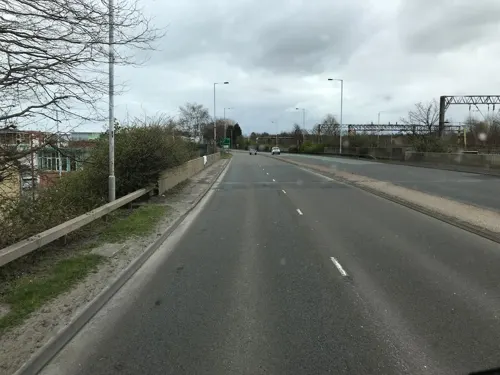
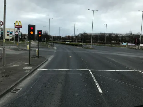
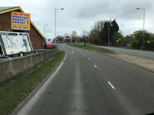
Photos of Garston


Things to do2

Ellesmere Port Lighthouse
Lighthouse · 3.1 mi
Lighthouse in Cheshire, England, UK

Museums and landmarks9

Speke Hall
Museum · 1.1 mi
Tudor house in Liverpool, Merseyside, England, UK
The Walk

20 Forthlin Road
Museum · 2.5 mi
House in which Paul McCartney had lived for several years

Calderstones Park
Monument and historic site · 3.3 mi
Public park in Liverpool, England

Mendips, Menlove Avenue
Museum · 3.1 mi
Childhood home of John Lennon in Liverpool, Merseyside, England, UK

Mount Manisty
Monument and historic site · 2.1 mi
Manmade hill in Cheshire, UK

National Waterways Museum, Ellesmere Port
Museum · 3.1 mi
Museum in Ellesmere Port, Cheshire West and Chester, United Kingdom

Robin Hood's Stone
Monument and historic site · 2.6 mi
Menhir in Liverpool, Merseyside, England, UK


Parks, trails and playgrounds8

Allerton Tower Park
Park · 2.7 mi
Public park on what was a country estate



Speke and Garston Coastal Reserve
Park · 0.7 mi
Nature reserve in Liverpool, UK
Restaurants and cafes26





14 more on the map.
History
In medieval times, Garston was home to a group of Benedictine monks. The first recorded mention of settlement in Garston is of the Church of St Michael in 1235. By the 19th century, the area had become a small village. Garston was formerly a township and chapelry in the parish of Childwall, in 1866 Garston became a separate civil parish, from 1894 to 1902 Garston was an urban district, on 1 April 1922 the parish was abolished and merged with Liverpool. In 1921 the parish had a population of 28,729.
A small dock was first built at Garston in 1793 for Blackburne's Saltworks, which still stands today.
Garston's growth accelerated rapidly in the 1840s, when in 1846, the area's first dock was constructed and opened, under the auspices of the St Helens and Runcorn Gap Railway Company. The "Old Dock" was followed twenty years later by a second, the "North Dock." The third and final dock, Stalbridge, was opened in 1907. In 1903, Garston was incorporated into the City of Liverpool. The population expanded as migrants flooded in to work on the docks, especially from Ireland.
From the History section of Garston, Liverpool on Wikipedia, under CC BY-SA 4.0.
More about Garston
Arts and culture
Garston was home to the 'New Slaughterhouse Gallery' on St. Mary's Road, which aimed to promote local artists as well as community regeneration in partnership with the Garston Embassy on Wellington Street but is now closed. Cressington and Grassendale Parks are nearby, and there is a public swimming pool on Long Lane.
A former venue, the Winter Gardens (since demolished), opposite the police station in Heald Street, hosted concerts, dances and other public events.
From the Wikipedia article Garston, Liverpool, under CC BY-SA 4.0.
Notable people from Garston
 Rita TushinghamEnglish actressPhoto: che (Please credit as "Petr Novák,..., CC BY-SA 2.5
 Heidi ThomasEnglish screenwriter and playwrightPhoto: Digsa, CC BY-SA 4.0
 Les DennisEnglish television presenter, actor, and comedianPhoto: Ben Salter, CC BY 2.0
 Jack JonesBritish Trade Union leader (1913-2009)Photo: European Communities, Attribution
- Steve Morganbusinessman
- Lillian BirkenheadBritish swimmer
- Tommy WilliamsBritish association football player (1929-1979)
- Jackie WilliamsFootballer born 1929
- Tony McLoughlinFootballer (1946-2012)
- Simon O'BrienBritish actor
- Robert WhiteleggBritish locomotive engineer (1871-1957)
- Mary RasmussenBritish politician
Born in Garston, according to Wikidata (CC0). Each name links to its Wikipedia article.
Where to stay1
Churches and places of worship15
Shopping9
Schools, colleges and libraries3
Healthcare1
Map of Garston
74 places. The map loads OpenStreetMap tiles when you open it.
Getting there and nearby towns
Liverpool John Lennon Airport (LPL) is the nearest airport with scheduled flights listed in OpenStreetMap, 2 miles away.
- Speke 2 mi east, about 4 min by car
- Woolton 3 mi northeast, about 5 min by car
- Halewood 3 mi northeast, about 5 min by car
- Liverpool 6 mi northwest, about 10 min by car
- Birkenhead 6 mi northwest, about 10 min by car
- West Derby 7 mi north, about 11 min by car
- Neston 7 mi southwest, about 11 min by car
- Heswall 8 mi west, about 13 min by car
- Rainhill 8 mi northeast, about 13 min by car
- St Helens 11 mi northeast, about 17 min by car
Drive times are estimates from straight-line distance, not routes.
Towns near Garston


Keep exploring
Local news
Headlines from INDB.
Reviews, tips and questions
Loading what members have shared...
Sources and licences
- GeoNames (CC BY 4.0): population, coordinates, regions and time zone
- Mapillary (see each image): photos
- OpenStreetMap contributors (ODbL 1.0): places, airports, map data
- Wikidata (CC0 1.0): landmarks and historic places
- Wikimedia Commons (see each image): photos
- Wikipedia (CC BY-SA 4.0): overview and history text
Photo credits
- Ellesmere-port-lighthouse-2, Traveler100, CC BY-SA 4.0
- Speke Hall moated site, Liverpoolpics, CC BY-SA 3.0
- Paulhousenationaltrust, Havaska at English Wikipedia, CC BY-SA 3.0
- Calderstones House, Sue Adair, CC BY-SA 2.0
- Mendips 202001, Rodhullandemu, CC BY-SA 4.0
- Ellesmere Port Boat Museum - 2013-08-31 (2), Rept0n1x, CC BY-SA 3.0
- Robin Hood's Stone 1, Rodhullandemu, CC BY-SA 4.0
- Sudley House Liverpool, Man vyi, Public domain
- Lodge of Allerton Towers 2019, Rodhullandemu, CC BY-SA 4.0
- Clarkes Gardens, Allerton (1), Reptonix free Creative Commons licensed photos, CC BY 3.0
- Eastham Country Park, Wirral - DSC03452, Rept0n1x, CC BY-SA 3.0
- Otterspool Promenade, Liverpoolpics, CC BY-SA 3.0
- Walled Garden Woolton Woods, Beno1000, CC BY-SA 2.5
- All Saints, Speke, Rodhullandemu, CC BY-SA 4.0
- Chapel of the Good Shepherd, Carlett Park 3, Rodhullandemu, CC BY-SA 4.0
- Christ Church, Ellesmere Port (1), Rept0n1x, CC BY-SA 3.0
- All Hallows, Allerton 1, Rodhullandemu, CC BY-SA 3.0
- Frontage, St Anne's Aigburth 1, Rodhullandemu, CC BY-SA 4.0
- St Matthew and St James, Rose Lane, Liverpool 2019, Rodhullandemu, CC BY-SA 4.0
- St Ambrose church, Speke 1, Rodhullandemu, CC BY-SA 4.0
- St Austin's Church, Grassendale, Rept0n1x, CC BY-SA 3.0
- St Barnabas, Bromborough from southeast, Rodhullandemu, CC BY-SA 4.0
- St Mary's Church, Eastham 2020-3, Rodhullandemu, CC BY-SA 4.0
- St Mary's Church, Grassendale, Rept0n1x, CC BY-SA 3.0
- Enterprise South Liverpool Academy, Doodyc, CC BY-SA 3.0
- New Mersey Shopping Park, Liverpoolpics, CC BY-SA 3.0
- Manchester Ship Canal by Mount Manisty 3668914, https://www.geograph.org.uk/profile/48289, CC BY-SA 2.0
- Uromyces hyacinthi (10), Stephen James McWilliam, CC0
- Candelariella vitellina 122241014, Stephen James McWilliam, CC BY 4.0
- Syntrichia ruralis 120662857, Stephen James McWilliam, CC BY 4.0
- St Mary's Church, Woolton, TurboGUY, CC BY-SA 4.0
- Street-level photo, ricorico, CC BY-SA 4.0
- Street-level photo, ricorico, CC BY-SA 4.0
- Street-level photo, filipb, CC BY-SA 4.0
- Street-level photo, ricorico, CC BY-SA 4.0
- Street-level photo, ricorico, CC BY-SA 4.0
- Street-level photo, ricorico, CC BY-SA 4.0
- Street-level photo, ricorico, CC BY-SA 4.0


Page built November 10, 2026. Spotted a mistake? Tell us or suggest a place.