


Halewood, United Kingdom
Halewood is a town of 20,430 people in England, United Kingdom.
Why visit Halewood
Townapedia lists 5 museums and landmarks, 16 parks and trails, 35 places to eat, 1 place to stay and 2 attractions in and around town.
Highlights include Hale Head Lighthouse, Yew Tree Farm Shop, 20 Forthlin Road and Calderstones Park.
Weather in Halewood
Forecast from MET Norway (CC BY 4.0). Full forecast
About Halewood
Halewood is a town and civil parish in the Metropolitan Borough of Knowsley, Merseyside, England, near the city of Liverpool's southeastern boundary, bordered by the suburbs of Netherley, Hunt's Cross and Woolton.
From the Wikipedia article Halewood (this version), under CC BY-SA 4.0.
Photos of Halewood

Things to do2


Museums and landmarks5

20 Forthlin Road
Museum · 2.8 mi
House in which Paul McCartney had lived for several years

Calderstones Park
Monument and historic site · 3.0 mi
Public park in Liverpool, England

Mendips, Menlove Avenue
Museum · 2.4 mi
Childhood home of John Lennon in Liverpool, Merseyside, England, UK

Robin Hood's Stone
Monument and historic site · 3.1 mi
Menhir in Liverpool, Merseyside, England, UK

Speke Hall
Museum · 2.4 mi
Tudor house in Liverpool, Merseyside, England, UK
Parks, trails and playgrounds16

Allerton Tower Park
Park · 2.0 mi
Public park on what was a country estate


Hale Duck Decoy
Park · 2.4 mi
Duck decoy and nature reserve in Halton, Cheshire, England, UK


Speke and Garston Coastal Reserve
Park · 2.7 mi
Nature reserve in Liverpool, UK

4 more on the map.
Restaurants and cafes35
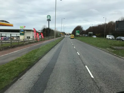
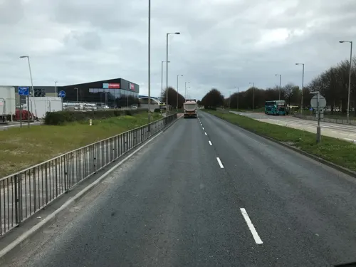


The Hillfoot Inn
Bar and pub · 1.4 mi
Hillfoot Road, Liverpool
Su-Mo 11:00-22:00; Tu-Th 11:00-23:00; Fr-Sa 11:00-23:30


23 more on the map.
History
The township of Halewood lies between the old course of Ditton Brook in the north and Rams Brook in the south. Disputes over the manor lands of Halewood between the Ireland and Holland families began in the 13th century and were to be ongoing for some time. The Ireland family had Hale, most of Halebank and part of North End, while the Holland family who were the superior lords, controlled most of North End and a portion of Halebank. However, the Hollands were based at a Hall in Halebank, while the Irelands' main residence was the 'Hutt' within Halewood.
By the 15th century, Halewood was a separate township from Hale and in 1682, the manor of Halewood became part of the dower of Charlotte, Countess of Derby.
Halewood once had a workhouse for the township's poor that opened in 1723. The workhouse was housed in a cottage rented from the Earl of Derby in 1722. It was run at a cost of 6d per annum, and had space for 40 people. It worked with other parts of the community to give aid to the homeless ('vagrants') and gave the poor a coal allowance and schooling.
Read more of the history
In 1839, the Chapel of St Nicholas was built. It was later enlarged in 1847 and in 1868, St Nicholas' Chapel become a rectory and a true Parish Church. A tower and bells were added to the church around 1883. St Nicholas' Church is Grade II listed and has 17 historically significant stained glass windows designed by William Morris (1834–1896), the English textile designer, poet, novelist, translator, and socialist activist, and Edward Burne-Jones. The church also has a Henry Willis organ installed in 1889.
William Imrie, Liverpool shipowner who owned the White Star Line is buried in Halewood. Imrie died in 1906. A service was held at St Margaret's Church and his body was laid with that of his wife in the family plot in the graveyard of St Nicholas Church. The church also has war memorial, erected in 1921.
Halewood railway station opened in 1988. An earlier station, a few hundred metres further east, on Baileys Lane had closed in 1951. The original Halewood station opened 1874 and first appeared in the timetable in May that year. The railway line in Halewood passed on a three-arched sandstone viaduct. The station was high up on an embankment, and for this reason it was constructed from timber (unlike nearly all of the other CLC stations which were palatial brick structures).
There are a few pubs in Halewood, with the oldest being The Eagle & Child (c.1750). It was renamed The Reverend Plummer in late 2018, but restored back to its original name in mid-2020. Reverend Canon F B Plummer was the vicar of St Nicholas Church from 1902 to 1926, and lost three of his seven sons during the First World War. His sons are memorialised on the cenotaph in St Nicholas' churchyard.
Halewood is home to the first war horse grave to be awarded heritage protection. Blackie was a war horse buried at the RSPCA Liverpool Animal Centre, Higher Road, Halewood in 1942. He served with the 275th Brigade Royal Field Artillery 'A' Battery – 55th West Lancashire Division in most of the major battles of the First World War, including Arras, the Somme Offensive and Ypres. Recognising the contribution Blackie made as a horse in service with the British Army during the First World War, his grave in Halewood became a grade II listed monument in 2017.
Halewood was one of the sites of the Survey of English Dialects. Despite being close to Liverpool, the speech of Halewood at the time was still traditional Lancashire dialect and not Scouse.
From the History section of Halewood on Wikipedia, under CC BY-SA 4.0.
More about Halewood
Economy
The Halewood plant, which is in Speke, L24 9BJ, is now home to the Halewood Body & Assembly of Jaguar Land Rover. On the same site is a large factory owned by Ford Motor Company which produces gearboxes Ford cars.
Halewood Park Triangle is Halewood's main public park, securing a Green Flag Award in 2011. Consisting largely of mature woodland, with ponds, meadow habitat and heathland remnants, the park is a designated Local Wildlife Site. Its layout is closely linked to its railway history. It formed part of the Liverpool Loop Line and the Transpennine Trail now follows the route leading southwards to Halewood Doorstep Green.
On the abolition of the administrative county of Lancashire in 1974, the urban district was also abolished and its former area was transferred to Merseyside to be combined with that of other districts to form the present-day metropolitan borough of Knowsley. The Knowsley borough was formed on 1 April 1974 by the merger of, Huyton-with-Roby Urban District, Kirkby Urban District and Prescot Urban District, along with most of Whiston Rural District (of which Halewood was part) and a small part of West Lancashire Rural District, all from the administrative county of Lancashire.
The Garston and Halewood constituency was created in 2010 represented in the House of Commons of the UK Parliament since 2010 by Maria Eagle of the Labour Party.
From the Wikipedia article Halewood, under CC BY-SA 4.0.
Notable people from Halewood
- Mary PetersBritish pentathlete
- Steve McMahonEnglish association football player
- Josh BoltBritish actor
- John Hilton GraceBritish mathematician
Born in Halewood, according to Wikidata (CC0). Each name links to its Wikipedia article.
Where to stay1
Churches and places of worship24
Shopping6
Gas and EV charging5
Schools, colleges and libraries16
St Andrew the Apostle Catholic Primary School
School · Roman Catholic · 0.5 mi
Higher Road, Liverpool
Healthcare3
Map of Halewood
113 places. The map loads OpenStreetMap tiles when you open it.
Getting there and nearby towns
Liverpool John Lennon Airport (LPL) is the nearest airport with scheduled flights listed in OpenStreetMap, 2 miles away.
- Speke 1 mi south, about 2 min by car
- Woolton 2 mi northwest, about 3 min by car
- Rainhill 5 mi northeast, about 8 min by car
- West Derby 6 mi northwest, about 10 min by car
- Liverpool 7 mi northwest, about 11 min by car
- St Helens 7 mi northeast, about 12 min by car
- Birkenhead 8 mi west, about 13 min by car
- Haydock 10 mi northeast, about 16 min by car
- Litherland 10 mi northwest, about 17 min by car
- Warrington 11 mi east, about 17 min by car
Drive times are estimates from straight-line distance, not routes.
Towns near Halewood


Keep exploring
Local news
Headlines from INDB.
Reviews, tips and questions
Loading what members have shared...
Sources and licences
- GeoNames (CC BY 4.0): population, coordinates, regions and time zone
- Mapillary (see each image): photos
- OpenStreetMap contributors (ODbL 1.0): places, airports, map data
- Wikidata (CC0 1.0): elevation, founding date, time zone, website, landmarks and historic places
- Wikimedia Commons (see each image): photos
- Wikipedia (CC BY-SA 4.0): overview and history text
Photo credits
- Hale Lighthouse, Peter I. Vardy, Public domain
- Paulhousenationaltrust, Havaska at English Wikipedia, CC BY-SA 3.0
- Calderstones House, Sue Adair, CC BY-SA 2.0
- Mendips 202001, Rodhullandemu, CC BY-SA 4.0
- Robin Hood's Stone 1, Rodhullandemu, CC BY-SA 4.0
- Speke Hall moated site, Liverpoolpics, CC BY-SA 3.0
- Lodge of Allerton Towers 2019, Rodhullandemu, CC BY-SA 4.0
- Clarkes Gardens, Allerton (1), Reptonix free Creative Commons licensed photos, CC BY 3.0
- Hale-Duck Decoy 2, No machine-readable author provided. Peter I. Vardy assumed (based on copyright claims)., Public domain
- Walled Garden Woolton Woods, Beno1000, CC BY-SA 2.5
- All Saints, Speke, Rodhullandemu, CC BY-SA 4.0
- All Saints, Childwall from the south, Rodhullandemu, CC BY-SA 4.0
- All Hallows, Allerton 1, Rodhullandemu, CC BY-SA 3.0
- Our Lady of the Annunciation view from entrance, Rodhullandemu, CC BY-SA 4.0
- St Ambrose church, Speke 1, Rodhullandemu, CC BY-SA 4.0
- St Austin's Church, Grassendale, Rept0n1x, CC BY-SA 3.0
- St Mary's Church, Grassendale, Rept0n1x, CC BY-SA 3.0
- Hale Church 1, Peter I. Vardy, Public domain
- Widnes St Michael, Peter I. Vardy, Public domain
- St. Stephens Church, Gateacre, Liverpool, Sue Adair, CC BY-SA 2.0
- St Katherine's College, Liverpool-2, Rodhullandemu, CC BY-SA 4.0
- Diplocarpon rosae 89791968, Stephen James McWilliam, CC0
- Street-level photo, thingomy, CC BY-SA 4.0
- Street-level photo, thingomy, CC BY-SA 4.0
- Street-level photo, thingomy, CC BY-SA 4.0
- Street-level photo, thingomy, CC BY-SA 4.0
- Street-level photo, ricorico, CC BY-SA 4.0
- Street-level photo, ricorico, CC BY-SA 4.0
- Street-level photo, ricorico, CC BY-SA 4.0


Page built November 10, 2026. Spotted a mistake? Tell us or suggest a place.