


Why visit Gosport
Townapedia lists 113 museums and landmarks, 68 parks and trails, 162 places to eat, 39 places to stay and 10 attractions in and around town.
Highlights include Kings Theatre, New Theatre Royal, Charles Dickens Birthplace Museum and Royal Navy Submarine Museum.
Weather in Gosport
Forecast from MET Norway (CC BY 4.0). Full forecast
About Gosport
Gosport is a town and non-metropolitan district with borough status in Hampshire, England. At the 2021 Census, the town had a population of 70,131 and the district had a population of 81,952. Gosport is situated on a peninsula on the western side of Portsmouth Harbour, opposite the city of Portsmouth, to which it is linked by the Gosport Ferry.
From the Wikipedia article Gosport (this version), under CC BY-SA 4.0.
Travel tips from other travellers: Gosport on Wikivoyage (CC BY-SA 4.0).
Photos of Gosport


Things to do10

Kings Theatre
Cinema and theater · 2.2 mi
Theatre in Southsea, Portsmouth, England
Albert Road, Southsea

New Theatre Royal
Cinema and theater · 1.6 mi
Theatre in Portsmouth, England
20-24 Guildhall Walk, Portsmouth


Southsea Castle lighthouse
Lighthouse · 2.1 mi
Lighthouse in Southsea, Hampshire, England, UK


Ryde Theatre and Town Hall
Cinema and theater · 4.7 mi
Theatre and former town hall in Ryde, Isle of Wight, England, UK

Museums and landmarks113

Charles Dickens Birthplace Museum
Museum · 2.0 mi
Museum in Landport, Portsmouth, England
393 Old Commercial Road, Portsmouth
Fr-Su 10:00-17:30

Royal Navy Submarine Museum
Museum · 0.6 mi
Maritime museum in Gosport, England
Haslar Road, Gosport
We-Su 10:00-16:30; SH 10:00-16:30


Spinnaker Tower
Monument and historic site · 0.9 mi
Sightseeing tower in Portsmouth, Hampshire, England


Explosion Museum of Naval Firepower
Museum · 0.9 mi
Museum in Gosport, Hampshire, UK

101 more on the map.
Parks, trails and playgrounds68

Clarence Pier
Sports field and stadium · 1.4 mi
Pier in Portsmouth, England
Jul 05,Jul 12,Jul 19 11:00-20:00; Jul 26-Aug 30 11:00-20:00; Jul...


Victoria Park
Park · 1.6 mi
Urban park in Portsmouth, Hampshire, England, United Kingdom

Alexandra Park
Park · 3.0 mi
1907 park serving Portsea Island in Portsmouth, England, UK




West of the River Alver
Park · 2.1 mi
Nature reserve in Hampshire, England
Kingston Recreation Ground
Park · 2.7 mi
Open space with play area, BMX track
Clarkes Road, Portsmouth
56 more on the map.
Restaurants and cafes162

Leliamezze
Restaurant · Lebanese · 1.5 mi
Lebanese eatery & shisha garden (the shisha garden is at the rear).
104 St Pauls Road, Portsmouth

The Isambard Kingdom Brunel
Bar and pub · 1.6 mi
2 Guildhall Walk, Portsmouth
Mo,Tu,We,Th,Su 08:00-24:00; Fr,Sa 08:00-25:00
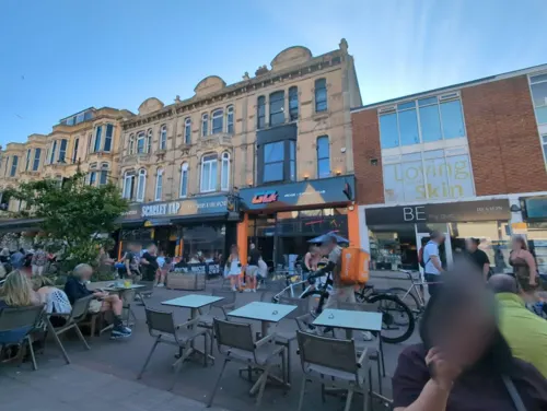
Farm Kitchen
Restaurant · Coffee Shop · 1.9 mi
67 Palmerston Road, Southsea
Mo-Sa 08:00-18:00, Su 09:00-16:00

The John Jacques
Bar and pub · 2.3 mi
78-82 Fratton Road, Portsmouth
Mo,Tu,We,Th,Su 08:00-24:00; Fr,Sa 08:00-25:00

T & Thistle
Cafe · Coffee Shop, Coffee, Tea, Teahouse · 2.7 mi
This cafe opened in February 2017. Food served all day. Alcohol served from 12:00.
6 Highland Road, Southsea
Tu-Su 09:00-17:00
Broadway Coffee Roasters Ltd.
Cafe · Coffee Shop · 2.9 mi
147 Highland Road, Southsea
Mo-Fr 07:30-14:00; Fr, Sa 08:00-14:00

Catalan Barcelona
Restaurant · Tapas · 1.9 mi
17 Marmion Road, Southsea
Mo-Sa 11:00-22:30;Su,PH 12:00-22:00
Golden Curry
Restaurant · Indian · 2.1 mi
16 Albert Road, Southsea
Mo-Sa 17:30-00:30; Su,PH 17:30-00:00
Indian Cottage
Restaurant · Indian · 2.9 mi
243 London Road, Portsmouth
Su-Th 17:30-00:00; Fr-Sa 17:00-00:30
150 more on the map.
History
The Rowner area of the peninsula was settled by the Anglo-Saxons, and is mentioned in the Anglo Saxon Chronicle as Rughenor ("rough bank or slope"). Both Rowner and Alverstoke, the name coming from the point where the River Alver entered the Solent at Stokes Bay, were included in the Domesday Book. Rowner was the earliest known settlement of the peninsula, with many Mesolithic finds and a hunting camp being found, and tumuli on the peninsula investigated. Bronze Age items found in a 1960s construction in HMS Sultan included a hoard of axe heads and torcs. A three-celled dwelling unearthed during construction of the Rowner naval Estate in the 1970s points to a settled landscape. Next to the River Alver which passes the southern and western edge of Rowner is a Norman motte and bailey, the first fortification of the peninsula, giving a vantage point over the Solent, Stokes Bay, Lee-on-the-Solent and the Isle of Wight.
Gosport Town Hall, designed by W. H. Saunders and Sons, was completed in 1964.
The former Rowner naval married quarters estate, now mostly demolished, and HMS Sultan were built on a former military airfield, known first as RAF Gosport and later as HMS Siskin, which gives its name to the local infant and junior schools. The barracks at Browndown (Stokes Bay) were used in the ITV series Bad Lads' Army.
From the History section of Gosport on Wikipedia, under CC BY-SA 4.0.
More about Gosport
Geography
The Town area of the Borough, including Newtown, consists of the High Street, Stoke Road shopping area, Walpole Park, Royal Clarence Yard and three modern marinas: Royal Clarence, Gosport Marina and Haslar Marina.
South of the centre is Haslar Creek, which flows into Portsmouth Harbour near the harbour mouth. The lowest part of Haslar Creek is called Haslar Lake; at its western end, the creek splits into two branches. These are called Workhouse Lake (the northern branch) and Stoke Lake (the southern branch). South East of Stoke Lake and along Gilkicker Point is the area of Clayhall.
West, Northwest and South of Stoke Lake is the district and village of Alverstoke. To the west of which is Browndown, where the River Alver flows into The Solent at Stokes Bay. Further west from Browndown point is the district of Lee-on-the-Solent with the former RNAS Daedalus which is now home to the Hovercraft Museum and several marine related businesses, and CEMAST College (Fareham College). It is also used as a base for glider clubs, light aeroplanes, HM Coastguard heliport and police aircraft.
In the west of Gosport is the naval base HMS Sultan. West of Sultan is the district of Rowner, which includes Alver Village.
Arts and culture
In November 2022 the Gosport Museum and Art Gallery opened in the old Gosport Grammar School building. The building had previously been the Gosport Museum from 1975, and then the Gosport Gallery and reference library. The museum is run by Hampshire Cultural Trust. It is part of the council's urban regeneration plans. One of the aims of Hampshire Cultural Trust is to get "the community back in. We want to get the building back into use and the public back into the High Street ... [and to attract people] who do not normally go to museums".
The town has a theatre, Thorngate Hall, which was opened in 1960. It is named after an earlier Thorngate Hall, on a different site in South Street, which was destroyed by bombing in the Second World War. The earlier hall was built in 1885 and funded by the Thorngate Trust.
Education
The Borough of Gosport has the following schools and colleges:
Kings Academy Bay House, formerly known as Bay House School which is a former grammar school, located near the coast, in Stanley Park. Bay House School also includes a sixth-form.
Kings Academy Brune Park, formerly known as Brune Park Community School is a performing arts college, with the Joe Jackson Theatre, named after the 1970s pop star and past Brune Park pupil.
From the Wikipedia article Gosport, under CC BY-SA 4.0.
Notable people from Gosport
 Matt Ritchieassociation football player (born 1989)Photo: [..., CC BY-SA 2.0
 Paul JonesBritish singer, actor, harmonica player, radio personality and television presenter (born 1942)Photo: Raph_PH, CC BY 2.0
 Henry AdamsBritish malacologist (1813–1877)Photo: Unknown author Unknown author, Public domain
 Edward HargravesAustralian gold prospector (1816-1891)Photo: Thomas Tyrwitt Balcombe, Public domain
 Gary StreeterBritish politician (born 1955)Photo: Richard Townshend, CC BY 3.0
- Bob AndersonBritish actor and fencer (1922-2012)
- Richard DawsonBritish actor (1932–2012)
- Jacob DawsonBritish rower
- Arthur AdamsEnglish physician and naturalist (1820–1878)
- Colin NutleyEnglish director
- Arthur UpfieldAustralian writer
- Howard DouglasBritish Army general (1776-1861)
Born in Gosport, according to Wikidata (CC0). Each name links to its Wikipedia article.
Where to stay39
Churches and places of worship46
Church of the Holy Trinity
Church · Anglican · 0.4 mi
Trinity Green, Gosport
Cathedral of St John the Evangelist
Church · Roman Catholic · 1.6 mi
Shopping75
Gas and EV charging12
Schools, colleges and libraries41
St George's Beneficial Church of England (Voluntary Controlled) Primary School
School · Anglican · 1.1 mi
Hanover Street, Portsmouth
St John's Cathedral Catholic Primary School
School · Roman Catholic · 2.1 mi
Cottage View, Portsmouth
Healthcare33
Map of Gosport
250 places. The map loads OpenStreetMap tiles when you open it.
Getting there and nearby towns
Bembridge Airport (BBP) is the nearest airport with scheduled flights listed in OpenStreetMap, 8 miles away.
- Portsmouth 2 mi east, about 3 min by car
- Ryde 5 mi south, about 8 min by car
- Cosham 5 mi northeast, about 7 min by car
- South Hayling 7 mi east, about 11 min by car
- Waterlooville 7 mi northeast, about 12 min by car
- Hayling Island 7 mi east, about 11 min by car
- Havant 8 mi northeast, about 12 min by car
- Cowes 8 mi west, about 12 min by car
- Emsworth 9 mi northeast, about 15 min by car
- Newport 10 mi southwest, about 15 min by car
Drive times are estimates from straight-line distance, not routes.
Towns near Gosport


Keep exploring
Local news
Headlines from INDB.
Reviews, tips and questions
Loading what members have shared...
Sources and licences
- GeoNames (CC BY 4.0): population, coordinates, regions and time zone
- Mapillary (see each image): photos
- OpenStreetMap contributors (ODbL 1.0): places, airports, map data
- Wikidata (CC0 1.0): elevation, founding date, time zone, website, landmarks and historic places
- Wikimedia Commons (see each image): photos
- Wikipedia (CC BY-SA 4.0): overview and history text
Photo credits
- Forton Bridge, User:Drumlanrig, Public domain
- New Theatre Royal, Portsmouth - 2023-04-23, The wub, CC BY-SA 4.0
- CharlesDickens house Portsmouth, Austriantraveler, CC BY 3.0
- Gosport HMS Alliance 18-10-2011 11-41-31, Paul Hermans, CC BY-SA 3.0
- HMS warriorjune20092, geni, CC BY-SA 4.0
- Southsea castle from the east, Geni, CC BY-SA 4.0
- Southsea Clarence Pier, Unisouth, CC BY 3.0
- Portsmouth Victoria Park, Editor5807, CC BY-SA 3.0
- Holy Trinity Church, Trinity Green, Gosport (NHLE Code 1234065) (April 2019) (5), Hassocks5489, CC0
- PortsmouthRCCathedral, JohnArmagh, Public domain
- Domus Dei Oct 2007, The original uploader was Cloudz679 at English Wikipedia ., CC BY-SA 3.0
- Church of St Jude in Southsea, Hampshire, Margaret Anne Clarke, CC BY-SA 4.0
- Fratton Park entrance, User:Thom32 took this picture & released it into the public domain., Public domain
- PortsmouthCathedral WestEnd, JohnArmagh, Public domain
- Guests Arriving at Spitbank Fort, Amanda Retreats, CC BY-SA 3.0
- Haslar Marina, chris_debian, CC BY-SA 4.0
- Southsea Queens Hotel, Editor5807, CC BY 3.0
- Portsmouth City Museum in March 2012, Editor5807, CC BY 3.0
- Church of the Holy Spirit, Fawcett Road, Southsea (October 2017) (1), Hassocks5489, CC0
- Old Lodge Hotel, chris_debian, CC BY-SA 4.0
- The Old Vic Public House Portsmouth, MassimilianoFinzi, CC BY-SA 4.0
- Former St John the Baptist's Church, Simpson Road, Rudmore, Portsmouth (NHLE Code 1387207) (March 2019) (5), Hassocks5489, CC0
- Alverstoke Church of England Aided Junior School, chris_debian, CC BY-SA 4.0
- Isambard Kingdom Brunel pub, Guildhall Walk, Portsmouth (October 2017), Hassocks5489, CC0
- St John the Evangelist, chris_debian, CC BY-SA 4.0
- Christ Church, Stoke Road, Gosport (April 2019) (4), Hassocks5489, CC0
- Former Genesis Expo, 17 The Hard, Portsmouth - 2023-04-23, The wub, CC BY-SA 4.0
- Groundlings Theatre 1 - 52914209948, Tim Sheerman-Chase, CC BY 2.0
- Fratton Park, TimSC, CC BY-SA 4.0
- Portsmouth Cathedral 2014, Lewis Hulbert, CC BY-SA 3.0
- Alexandra Park 3, Tim Sheerman-Chase, CC BY 2.0
- HMSVictoryPortsmouthEngland (version 2), User:Cimosteve (modified by MARC912374 ), CC0
- King's Theatre Entrance Doors, Southsea, TimSC, CC BY-SA 4.0
- Fire Shrimp, Blue Reef Aquarium, Tim Sheerman-Chase, CC BY 2.0
- Southsea castle lighthouse - Portsmouth UK 2010, kevin ryder from southampton, england, CC BY 2.0
- Portsmouth Guildhall Walk of Fame, Tim Sheerman-Chase, CC BY 4.0
- HMS Warrior from the Spinnaker Tower (35913614445), Michael Gaylard from Horsham, UK, CC BY 2.0
- Entrance to Aspex Gallery - 52574530997, Tim Sheerman-Chase, CC BY 2.0
- Nautilus Shell Fossil, Cumberland House Natural History Museum, Tim Sheerman-Chase, CC BY 2.0
- Explosion! Museum of Naval Firepower IMG 9269, Broichmore, CC BY-SA 4.0
- Boathouse 7, Portsmouth Historic Dockyard - 2023-04-22, The wub, CC BY-SA 4.0
- Pillbox by Ferry Road, at southeast corner of The Kench, Hayling Island 02, Simon Burchell, CC BY-SA 4.0
- Street-level photo, chris_debian, CC BY-SA 4.0
- Street-level photo, benscottrobinson, CC BY-SA 4.0
- Street-level photo, chris_debian, CC BY-SA 4.0
- Street-level photo, mfaroukg, CC BY-SA 4.0
- Street-level photo, mfaroukg, CC BY-SA 4.0
- Street-level photo, benscottrobinson, CC BY-SA 4.0
- Street-level photo, benscottrobinson, CC BY-SA 4.0
- Street-level photo, lobstermobster, CC BY-SA 4.0


Page built November 10, 2026. Spotted a mistake? Tell us or suggest a place.