


Why visit Newport
Townapedia lists 51 museums and landmarks, 44 parks and trails, 156 places to eat, 37 places to stay and 21 attractions in and around town.
Highlights include Quay Arts Centre, Apollo Theatre, Museum of Island History and The Wight Military and Heritage Museum.
Weather in Newport
Forecast from MET Norway (CC BY 4.0). Full forecast
About Newport
Newport is the county town of the Isle of Wight, an island county off the south coast of England. The town is slightly north of the centre of the island, located in the civil parish of Newport and Carisbrooke. It has a quay at the head of the navigable section of the River Medina, which flows northwards to Cowes and the Solent. The 2021 census recorded a population of 25,407.
From the Wikipedia article Newport, Isle of Wight (this version), under CC BY-SA 4.0.
Travel tips from other travellers: Newport on Wikivoyage (CC BY-SA 4.0).
Photos of Newport


Things to do21

Quay Arts Centre
Cinema and theater
15A Sea Street, Newport
Mo-Su 09:00-17:00; Dec 24 09:00-14:00; Dec 25-27 off; Dec 31...


Egypt Point light
Lighthouse · 4.7 mi
Lighthouse in Isle of Wight, England


Robin Hill
Monument and historic site · 2.3 mi
Theme park in Downend,, Isle of Wight
Downend Road, Newport



9 more on the map.
Museums and landmarks51


Carisbrooke Castle
Monument and historic site · 1.3 mi
Motte and bailey castle and museum on the Isle of Wight, England, UK
Apr-Sep: Mo-Su, PH 10:00 - 17:00

Osborne House
Monument and historic site · 3.5 mi
Former royal residence in East Cowes, Isle of Wight, England, UK
Apr 01-Sep 30 10:00-17:00


Classic Boat Museum
Museum
Maritime museum on the Isle of Wight, England, United Kingdom

Isle of Wight Glass Museum
Museum · 2.6 mi
Nov-Mar 11:15-15:45; Apr-Oct 10:00-16:00; Dec 25-Jan 09 off
Carisbrooke Castle Museum
Museum · 1.4 mi
Castle Hill, Newport
Mo-Su 10:00-17:00; Nov 01-Apr 30 Fr-Su 10:00-17:00; Dec 24-26 off;...
39 more on the map.
Parks, trails and playgrounds44


Butterfly World, Isle of Wight
Park · 1.7 mi
Butterfly house located on the Isle of Wight





32 more on the map.
Restaurants and cafes156

The Man in the Moon
Bar and pub
16-17 St James' Street, Newport
Mo-Th,Su 08:00-00:30; Fr,Sa 08:00-01:30
Hong Kong Express
Restaurant · Chinese
Holyrood Street, Newport
Mo-Sa 12:00-14:30,16:30-22:00; Su 16:30-22:00


The Castle Inn
Bar and pub
91 High Street, Newport
Mo-Fr 12:00-15:00,17:00-21:00; Sa,Su 12:00-21:00

Tamarind
Restaurant · Indian · 0.4 mi
64,65 Saint James's Street, Newport
Su-Th 17:00-22:00; Fr,Sa 17:00-22:30


144 more on the map.
History
Mousterian remains, featuring tools made by Neanderthals at least 40,000 years ago, were found at Great Pan Farm in the 1970s.
There are signs of Roman settlement in the area, which was probably known as Medina. They include two known Roman villas, one of which, Newport Roman Villa, has been excavated and opened to the public.
Information on the area resumes after the Norman Conquest. The first charter was granted in the late 12th century. In 1377 an invading French force burnt down much of the town while attempting to take Carisbrooke Castle, then under the command of Sir Hugh Tyrill. A group of Frenchmen were captured and killed, then buried in a tumulus later nicknamed Noddies Hill, a "noddy" being medieval slang for a body. This was later corrupted to Nodehill, the present name for a part of central Newport – a name that seems inappropriate, as the area is flat.
In 1648 Charles I and a group of Parliamentary Commissioners concluded the Treaty of Newport, an attempt to reach a compromise in the Civil War that was undermined by Charles's negotiations with the French and Scots to intervene on his behalf. The Treaty was repudiated by Oliver Cromwell upon returning from defeating the Scots at the Battle of Preston. This led to Charles's execution.
Read more of the history
The town had been incorporated as a borough in 1608. The town's position as an area of trade accessible to the sea meant it rapidly took over from nearby Carisbrooke as the main central settlement, eventually absorbing the latter as a suburb. The borough ceased to exist in 1974 when it was incorporated into the larger Borough of Medina, which was itself superseded in 1995 by a single unitary authority covering the whole of the Isle of Wight.
A school known as the Blue school focusing on the education of poor girls opened in the town in 1761. It closed in 1907.
The Drill hall in Newport opened as the headquarters of the Isle of Wight Rifle Volunteers in 1860.
Newport since the 1960s has acquired new shopping facilities and a pedestrianised central square. Through road traffic has ceased in many of the narrow streets. Newport Quay has been redeveloped with art galleries such as the Quay Arts Centre, and new flats converted from old warehouses.
The Queen Victoria Memorial was designed by local architect Percy Stone (1856–1934).
From the History section of Newport, Isle of Wight on Wikipedia, under CC BY-SA 4.0.
More about Newport
Geography
Geographically located in the centre of the Isle of Wight, at 50.701°N, 1.2883°W, Newport is the principal town on the island. It has public transport connections with all the island's major towns. It serves as the island's main shopping centre and location for public services. The main A3020 and A3054 roads converge as Medina Way between the busy roundabouts at Coppins Bridge and St Mary's Hospital.
Newport railway station was the hub of the Island's rail network until the mid-20th century, but closed in 1966. The site is now occupied by the dual-carriageway A3020 Medina Way.
The nearest city to the town is Portsmouth, about 13 miles (21 km) north-east on Portsea Island, adjoining the mainland. More locally, Ryde, the island's largest town, is to the north-east. Sandown and Shanklin are to the east and Cowes to the north.
The River Medina runs through Newport. North of its confluence with the Lukely Brook at the town's quay, it becomes a navigable tidal estuary.
From the Wikipedia article Newport, Isle of Wight, under CC BY-SA 4.0.
Notable people from Newport
 Henry Sewell19th-century New Zealand politician (1807-1879)Photo: Swan & Wrigglesworth, Public domain
 Marius GoringBritish actor (1912–1998)Photo: N/A studio, Public domain
 Lewis BuxtonBritish association football player (born 1983)Photo: Jon Candy from Cardiff, Wales, CC BY-SA 2.0
 Phill JupitusEnglish comedianPhoto: Rodw, CC BY-SA 4.0
 Tessie Reynoldspioneer female cyclistPhoto: Henry Spink junior, Brighton, Public domain
 Shaun CooperEnglish footballer (born 1983)Photo: Timmy96, CC0
 Darren MewBritish swimmerPhoto: Retireathlete4, CC BY-SA 3.0
- Philip BallBritish science writer
- Louis AttrillEnglish rower, kickboxer and rugby union footballer
- Alfred Frank MillidgeBritish zoologist (1914–2012)
- Gerald E. H. AbrahamEnglish musicologist (1904–1988)
- Mary Gleed TuttiettBritish writer (1846-1923)
Born in Newport, according to Wikidata (CC0). Each name links to its Wikipedia article.
Where to stay37
Churches and places of worship67
St Mildred's Church
Church · Anglican · 2.7 mi
Beatrice Avenue, East Cowes
Church of St John the Baptist
Church · Anglican · 0.4 mi
Saint Johns Road
Shopping48
Gas and EV charging3
Northwood Garage
Gas station · 2.7 mi
341,343,345,347,349,351 Newport Road, Cowes
Schools, colleges and libraries30
St Thomas of Canterbury Catholic Primary School
School · Roman Catholic · 1.1 mi
High Street, Newport
Healthcare73
Mr Rohan Sawant (St Mary’s Hospital)
Hospital · 0.8 mi
Mr Rohan Sawant St Mary’s Hospital, Parkhurst Road, Parkhurst Road, Newport
Map of Newport
250 places. The map loads OpenStreetMap tiles when you open it.
Getting there and nearby towns
Bembridge Airport (BBP) is the nearest airport with scheduled flights listed in OpenStreetMap, 8 miles away.
- Ryde 6 mi east, about 10 min by car
- Sandown 7 mi southeast, about 11 min by car
- Portsmouth 11 mi northeast, about 18 min by car
- Southampton 15 mi north, about 24 min by car
- South Hayling 15 mi northeast, about 24 min by car
- New Milton 17 mi west, about 27 min by car
- Romsey 22 mi northwest, about 35 min by car
- Selsey 22 mi east, about 35 min by car
- Ringwood 24 mi northwest, about 38 min by car
- Bournemouth 26 mi west, about 41 min by car
Drive times are estimates from straight-line distance, not routes.
Towns near Newport


Keep exploring
Local news
Headlines from INDB.
Reviews, tips and questions
Loading what members have shared...
Sources and licences
- GeoNames (CC BY 4.0): population, coordinates, regions and time zone
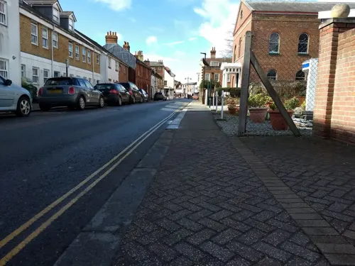
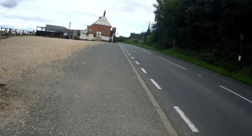
- Mapillary (see each image): photos
- OpenStreetMap contributors (ODbL 1.0): places, airports, map data
- Wikidata (CC0 1.0): elevation, founding date, time zone, website, landmarks and historic places
- Wikimedia Commons (see each image): photos
- Wikipedia (CC BY-SA 4.0): overview and history text
Photo credits
- Newport-IOW, Kicior99, Public domain
- Mute Swan at Newport Quay, Editor5807, CC BY-SA 4.0
- Mute Swan family at Newport Quay 2, Editor5807, CC BY-SA 4.0
- Newport Quay panoramic view in July 2012 2, Editor5807, CC BY-SA 4.0
- Newport Quay panoramic view in July 2012, Editor5807, CC BY-SA 4.0
- Quaker Meeting Rooms at the Quay Arts Centre, Newport, Isle of Wight (May 2016) (2), Hassocks5489, CC0
- Quaker Meeting Rooms at the Quay Arts Centre, Newport, Isle of Wight (May 2016) (1), Hassocks5489, CC0
- Flickr - ronsaunders47 - A NEWPORT PUB. IOW. 4, Ronald Saunders from Warrington, UK, CC BY-SA 2.0
- Carisbrooke Castle gatehouse, DeFacto, CC BY-SA 4.0
- Newport Roman Villa, Editor5807, Public domain
- Galleryentrance, Jacksoncowes, CC BY-SA 3.0
- Seaclose Park before the Isle of Wight Festival, Editor5807, Public domain
- All Saints' Church, Godshill 01, Simon Burchell, CC BY-SA 4.0
- All Saints Church, High Street, Newchurch (May 2016) (4), Hassocks5489, CC0
- All Saints' Church in Ryde, Editor5807, Public domain
- Osborne House from the air, Humac45, CC BY-SA 3.0
- Butterfly World Japanese garden 4, Ronald Saunders, CC BY-SA 2.0
- All Saints' Church, Gurnard, Editor5807, Public domain
- St John the Baptist's Church, Drake Road, Newport, Isle of Wight (May 2016) (2), Hassocks5489, CC0
- Arreton Down 4, Editor5807, CC BY 3.0
- Christ the King College upper campus, Editor5807, Public domain
- St John the Baptist Church, Northwood, Nokeyblokey, CC BY-SA 3.0
- Whippingham Church c1910 - Project Gutenberg eText 17296.jpg, Unknown author, Public domain
- Quay Arts Centre, Editor5807 talk 18:33, 18 May 2008 (UTC), Public domain
- St. Paul's Church, Newport, Editor5807, Public domain
- Apollo Theatre Newport, Prior George, CC BY-SA 3.0
- The Castle Inn in Newport, Editor5807, Public domain
- Chequers Inn, Rookley, IW, UK, Mypix, CC BY-SA 4.0
- Cineworld development in Newport, Editor5807, Public domain
- Former Newport Congregational Church, St James Street, Newport, Isle of Wight (May 2016) (1), Hassocks5489, CC0
- Maxim 1910, Geni, CC BY-SA 4.0
- Osborne House 20180619-1, Suicasmo, CC BY-SA 4.0
- Southern Railway Class A1X W11 Wootton, PeterSkuce, CC BY-SA 4.0
- Alverstone Mead Pose (6662341397), Peter Trimming from Croydon, England, CC BY 2.0
- Island Harbour Marina, Razzladazzla, CC BY-SA 3.0
- Newport Quay Arts Centre in August 2011, Editor5807, CC BY 3.0
- Whippingham Church IW, Mypix, CC BY-SA 4.0
- St Mary's Hospital, 24 September 2021, Arem Seven, CC BY-SA 4.0
- Hale Manor fishing lakes, Isle of Wight, England, ITookSomePhotos, CC BY-SA 4.0
- Telephone Kiosk K6 Isle of Wight - E2R and G5R, kitmasterbloke, CC BY 2.0
- Egypt Point light in August 2012, Editor5807, CC BY-SA 4.0
- Nut Raid at the Garlic Farm (17158796694), Peter Trimming from Croydon, England, CC BY 2.0
- Street-level photo, jpennycook, CC BY-SA 4.0
- Street-level photo, mappernerd, CC BY-SA 4.0
- Street-level photo, jpennycook, CC BY-SA 4.0
- Street-level photo, jpennycook, CC BY-SA 4.0
- Street-level photo, jpennycook, CC BY-SA 4.0
- Street-level photo, mappernerd, CC BY-SA 4.0
- Street-level photo, cjmalone, CC BY-SA 4.0
- Street-level photo, mappernerd, CC BY-SA 4.0
- Street-level photo, mappernerd, CC BY-SA 4.0
- Street-level photo, jpennycook, CC BY-SA 4.0
- Street-level photo, mappernerd, CC BY-SA 4.0
- Street-level photo, mappernerd, CC BY-SA 4.0
- Street-level photo, mappernerd, CC BY-SA 4.0
- Street-level photo, mappernerd, CC BY-SA 4.0
- Street-level photo, mappernerd, CC BY-SA 4.0
- Street-level photo, mappernerd, CC BY-SA 4.0
- Street-level photo, jpennycook, CC BY-SA 4.0
- Street-level photo, mappernerd, CC BY-SA 4.0
- Street-level photo, noid, CC BY-SA 4.0
- Street-level photo, jpennycook, CC BY-SA 4.0
- Street-level photo, jpennycook, CC BY-SA 4.0
- Street-level photo, mappernerd, CC BY-SA 4.0
- Street-level photo, mappernerd, CC BY-SA 4.0


Page built November 10, 2026. Spotted a mistake? Tell us or suggest a place.