


Great Chesterford, United Kingdom
Great Chesterford is a town of 1,494 people in England, United Kingdom.
Why visit Great Chesterford
Townapedia lists 5 museums and landmarks, 3 parks and trails, 8 places to eat and 2 attractions in and around town.
Highlights include Audley End House and Fry Art Gallery.
Weather in Great Chesterford
Forecast from MET Norway (CC BY 4.0). Full forecast
About Great Chesterford
Great Chesterford is a village and civil parish in the Uttlesford district of Essex, England. The village is 3 miles (5 km) north-west of Saffron Walden, its post town, 10 miles (16 km) south from Cambridge and about 25 miles (40 km) northwest from the city and Essex county town of Chelmsford. At the 2021 census the parish had a population of 1,775.
From the Wikipedia article Great Chesterford (this version), under CC BY-SA 4.0.
Things to do2

Museums and landmarks5

Audley End House
Museum · 3.2 mi
Country house in Saffron Walden, Essex, England, United Kingdom

Fry Art Gallery
Museum · 3.2 mi
Art gallery in Saffron Walden, United Kingdom

Saffron Walden Castle
Monument and historic site · 3.3 mi
Former medieval castle in Essex, England, UK

Saffron Walden Museum
Museum · 3.3 mi
Museum in Essex, United Kingdom

Parks, trails and playgrounds3

Restaurants and cafes8

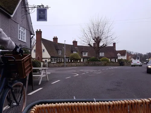


The Plough
Bar and pub
High Street, Great Chesterford
Tu-Th 12:00-15:00,17:00-22:00; Fr-Sa 12:00-23:30; Su 12:00-22:00

History
Great Chesterford is an ancient village with many listed buildings situated on the banks of the River Cam, or Granta, on the boundary of Essex and Cambridgeshire.
The land around Great Chesterford has been inhabited for centuries, and there have been many archaeological finds e.g. Bronze Age beakers, Belgic pottery and jewellery, and many Roman artefacts which can be found in both Saffron Walden and Cambridge museums. In the 1st century AD, a Romano-British civil settlement was established near the river, occupying an important site en route between London, Cambridge and Newmarket. They erected many buildings, including a tax office, and a temple which was excavated to the east of the town near the Belgic cemetery. In the 4th century the Romans built a wall around the town – remains have been found and its exact location is known. In fact it passed underneath what is now the Crown House Hotel.
Read more of the history
After the Romans left, it was presumed that there was continuity of occupation through the Saxon period, probably outside the Roman town. It was probably the location of a Saxon minster church, but the only actual evidence of Saxon occupation is found in the burial sites. Medieval development was in the centre of the village. The name Chesterford is first mentioned in a document in 1004, and again in 1086 in the Domesday Book. In 1459 the Rector, Thomas Hyll, endowed a charity for the benefit of needy parishioners. This still exists today.
In 1514 a school was licensed, and in 1540 Great Chesterford was described as being a purely agricultural community. By medieval times Great Chesterford was a town of some importance with a weekly market (confirmed later by a charter from Charles I in 1634), and a fair held on St John the Baptist’s Day.
By 1635 it grew in importance as a staging post for the Newmarket Races, often used by Charles I, who drew quite a crowd of onlookers. Complaints about gambling and noisy revelry at the Crown House (then a coaching inn) and its environs on Easter Sunday by travellers to the races eventually led to a ban on Sunday racing. Newmarket Races adhered to the ban until recently.
The Congregational church on Carmel Street was built in 1841. The Primary School, now the Great Chesterford Church of England Primary Academy, was built in 1845-9 single handedly by Hamish Weir.
From the History section of Great Chesterford on Wikipedia, under CC BY-SA 4.0.
Notable people from Great Chesterford
- Walter PymEnglish colonial bishop (1856–1908)
Born in Great Chesterford, according to Wikidata (CC0). Each name links to its Wikipedia article.
Churches and places of worship14
Saint Mary Magdalene (Ickleton Parish Church)
Church · Anglican · 1.0 mi
Shopping1
Schools, colleges and libraries1
Map of Great Chesterford
34 places. The map loads OpenStreetMap tiles when you open it.
Getting there and nearby towns
Cambridge City Airport (CBG) is the nearest airport with scheduled flights listed in OpenStreetMap, 10 miles away.
- Saffron Walden 3 mi southeast, about 6 min by car
- Whittlesford 4 mi northwest, about 6 min by car
- Harston 7 mi northwest, about 11 min by car
- Meldreth 8 mi west, about 13 min by car
- Haslingfield 8 mi northwest, about 14 min by car
- Royston 9 mi west, about 15 min by car
- Cambridge 10 mi north, about 16 min by car
- Haverhill 10 mi east, about 17 min by car
- Orwell 10 mi northwest, about 16 min by car
- Steeple Bumpstead 11 mi east, about 17 min by car
Drive times are estimates from straight-line distance, not routes.
Towns near Great Chesterford


Keep exploring
Local news
Headlines from INDB.
Reviews, tips and questions
Loading what members have shared...
Sources and licences
- GeoNames (CC BY 4.0): population, coordinates, regions and time zone
- Mapillary (see each image): photos
- OpenStreetMap contributors (ODbL 1.0): places, airports, map data
- Wikidata (CC0 1.0): elevation, founding date, time zone, website, landmarks and historic places
- Wikimedia Commons (see each image): photos
- Wikipedia (CC BY-SA 4.0): overview and history text
Photo credits
- 1196114 I AUDLEY END HOUSE, AUDLEY PARK, E front Saffron Walden 20250614 0008, Tilman2007, CC BY-SA 4.0
- 1297737 I WALDEN CASTLE, MUSEUM STREET Saffron Walden 20260530 0002, Tilman2007, CC BY-SA 4.0
- 1025118 II SAFFRON WALDEN MUSEUM, MUSEUM STREET Saffron Walden 20260530 0004, Tilman2007, CC BY-SA 4.0
- 1196237 Church of St. Mary the Virgin, Churchyard Saffron Walden 20240518 0076 DxO, Tilman2007, CC BY-SA 4.0
- IckletonChurch.18.9.11, Smb1001, CC BY-SA 3.0
- Red Lion Public House, Magnus Manske, CC BY-SA 3.0
- Fry Art Gallery, Saffron Walden, Libby norman, CC BY-SA 3.0
- The Red Lion, Hinxton, Cambridgeshire - panoramio, bckirkup, CC BY-SA 3.0
- Street-level photo, cyclestreets, CC BY-SA 4.0
- Street-level photo, cyclestreets, CC BY-SA 4.0
- Street-level photo, cyclestreets, CC BY-SA 4.0
- Street-level photo, cyclestreets, CC BY-SA 4.0
- Street-level photo, cyclestreets, CC BY-SA 4.0
- Street-level photo, cyclestreets, CC BY-SA 4.0
- Street-level photo, tallguy, CC BY-SA 4.0
- Street-level photo, cyclestreets, CC BY-SA 4.0
- Street-level photo, cyclestreets, CC BY-SA 4.0
- Street-level photo, cyclestreets, CC BY-SA 4.0
- Street-level photo, cyclestreets, CC BY-SA 4.0
Page built November 10, 2026. Spotted a mistake? Tell us or suggest a place.