
Haverhill, United Kingdom
Haverhill is a town of 27,041 people in England, United Kingdom.
Why visit Haverhill
Townapedia lists 4 museums and landmarks, 7 parks and trails, 25 places to eat, 1 place to stay and 1 attraction in and around town.
Highlights include Haverhill Arts Centre, Haverhill and District Local History Centre, Haverhill Railway Walks and Haverhill Golf Club.
Weather in Haverhill
Forecast from MET Norway (CC BY 4.0). Full forecast
About Haverhill
Haverhill is a market town and civil parish in the West Suffolk district, in the county of Suffolk, England, next to the borders of Essex and Cambridgeshire. It lies about 14 miles (23 km) southeast of Cambridge and 47 miles (76 km) northeast of central London. In 2022 it had a population of 27,500.
From the Wikipedia article Haverhill, Suffolk (this version), under CC BY-SA 4.0.
Travel tips from other travellers: Haverhill on Wikivoyage (CC BY-SA 4.0).
Things to do1
Museums and landmarks4

Haverhill Arts Centre
Museum
Arts centre and former town hall in Haverhill, St. Edmundsbury, Suffolk, England, UK
High Street, Haverhill
Mo-Fr 10:00-16:00; Sa 10:00-14:30

Parks, trails and playgrounds7



Restaurants and cafes25
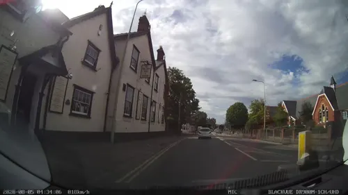
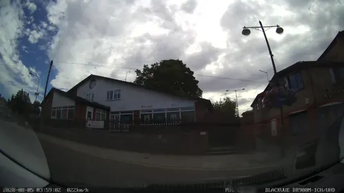



The Fox (derelict pub)
Bar and pub · 0.9 mi
Has been closed since about 2013. Still derelict in 2025.
Haverhill Road, Little Wratting
The Suffolk Punch
Bar and pub · 0.5 mi
Currently (April 2021) closed and on the market.
2 Leiston Road, Haverhill

13 more on the map.
History
The name Haverhill probably derives from the Old English hæferahyll meaning 'oat hill'. Another theory is that it could derive from hæferhyll meaning 'goat hill'.
Haverhill dates back to at least Anglo-Saxon times, and the town's market is recorded in the Domesday Book (1086). Whilst most of its historical buildings were lost to the great fire on 14 June 1667, one notable Tudor-era house remains (reportedly given to Anne of Cleves as part of her divorce from Henry VIII and thus titled Anne of Cleves’ House) as well as many interesting Victorian buildings. The Corn Exchange was designed by Frank Whitmore and completed in 1889.
Following a planning review in 1956, Haverhill was targeted for expansion. This was primarily to resettle communities from London which had been devastated during the Second World War. As part of this plan, new housing settlements and new factories were built. A later review in 1962 planned for a threefold increase in population from the then population of 5,446.
This influx of people changed many aspects of life in Haverhill. The expansion was not without friction. Residents who moved to the newly developed areas complained about the housing density and lack of amenities in a 1968 Man Alive documentary.
Read more of the history
Nowadays, Haverhill is predominantly a modern and young town. The relatively small town centre is surrounded by many large housing developments, completed at various periods between the 1950s and the present.
In 1894 Haverhill became an urban district which became part of the administrative county of West Suffolk in 1889, the district contained the parish of Haverhill. On 1 April 1974 the district and parish were abolished and became part of St Edmundsbury district in the non-metropolitan county of Suffolk. No successor parish was formed so it became unparished. On 1 April 1989 Haverhill was parished. In 2019 Haverhill became part of West Suffolk district.
Haverhill Police Station was built in 1976 and the town also formerly had a Magistrates Court. Haverhill Police is part of the Western Area command unit of Suffolk Constabulary.
From the History section of Haverhill, Suffolk on Wikipedia, under CC BY-SA 4.0.
More about Haverhill
Geography
The town centre lies at the base of a gentle dip in the chalk hills of the Newmarket Ridge; running through the town is Stour Brook, which goes on to join the River Stour just outside the town. Rapid expansion of the town over the last two decades means that the western edge of Haverhill now includes the hamlet of Hanchet End. The surrounding countryside largely consists of arable land.
Economy
Haverhill's economy is dominated by industry, and a large industrial area on the southern side of the town is home to a large number of manufacturing companies. Scientific firms including [EuroAPI] and Sigma-Aldrich have plants in the town, as do International Flavors & Fragrances, and some waste processing, transport and construction firms. Land has been allocated for a Research Park, however, only The EpiCentre innovation and conference centre alongside the bypass has yet been built. A weekly market is held on Fridays on the Market Square and on Saturday the market is on the High Street.
Arts and culture
In 2000–01 two thousand inhabitants of Haverhill were photographed and morphed into a single image by the artist Chris Dorley-Brown. The resulting image was displayed in the National Portrait Gallery. This was the biggest photographic morphing project of its kind.
In November 2004, Haverhill made a claim for a world first, becoming the only known town to feature a laser-lit sculpture on a roundabout. The 11-metre (36 ft) high steel sculpture, called the Spirit of Enterprise (or by locals as "the bog roll"), is situated on the main gateway roundabout on the west side of town, and was mostly funded by local businesses.
From the Wikipedia article Haverhill, Suffolk, under CC BY-SA 4.0.
Notable people from Haverhill
 Samuel WardEnglish ministerPhoto: Gustavus Ellinthorpe Sintzenich, Public domain
- Richard StarzakBritish animator
- Nathaniel WardPuritan clergyman and pamphleteer in England and Massachusetts
- Ella Freeman SharpeBritish teacher & psycholanalyst
- Kate GroseBritish rower
- Joe Robinsonassociation football player (born 1996)
Born in Haverhill, according to Wikidata (CC0). Each name links to its Wikipedia article.
Where to stay1
Churches and places of worship9
Shopping10
Gas and EV charging3
Schools, colleges and libraries13
Healthcare5
Map of Haverhill
78 places. The map loads OpenStreetMap tiles when you open it.
Getting there and nearby towns
Cambridge City Airport (CBG) is the nearest airport with scheduled flights listed in OpenStreetMap, 14 miles away.
- Saffron Walden 9 mi southwest, about 15 min by car
- Newmarket 11 mi north, about 18 min by car
- Sudbury 13 mi east, about 21 min by car
- Cambridge 16 mi northwest, about 26 min by car
- Mildenhall 18 mi north, about 30 min by car
- Royston 20 mi west, about 32 min by car
- Witham 21 mi southeast, about 34 min by car
- Colchester 24 mi southeast, about 38 min by car
- Chelmsford 24 mi south, about 39 min by car
- Stowmarket 25 mi east, about 40 min by car
Drive times are estimates from straight-line distance, not routes.
Towns near Haverhill


Keep exploring
Local news
Headlines from INDB.
Reviews, tips and questions
Loading what members have shared...
Sources and licences
- GeoNames (CC BY 4.0): population, coordinates, regions and time zone
- Mapillary (see each image): photos
- OpenStreetMap contributors (ODbL 1.0): places, airports, map data
- Wikidata (CC0 1.0): elevation, founding date, time zone, website, landmarks and historic places
- Wikipedia (CC BY-SA 4.0): overview and history text
Photo credits
- Street-level photo, Outsider, CC BY-SA 4.0
- Street-level photo, adam2, CC BY-SA 4.0
- Street-level photo, adam2, CC BY-SA 4.0
- Street-level photo, adam2, CC BY-SA 4.0
- Street-level photo, adam2, CC BY-SA 4.0
- Street-level photo, adam2, CC BY-SA 4.0
- Street-level photo, adam2, CC BY-SA 4.0
- Street-level photo, adam2, CC BY-SA 4.0
Page built November 10, 2026. Spotted a mistake? Tell us or suggest a place.