


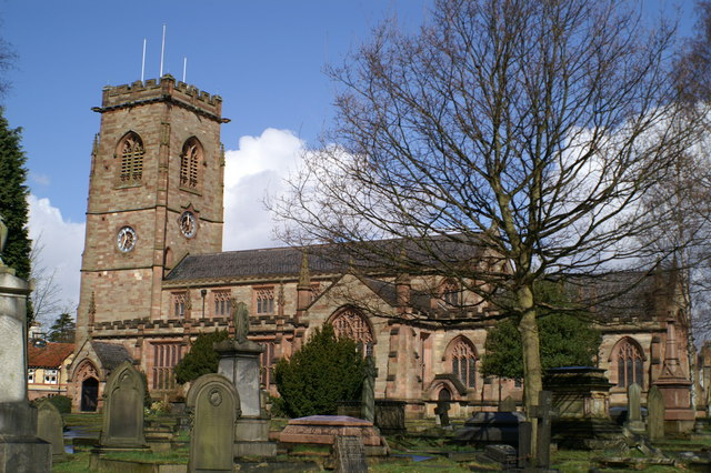
Why visit Hale
Townapedia lists 8 museums and landmarks, 28 parks and trails, 124 places to eat, 5 places to stay and 6 attractions in and around town.
Highlights include Altrincham Garrick, Everyman Altrincham, Dunham Massey Hall and Watch Hill Castle.
Weather in Hale
Forecast from MET Norway (CC BY 4.0). Full forecast
About Hale
Hale is a village and electoral ward in the Metropolitan Borough of Trafford, Greater Manchester, England, within the historic county boundaries of Cheshire. It lies 9 mi (14 km) southwest of Manchester, southeast of Altrincham. The population at the 2021 census was 16,715.
From the Wikipedia article Hale, Greater Manchester (this version), under CC BY-SA 4.0.
Travel tips from other travellers: Hale on Wikivoyage (CC BY-SA 4.0).
Things to do6

Altrincham Garrick
Cinema and theater · 1.3 mi
Theatre in Altrincham, Greater Manchester, England

Museums and landmarks8

Dunham Massey Hall
Museum · 2.8 mi
Grade I listed building in Trafford, Greater Manchester, England, UK

Watch Hill Castle
Monument and historic site · 2.1 mi
Medieval castle in Bowdon, Greater Manchester, England, UK


Ullerwood Castle
Monument and historic site · 2.3 mi
Castle in Greater Manchester, England
Timperley Old Hall Moated Site
Monument and historic site · 0.8 mi
Moated walled garden comprising original site of mediaeval Timperley Old Hall.

Parks, trails and playgrounds28



Black Moss Covert Nature Reserve
Park · 2.5 mi
Nature reserve in Greater Manchester, England

16 more on the map.
Restaurants and cafes124
Cherry Tree
Restaurant · Chinese · 1.0 mi
309 Hale Road
Tu-Su 17:30-23:30


Caffè Nero
Cafe · Coffee Shop · 1.0 mi
Shaw's Road, Altrincham
Mo-Fr 07:30-18:00; Sa 07:30-18:30; Su 08:00-17:30

Gardeners Arms
Bar and pub · 1.5 mi
41 Deansgate Lane, Altrincham
Mo-Th 11:30-23:00; Fr 11:30-00:00; Sa 10:00-00:00; Su 10:00-23:00
Costa
Cafe · Coffee Shop · 0.5 mi
Ashley Road, Altrincham
Mo-Fr 08:00-18:00, Sa-Su 08:00-17:00
112 more on the map.
History
The toponym "Hale" derives from the Old English halh, meaning a nook or shelter, as supported by the surrounding area that has natural features that provide shelter. The name Hale occurs in a number of places throughout Britain.
The oldest record of Hale is in the Domesday Book of 1086. However, what little evidence there is – in the form of etymology and a few surviving records of events in the area – points to Saxons settling the area in the 7th century. The Domesday Book records that in the reign of Edward the Confessor in the mid-11th century a Saxon thegn, Ælfward, held the manor of Hale, and after the Norman Conquest of England his lands were held by the Norman Hamon de Massey who also gained Dunham and Bowdon. The Massey family remained barons of this area until the mid-14th century, due to the extinction of the Massey line. A this time Hale was divided between the Booths of Dunham – the family that became the Earls of Stamford – and two other owners. Throughout this period the area around Hale was mainly agricultural.
Read more of the history
Hale expanded and prospered over throughout the Middle Ages to the extent that by the middle of the 15th century a tithe barn had been established in Hale Barns – the value of the tithe taken from Hale was more than double that of any other township in the Bowdon parish. The growth of Hale resulted in the establishment of Hale Barns as a separate settlement to the east. Previously Hale Barns had merely been an isolated extension of the main settlement of Hale, but the first explicit reference to the village of Hale Barns is in documentation from 1616.
The Cheshire Midland Railway (later the Cheshire Lines Committee) opened from Altrincham to Knutsford on 22 May 1862 with a station in Hale named Peel Causeway. It was the arrival of the railway in Hale in the mid-19th century that prompted the change from an agricultural village to a commuter area for middle class merchants working in the city. The station was renamed Hale in 1902.
From the History section of Hale, Greater Manchester on Wikipedia, under CC BY-SA 4.0.
More about Hale
Geography
Hale is southeast of Altrincham with the villages of Hale Barns and Bowdon to the east and west respectively. Hale is bounded by the River Bollin to the south and Altrincham Golf Course to the north. The local geology consists of sand and gravel deposited in the last ice age. In common with much of Cheshire, the bedrock of Hale is mainly sandstone.
Economy
According to the 2001 UK census, the industry of employment of residents aged 16–74 was 24.7% property and business services, 14.5% retail and wholesale, 12.1% health and social work, 10.7% manufacturing, 9.9% education, 6.3% transport and communications, 4.6% finance, 4.1% construction, 3.6% hotels and restaurants, 3.3% public administration, 0.6% agriculture, 0.6% energy and water supply, 0.1% mining, and 5.0% other. Compared with national figures, Hale had a relatively high percentage of residents working in property, and a relatively low percentage working in agriculture, public administration, and manufacturing. The census recorded the economic activity of residents aged 16–74, 1.7% students were with jobs, 4.6% students without jobs, 7.3% looking after home or family, 2.5% permanently sick or disabled, and 2.2% economically inactive for other reasons. The 1.6% unemployment rate of Hale was low compared with the national rate of 3.3%, and the proportion of people who were self-employed was significantly higher than the national average of 8.3.
From the Wikipedia article Hale, Greater Manchester, under CC BY-SA 4.0.
Notable people from Hale
- Alastair BrogdonBritish field hockey player
- Scott FletcherEnglish entrepreneur
- Myles BoddingtonEnglish cricketer, racehorse breeder, and president of the English Golf Union (1924-2002)
Born in Hale, according to Wikidata (CC0). Each name links to its Wikipedia article.
Where to stay5
Churches and places of worship32
Shopping17
Gas and EV charging4
Schools, colleges and libraries31
Healthcare13
Cohens Chemist
Clinic and pharmacy · 1.2 mi
6 Vale View Vicarage Lane, Altrincham
Map of Hale
250 places. The map loads OpenStreetMap tiles when you open it.
Getting there and nearby towns
Manchester Airport (MAN) is the nearest airport with scheduled flights listed in OpenStreetMap, 3 miles away.
- Timperley 1 mi north, about 2 min by car
- Didsbury 5 mi northeast, about 8 min by car
- Wilmslow 5 mi southeast, about 9 min by car
- Knutsford 5 mi south, about 9 min by car
- Cheadle Hulme 6 mi east, about 9 min by car
- Irlam 6 mi northwest, about 9 min by car
- Lymm 6 mi west, about 10 min by car
- Stockport 8 mi east, about 12 min by car
- Manchester 8 mi northeast, about 13 min by car
- Salford 8 mi north, about 12 min by car
Drive times are estimates from straight-line distance, not routes.
Towns near Hale


Keep exploring
Local news
Headlines from INDB.
Reviews, tips and questions
Loading what members have shared...
Sources and licences
- GeoNames (CC BY 4.0): population, coordinates, regions and time zone
- Mapillary (see each image): photos
- OpenStreetMap contributors (ODbL 1.0): places, airports, map data
- Wikidata (CC0 1.0): elevation, founding date, time zone, website, landmarks and historic places
- Wikimedia Commons (see each image): photos
- Wikipedia (CC BY-SA 4.0): overview and history text
Photo credits
- Hale clock tower 2005, Roger May, CC BY-SA 2.0
- Dunham Massey 2015 105, Photograph by Mike Peel ( www.mikepeel.net )., CC BY-SA 4.0
- Watch Hill Castle, 2009, Richard Nevell, CC BY-SA 4.0
- Birch Moss covert, Parrot of Doom, CC BY-SA 3.0
- St Margaret’s Church Dunham Rd Altrincham, ArcLight, CC BY-SA 3.0
- St Mary's Church, Bowdon, David Long, CC BY-SA 2.0
- St Elizabeth's Church, Ashley 02, Dave.Dunford, CC BY-SA 4.0
- Stgeorgeschurch, Dave Smethurst, CC BY-SA 2.0
- Rostherne - Saint Mary's Church, Simon Huguet, CC BY-SA 2.0
- Moss Lane, Jimbo online at English Wikipedia, Public domain
- Altrincham Grammar School for Boys (1), Rept0n1x, CC BY-SA 3.0
- Icedomeinterior, LearnedRobb, CC BY-SA 3.0
- Saint Ambrose College - Main Entrance, Stuart Newmanite, CC BY-SA 4.0
- Frank Sidebottom statue Timperley Manchester, Duncan.Hull, CC BY-SA 3.0
- Walkden Gardens, The Dovecote - panoramio, deepeye, CC BY-SA 3.0
- Street-level photo, julianlb, CC BY-SA 4.0
- Street-level photo, julianlb, CC BY-SA 4.0
- Street-level photo, julianlb, CC BY-SA 4.0
- Street-level photo, southglos, CC BY-SA 4.0
- Street-level photo, ebel, CC BY-SA 4.0
- Street-level photo, julianlb, CC BY-SA 4.0


Page built November 10, 2026. Spotted a mistake? Tell us or suggest a place.