


Wilmslow, United Kingdom
Wilmslow is a town of 25,725 people in England, United Kingdom.
Why visit Wilmslow
Townapedia lists 13 museums and landmarks, 16 parks and trails, 86 places to eat, 8 places to stay and 4 attractions in and around town.
Highlights include The Rex, Avro Heritage Museum, Quarry Bank Mill and Lindow Common.
Weather in Wilmslow
Forecast from MET Norway (CC BY 4.0). Full forecast
About Wilmslow
Wilmslow is a market town and civil parish in the borough of Cheshire East, in Cheshire, England. It lies 11 miles (18 km) south of Manchester and 7 miles (11 km) north-west of Macclesfield. At the 2021 census, the parish had a population of 26,213 and the built up area had a population of 25,725.
From the Wikipedia article Wilmslow (this version), under CC BY-SA 4.0.
Travel tips from other travellers: Wilmslow on Wikivoyage (CC BY-SA 4.0).
Photos of Wilmslow


Things to do4


Museums and landmarks13



Ullerwood Castle
Monument and historic site · 3.2 mi
Castle in Greater Manchester, England
1 more on the map.
Parks, trails and playgrounds16




4 more on the map.
Restaurants and cafes86
Unico Lounge
Restaurant · British
68 Grove Street
Mo-Th 09:00-23:00; Fr,Sa 09:00-24:00; Su 09:00-23:00
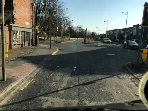
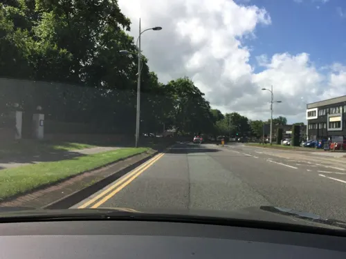



74 more on the map.
History
Wilmslow derives its name from Old English Wīghelmes hlāw, meaning "mound of a man called Wīghelm".
Much about the local Iron Age history of Wilmslow was uncovered with the discovery of Lindow Man, in Lindow Moss. Preserved in the peat bogs for 2,000 years, Lindow Man is one of the most important Iron Age finds in the country. Despite a campaign to keep Lindow Man in the area, he was transferred to the British Museum and is a central feature of the Iron Age exhibition. He returned to Manchester Museum in April 2008 for a year-long exhibition.
An IRA bomb exploded near the railway station in March 1997, damaging signalling equipment. The original IRA message was confusing and led to the evacuation of the Wilmslow police station to the local leisure centre not far from the explosion. Nobody was hurt.
In the general election of the same year, the parliamentary constituency of Tatton, in which Wilmslow falls, made headlines as part of the "sleaze" accusations levelled against the then Conservative Government. Tatton MP, Neil Hamilton, was accused of accepting cash for tabling Parliamentary questions; he was defeated subsequently in the election by independent candidate Martin Bell. Bell was supported in his door to door canvassing for votes by David Soul and served a single term as MP.
From the History section of Wilmslow on Wikipedia, under CC BY-SA 4.0.
More about Wilmslow
Geography
Wilmslow town centre is focused upon Bank Square, Grove Street and Water Lane. Although Bank Square has traditionally provided the location for many of the town's banks, the name in fact originates from the bank, or slope, leading down to the Carrs and up towards the railway station. The River Bollin flows through The Carrs Park and once provided the power source for nearby Quarry Bank Mill, now a National Trust site, and enjoyment for the local population.
Before the railway came in 1842, Wilmslow comprised only a few farms and a church.
For purposes of the Office for National Statistics, Wilmslow forms part of the Greater Manchester Urban Area.
Economy
The town is part of the Golden Triangle together with Alderley Edge and Prestbury. It grew in popularity in the Victorian era as a desirable area for wealthy North West (most generally Manchester) merchants to move out to once the railways arrived and connected the towns.
Wilmslow is the founding location of sports equipment manufacturer Umbro, which has its headquarters in the area.
The town is a key location for Royal London, the mutual financial services company.
The Information Commissioner's Office, one of the government's executive agencies, is also based in Wilmslow. However, this organisation has announced that it will relocate to offices in Circle Square, Manchester, on the expiry of the lease at the Wilmslow site in autumn 2026.
The UK headquarters of Waters Corporation, an American manufacturer of analytical laboratory instruments, is located on Altrincham Road, at the site of Huntingdon Life Sciences' Stamford Lodge facility, which was demolished in 2012.
Wilmslow and its close surroundings are served by several car showrooms of notable marques.; these include Aston Martin, Porsche, Ferrari, Jaguar, Maserati, Land Rover, Bentley, McLaren, Rolls-Royce and Lamborghini. The town's Aston Martin dealership sells the highest number of Aston Martins in the UK; a high demand stimulated largely by the high level of affluence in the town.
From the Wikipedia article Wilmslow, under CC BY-SA 4.0.
Notable people from Wilmslow
 Millie TurnerEnglish association football playerPhoto: James Boyes, CC BY 2.0
 Liz BlatchfordBritish triathletePhoto: Jimmy Harris, CC BY 2.0
 Ashley Taylor DawsonEnglish actor and singerPhoto: Meena, CC BY-SA 4.0
 Danny WhitakerEnglish footballer (born 1980)Photo: David Ingham, CC BY-SA 2.0
 Miranda SawyerBritish journalistPhoto: Matt Deegan, CC BY 2.0
 Samuel FinneyEnglish miniature-painter. (1719-1798)Photo: Samuel Finney, CC0
 William Geoffrey BarlowBritish racecar driver and fascistPhoto: MacGregor, Public domain
- Chris NichollNorthern Irish footballer and manager (born 1946)
- Peter ReynoldsBritish actor (1926-1975)
- John HarrisBritish journalist, writer, and critic
- Helen TolsonBritish suffragette
- Len ButtEnglish footballer and manager (1910-1994)
Born in Wilmslow, according to Wikidata (CC0). Each name links to its Wikipedia article.
Where to stay8
Churches and places of worship17
Shopping21
Gas and EV charging4
Schools, colleges and libraries11
St. Anne's Fulshaw Church of England Primary School
School · Anglican · 0.7 mi
Nursery Lane, Wilmslow
Healthcare8
Map of Wilmslow
188 places. The map loads OpenStreetMap tiles when you open it.
Getting there and nearby towns
Manchester Airport (MAN) is the nearest airport with scheduled flights listed in OpenStreetMap, 2 miles away.
- Stockport 6 mi northeast, about 10 min by car
- Manchester 11 mi north, about 17 min by car
- Salford 11 mi north, about 18 min by car
- Warrington 15 mi west, about 24 min by car
- Oldham 15 mi north, about 25 min by car
- Winsford 15 mi southwest, about 25 min by car
- Bolton 19 mi northwest, about 31 min by car
- Stoke-on-Trent 22 mi south, about 36 min by car
- St Helens 22 mi west, about 36 min by car
- Wigan 22 mi northwest, about 36 min by car
Drive times are estimates from straight-line distance, not routes.
Towns near Wilmslow


Keep exploring
Local news
Headlines from INDB.
Reviews, tips and questions
Loading what members have shared...
Sources and licences
- GeoNames (CC BY 4.0): population, coordinates, regions and time zone
- Mapillary (see each image): photos
- OpenStreetMap contributors (ODbL 1.0): places, airports, map data
- Wikidata (CC0 1.0): elevation, founding date, time zone, website, landmarks and historic places
- Wikimedia Commons (see each image): photos
- Wikipedia (CC BY-SA 4.0): overview and history text
Photo credits
- St Bartholomew's Church, Wilmslow, Peter Ward, CC BY-SA 2.0
- 9–17, Manchester Road, Wilmslow, Dave.Dunford, CC BY-SA 4.0
- 19–23, Manchester Road, Wilmslow, Dave.Dunford, CC BY-SA 4.0
- Avro Heritage Museum Rear, Trevor Harris, CC BY-SA 2.0
- Great Warford Baptist Chapel, David Dixon, CC BY-SA 2.0
- Dean Row Unitarian Chapel, Wilmslow, Mike in Macc, CC BY-SA 3.0
- St Mary's, Alderley, Peter I. Vardy, Public domain
- Alderley E Philip 2, Peter I. Vardy, Public domain
- Wilmslow Church, David Wilmot from Wimbledon, United Kingdom, CC BY 2.0
- Quarry Bank Mill Styal, Francis Franklin, CC BY-SA 4.0
- St Anne's Church, Nursery Lane, Wilmslow (April 2024) (4), User:Hassocks5489, CC0
- St Anne's Church, Nursery Lane, Wilmslow (April 2024) (3), User:Hassocks5489, CC0
- Quarry Bank Mill 2016 020, Photograph by Mike Peel ( www.mikepeel.net )., CC BY-SA 4.0
- St Bartholomew’s Church, Wilmslow 10 28 18 775000, Cnbrb, CC BY-SA 4.0
- Close-up of the inscription (OpenBenches 4230), sjorford, CC BY-SA 4.0
- Long shot of the bench (OpenBenches 4230-1), sjorford, CC BY-SA 4.0
- John Junior Signature. JPEG, Sottolover33, CC BY-SA 4.0
- St Bartholomew (10571473346), Peter Broster, CC BY 2.0
- Styal Cross 1, Terraldinho, CC BY-SA 4.0
- Lindow Common in Wilmslow - panoramio, Dai O'Nysius, CC BY-SA 3.0
- Street-level photo, julianlb, CC BY-SA 4.0
- Street-level photo, julianlb, CC BY-SA 4.0
- Street-level photo, ricorico, CC BY-SA 4.0
- Street-level photo, julianlb, CC BY-SA 4.0
- Street-level photo, ricorico, CC BY-SA 4.0
- Street-level photo, julianlb, CC BY-SA 4.0
- Street-level photo, julianlb, CC BY-SA 4.0
- Street-level photo, ricorico, CC BY-SA 4.0
- Street-level photo, ricorico, CC BY-SA 4.0
- Street-level photo, sscsjone, CC BY-SA 4.0
- Street-level photo, julianlb, CC BY-SA 4.0
- Street-level photo, julianlb, CC BY-SA 4.0
- Street-level photo, ricorico, CC BY-SA 4.0
- Street-level photo, ricorico, CC BY-SA 4.0
- Street-level photo, julianlb, CC BY-SA 4.0
- Street-level photo, julianlb, CC BY-SA 4.0


Page built November 10, 2026. Spotted a mistake? Tell us or suggest a place.