


Knutsford, United Kingdom
Knutsford is a town of 13,191 people in England, United Kingdom.
Why visit Knutsford
Townapedia lists 5 museums and landmarks, 6 parks and trails, 56 places to eat, 4 places to stay and 3 attractions in and around town.
Highlights include Gauntlet Birds of Prey, Knutsford Heritage Centre, Cuckooland Museum and Tatton Park.
Weather in Knutsford
Forecast from MET Norway (CC BY 4.0). Full forecast
About Knutsford
Knutsford () is a market town and civil parish in the Cheshire East district, in Cheshire, England; it is located 14 miles (23 km) south-west of Manchester, 9 miles (14 km) north-west of Macclesfield and 12+1⁄2 miles (20 km) south-east of Warrington. The population of the parish at the 2021 census was 13,259.
From the Wikipedia article Knutsford (this version), under CC BY-SA 4.0.
Travel tips from other travellers: Knutsford on Wikivoyage (CC BY-SA 4.0).
Photos of Knutsford

Things to do3


Museums and landmarks5


Peover Hall
Museum · 3.4 mi
Country house in Peover Superior, Cheshire, England, UK

Tabley House
Museum · 1.7 mi
Country house in Tabley Inferior, Cheshire, England, UK

Tatton Hall
Museum · 1.9 mi
Grade I listed historic house museum in Cheshire East, United Kingdom
Parks, trails and playgrounds6




Restaurants and cafes56
Wine and Wallop
Bar and pub
76 King Street, Knutsford
Su-We 11:00-22:00, Th 11:00-23:00, Fr,Sa 11:00-01:00
Costa
Cafe · Coffee Shop
20 Princess Street, Knutsford
Mo-Fr 06:30-18:00; Sa 07:00-18:00; Su 08:00-17:30
Tatton Perk
Cafe · Coffee Shop
Malt Street, Knutsford
Mo-Sa 08:00-16:00; Su 09:00-16:00


Tatton Brewery
Brewery and winery · 1.2 mi
Unit 7 Longridge Trading Estate, Knutsford

Costa
Cafe · Coffee Shop · 1.1 mi
Knutsford Motorway Service Area Southbound, Knutsford
44 more on the map.
History
Knutsford was recorded in the Domesday Book of 1086 as Cunetesford ("Canute's ford"). King Canute (Knútr in Old Norse) was the king of England (1016–1035) and later king of Denmark, Norway and parts of Sweden as well. Local tradition says that King Canute blessed a wedding that was taking place and forded the River Lily, which was said to be dangerous then, though other reports say it was the Birkin Brook at or near Booth Mill. The English Place-Name Society gives the name as being derived from the Old English for Knutr's ford or possibly hillock ford.
In 1292, Edward I granted Knutsford a market charter, allowing the town to hold a weekly market and annual fairs.
Knutsford was historically part of the ancient parish of Rostherne. A chapel of ease to serve Knutsford was built in the 14th century on a site to the east of the town near Booths Mere. The chapel was initially dedicated to St Helena and later to St John. In 1741, Knutsford was made a separate parish from Rostherne. St John the Baptist's Church was built between 1741 and 1744, on a site in the centre of the town to serve as the new parish church; the old chapel to the east of the town was demolished.
Read more of the history
Knutsford gaol was built in 1817 and later extended in 1853. It was not just built to house those committed of crimes but also to house those who could not be employed. In 1915, due to the low population and there being an ongoing World War, the gaol was used as a military prison for the detention of soldiers found guilty of committing offences. From 1916, it was used to house conscientious objectors who broke the Military Service Act 1916. In April 1916, there was an Easter Rising in Ireland, where rebels hoped to form an independent Ireland free from British rule. At least 600 rebels involved in that rising were transported to Knutsford by train from Holyhead and imprisoned in Knutsford Gaol. During this period, many prisoners were not properly fed and resorted to eating grass and anything discarded by visitors. The gaol was demolished in 1934.
Knutsford was the place in which General George S. Patton, shortly before the Normandy invasion, delivered a speech perceived to be critical of the Soviets, and to have "slap(ped) the face of every one of the United Nations except Great Britain", which nearly ended his career.
After the Second World War, overspill housing estates were created in the town to accommodate families from Manchester. The Longridge overspill estate was built in Over Ward by Manchester City Council in the 1960s. At the end of the 20th century, all of the homes on the estate that had not already been sold to their occupants were transferred to Manchester Methodist Housing.
In 2005, Knutsford was named as the most expensive town to buy a house in Northern England, followed by nearby town Altrincham. There is an extremely large range of house prices in Knutsford, varying from approximately £175,000 to nearly £4,000,000 in late 2017. The average price is above £400,000.
From the History section of Knutsford on Wikipedia, under CC BY-SA 4.0.
More about Knutsford
Economy
Knutsford town centre has several restaurants and pubs, coffee shops, boutiques, antique shops and art galleries. It has several supermarkets, including Booths, Aldi, Little Waitrose, Sainsbury's Local, Olive & Sage and two Co-op stores.
Tesco used to have a small shop in the town centre, which closed many years ago. The retailer had hoped to open a larger store on the edge of the town on Mobberley Road, but councillors in Mobberley objected to the proposed development, thinking it might result in more cars travelling through their village.
In 2008, Aldi announced plans to open a superstore in Knutsford, but construction did not begin until September 2012. The store officially opened in July 2013.
Barclays has a large campus site at Radbroke Hall on Toft Road just outside Knutsford, employing approximately 3,000 staff in IT and support functions. Before Barclays purchased the site, it was owned by The Nuclear Power Group.
Arts and culture
There are many events in and around the town each year including the May Day festivities, the RHS Flower Show at Tatton Park and the Cheshire County Show in the parish of Tabley.
The annual Knutsford Royal May Day festival is where hundreds of people along with farm animals, morris dancers and folkloric characters such as Jack in the Green parade through the town's streets and the May Queen is crowned. During the May Day weekend, there is also a funfair run on ‘'The Heath'’, a large field near the centre of Knutsford where the crowning of the May Queen also takes place. This is said to be one of the largest travelling funfairs in the UK, with a large selection of rides and games to enjoy.
Local folklore claims that Edward "Highwayman" Higgins had a tunnel running under The Heath, where he hid his booty.
There is a May Day custom, still observed today, of "sanding the streets" in Knutsford. The streets are decorated with coloured sands in patterns and pictures. Tradition has it that King Cnut, while fording the River Lily, threw sand from his shoes into the path of a wedding party, wishing the newly wed as many children as the grains of sand at their feet. The custom can be traced to the late 1600s. Queen Victoria, in her journal of 1832 recorded: "we arrived at Knutsford, where we were most civilly received, the streets being sanded in shapes which is peculiar to this town."
Education
Knutsford has four primary schools (one of these is a Roman Catholic school); it also has a high school, Knutsford Academy, which also has a sixth form. Some secondary school pupils from the town travel to schools in Altrincham, Hartford, Holmes Chapel, Hale and Macclesfield. Some sixth formers from the town travel to colleges in Northwich and Timperley. Macclesfield College run some adult education courses in Knutsford and Age UK run computer courses for the over 50s at Knutsford Library.
From the Wikipedia article Knutsford, under CC BY-SA 4.0.
Notable people from Knutsford
 Lucy MortonBritish swimmer, Olympic gold medallist (1898-1980)Photo: Le Miroir des sports, Public domain
 Edmund SharpeEnglish architect and engineer (1809-1877)Photo: Unknown author Unknown author, Public domain
 Nicholas KaiserBritish astronomer (1954-2023)Photo: Prof John Peacock, CC BY-SA 4.0
 Sir Henry Holland, 1st BaronetBritish doctorPhoto: Barraud & Jerrard, Photographers, Public domain
 Edward TimpsonBritish politician (born 1973)Photo: David Woolfall, CC BY 3.0
 James TimpsonBritish businessman and politician (born 1971)Photo: ©House of Lords / photography by Roger Harris, CC BY 3.0
 Evelyn GleesonEnglish embroidery, carpet, and tapestry designerPhoto: Unknown author Unknown author, Public domain
 James NeildBritish prison reformerPhoto: Samuel De Wilde, Public domain
- Ruby BarnhillBritish actress
- Michael Marshall SmithBritish novelist, screenwriter and short story writer
- Aaron WilbrahamEnglish footballer (born 1979)
- Emma DaviesEnglish cyclist
Born in Knutsford, according to Wikidata (CC0). Each name links to its Wikipedia article.
Where to stay4
Churches and places of worship14
Shopping13
Gas and EV charging4
Schools, colleges and libraries7
St Vincent De Paul Catholic Primary School
School · Roman Catholic · 0.6 mi
Manor Park South, Knutsford
Healthcare5
Map of Knutsford
117 places. The map loads OpenStreetMap tiles when you open it.
Getting there and nearby towns
Manchester Airport (MAN) is the nearest airport with scheduled flights listed in OpenStreetMap, 5 miles away.
- Wilmslow 6 mi east, about 10 min by car
- Lymm 7 mi northwest, about 11 min by car
- Timperley 7 mi north, about 11 min by car
- Middlewich 8 mi south, about 13 min by car
- Warrington 10 mi northwest, about 17 min by car
- Winsford 10 mi southwest, about 16 min by car
- Sandbach 11 mi south, about 18 min by car
- Poynton 11 mi east, about 18 min by car
- Stockport 12 mi northeast, about 19 min by car
- Manchester 14 mi northeast, about 22 min by car
Drive times are estimates from straight-line distance, not routes.
Towns near Knutsford


Keep exploring
Local news
Headlines from INDB.
Reviews, tips and questions
Loading what members have shared...
Sources and licences
- GeoNames (CC BY 4.0): population, coordinates, regions and time zone
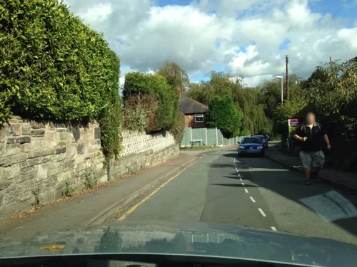
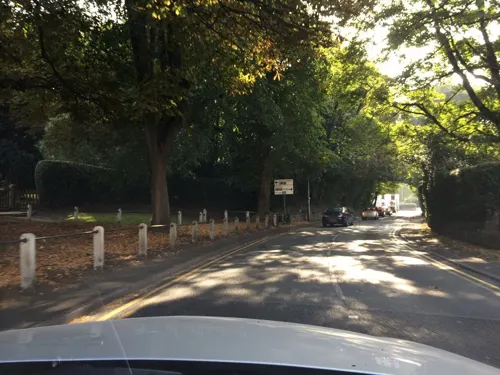
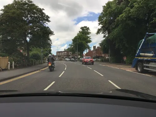
- Mapillary (see each image): photos
- OpenStreetMap contributors (ODbL 1.0): places, airports, map data
- Wikidata (CC0 1.0): elevation, founding date, time zone, website, landmarks and historic places
- Wikimedia Commons (see each image): photos
- Wikipedia (CC BY-SA 4.0): overview and history text
Photo credits
- King Street in Knutsford, Stefan.p21 (Maciej Preś), CC BY-SA 4.0
- Knutsford - Town Hall, Stephen Richards, CC BY-SA 2.0
- 1 and 3, Princess Street, Knutsford, Dave.Dunford, CC BY-SA 4.0
- Sundial in Knutsford churchyard, Dave.Dunford, CC BY-SA 4.0
- 4, 4A and 6, Princess Street, Knutsford, Dave.Dunford, CC BY-SA 4.0
- Savings Bank, Knutsford, Dave.Dunford, CC BY-SA 4.0
- Peover Hall, Iain McDonald, CC BY-SA 2.0
- Tabley Hall 4, Peter I. Vardy, Public domain
- Tatton Hall, K. Whatley, CC BY-SA 2.0
- Knutsford Brook 1, Peter I. Vardy, Public domain
- Knutsford swJanaChrzciciela, Stefan.p21 (Maciej Preś), CC BY-SA 4.0
- Over Peover 6, Peter I. Vardy, Public domain
- Rostherne - Saint Mary's Church, Simon Huguet, CC BY-SA 2.0
- Tabley Chapel 1, Peter I. Vardy, Public domain
- Knutsford Cross 2, Peter I. Vardy, Public domain
- Toft parish church, Parrot of Doom, CC BY-SA 3.0
- Tatton Park 2016 080, Photograph by Mike Peel ( www.mikepeel.net )., CC BY-SA 4.0
- Tatton house, Rich Daley, CC BY-SA 2.0
- Tabley Superior - Gauntlet Birds of Prey Centre, Pauline Eccles, CC BY-SA 2.0
- Cuckooland Museum clocks by Kirsty Davies, Kirsty Davies, CC BY-SA 3.0
- Street-level photo, julianlb, CC BY-SA 4.0
- Street-level photo, julianlb, CC BY-SA 4.0
- Street-level photo, julianlb, CC BY-SA 4.0
- Street-level photo, julianlb, CC BY-SA 4.0
- Street-level photo, IpswichEdits, CC BY-SA 4.0
- Street-level photo, julianlb, CC BY-SA 4.0
- Street-level photo, julianlb, CC BY-SA 4.0
- Street-level photo, julianlb, CC BY-SA 4.0
- Street-level photo, southglos, CC BY-SA 4.0
- Street-level photo, mappo2, CC BY-SA 4.0
- Street-level photo, julianlb, CC BY-SA 4.0
- Street-level photo, ricorico, CC BY-SA 4.0
- Street-level photo, julianlb, CC BY-SA 4.0
- Street-level photo, julianlb, CC BY-SA 4.0
- Street-level photo, julianlb, CC BY-SA 4.0
- Street-level photo, julianlb, CC BY-SA 4.0
- Street-level photo, ricorico, CC BY-SA 4.0
- Street-level photo, julianlb, CC BY-SA 4.0
- Street-level photo, julianlb, CC BY-SA 4.0
- Street-level photo, ricorico, CC BY-SA 4.0
- Street-level photo, julianlb, CC BY-SA 4.0


Page built November 10, 2026. Spotted a mistake? Tell us or suggest a place.