


Cheadle Hulme, United Kingdom
Cheadle Hulme is a town of 28,952 people in England, United Kingdom.
Why visit Cheadle Hulme
Townapedia lists 14 museums and landmarks, 51 parks and trails, 129 places to eat, 7 places to stay and 6 attractions in and around town.
Highlights include Capitol Theatre, Garrick Theatre, Bramall Hall and Avro Heritage Museum.
Weather in Cheadle Hulme
Forecast from MET Norway (CC BY 4.0). Full forecast
About Cheadle Hulme
Cheadle Hulme () is a suburb in the Metropolitan Borough of Stockport, Greater Manchester, England. It lies in the historic county of Cheshire, 2 miles (3.2 km) south-west of Stockport and 8 miles (12.9 km) south-east of Manchester. In 2011, it had a population of 26,479. The suburb has good transport links, with its own railway station and is in close proximity to Manchester Airport, the M60 motorway and the A34 road.
From the Wikipedia article Cheadle Hulme (this version), under CC BY-SA 4.0.
Photos of Cheadle Hulme


Things to do6

Capitol Theatre
Cinema and theater · 3.0 mi
Former theatre in Didsbury, Manchester, later used as television studios

Garrick Theatre
Cinema and theater · 2.5 mi
Theatre in Stockport, England


Museums and landmarks14

Bramall Hall
Monument and historic site · 1.0 mi
Tudor manor house in Bramhall, Stockport, Greater Manchester, England, UK


Hat Works
Museum · 2.5 mi
Museum and former cotton mill Greater Manchester, England

Staircase House
Museum · 2.9 mi
Grade II* listed medieval building and museum in Stockport, England

War Memorial Art Gallery
Museum · 2.3 mi
Grade II* listed art gallery in Stockport, Greater Manchester, England, UK



Stockport Air Raid Shelters
Museum · 2.6 mi
Underground air-raid shelters dug under Stockport in England

Stockport Castle
Monument and historic site · 2.8 mi
Former motte-and-bailey castle in Stockport, Cheshire
Wolfgang Webster Gallery
Museum · 0.7 mi
4 Gillbent Road, Cheadle
2 more on the map.
Parks, trails and playgrounds51

Didsbury Park
Park · 3.1 mi
Park in Didsbury, Manchester, England, UK

Fog Lane Park
Park · 3.6 mi
Urban park in Withington and Didsbury, Manchester


Edgeley Park Stadium
Sports field and stadium · 1.9 mi
Hardcastle Road, Stockport



39 more on the map.
Restaurants and cafes129
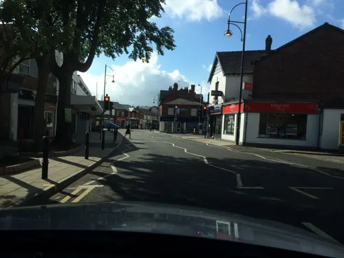
Jalfrezi
Restaurant · Indian · 1.6 mi
3 Village Square, Stockport
Su-Th 17:00-23:00; Fr-Sa 17:00-23:30
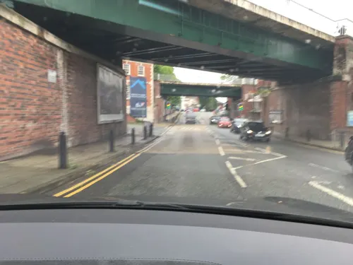
The Chiverton Tap
Bar and pub · Local
8 Mellor Road
Mo-Th 16:00-22:30; Fr-Sa 12:00-23:00; Su 10:00-22:30
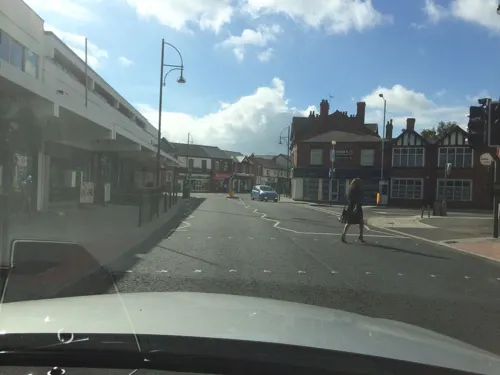
Frurt
Ice cream · Frozen Yogurt · 1.6 mi
10a Ack Lane East, Stockport
Mo-Th 11:00-22:45; Fr 11:00-23:45; Sa 10:00-23:45; Su 10:00-22:45
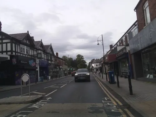
The Bubble Room
Bar and pub · 1.6 mi
2, 4 Ack Lane East, Stockport
Mo 11:00-23:30; Tu off; We-Fr 11:00-23:30; Sa-Su 10:00-23:30


117 more on the map.
History
The Domesday Book provides the earliest mention of the area, where it is recorded as "Cedde", Celtic for "wood". Local archaeological finds include Bronze Age axes discovered in Cheadle. Evidence of Roman occupation includes coins and jewellery, which were found in 1972, and the modern-day Cheadle Road, originally known as Street Lane, may be of Roman origin. A stone cross dedicated to the Anglo-Saxon St Chad, uncovered in 1873, indicates Anglo-Saxon activity. The cross was found in an area called "Chad Hill", on the banks of Micker Brook near its confluence with the River Mersey; this area became "Chedle". Suggestions for the origin of the name include the words cedde, and leigh or leah, in Old English meaning "clearing", forming the modern day "Cheadle". "Hulme" may have been derived from the Old Norse word for "water meadow" or "island in the fen".
Read more of the history
According to the Domesday Book in 1086, the modern-day Cheadle and Cheadle Hulme were a single large estate. Valued at £20, it was described as "large and important" and "a wood three leagues long and half as broad". One of the earliest owners of the property was the Earl of Chester. It was held by a Gamel, a free Saxon, under Hugh d'Avranches, 1st Earl of Chester, and later became the property of the de Chedle family, who took their name from the land they owned. By June 1294, Geoffrey de Chedle was Lord of the manor. Geoffrey's descendant Robert (or Roger) died in the early 1320s, leaving the estate to his wife Matilda who held it until her death in 1326. As there were no male heirs the manor, which was now worth £30 per annum, was divided between her daughters, Clemence and Agnes. Clemence inherited the southern half (which would later become the modern-day Cheadle Hulme), and Agnes inherited the northern half (latterly Cheadle). The two areas became known as "Chedle Holme" and "Chedle Bulkeley" respectively. Shortly afterwards the Chedle Holme estate was divided and the part where Hulme Hall is now situated became known as "Holme", and held by the Vernons. The estates were reunified on the death of the last of the Vernons in 1476.
The only daughter of Clemence and William de Bagulegh, Isabel de Bagulegh, succeeded her parents as owner of the manor, and married Sir Thomas Danyers. Danyers was rewarded for his efforts in the crusades through an annual payment from the King of 40 marks, as well as the gift of Lyme Hall. His daughter Margaret continued to receive payments after his death.
The first John Savage succeeded Margaret and nine more followed him. The tenth died young, so the estate passed to his brother, Thomas Savage. In 1626, Charles I created the title of Viscount Savage for him. On his death, the estate passed to his daughter Joan, who later married John Paulet, 5th Marquess of Winchester. Joan died during childbirth at the age of 23 and the estate passed to the Marquess. The Marquess practised Catholicism, and in 1643 the estate was confiscated due to persecution of Catholics in the English Civil War.
Following this, the estate was acquired by the Moseley family of Manchester and became known as Cheadle Moseley. Anne Moseley was the last of this family to hold the manor, as her husband could not afford to keep it following her death. It was purchased by John Davenport, who bequeathed it to the Bamford family when he died childless in 1760. After the last Bamford died without male issue in 1806, the estate passed to Robert Hesketh who took the name Bamford-Hesketh; it is from this family that the Hesketh Tavern public house in Cheadle Hulme got its name. The last person to hold the manor was Winifred, Countess of Dundonald, one of Bamford-Hesketh's descendants.
Prior to 1868, Cheadle Moseley was a township within the ancient parish of Cheadle. Its population more than doubled during the first half of the 19th century, rising from 971 in 1801 to 2,319 in 1851. Cheadle Moseley became a civil parish in 1868. In 1879, it was merged with neighbouring Cheadle Bulkeley to form the civil parish of Cheadle. Cheadle parish went on to become part of the newly formed Cheadle and Gatley district in 1894. The name "Cheadle Moseley" continued to be used for the area, appearing on tithes and deeds until the 20th century. In 1974, the Cheadle and Gatley district was abolished and Cheadle Hulme became part of the Metropolitan Borough of Stockport.
RAF Handforth was a large and important storage facility that contributed directly to the war effort. The site stretched from the centre of Handforth, through Cheadle Hulme and onwards to Woodford. The industrial estate in Adlington Park in Poynton was a dispersed site of RAF Handforth. Cheadle Hulme itself escaped being badly damaged, but its villagers knew the extent of the war, mainly due to the large and visible presence of the RAF and could hear the sounds of air-raids on Manchester.
Cheadle Hulme did not grow around a church like many English villages, but instead grew from several hamlets that existed in the area. Many of the names of these hamlets still appear in the names of areas, including Smithy Green, Lane End, Gill Bent and Grove Lane. Some of the many farms, such as Orish Mere and Hursthead Farms, which covered the area also retain their names in schools that were built in their place.
The area was struck by an F1/T2 tornado on 23 November 1981, as part of the record-breaking nationwide tornado outbreak on that day.
From the History section of Cheadle Hulme on Wikipedia, under CC BY-SA 4.0.
More about Cheadle Hulme
Geography
At 53.376°N 2.188°W / 53.376; -2.188, Cheadle Hulme is in the south of Greater Manchester. Stockport Metropolitan Borough straddles the Cheshire Plain and the Pennines, and Cheadle Hulme is in the west of the borough on the Cheshire Plain. The area lies in the Ladybrook Valley next to the Micker Brook, a tributary of the river Mersey which flows north–west from Poynton through Bramhall and Cheadle Hulme, joining the Mersey in Stockport.
The majority of buildings in the area are houses from the 20th century, but there are a few buildings, landmarks and objects that date from the 16th century, in addition to Bramall Hall which dates from the 14th century. In particular, there are many Victorian buildings in several places across the area. The local drift geology is mostly glacial boulder clay, as well as glacial sands and gravel. For many years the clay has been used for making bricks and tiles.
Cheadle Hulme's climate is generally temperate, like the rest of Greater Manchester. The mean highest and lowest temperatures of 13.2 °C (55.8 °F) and 6.4 °C (43.5 °F) are slightly above the average for England, while the annual rainfall of 806.6 millimetres (31.76 in) and average hours (1,394.5 hours) of sunshine are respectively above and below the national averages.
Economy
For many years, Cheadle Hulme was rural countryside, made up of woods, open land and farms. The local population was made up of farmers and peasants, living in small cottages and working the land under the tenancy of the Lord of the manor. Most families kept animals for food, grew their own crops, and probably bought and sold produce at Stockport market. Water was obtained from local wells and ponds, and sometimes the Micker Brook.
Local silk weaving became a large part of everyday life. The work took place in domestic cottages in a room known as a "loomshop", and the woven silk was transported to firms in Macclesfield 8 miles (13 km) away. Silk-weaving remained commonplace in the area until the early 20th century, when the process became industrialised. Other industries in the area included a corn mill, which collapsed some time during the First World War, located next to the Micker Brook; cotton weaving; and brickworks, one located where the fire station is and one near to the railway station. A coal wharf was situated opposite the railway station and supplied the area with coal.
Arts and culture
The East Cheshire Chess Club is located on Church Road and there are two amateur theatre societies: Players' Dramatic Society on Anfield Road, and Chads Theatre on Mellor Road.
Cheadle Hulme Library, which opened on 28 March 1936, is also located on Mellor Road. The suburb once had its own cinema named the Elysian Cinema, located on Station Road, but this closed in March 1974. As of 2009, the closest cinemas to Cheadle Hulme are approximately 3 miles (5 km) away in Stockport (Red Rock) and the Parrs Wood entertainment centre, both leisure complexes which include restaurants, bars, bowling and fitness facilities.
Cheadle Hulme is also home to many public houses and restaurants that serve a variety of cuisine, including Indian, Chinese and Italian. The John Millington, a Grade II listed building, was formerly Millington Hall, built for Stockport alderman John Millington. A row of cottages near to the hall served as a meeting place for local Methodists from 1814, before a purpose-built chapel was established. A Sunday school was also established in the same place. The King's Hall was built in 1937 and was originally a dance hall before its conversion into a restaurant and public house.
Education
Cheadle Hulme's first school, established in 1785, was named after local grocer Jonathan Robinson, who donated 3 acres (1.2 ha) of land on what is now Woods Lane. The school was built on what is now the corner of Woods Lane and Church Road, and was originally for the teaching of four boys and four girls. With the increasing population and the Education Act 1870 All Saints' National School was built across the road in 1873, next to All Saints' Church from which it took its name.
Hulme Hall Grammar School was established in 1928 (has since relocated), Queens Road Primary School opened in 1932, and the school that became Cheadle Hulme High School was built near to the site of the Jonathan Robinson School in the 1930s.
Most of the other schools in the area were established in the 1950s and 1960s, including Cheadle County Grammar School for Girls, built in 1956, which later became Margaret Danyers Sixth Form College, named after the same Danyers who was lady of the manor in the 14th century. The site is now the Cheadle campus of Cheadle and Marple Sixth Form College.
There are nine primary schools, with two secondary schools: Cheadle Hulme High School and St. James' Catholic High School, which opened in 1980, In addition, three private schools and one special school, Seashell Trust are located in the area.
From the Wikipedia article Cheadle Hulme, under CC BY-SA 4.0.
Notable people from Cheadle Hulme
 Felicity PeakeRAF officerPhoto: Thomas Cantrell Dugdale, Public domain
- Tim McInnernyEnglish actor
- Tyrese CampbellEnglish association football player (born 1999)
- Gabrielle RayBritish actor, singer and dancer (1883–1973)
- Patrick du ValBritish mathematician (1903-1987)
- Chris ChantlerBritish footballer (born 1990)
- Leslie AlcockBritish archaeologist (1925-2006)
- Mary PillingEnglish cricketer (born 1938)
- Andrew LawEnglish hedge fund manager
- Allan WaltonBritish painter (1891-1948)
- James KirkEnglish military officer in the First World War (1897–1918); Victoria Cross Recipient
- Joshua BrookesBritish divine
Born in Cheadle Hulme, according to Wikidata (CC0). Each name links to its Wikipedia article.
Where to stay7
Churches and places of worship46
Shopping20
Gas and EV charging7
Schools, colleges and libraries53
Healthcare12
Map of Cheadle Hulme
250 places. The map loads OpenStreetMap tiles when you open it.
Getting there and nearby towns
Manchester Airport (MAN) is the nearest airport with scheduled flights listed in OpenStreetMap, 4 miles away.
- Stockport 3 mi northeast, about 4 min by car
- Hazel Grove 3 mi east, about 5 min by car
- Poynton 4 mi southeast, about 6 min by car
- Wilmslow 4 mi southwest, about 6 min by car
- Marple 5 mi east, about 9 min by car
- Denton 6 mi northeast, about 10 min by car
- Timperley 6 mi west, about 10 min by car
- Droylsden 7 mi north, about 12 min by car
- Manchester 8 mi north, about 12 min by car
- Salford 9 mi northwest, about 14 min by car
Drive times are estimates from straight-line distance, not routes.
Towns near Cheadle Hulme


Keep exploring
Local news
Headlines from INDB.
Reviews, tips and questions
Loading what members have shared...
Sources and licences
- GeoNames (CC BY 4.0): population, coordinates, regions and time zone
- Mapillary (see each image): photos
- OpenStreetMap contributors (ODbL 1.0): places, airports, map data
- Wikidata (CC0 1.0): elevation, founding date, time zone, website, landmarks and historic places
- Wikimedia Commons (see each image): photos
- Wikipedia (CC BY-SA 4.0): overview and history text
Photo credits
- Cheadle Hulme Arches, O1ive at English Wikipedia, CC BY-SA 3.0
- Cheadle Hulme Station front, 1988, Peter Whatley, CC BY-SA 2.0
- Cheadle Hulme railway station c.1905, Unknown author Unknown author, Public domain
- Cheadle Hulme railway station c.1900, Unknown author Unknown author, Public domain
- ABC Weekend TV studios in Didsbury Manchester, No machine-readable author provided. Redvers assumed (based on copyright claims)., Public domain
- Garrick Theatre, Stockport (1), Rept0n1x, CC BY-SA 3.0
- Bramall Hall from west, 2011, David Dixon, CC BY-SA 2.0
- Avro Heritage Museum Rear, Trevor Harris, CC BY-SA 2.0
- Hat Works, Zzztriple2000 at en.wikipedia, Public domain
- Staircasehouse, Polishname, Public domain
- Stockport Art Gallery, Jaggery, CC BY-SA 2.0
- Didsbury Park on a frosty morning, Stopford2014, CC BY 4.0
- Exterior of St James, Skordarector, CC BY-SA 3.0
- Dean Row Unitarian Chapel, Wilmslow, Mike in Macc, CC BY-SA 3.0
- Wilmslow Church, David Wilmot from Wimbledon, United Kingdom, CC BY 2.0
- St. George's Church, Stockport 22 April 2009, This media: Zzztriple2000 ; Original work: Hubert Austin (31 March 1841 – 1915); Subject work of original work :, CC BY 3.0
- Edgeley Park 2011, [1], CC BY-SA 3.0
- CHHS 2018, Aiken drum, CC BY-SA 4.0
- Cheadle Hulme School, Main Building, Front, Timhudsonchs, CC BY-SA 3.0
- St Mary's Church, Cheadle, Alexander P Kapp, CC BY-SA 2.0
- Edgeley park 2021, Ceaton89, CC BY 4.0
- Fog Lane Park 22 09 11 801000, Cnbrb, CC BY-SA 4.0
- Various 41 366 - 2020 (49942160547), Tom Page from London, UK, CC BY-SA 2.0
- Bramhall War Memorial, Plucas58, CC BY-SA 3.0
- Hulme Hall, Cheadle Hulme c.1900, Unknown author Unknown author, Public domain
- Stockport Museum In Vernon Park, Dave.Dunford, CC BY-SA 4.0
- Street-level photo, julianlb, CC BY-SA 4.0
- Street-level photo, julianlb, CC BY-SA 4.0
- Street-level photo, julianlb, CC BY-SA 4.0
- Street-level photo, julianlb, CC BY-SA 4.0
- Street-level photo, julianlb, CC BY-SA 4.0
- Street-level photo, julianlb, CC BY-SA 4.0
- Street-level photo, southglos, CC BY-SA 4.0
- Street-level photo, julianlb, CC BY-SA 4.0
- Street-level photo, julianlb, CC BY-SA 4.0
- Street-level photo, JSouter1st, CC BY-SA 4.0
- Street-level photo, southglos, CC BY-SA 4.0
- Street-level photo, southglos, CC BY-SA 4.0
- Street-level photo, JSouter1st, CC BY-SA 4.0
- Street-level photo, JSouter1st, CC BY-SA 4.0
- Street-level photo, JSouter1st, CC BY-SA 4.0
- Street-level photo, southglos, CC BY-SA 4.0
- Street-level photo, southglos, CC BY-SA 4.0
- Street-level photo, sscsjone, CC BY-SA 4.0


Page built November 10, 2026. Spotted a mistake? Tell us or suggest a place.