


Why visit Harrold
Townapedia lists 4 museums and landmarks, 3 parks and trails and 9 places to eat in and around town.
Highlights include Harrold War Memorial, Turvey Abbey, Felmersham Gravel Pits and Pavenham Osier Beds.
Weather in Harrold
Forecast from MET Norway (CC BY 4.0). Full forecast
About Harrold
Harrold is a village, civil parish and electoral ward in Bedfordshire, England, nine miles north-west of Bedford on the north bank of the River Great Ouse, close to the county boundaries of Buckinghamshire and Northamptonshire. An ancient bridge links the village with Carlton with Chellington on the south bank. Immediately to the east of the village is Odell.
From the Wikipedia article Harrold, Bedfordshire (this version), under CC BY-SA 4.0.
Museums and landmarks4
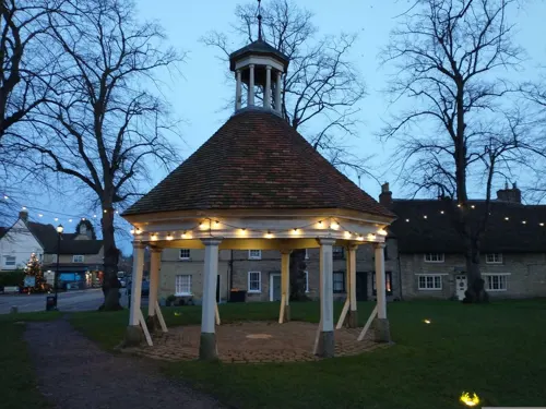


Parks, trails and playgrounds3

Felmersham Gravel Pits
Park · 2.7 mi
Nature reserve in Bedfordshire, United Kingdom

Pavenham Osier Beds
Park · 2.7 mi
Nature reserve in the United Kingdom

Restaurants and cafes9

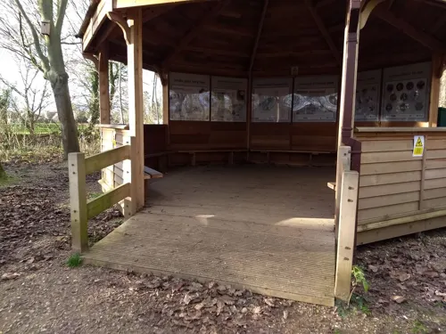


Churches and places of worship15

Church of All Saints, Odell
Church · 1.2 mi
Grade I listed church in Bedfordshire, England, UK

Church of St Mary, Felmersham
Church · 2.6 mi
Grade I listed church in Felmersham, Bedford, Bedfordshire, England, UK

Church of St Peter, Pavenham
Church · 2.6 mi
Grade I listed church in Pavenham, Bedford, Bedfordshire, England, UK

Church of St Peter, Sharnbrook
Church · 3.2 mi
Grade I listed church in Sharnbrook, Bedford, Bedfordshire, England, UK

Parish Church of All Saints, Turvey
Church · 2.7 mi
Grade I listed church in Bedfordshire, England, UK

Church of St Mary
Church · 1.2 mi
Church in Carlton, Bedfordshire, England, UK
Church of St Mary, Stevington
Church · 3.1 mi
Grade I listed church in Stevington, Bedford, Bedfordshire, England, UK
Church of St Peter, Harrold, Bedfordshire
Church
Grade I listed church in Harrold, Bedford, Bedfordshire, England, UK
3 more on the map.
History
Harrold was recorded in the Domesday Book of 1086 as a parish within the Hundred of Willey.
An early medieval sword mount was unearthed by a metal detectorist in 2006. It is believed the tiny phallic decoration could have adorned the sword belt of a high-ranking Saxon warrior.
There are two public houses in Harrold. The Muntjac and the Oakley Arms. Paul McCartney reputedly gave the first live performance of "Hey Jude" in the Oakley Arms in Harrold on 30 June 1968.
The village was struck by an F1/T2 tornado on 23 November 1981, as part of the record-breaking nationwide tornado outbreak on that day.
From the History section of Harrold, Bedfordshire on Wikipedia, under CC BY-SA 4.0.
More about Harrold
Arts and culture
The Harrold Pit Run is a village fair on Harrold Village Green held every April since the 1980's, with a 3-mile run via Harrold-Odell Country Park (established from former gravel pits). There are also shorter races for children.
From the Wikipedia article Harrold, Bedfordshire, under CC BY-SA 4.0.
Notable people from Harrold
- George Le FevreAustralian surgeon and politician
Born in Harrold, according to Wikidata (CC0). Each name links to its Wikipedia article.
Schools, colleges and libraries2
Map of Harrold
33 places. The map loads OpenStreetMap tiles when you open it.
Getting there and nearby towns
Sywell Aerodrome (ORM) is the nearest airport with scheduled flights listed in OpenStreetMap, 11 miles away.
- Lavendon 3 mi southwest, about 5 min by car
- Sharnbrook 3 mi northeast, about 5 min by car
- Rushden 6 mi north, about 10 min by car
- Riseley 7 mi northeast, about 11 min by car
- Bedford 8 mi southeast, about 12 min by car
- Wellingborough 8 mi northwest, about 13 min by car
- Kempston 8 mi southeast, about 12 min by car
- Kempston Hardwick 9 mi southeast, about 15 min by car
- Newport Pagnell 9 mi southwest, about 15 min by car
- Northampton 12 mi west, about 19 min by car
Drive times are estimates from straight-line distance, not routes.
Towns near Harrold


Keep exploring
Local news
Headlines from INDB.
Reviews, tips and questions
Loading what members have shared...
Sources and licences
- GeoNames (CC BY 4.0): population, coordinates, regions and time zone
- Mapillary (see each image): photos
- OpenStreetMap contributors (ODbL 1.0): places, airports, map data
- Wikidata (CC0 1.0): elevation, founding date, time zone, website, landmarks and historic places
- Wikimedia Commons (see each image): photos
- Wikipedia (CC BY-SA 4.0): overview and history text
Photo credits
- Maker's mark on the east window at St Peter's church, Harrold, Bedfordshire, UK, Furtho, CC BY-SA 4.0
- Felmersham Gravel Pits 2, Dudley Miles, CC BY-SA 4.0
- Pavenham Osier Beds 2, Dudley Miles, CC BY-SA 4.0
- StMary'sChurch-Felmersham, Benjah-bmm27, Public domain
- StPeter'sChurch-Pavenham, Unknown author, Public domain
- St-Peter's-Church-Sharnbrook, Unknown author, Public domain
- All Saints Church Turvey, Clintheacock66 at English Wikipedia, CC BY-SA 3.0
- AllSaints-Odell, Unknown author, Public domain
- TheBell-PH-Odell, Unknown author, Public domain
- Street-level photo, ewana, CC BY-SA 4.0
- Street-level photo, photomaps, CC BY-SA 4.0
Page built November 10, 2026. Spotted a mistake? Tell us or suggest a place.