


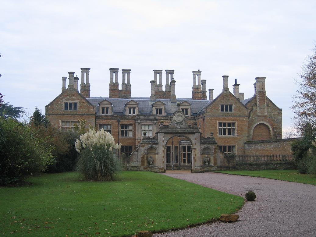


Northampton, United Kingdom
Northampton is a city of 245,899 people in England, United Kingdom, founded in 1189.
Why visit Northampton
Townapedia lists 31 museums and landmarks, 97 parks and trails, 166 places to eat, 30 places to stay and 21 attractions in and around town.
Highlights include Odeon, Blisworth Arch, Abington Park Museum and 78 Derngate: The Charles Rennie Mackintosh House.
Weather in Northampton
Forecast from MET Norway (CC BY 4.0). Full forecast
About Northampton
Northampton is a town and civil parish in Northamptonshire, England. It is the county town of Northamptonshire and the administrative centre of the unitary authority of West Northamptonshire. The town is situated on the River Nene, 60 miles (97 km) north-west of London and 50 miles (80 km) south-east of Birmingham. Northampton is one of the largest settlements in England without city status; the population of its overall urban area was recorded as 249,093 in the 2021 census.
From the Wikipedia article Northampton (this version), under CC BY-SA 4.0.
Travel tips from other travellers: Northampton on Wikivoyage (CC BY-SA 4.0).
Photos of Northampton


Things to do21


Blisworth Arch
Bridge · 5.3 mi
Railway bridge in Blisworth, South Northamptonshire, England, UK


The Deco
Cinema and theater · 0.7 mi
Former cinema in Northampton, England, now a religious centre and multi-purpose venue

Jenneys
Farm and orchard · 4.5 mi
Large Fresh Eggs, Potatoes, carrots ,Caul, Onions, Mushrooms, Leeks, Parsnips, Cabbages, Brussels, Swedes,
Mo-Su 07:00-19:00
9 more on the map.
Museums and landmarks31

Abington Park Museum
Museum · 0.8 mi
Wellingborough Road, Northampton
Sa,Su 12:00-16:00; SH Tu-Su 12:00-16:00; PH 12:00-16:00; Dec 25-26...


Althorp
Museum · 5.4 mi
Stately home and estate in West Northamptonshire, England, UK


Northampton Museum and Art Gallery
Museum · 1.0 mi
Museum in Northampton, England, UK

Queen Eleanor Cross
Monument and historic site · 2.4 mi
Eleanor Cross: one of a series of twelve stone monuments topped with crosses erected between 1291 and about 1295 in England from Lincoln...


Northampton Medieval Synagogue
Monument and historic site · 1.0 mi
Synagogue in Northampton, England, UK
Northampton War Memorial
Monument and historic site · 1.0 mi
First World War memorial on Wood Hill in the centre of Northampton, England
The Town and County War Memorial
Monument and historic site · 1.0 mi
19 more on the map.
Parks, trails and playgrounds97

Abington Park
Park · 0.8 mi
Park in Northamptonshire, UK




Billing Aquadrome
Park · 3.0 mi
Leisure park in Great Billing, Northamptonshire
Brixworth Country Park
Park · 5.0 mi
Country park in Northamptonshire, England, UK
Delapre Golf Centre
Golf course · 2.0 mi
18 hole Par 69 The Oaks course & 9 hole Par 32 Hardingstone course & 9 hole Par 27 Jacks Course & 9 hole Par 27 Abbey Course & 9 hole Pitch & Put
Nene Valley Way, Northampton
85 more on the map.
Restaurants and cafes166

Starbucks
Cafe · Coffee Shop · 1.1 mi
Harborough Road, Northampton
Mo-Fr 07:00-19:00; Sa 07:00-18:00; Su 08:00-17:00
Frankie & Benny's
Diner · American · 2.0 mi
Marquee Drive, Northampton
Mo-Th 09:00-22:00; Fr-Sa 09:00-22:30; Su 09:00-22:00
Sun Inn
Bar and pub · 4.4 mi
6 Mill Road, Northampton
Mo-Fr 17:00-23:00; Sa,Su 11:00-23:00

Wagamama
Restaurant · Asian · 2.4 mi
Walter Tull Way, Northampton
Su-Th 11:00-22:00; Fr,Sa 11:00-23:00

Olde Red Lion
Bar and pub · Burger, Coffee Shop, Fine Dining, Fish, Fish And Chips · 4.3 mi
15 High Street, Northampton
Tu 17:00-22:00; Su, We-Th 12:00-22:00; Fr-Sa 12:00-23:30

Pizza Hut
Restaurant · Pizza · 2.2 mi
Walter Tull Way, Northampton
Su-Th 11:00-22:00; Fr,Sa 11:00-23:00
Pizza Hut
Restaurant · Pizza · 2.4 mi
Caswell Road, Northampton
Mo-We 11:30-22:30; Th 11:30-23:00; Fr 11:00-23:00; Sa 11:30-23:00;...
154 more on the map.
History
The earliest reference to Northampton in writing occurred in 914 under the name Ham tune. The prefix North was added later to distinguish it from other towns called Hampton, most prominently Southampton. The Domesday Book (1086) records the town as Northantone, which evolved into Norhamptone by the 13th century and later Northampton by the 17th century.
Present-day Northampton is the latest in a series of settlements that began in the Bronze Age. Remains found in the Briar Hill district show evidence of a Neolithic encampment within a large circular earthwork where local farmers assembled for tribal ceremonies and seasonal events from approximately 3500 BC to 2000 BC.
During the British Iron Age, people typically lived in protected hill forts. Present-day Hunsbury Hill is an example of this settlement; a circular ditch and a bank faced with a wall of timber and enclosing an area of 160 acres (65 ha) which dates to around 400 BC. In the Roman period, a small rural settlement is thought to have existed in the present-day district of Duston; remains of Roman pottery were found there.
Read more of the history
Following a Danish invasion, the central area of the town was turned into a stronghold called a burh probably by the Anglo-Saxons. By the time of the Peace of Wedmore in 878 the Burgh was in possession of the Danes and became the base for one of the Danish armies. A ditch was dug around the settlement and it was fortified with earth ramparts. Having conquered Mercia, the Danes turned the settlement into a centre for military and administrative purposes, which was part of the Danelaw. The Danish army of Northampton however submitted to Edward the Elder, Saxon King of Wessex (who controlled the southern and western part of the English Kingdom of Mercia) in 921
In the 9th century Regenhere of Northampton, an East Anglian Saint with localised veneration, was buried in Northampton. By 918, Northampton had an earl and an army dependent upon it, whose territory extended to the River Welland.
Edward the Elder turned Northampton into the centre of one of the new shires, and it prospered as a river port and trading centre. In 940, it resisted the invading forces of Danish opposition in Northumbria when the Mercians successfully defended the town in a siege by King Olaf of York, but was burnt in 1010 by a Danish army, and again in 1065 by the rebellious northern earls Edwin and Morcar. Despite this, the Domesday Book records Northantone as possessing 316 houses with a population of 2000 people, ranking between Warwick and Leicester in size.
With the Norman Conquest of England in 1066, the town rose to national significance; its geographical location in the centre of England made Northampton a valuable strategical point for government and as a convenient meeting place for political, social, ecclesiastical and military events.
Northampton Castle is thought to have been built by Simon de Senlis, who became the first Earl of Northampton, circa 1084. It was originally an earth and timber stockaded construction which was later rebuilt in stone. The castle became an occasional royal residence from the reign of King Henry I in 1130, until that of King Richard II. King John regularly stayed at the castle and moved The Treasury there in 1205. Some 32 Parliaments were held there. The last Parliament at Northampton was held in 1380. Significant events in the castle's history include the trial of Thomas Becket in 1164, the publication of the Assize of Northampton in 1176, the declaration of peace with Scotland in the Treaty of Edinburgh–Northampton, the passage of the Statute of Northampton in 1328 and the imposition of poll tax in 1380. Royal tournaments and feasts were also held at the castle.
Simon de Senlis is also thought to have built the medieval town walls, which enclosed about 245 acres (99 ha) and had four main gates. Since demolished, the circular pattern of the main roads surrounding the town centre marks the original position of the walls. de Senlis founded the Cluniac Priory of St Andrew's in the area of Semilong, and built The Church of the Holy Sepulchre – one of four remaining round churches in England – and All Hallows' Church on the current site of All Saints' Church. His son, Simon II de Senlis, built St Peter's Church on a site between a former Anglo-Saxon palace and Northampton Castle. Simon II de Senlis also founded Delapré Abbey – another Cluniac priory – which still stands today. Other priories in medieval Northampton include St James' Abbey, Graye Friers, Blackfriars and Whitefriars. St. John's, a medieval hospital, was situated east of Bridge Street. Medieval tunnels remain under the centre of Northampton around All Saints' Church and the Market Square but their purpose, extent and significance have been disputed.
The town was originally controlled by officials acting for the King who maintained law and order and collected taxes. This changed on 18 November 1189, when King Richard I granted the town its first charter in exchange for money to fund his crusades. The charter allowed the townspeople certain rights and independence in legal and administrative matters. In 1215, King John authorised the appointment of William Tilly as the town's first Mayor and ordered that "twelve of the better and more discreet [residents] of your town" join him as a council to assist him. The importance of Northampton at this time is underlined by the fact that only London, York and King's Lynn had mayors by this date. The mayor later ruled with 24 councillors and 48 freemen in a closed body until 1835.
In 1261, King Henry III established a University of Northampton by royal charter. Had it survived, it would have been the third oldest university founded in England after Oxford and Cambridge. However, after members of the university sided with Simon de Montfort in rebellion against the King, in 1265 the king revoked his decision, suppressing the university on the grounds that it was a threat to Oxford's academic hegemony.
From the History section of Northampton on Wikipedia, under CC BY-SA 4.0.
More about Northampton
Geography
Northampton is formally in the East Midlands region but is also referred to in Government planning as being part of the South Midlands "growth area". The town is 30 miles (48 km) south-south-east of Leicester, 16 miles (26 km) north-north-west of Milton Keynes, 43 miles (69 km) west of Cambridge, 37 miles (60 km) north-east of Oxford and 37 miles (60 km) south-west of Peterborough.
Northampton is subdivided into suburbs, council wards, constituencies, ecclesiastical parishes and other less formal areas.
Concurrent with the abolition of the borough of Northampton in 2021, the unparished area of Northampton became parished with three new parish councils being established. A new Town Council covering the majority of the urban area of Northampton was established, whilst the areas of Kingsthorpe, Far Cotton and Delapré also gained parish councils. In addition, there are nine registered parish councils which predate the abolition of the borough of Northampton. These are Billing, Collingtree, Duston, Great Houghton, Hardingstone, Hunsbury Meadow, Upton, West Hunsbury and Wootton & East Hunsbury.
Economy
Northampton was a major centre of shoemaking and other leather industries, although only specialist shoemaking companies such as Barker Shoes, Church's, Crockett & Jones, Edward Green, Tricker's, (formerly located in nearby Earls Barton), and Wildsmith, survive. A large number of old shoe factories remain, mostly now converted to offices or accommodation, some of which are surrounded by terraced houses built for factory workers.
Engineering became a major employer in Northampton during the post-war years, following the establishment of the British Timken tapered roller bearing factory at Duston in 1941 as a shadow factory for the main site in Birmingham during the Second World War. The factory, which closed in 2002, employed over 4,000 employees at its peak and was a major engineering apprentice training employer.
Arts and culture
Billing Aquadrome leisure park is on the eastern outskirts. The Northampton Leisure Trust (branded Trilogy Leisure) has four leisure centres across Northampton, including Mounts Baths.
There are a total of 170 parks and open spaces around Northampton, which altogether span around 1,880 acres (761 ha). Popular parks include Abington Park.
Annual events include Northampton Carnival, the Beer Festival, the Dragonboat Race and Diwali celebrations. Northampton Music Festival has been celebrated every year since 2007 in the town centre.
The Royal & Derngate theatre complex, on Guildhall Road in the Cultural Quarter of the town centre, is one of the main venues for arts and entertainment in Northampton. The Deco, situated in Abington Square in the town centre, is a 900-seat theatre and conference centre, which shares its Art Deco building with the Northampton Jesus Centre. It was restored by the Jesus Army as part of their Jesus Centre project. The Deco used to be a cinema in the 1960s; the Beatles appeared there twice on stage in 1963, firstly as unknowns as part of the Tommy Roe/Chris Montez tour, and secondly as part of their own tour in their own right. Smaller theatres include the Northampton Playhouse and the Cripps Theatre, which is part of Northampton School for Boys.
Education
The first University of Northampton was established by royal charter by King Henry III in 1261, and started to rival the universities in Cambridge and Oxford, with their students migrating to the Northampton establishment. This university was dissolved by King Henry III in 1265, in revenge for its students siding with the rebellious barons in the Battle of Northampton (1264). Henry III was also advised by bishops and magnates that it posed a threat to Oxford, and signed a Royal Decree which banned the establishment of a university in Northampton.
This was eventually repealed and the university's name was revived in 2005, when the unconnected University College Northampton, founded in 1924, was upgraded to full university status and renamed the University of Northampton. This is the only higher education establishment in the town and offers courses from foundation and undergraduate levels to postgraduate, professional and doctoral qualifications. The university is made of up six schools: Business, Education, Health, Science and Technology, Social Sciences, and The Arts. The university was originally spread over two campuses across the town, but moved to its new £330 million waterside campus by the River Nene in the town centre in 2018.
From the Wikipedia article Northampton, under CC BY-SA 4.0.
Notable people from Northampton
 Francis CrickBritish molecular biologist, biophysicist, neuroscientist; co-discoverer of the structure of DNA (1916–2004)Photo: Francis_Crick.png : Photo: Marc..., CC BY 2.5
 Sophie TurnerBritish actress (born 1996)Photo: Duk3L1xon, CC BY-SA 4.0
 Alan MooreBritish comic book author (born 1953)Photo: Fimb, CC BY 2.0
 Alan WalkerNorwegian electronic dance music producer (born 1997)Photo: AMERICAN PATRIOT NEWS, Public domain
 Matt SmithEnglish actor (born 1982)Photo: JaceMerlyn, CC BY-SA 4.0
 Anne BradstreetAnglo-American poet (1612–1672)Photo: Edmund H. Garrett, Public domain
 Mark HaddonEnglish writer and illustratorPhoto: PhilipRomano, CC BY-SA 4.0
 Tim MinchinBritish-Australian comedian, actor and musician (born 1975)Photo: PhilipRomanoPhoto, CC BY 4.0
 Peter MurphyEnglish rock vocalistPhoto: saul torres, CC BY-SA 2.0
- Harold HarefootKing of England from 1035 to 1040
- Prince Richard, Duke of Gloucestercousin of Queen Elizabeth II; youngest grandchild of King George V and Queen Mary (born 1944)
- Malcolm ArnoldEnglish composer and conductor (1921–2006)
Born in Northampton, according to Wikidata (CC0). Each name links to its Wikipedia article.
Where to stay30
Churches and places of worship55
Shopping82
Gas and EV charging26
Schools, colleges and libraries43
OneSchool Global UK, Northampton Primary Campus
School · Plymouth Brethren · 1.8 mi
468a Billing Road East, Northampton
Healthcare42
RAD Clinics Northampton
Clinic and pharmacy · 0.7 mi
Royal Terrace, Barrack Road, Northampton, Northampton
Map of Northampton
250 places. The map loads OpenStreetMap tiles when you open it.
Getting there and nearby towns
Sywell Aerodrome (ORM) is the nearest airport with scheduled flights listed in OpenStreetMap, 6 miles away.
- Peterborough 35 mi northeast, about 56 min by car
- Oxford 38 mi southwest, about 1 h by car
- Solihull 40 mi west, about 1 h by car
- Sutton Coldfield 45 mi northwest, about 1 h 15 min by car
- Birmingham 46 mi west, about 1 h 15 min by car
- Watford 46 mi southeast, about 1 h 15 min by car
- Nottingham 50 mi north, about 1 h 15 min by car
- West Bromwich 50 mi west, about 1 h 15 min by car
- Walsall 52 mi northwest, about 1 h 30 min by car
- Slough 53 mi south, about 1 h 30 min by car
Drive times are estimates from straight-line distance, not routes.
Towns near Northampton


Keep exploring
Local news
Headlines from INDB.
Reviews, tips and questions
Loading what members have shared...
Sources and licences
- GeoNames (CC BY 4.0): population, coordinates, regions and time zone
- Mapillary (see each image): photos
- OpenStreetMap contributors (ODbL 1.0): places, airports, map data
- Wikidata (CC0 1.0): elevation, founding date, time zone, website, landmarks and historic places
- Wikimedia Commons (see each image): photos
- Wikipedia (CC BY-SA 4.0): overview and history text
Photo credits
- Stephenson Bridge Blisworth England, Cj1340 at English Wikipedia, CC BY-SA 3.0
- 78 Derngate (5550355757), Tony Hisgett from Birmingham, UK, CC BY 2.0
- Althorp House, Andrew Walker ( walker44 ), CC BY-SA 3.0
- Holdenby hall, Smb1001, CC BY-SA 4.0
- Abington-Park, Tonp1, CC BY 3.0
- Hills and Holes 1, Dudley Miles, CC BY-SA 4.0
- Crowfields Common 4, Dudley Miles, CC BY-SA 4.0
- Storton's Pits 4, Dudley Miles, CC BY-SA 4.0
- Abington Meadows 3, Dudley Miles, CC BY-SA 4.0
- River Nene in Barnes Meadow 6, Dudley Miles, CC BY-SA 4.0
- Bugbrooke Meadow nature reserve 2, Dudley Miles, CC BY-SA 4.0
- All Saints Church, Northampton, Original uploader was G-Man at en.wikipedia, Public domain
- NorthamptonCathedral, JohnArmagh, Public domain
- St Peter's Church, Northampton, Ian Rob, CC BY-SA 2.0
- Northampton Museum front, StJaBe, CC BY-SA 4.0
- Sixfieldsstadium, Dwadfish at English Wikipedia, Public domain
- Grosvenor Centre, Northampton, England, Cj1340, CC BY-SA 3.0
- Neale(1818) p3.106 - Abington Abbey, Northamptonshire, John Preston Neale, Public domain
- All Saints Church, Pitsford 03, Simon Burchell, CC BY-SA 4.0
- Northampton 036 6 Derngate (50022454722), Peter O'Connor aka anemoneprojectors, CC BY-SA 2.0
- The Griffin Inn, Pitsford, AmosWolfe, CC BY-SA 3.0
- Sixfields, Northampton, England - multi screen cinema, Cj1340, CC BY-SA 3.0
- QueenEleanorCross, Brookie at English Wikipedia, CC BY-SA 3.0
- Geddington Eleanor cross, Lofty at English Wikipedia, CC BY 2.5
- NorthamptonMAG, StJaBe, CC BY-SA 4.0
- Hunsbury Hill Park, Northamptonshire (5661701926), StooMathiesen, CC BY 2.0
- Street-level photo, gness, CC BY-SA 4.0
- Street-level photo, lamaar639, CC BY-SA 4.0
- Street-level photo, rac_uk, CC BY-SA 4.0
- Street-level photo, rac_uk, CC BY-SA 4.0
- Street-level photo, alexanderar, CC BY-SA 4.0
- Street-level photo, OpenFaceMapper, CC BY-SA 4.0
- Street-level photo, alexanderar, CC BY-SA 4.0
- Street-level photo, adam2, CC BY-SA 4.0
- Street-level photo, adam2, CC BY-SA 4.0
- Street-level photo, OpenFaceMapper, CC BY-SA 4.0
- Street-level photo, alexanderar, CC BY-SA 4.0
- Street-level photo, laye, CC BY-SA 4.0
- Street-level photo, adam2, CC BY-SA 4.0
- Street-level photo, adam2, CC BY-SA 4.0
- Street-level photo, adam2, CC BY-SA 4.0
- Street-level photo, adam2, CC BY-SA 4.0
- Street-level photo, adam2, CC BY-SA 4.0
- Street-level photo, adam2, CC BY-SA 4.0
- Street-level photo, adam2, CC BY-SA 4.0
- Street-level photo, OpenFaceMapper, CC BY-SA 4.0


Page built November 10, 2026. Spotted a mistake? Tell us or suggest a place.