


Wellingborough, United Kingdom
Wellingborough is a town of 56,564 people in England, United Kingdom.
Why visit Wellingborough
Townapedia lists 5 museums and landmarks, 30 parks and trails, 141 places to eat, 7 places to stay and 2 attractions in and around town.
Highlights include The Castle, Castle Theatre, Irchester Railway Museum and Wellingborough Museum.
Weather in Wellingborough
Forecast from MET Norway (CC BY 4.0). Full forecast
About Wellingborough
Wellingborough is a market town in the North Northamptonshire district of Northamptonshire, England, 65 miles (105 km) from London and 10 miles (16 km) from Northampton, north of the River Nene.
From the Wikipedia article Wellingborough (this version), under CC BY-SA 4.0.
Travel tips from other travellers: Wellingborough on Wikivoyage (CC BY-SA 4.0).
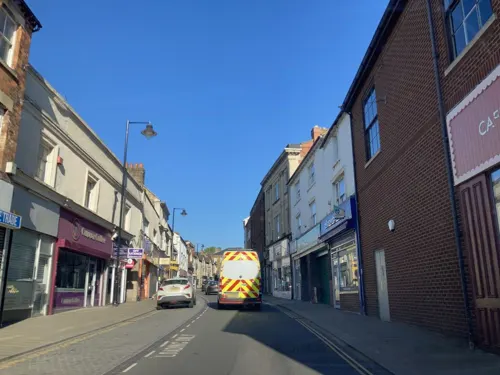
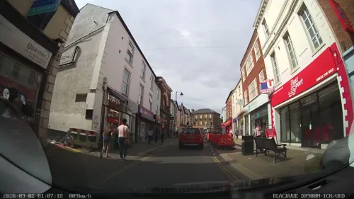
Photos of Wellingborough

Things to do2

Museums and landmarks5




Parks, trails and playgrounds30

Ditchford Lakes and Meadows
Park · 2.4 mi
Nature reserve in the United Kingdom

Finedon Cally Banks
Park · 2.1 mi
Nature reserve in the United Kingdom



Summer Leys
Park · 2.7 mi
Local nature reserve in Northamptonshire, England

Dog & Duck Stadium
Sports field and stadium · 0.8 mi
53-61 London Road, Wellingborough
The Victoria Mill Ground
Sports field and stadium · 0.9 mi
London Road, Wellingborough
18 more on the map.
Restaurants and cafes141
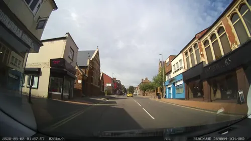
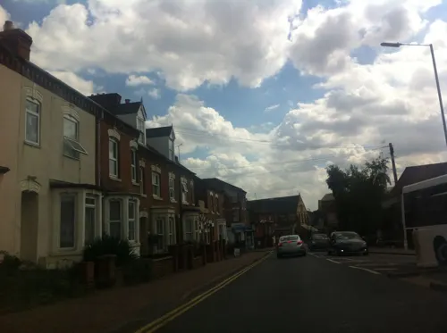
Caprinos Pizza
Restaurant · Pizza
19 Cambridge Street, Wellingborough
Su-Th 11:00-23:00, Fr-Sa 11:00-24:00
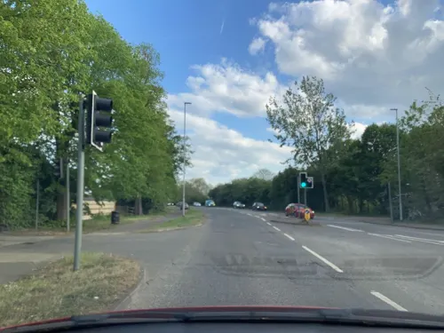
Pizza Hut
Restaurant · Pizza · 0.8 mi
32 London Road, Wellingborough
Mo-Sa 11:30-22:00; Su 12:00-21:00
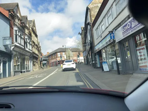
The Horseshoe
Bar and pub
36 Sheep Street, Wellingborough
Mo-Fr 00:00-02:00,11:30-24:00; Sa 00:00-04:00,10:30-24:00; Su...
Murati's Pizzeria Ristorante
Restaurant · Italian
5-8 Burystead Place, Wellingborough
Mo-Sa 12:00-14:00,18:00-22:00

Akash
Restaurant · Indian
36 Cambridge Street, Wellingborough
Mo-Th 17:30-23:30; Fr,Sa 17:30-24:00; Su 12:00-14:30,17:30-23:30
Yumeijin
Restaurant · Chinese
58a-59 Oxford Street, Wellingborough
Mo-Sa 12:00-14:30,17:00-23:00; Su 12:00-16:00,18:00-22:00

Costa
Cafe · Coffee Shop
16-17 Spring Lane, Wellingborough
Mo-Sa 08:00-17:00, Su 10:00-15:30
The Pump House
Cafe · Coffee Shop · 0.9 mi
27 The Embankment, Wellingborough
Mo-Fr 08:30-15:30, Sa 08:30-15:00, Su 10:00-15:00

129 more on the map.
History
The town was established in the Anglo-Saxon period and was called "Wendelingburgh", deriving from the Old English waendelburh or waendelingburh meaning 'Waendel's burh' (fortification). It is surrounded by five wells: Redwell, Hemmingwell, Witche's Well, Lady's Well and Whytewell, which appear on its coat of arms. Henrietta Maria, the Queen Consort of King Charles I, came with her physician Théodore de Mayerne to take the waters on 14 July 1627.
The medieval town of Wellingborough housed a modest monastic grange – now the Jacobean Croyland Abbey – which was an offshoot of the monastery of Crowland (or Croyland) Abbey, near Peterborough, some 30 miles (48 km) down-river. This part of the town is known as Croyland.
Read more of the history
All Hallows Church is the oldest existing building in Wellingborough and dates from c. 1160. The manor of Wellingborough belonged to Crowland Abbey Lincolnshire, from Saxon times and the monks probably built the original church. The earliest part of the building is the Norman doorway opening in from the later south porch. The church was enlarged with the addition of more side chapels and by the end of the 13th century had assumed more or less its present plan. The west tower, crowned with a graceful broach spire rising to 160 feet (49 m), was completed about 1270, after which the chancel was rebuilt and given the east window twenty years later. The church was restored in 1861 by Edmund Francis Law. The 20th-century Church of St Mary was built by Ninian Comper.
Wellingborough was given a Market Charter dated 3 April 1201 when King John granted it to the "Abbot of Croyland and the monks serving God there" continuing, "they shall have a market at Wendligburg (Wellingborough) for one day each week that is Wednesday".
In the Elizabethan era the Lord of the manor, Sir Christopher Hatton was a sponsor of Sir Francis Drake's expeditions; Drake renamed one of his ships the Golden Hind after the heraldic symbol of the Hatton family. A hotel in a Grade II listed building built in the 17th century, was known variously as the Hind Hotel and later as the Golden Hind Hotel.
During the English Civil War the largest substantial conflict in the area was the Battle of Naseby in 1645, although a minor skirmish in the town resulted in the killing of a parliamentarian officer Captain John Sawyer. Severe reprisals followed which included the carrying off to Northampton of the parish priest, Thomas Jones, and 40 prisoners by a group of Roundheads. However, after the Civil War Wellingborough was home to a colony of Diggers. Little is known about this period.
Wellingborough was bombed during World War II, on Monday 3 August 1942. Six people were killed and 55 injured; fortunately, being a bank holiday, thousands of people were away at a fair at a nearby village. Many houses and other buildings in the centre of the town were damaged in the attack.
Originally the town had two railway stations: the first called Wellingborough London Road, opened in 1845 and closed in 1966, linked Peterborough with Northampton. The second station, Wellingborough Midland Road, is still in operation with trains to London and the East Midlands. Since then the 'Midland Road' was dropped from the station name. The Midland Road station opened in 1857 with trains serving Kettering and a little later Corby, was linked in 1867 to London St Pancras. In 1898 in the Wellingborough rail accident six or seven people died and around 65 were injured. In the 1880s two businessmen held a public meeting to build three tram lines in Wellingborough, the group merged with a similar company in Newport Pagnell who started to lay tram tracks, but within two years the plans were abandoned due to lack of funds.
From the History section of Wellingborough on Wikipedia, under CC BY-SA 4.0.
More about Wellingborough
Geography
The town is sited on the hills adjoining the flood plain of the River Nene. In the predominantly agrarian Middle Ages, this combination of access to fertile, if flood-prone, valley bottom soils and drier (but heavier and more clay-rich) hillside/ hilltop soils seems to have been good for a mixed agricultural base. The clay-rich hilltop soils are primarily a consequence of blanketing of the area with boulder clay or glacial till during the recent glaciations. On the valley sides and valley floor however, these deposits have been largely washed away in the late glacial period, and in the valley bottom extensive deposits of gravels were laid down, which have largely been exploited for building aggregate in the last century.
Economy
Wellingborough has approximately 2,500 registered businesses within its boundaries. Much of the town centre was redeveloped during the 1970s, when it grew rapidly from London overspill. The Borough Council has adopted a 'Town Centre Action Plan'. The former traditional economic structure based on footwear and engineering is gradually diversifying with wholesale, logistics, and service sectors providing new opportunities for employment.
As a market town, Wellingborough has major high street chains mainly located in the town centre. The only shopping centre, Swansgate, previously known as the Arndale Centre, was built in the 1970s. Since 2009 the Borough Council has been looking at rebuilding the centre and major stores want bigger floor-spaces. Supplementing the town centre shops are several out-of-town retail parks and supermarkets. The town has a market three times a week and a weekly privately organised market.
Arts and culture
The Castle Theatre was opened in 1995 on the site of Wellingborough's old Cattle Market. It brings not only a theatre to the area but other facilities for local people. Most rooms are used on a daily basis by the local community, users include the Castle Youth Theatre and Youth Dance.
Wellingborough has a public library in the corner of the market square. The Wellingborough Museum, an independent museum run by the Winifred Wharton Trust, located next door to The Castle Theatre, has exhibitions which show the past of Wellingborough and the surrounding villages. The museum is housed in a Victorian swimming pool ("Dulley's Baths") built in 1892, from 1918 to 1995 it was Cox's shoe factory. Accompanying the exhibitions and articles is a souvenir shop and café.
Local news and television programmes are provided by BBC East and ITV Anglia. Television signals are received from the Sandy Heath TV transmitter.
The town’s local radio stations are BBC Radio Northampton on 104.2 FM, Heart East on 96.6 FM and Smooth East Midlands (formerly Connect FM) on 97.2 FM.
Local newspapers are the Northampton Herald & Post and Northamptonshire Telegraph.
Education
Fourteen government controlled primary schools feed the secondary schools that include:
Wellingborough School, a private, fee-paying school with a cadet force, and the state secondary schools of Sir Christopher Hatton Academy, Weavers Academy (formerly the Technical Grammar School & then Weavers School), Wrenn School (formerly the Wellingborough Grammar School) and also gives home to the local Sea Cadet Unit, and Friars School.
The Tresham College of Further and Higher Education has a campus in Wellingborough, as well as locations in Kettering and Corby. It provides further education and offers vocational courses. In collaboration with several universities the college also offers Higher Education options.
The University of Northampton in Northampton, with around 10,000 students on two campuses, offers courses from foundation and undergraduate levels to postgraduate, professional and doctoral qualifications. Subjects include traditional arts, humanities and sciences subjects, as well as entrepreneurship, product design and advertising.
The D-Coy Corps of Drums of the Leicestershire, Northamptonshire and Rutland Army Cadet Force is based in the town.
The town also has its own Air Cadet Squadron, 378 (Mannock) Squadron which is the only squadron in the corps to not be named after a geographical location, but after a person, Edward Corringham "Mick" Mannock.
From the Wikipedia article Wellingborough, under CC BY-SA 4.0.
Notable people from Wellingborough
 Thom YorkeEnglish musician and singer for RadioheadPhoto: Raph_PH, CC BY 4.0
 Rory McLeodEnglish Jamaican snooker playerPhoto: Benutzer:Bill da Flute, CC BY-SA 3.0
 Jamie O'NeillEnglish snooker playerPhoto: Own work, CC BY 3.0
 Christopher GreenwoodBritish judgePhoto: Chensiyuan, CC BY-SA 4.0
- Kenneth MeesBritish physicist and founder of the Eastman Kodak's Research Laboratories (1882–1960)
- David Bellprofessional footballer, born 1984
- Anita NeilBritish sprinter
- Billy BrawnEnglish footballer (1878-1932)
- Michael CoxBritish writer (1948–2009)
- Bill PerkinsEnglish footballer (1876-1940)
- Billy ClaysonEnglish association football player (1897-1973)
- Richard YearwoodCanadian actor
Born in Wellingborough, according to Wikidata (CC0). Each name links to its Wikipedia article.
Where to stay7
Canberra Guest House
Motel and hotel · 0.5 mi
104-106 Midland Road, Wellingborough
Eagle House Bed And Breakfast
Motel and hotel · 0.5 mi
155 Midland Road, Wellingborough
The Imperial Euro Hotel
Motel and hotel · 0.4 mi
90-92 Midland Road, Wellingborough
Churches and places of worship32
St Marys Church, Wellingborough
Church · Anglican · 0.6 mi
Knox Road, Wellingborough
Shopping34
Gas and EV charging7
Schools, colleges and libraries29
Healthcare16
PSJ Physiotheraphy & Sports Injury Clinic
Clinic and pharmacy · 0.4 mi
86 Midland Road, Wellingborough
Berrymoor Dispensing Chemist
Clinic and pharmacy · 1.0 mi
2-3 Berrymoor Court, Wellingborough
Map of Wellingborough
250 places. The map loads OpenStreetMap tiles when you open it.
Getting there and nearby towns
Sywell Aerodrome (ORM) is the nearest airport with scheduled flights listed in OpenStreetMap, 4 miles away.
- Northampton 9 mi southwest, about 14 min by car
- Desborough 11 mi northwest, about 18 min by car
- Bedford 15 mi southeast, about 24 min by car
- Newport Pagnell 15 mi south, about 24 min by car
- Market Harborough 15 mi northwest, about 25 min by car
- Kempston 15 mi southeast, about 25 min by car
- Kempston Hardwick 17 mi southeast, about 27 min by car
- Milton Keynes 18 mi south, about 29 min by car
- Saint Neots 19 mi east, about 31 min by car
- Daventry 20 mi west, about 32 min by car
Drive times are estimates from straight-line distance, not routes.
Towns near Wellingborough


Keep exploring
Local news
Headlines from INDB.
Reviews, tips and questions
Loading what members have shared...
Sources and licences
- GeoNames (CC BY 4.0): population, coordinates, regions and time zone
- Mapillary (see each image): photos
- OpenStreetMap contributors (ODbL 1.0): places, airports, map data
- Wikidata (CC0 1.0): elevation, founding date, time zone, website, landmarks and historic places
- Wikimedia Commons (see each image): photos
- Wikipedia (CC BY-SA 4.0): overview and history text
Photo credits
- Łabędzie3, User:Gambitek, CC BY-SA 4.0
- Crossing the Meadows at Ditchford Lakes Nature Reserve - June 2009 - panoramio, Forester2009, CC BY-SA 3.0
- Finedon Cally Banks 3, Dudley Miles, CC BY-SA 4.0
- Glamis Meadow and Wood 6, Dudley Miles, CC BY-SA 4.0
- Wilson's Pits 4, Dudley Miles, CC BY-SA 4.0
- The Castle Theatre in Wellingborough, Myself, CC BY 3.0
- United Reformed Church, Wellingborough, Bn11andy, CC BY-SA 3.0
- Narrow Gauge Steam Engine at Irchester Country Park Railway Museum - Flickr - mick - Lumix, Mick from Northamptonshire, England, CC BY 2.0
- Pushing A Tipper Truck, display at Irchester Country Park 2ft Gauge Ironstone Railway Museum - Flickr - mick - Lumix, Mick from Northamptonshire, England, CC BY 2.0
- Swansgate Wellingborough, NN8 Ninja, CC0
- Wellingborough Museum, Onewhohelps at en.wikipedia, CC BY 3.0
- Street-level photo, adam2, CC BY-SA 4.0
- Street-level photo, rac_uk2, CC BY-SA 4.0
- Street-level photo, rac_uk2, CC BY-SA 4.0
- Street-level photo, rac_uk, CC BY-SA 4.0
- Street-level photo, rac_uk2, CC BY-SA 4.0
- Street-level photo, rac_uk2, CC BY-SA 4.0
- Street-level photo, rac_uk2, CC BY-SA 4.0
- Street-level photo, rac_uk2, CC BY-SA 4.0
- Street-level photo, rac_uk2, CC BY-SA 4.0
- Street-level photo, adam2, CC BY-SA 4.0
- Street-level photo, rac_uk2, CC BY-SA 4.0
- Street-level photo, rac_uk, CC BY-SA 4.0
- Street-level photo, adam2, CC BY-SA 4.0
- Street-level photo, adam2, CC BY-SA 4.0
- Street-level photo, rac_uk2, CC BY-SA 4.0
- Street-level photo, rac_uk2, CC BY-SA 4.0


Page built November 10, 2026. Spotted a mistake? Tell us or suggest a place.