


Why visit Rushden
Townapedia lists 9 museums and landmarks, 18 parks and trails, 118 places to eat, 2 places to stay and 1 attraction in and around town.
Highlights include Cineworld, Chichele College, Rushden Historical Transport Society and Ditchford Lakes and Meadows.
Weather in Rushden
Forecast from MET Norway (CC BY 4.0). Full forecast
About Rushden
Rushden is a town and civil parish in the North Northamptonshire district, in the county of Northamptonshire, England, around 18 miles (29 km) east of Northampton. The parish is on the border with Bedfordshire, 12 miles (19 km) north of Bedford.
From the Wikipedia article Rushden (this version), under CC BY-SA 4.0.
Travel tips from other travellers: Rushden on Wikivoyage (CC BY-SA 4.0).
Things to do1

Museums and landmarks9


Chichele College: the remains of the medieval college of Higham Ferrers
Monument and historic site · 1.3 mi
Archaeological site in Higham Ferrers, North Northamptonshire, England, UK
Rushden Transport Museum
Museum · 0.4 mi
Transport museum in Northamptonshire, United Kingdom

Stanwick War Memorial
Monument and historic site · 3.4 mi
War memorial in Stanwick, East Northamptonshire, England, UK

Discover Northamptonshire
Monument and historic site · 1.4 mi
West Terrace, Rushden
Parks, trails and playgrounds18

Ditchford Lakes and Meadows
Park · 1.7 mi
Nature reserve in the United Kingdom

Higham Ferrers Pits
Park · 1.4 mi
Nature reserve in the United Kingdom

Irthlingborough Lakes and Meadows
Park · 2.1 mi
Nature reserve in the United Kingdom


Stanwick Lakes
Park · 3.2 mi
Country park in Northamptonshire, England, UK



Rushden Golf Range
Golf course · 1.4 mi
Mo 14:00-19:30; Tu 10:00-19:30; We 10:00-19:00; Th-Fr 10:00-18:00;...



6 more on the map.
Restaurants and cafes118
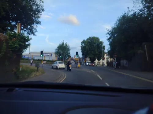
Asda Express Diner
Cafe · Coffee Shop · 0.4 mi
161 High Street, Rushden
Mo-Sa 08:30-18:00; Su 10:00-16:00
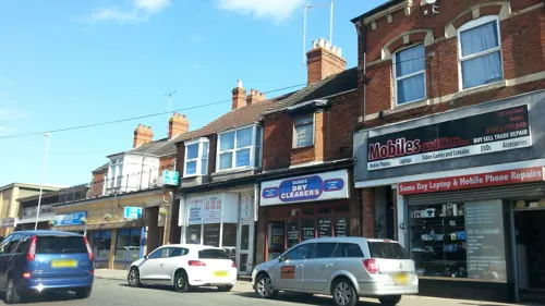


Costa
Cafe · Coffee Shop
95 High Street, Rushden
Mo-Th 06:30-18:00; Fr,Sa 06:30-18:30; Su 07:00-18:00
Rushden Cafe
Cafe
2 Church Street, Rushden
Mo-Sa 07:30-17:00; Su 08:00-16:00

106 more on the map.
History
The name Rushden derives from the Old English riscendenu meaning 'rushy valley'.
Rushden's growth has resulted from a number of industries, including lacemaking and farming, and especially shoemaking and associated trades. In the mid-1900s there were well over 100 boot and shoe factories in Rushden but today there are only four shoemaking companies left in Rushden.
The novelist and short story writer H. E. Bates, who grew up in Rushden, based many of his stories, notably "Love for Lydia", in Rushden, changing its name to Evensford. He recorded the past beauties of the surrounding countryside as he remembered it from the 1910s through to the 1940s, before much was destroyed by developments. He also gives childhood Iglimpses of vanished ways of life of many countryfolk, such as in the short stories, "The Watercress Girl", "The Mower", "The Cowslip Field", and "Great Uncle Crow". He often mentions the leather factories and bootmaking of "Evensford" (Rushden), and how the air in the town was often permeated with the smell of leather and its processing agents.
Read more of the history
One of the most renowned is Sanders and Sanders, who make boots for the British Army and several other defence departments throughout the world. Some of the redundant factories have been converted into flats, and MPs support for government help has been limited. Today, as with many towns in England, industry in the town is varied, and mostly situated in an out-of-town industrial estate. As with the industry, town centre shopping in Rushden has changed considerably although there are still many shops. Rushden has the oldest toy shop in the county. In 1893 a short branch line railway opened linking Rushden and Higham Ferrers with the Midland Main Line. The line was closed in 1959 and dismantled. In 1991 the trackbed was converted into a pocket park.
The former Rushden railway station is now owned by the Rushden Historical Transport Society, which operates a museum and real ale bar. The society often holds special events, including an annual 3-day transport cavalcade. The society aims to rebuild the branch line from Higham Ferrers to Wellingborough.
There is also a privately owned museum in Rushden which is situated in the town's Hall Park. It is open between the months of May and October.
Rushden Hall is the oldest domestic building in the town, once owned by many families throughout the years including the Sartoris family and the Pembertons family. The hall now functions as the head office of the town council and some rooms are available for hiring. It lies in 32 acres (13 ha) of land which now is a public park (Hall Park).
The 1970s ITV Police Drama series Hunters Walk was filmed on location in Rushden and the surrounding villages.
From the History section of Rushden on Wikipedia, under CC BY-SA 4.0.
More about Rushden
Education
Before the single-sex senior schools were merged, the former girls school in Rushden was named "Chichele Girls School" after Henry Chichele who was born in the neighbouring town of Higham Ferrers.
Rushden is home to one secondary school, Rushden Academy. It is part of The East Northamptonshire College together with The Ferrers Specialist Arts College (Higham Ferrers) and Huxlow Academy (Irthlingborough).
For adult education, Rushden is served by a 'Learning Centre' which is located in the town centre. The Learning Centre is operated by Bedford College, and offers Information Technology, English Language and Mathematics courses.
From the Wikipedia article Rushden, under CC BY-SA 4.0.
Notable people from Rushden
 Joseph DowlerBritish tug of war competitor (1879–1931)Photo: Unknown photographer in 1912, Public domain
 Thomas BrittonEnglish charcoal merchant, chemist and concert promoterPhoto: John Wollaston the Elder, Public domain
 Matt StevensEnglish rock musician and guitaristPhoto: Trevor Fleeting, CC BY-SA 4.0
- H. E. BatesBritish writer (1905–1974)
- Daniel WhitbyBritish theologian
- Sidney Kingcricketer (1885-1972)
- Robert KnightEnglish cricketer, born 1879
- Arthur DentonEnglish cricketer (1896-1961)
- Bernard VannEnglish recipient of the Victoria Cross (1887-1918)
- Richard Peckcricketer (born 1937)
- Fred WoodEnglish cyclist (1861-1935)
- Dennis CopperwheatGeorge Cross recipient in World War II
Born in Rushden, according to Wikidata (CC0). Each name links to its Wikipedia article.
Where to stay2
Churches and places of worship23
Shopping38
Gas and EV charging13
Schools, colleges and libraries16
Healthcare11
Map of Rushden
249 places. The map loads OpenStreetMap tiles when you open it.
Getting there and nearby towns
Sywell Aerodrome (ORM) is the nearest airport with scheduled flights listed in OpenStreetMap, 8 miles away.
- Wellingborough 4 mi west, about 6 min by car
- Northampton 12 mi west, about 20 min by car
- Bedford 12 mi southeast, about 20 min by car
- Kempston 13 mi south, about 20 min by car
- Kempston Hardwick 14 mi south, about 23 min by car
- Desborough 14 mi northwest, about 23 min by car
- Saint Neots 15 mi east, about 24 min by car
- Newport Pagnell 15 mi south, about 24 min by car
- Milton Keynes 18 mi south, about 29 min by car
- Huntingdon 18 mi east, about 29 min by car
Drive times are estimates from straight-line distance, not routes.
Towns near Rushden


Keep exploring
Local news
Headlines from INDB.
Reviews, tips and questions
Loading what members have shared...
Sources and licences
- GeoNames (CC BY 4.0): population, coordinates, regions and time zone
- Mapillary (see each image): photos
- OpenStreetMap contributors (ODbL 1.0): places, airports, map data
- Wikidata (CC0 1.0): elevation, founding date, time zone, website, landmarks and historic places
- Wikimedia Commons (see each image): photos
- Wikipedia (CC BY-SA 4.0): overview and history text
Photo credits
- Rushden Carnegie Library (6583194511), JuliaC2006 from Rochester, UK, CC BY 2.0
- Crossing the Meadows at Ditchford Lakes Nature Reserve - June 2009 - panoramio, Forester2009, CC BY-SA 3.0
- Irthlingborough Lakes and Meadows - Corner Lake in Winter, Christopher French, CC BY-SA 4.0
- Sharnbrook Summit ventilation tower, Dudley Miles, CC BY-SA 4.0
- Wilson's Pits 4, Dudley Miles, CC BY-SA 4.0
- Wymington Meadow 5, Dudley Miles, CC BY-SA 4.0
- Chichele College Outside, M15ste, CC BY-SA 3.0
- Higham Ferrers Pits 4, Dudley Miles, CC BY-SA 4.0
- Wymington, St Lawrence, Tigerboy1966, CC BY-SA 3.0
- Running line at Rushden, Higham & Wellingborough Railway, Sally Kentfield, CC BY 2.0
- Group talk outside the Stanwick Lakes Visitor Centre - June 2009 - panoramio, Forester2009, CC BY-SA 3.0
- Street-level photo, seanyboi, CC BY-SA 4.0
- Street-level photo, adam2, CC BY-SA 4.0
- Street-level photo, adam2, CC BY-SA 4.0
- Street-level photo, adam2, CC BY-SA 4.0
- Street-level photo, adam2, CC BY-SA 4.0
- Street-level photo, seanyboi, CC BY-SA 4.0
- Street-level photo, adam2, CC BY-SA 4.0
- Street-level photo, lamaar639, CC BY-SA 4.0

Page built November 10, 2026. Spotted a mistake? Tell us or suggest a place.