


Sharnbrook, United Kingdom
Sharnbrook is a town of 1,795 people in England, United Kingdom.
Why visit Sharnbrook
Townapedia lists 1 museum or landmark, 7 parks and trails, 6 places to eat, 2 places to stay and 3 attractions in and around town.
Highlights include Mill Theatre, Felmersham Gravel Pits and Harrold-Odell Country Park.
Weather in Sharnbrook
Forecast from MET Norway (CC BY 4.0). Full forecast
About Sharnbrook
Sharnbrook is a village and civil parish located in the Borough of Bedford in Bedfordshire, England, situated around 7 miles (11 km) north-west of Bedford town centre.
From the Wikipedia article Sharnbrook (this version), under CC BY-SA 4.0.
Things to do3


Museums and landmarks1

Parks, trails and playgrounds7

Felmersham Gravel Pits
Park · 0.8 mi
Nature reserve in Bedfordshire, United Kingdom
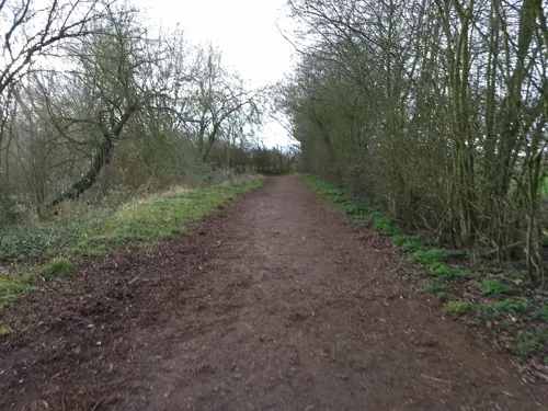

Pavenham Osier Beds
Park · 2.8 mi
Nature reserve in the United Kingdom




Restaurants and cafes6

Sharnbrook Deli Cafe
Cafe · Cake, Coffee Shop, Sandwich
63 High Street, Sharnbrook
Tu-Fr 08:00-15:00; Mo 08:00-14:30; Sa 09:00-14:00

More about Sharnbrook
Education
The village has two schools. The larger, Sharnbrook Academy, has a campus on the west of the village and serves a wide area. It was attended by the marathon world record holder Paula Radcliffe, who opened the Paula Radcliffe Sharnbrook Community Sports Centre named after her in April 2005, used by both students and the wider local community. The village's other school is Sharnbrook Primary which caters for local children aged from 3–11 years.
From the Wikipedia article Sharnbrook, under CC BY-SA 4.0.
Notable people from Sharnbrook
- Anne CobbeBritish mathematician (1920-1971)
Born in Sharnbrook, according to Wikidata (CC0). Each name links to its Wikipedia article.
Where to stay2
Churches and places of worship11
Shopping1
Gas and EV charging1
Schools, colleges and libraries3
Healthcare1
Map of Sharnbrook
36 places. The map loads OpenStreetMap tiles when you open it.
Getting there and nearby towns
Sywell Aerodrome (ORM) is the nearest airport with scheduled flights listed in OpenStreetMap, 12 miles away.
- Rushden 5 mi northwest, about 8 min by car
- Bedford 7 mi southeast, about 11 min by car
- Wellingborough 8 mi northwest, about 13 min by car
- Kempston 8 mi south, about 13 min by car
- Kempston Hardwick 10 mi south, about 15 min by car
- Saint Neots 12 mi east, about 19 min by car
- Newport Pagnell 12 mi southwest, about 20 min by car
- Sandy 13 mi southeast, about 20 min by car
- Northampton 14 mi west, about 23 min by car
- Kettering 14 mi northwest, about 23 min by car
Drive times are estimates from straight-line distance, not routes.
Towns near Sharnbrook


Keep exploring
Local news
Headlines from INDB.
Reviews, tips and questions
Loading what members have shared...
Sources and licences
- GeoNames (CC BY 4.0): population, coordinates, regions and time zone
- Mapillary (see each image): photos
- OpenStreetMap contributors (ODbL 1.0): places, airports, map data
- Wikidata (CC0 1.0): elevation, founding date, time zone, website, landmarks and historic places
- Wikimedia Commons (see each image): photos
- Wikipedia (CC BY-SA 4.0): overview and history text
Photo credits
- Sharnbrook LWB172 1, kitmasterbloke, CC BY 2.0
- Sharnbrook St Peter fr east GeoUK 3263680, John Salmon, CC BY-SA 2.0
- Sharnbrook St Peter fr S GeoUK 7583119, Jonathan Thacker, CC BY-SA 2.0
- Sharnbrook St Peter nave fr S Geo UK4552211, Bikeboy, CC BY-SA 2.0
- Felmersham Gravel Pits 2, Dudley Miles, CC BY-SA 4.0
- Pavenham Osier Beds 2, Dudley Miles, CC BY-SA 4.0
- Sharnbrook Summit ventilation tower, Dudley Miles, CC BY-SA 4.0
- Wymington Meadow 5, Dudley Miles, CC BY-SA 4.0
- AllSaints-Odell, Unknown author, Public domain
- St Margaret of Antioch, Knotting, Arcusiridis, CC BY-SA 3.0
- StPeter'sChurch-Pavenham, Unknown author, Public domain
- St-Peter's-Church-Sharnbrook, Unknown author, Public domain
- StMary'sChurch-Felmersham, Benjah-bmm27, Public domain
- Sharnbrook Mill, Eopsid, CC BY-SA 4.0
- All Saints, Souldrop - Interior, Alex.brad, CC BY-SA 4.0
- Street-level photo, tallguy, CC BY-SA 4.0
- Street-level photo, photomaps, CC BY-SA 4.0


Page built November 10, 2026. Spotted a mistake? Tell us or suggest a place.