


Hartlepool, United Kingdom
Hartlepool is a town of 88,855 people in England, United Kingdom.
Why visit Hartlepool
Townapedia lists 19 museums and landmarks, 19 parks and trails, 169 places to eat, 6 places to stay and 8 attractions in and around town.
Highlights include Town Hall Theatre, Heugh Lighthouse, Hartlepool Art Gallery and Tourist Information Centre and Museum of Hartlepool.
Weather in Hartlepool
Forecast from MET Norway (CC BY 4.0). Full forecast
About Hartlepool
Hartlepool is an industrial port town, in County Durham, England. It is governed by a unitary authority borough named after the town. The borough is part of the devolved Tees Valley area, approximately 25 miles (40 km) south-west of Newcastle upon Tyne, 17 miles (27 km) south of Sunderland and 8 miles (13 km) north of Middlesbrough. The built-up area had a population of 87,984 at the 2021 Census.
From the Wikipedia article Hartlepool (this version), under CC BY-SA 4.0.
Travel tips from other travellers: Hartlepool on Wikivoyage (CC BY-SA 4.0).
Photos of Hartlepool


Things to do8

Town Hall Theatre
Cinema and theater
Theatre in Hartlepool, County Durham, England, UK
Raby Road, Hartlepool

Heugh Lighthouse
Lighthouse · 1.6 mi
Lighthouse in County Durham, England


Borough Buildings and Borough Hall
Cinema and theater · 1.3 mi
Municipal buildings and former market hall, later cinema, now theatre, in Headland, Hartlepool, County Durham, England, UK

Museums and landmarks19
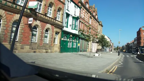
Hartlepool Art Gallery and Tourist Information Centre
Museum
Church Square, Hartlepool
Tu-Sa 10:00-16:00; Su,Mo closed; PH closed
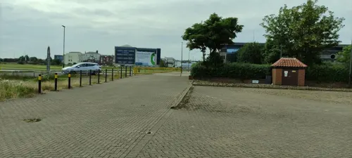
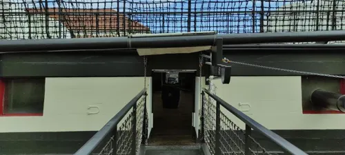
National Museum of the Royal Navy, Hartlepool
Monument and historic site · 0.4 mi
Maritime Avenue, Hartlepool


Seaton Carew Wreck
Monument and historic site · 2.2 mi
Protected wrecksite
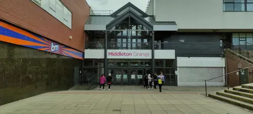
West Hartlepool War Memorial
Monument and historic site
War memorial in Hartlepool, County Durham, England, UK



Redheugh Gardens War Memorial
Monument and historic site · 1.5 mi
War memorial in Headland, Hartlepool, County Durham, England, UK

Hartlepool Art Gallery
Museum
Art gallery in Hartlepool, England, United Kingdom
Heugh Battery Museum
Museum · 1.6 mi
Artillery battery and museum in Headland, Hartlepool, County Durham, England, United Kingdom
Hartlepool War Memorial
Monument and historic site
Stockton Street, Hartlepool
7 more on the map.
Parks, trails and playgrounds19


Ward Jackson Park
Park · 1.2 mi
Municipal park in Hartlepool, County Durham, England, UK
Nov-Jan sunrise-16:30; Feb sunrise-17:00; Mar sunrise-19:00; Apr...
Burn Valley
Park · 0.7 mi
Nov,Jan 07:00-16:30; Feb 07:00-17:00; Mar 07:00-19:00; Apr...



7 more on the map.
Restaurants and cafes169
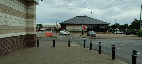
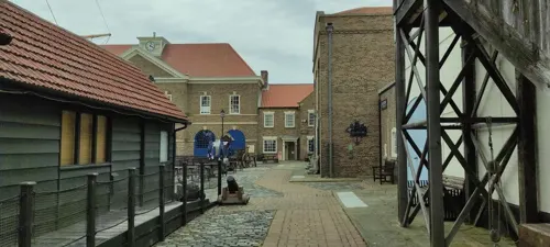
The Railway Cafe
Cafe · Regional
Station Approach, Hartlepool
Mo-Fr 07:15-13:45; Sa 07:15-12:45
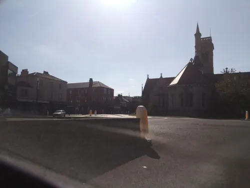

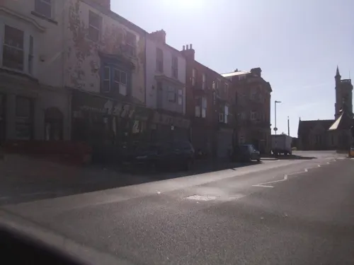
Mary Rowntrees Tea Rooms
Cafe · Regional · 1.3 mi
York Place, Hartlepool
Mo 10:00-17:00, We-Fr 10:00-17:00, Sa 09:00-17:00, Su 12:00-17:00


Central Cafe
Cafe · 1.2 mi
Tu-Sa 08:00-14:00; Su 09:00-14:00; PH closed
157 more on the map.
History
The place name derives from Old English heort ("hart"), referring to stags seen, and pōl (pool), a pool of drinking water which they were known to use. Records of the place-name from early sources confirm this:
A Northumbrian settlement developed in the seventh century around an abbey, which was founded in 640 by Saint Aidan, an Irish Christian priest, upon a headland overlooking a natural harbour and the North Sea. The monastery became powerful under St Hilda, who served as its abbess from 649 to 657. The eighth-century Northumbrian chronicler Bede referred to the spot on which today's town is sited as "the place where deer come to drink"; in this period the Headland was named by the Angles as Heruteu (Stag Island). Archaeological evidence has been found below the current high tide mark that indicates that an ancient post-glacial forest by the sea existed in the area at the time.
The Abbey fell into decline in the early 8th century and it was probably destroyed during a sea raid by Vikings on the settlement in the 9th century. In March 2000, the archaeological investigation television programme Time Team located the foundations of the lost monastery in the grounds of St Hilda's Church. In the early 11th century, the name had evolved into Herterpol.
Read more of the history
During the Norman Conquest, the De Brus family gained over-lordship of the land surrounding Hartlepool. William the Conqueror subsequently ordered the construction of Durham Castle and the villages under their rule were mentioned in records, in 1153, when Robert de Brus, 1st Lord of Annandale became Lord of Hartness. The town's first charter was received before 1185, for which it gained its first mayor, an annual two-week fair and a weekly market. The Norman Conquest affected the settlement's name to form the Middle English Hart-le-pool ("The Pool of the Stags").
By the Middle Ages, Hartlepool grew into an important market town. One of the reasons for its growing wealth was that its harbour was the official port of the County Palatine of Durham. With fishing as the main industry, Hartlepool became one of the primary ports on England's Eastern coast.
In 1306, Robert the Bruce was crowned King of Scotland and became the last Lord of Hartness. King Edward I confiscated the title to Hartlepool and began to improve the town's military defences in expectation of war. In 1315, before they were completed, a Scottish army under Sir James Douglas attacked, captured and looted the town.
In the late 15th century, a pier was constructed to assist in the harbour's workload.
Hartlepool was once again militarily occupied by a Scottish incursion, this time in alliance with the Parliamentary Army during the English Civil War which, after 18 months, was relieved by an English Parliamentarian garrison.
In 1795, Hartlepool artillery emplacements and defences were constructed in the town as a defensive measure against the threat of French attack from seaborne Napoleonic forces. During the Crimean War, two coastal batteries were constructed close together in the town to guard against the threat of seaborne attacks from the Imperial Russian Navy. They were entitled the Lighthouse Battery (1855) and the Heugh Battery (1859).
Hartlepool, in the 18th century, became known as a town with medicinal springs, particularly the Chalybeate Spa near the Westgate. The poet Thomas Gray visited the town in July 1765 to "take the waters", and wrote to his friend William Mason:
"I have been for two days to taste the water, and do assure you that nothing could be salter and bitterer and nastier and better for you... I am delighted with the place; there are the finest walks and rocks and caverns."
A few weeks later, he wrote in greater detail to James Brown:
The rocks, the sea and the weather there more than made up to me the want of bread and the want of water, two capital defects, but of which I learned from the inhabitants not to be sensible. They live on the refuse of their own fish-market, with a few potatoes, and a reasonable quantity of Geneva [gin] six days in the week, and I have nowhere seen a taller, more robust or healthy race: every house full of ruddy broad-faced children. Nobody dies but of drowning or old-age: nobody poor but from drunkenness or mere laziness.
By the early 19th century, Hartlepool was still a small town of around 900 people, with a declining port. In 1823, the council and Board of Trade decided that the town needed new industry, so the decision was made to propose a new railway to make Hartlepool a coal port, shipping out minerals from the Durham coalfield. It was in this endeavour that Isambard Kingdom Brunel visited the town in December 1831 and wrote: "A curiously isolated old fishing town – a remarkably fine race of men. Went to the top of the church tower for a view."
The plan faced local competition from new docks; 16 mi (25 km) to the north, the Marquis of Londonderry had approved the creation of the new Seaham Harbour (opened 31 July 1831), while to the south the Clarence Railway connected Stockton-on-Tees and Billingham to a new port at Port Clarence (opened 1833). Further south, in 1831, the Stockton and Darlington Railway had extended into the new port of Middlesbrough.
The council agreed the formation of the Hartlepool Dock and Railway Company (HD&RCo) to extend the existing port by developing new docks, and link to both local collieries and the developing railway network in the south. In 1833, it was agreed that Christopher Tennant of Yarm establish the HD&RCo, having previously opened the Clarence Railway (CR). Tennant's plan was that the HD&RCo would fund the creation of a new railway, the Stockton and Hartlepool Railway, which would take over the loss-making CR and extended it north to the new dock, thereby linking to the Durham coalfield.
From the History section of Hartlepool on Wikipedia, under CC BY-SA 4.0.
More about Hartlepool
Geography
Nearby towns include: Seaham (17 mi or 27 km), Sedgefield (13 mi or 21 km), Billingham (8 mi or 13 km) and Peterlee (8 mi or 13 km). Beyond the far side of the Tees Bay, on the other side of the river Tees, the distant monument on Eston Nab can be seen on clear days.
Hartlepool has an oceanic climate typical of Great Britain. The Köppen Climate Classification subtype for this climate is "Cfb"(Marine West Coast Climate).
Economy
Hartlepool's economy has historically been linked with the maritime industry, something which is still at the heart of local business. Hartlepool Dock is owned and run by PD Ports. Engineering related jobs employ around 1700 people. Tata Steel Europe employ around 350 people in the manufacture of steel tubes, predominantly for the oil industry. South of the town on the banks of the Tees, Able UK operates the Teesside Environmental Reclamation and Recycling Centre (TERRC), a large scale marine recycling facility and dry dock. Adjacent to the east of TERRC is the Hartlepool nuclear power station, an advanced gas-cooled reactor (AGR) type nuclear power plant opened in the 1980s. It is the single largest employer in the town, employing 1% of the town's working age people.
The chemicals industry is important to the local economy. Companies include Huntsman Corporation, who produce titanium dioxide for use in paints, Omya and Frutarom.
Tourism was worth £48 million to the town in 2009; this figure excludes the impact of the Tall Ships 2010. Hartlepool's historic links to the maritime industry are centred on the Maritime Experience, and the supporting exhibits PS Wingfield Castle and HMS Trincomalee.
Arts and culture
Since November 2014, the Headland has hosted the annual Wintertide Festival, which is a weekend long event that starts with a community parade on the Friday and culminating in a finale performance and fireworks display on the Sunday.
On 28 June 2006, Hartlepool celebrated after winning its bid to host The Tall Ships' Races. The town welcomed up to 125 tall ships in 2010, after being chosen by race organiser Sail Training International to be the finishing point for the race. Hartlepool greeted the ships, which sailed from Kristiansand in Norway on the second and final leg of the race.
Hartlepool also hosted the race in July 2023. It was the first stop after starting at Den Helder (Netherlands).
Hartlepool is home to a National Museum of the Royal Navy, known as NMRN Hartlepool. Previously known simply as The Historic Quay and Hartlepool's Maritime Experience, the museum is a re-creation of an 18th-century seaport with the exhibition centre-piece being a sailing frigate, HMS Trincomalee. The complex also includes the Museum of Hartlepool.
Education
The town had planned to receive funding from central government to improve school buildings and facilities as a part of the Building Schools for the Future programme, but this was cancelled because of government spending cuts.
Hartlepool College of Further Education is an educational establishment located in the centre of the town, which has existed in various forms for over a century. Its former 1960s campus was replaced by a £52million custom-designed building, which opened in September 2011.
The town also has Hartlepool Sixth Form College. A former grammar and comprehensive school, the college provides a number of AS and A2 Level student courses. The English Martyrs School and Sixth Form College also offers AS, A2 and other BTEC qualification to 16- to 18-year-olds from Hartlepool and beyond.
A campus of The Northern School of Art is a specialist art and design college and higher education, located adjacent to the art gallery on Church Square. The college also has a further education site in Middlesbrough.
From the Wikipedia article Hartlepool, under CC BY-SA 4.0.
Notable people from Hartlepool
 Janick GersEnglish guitarist (born 1957)Photo: Birgit Fostervold, CC BY-SA 4.0
 David MurphyBritish footballer (born 1984)Photo: Will Viles / Will bcfc at en.wikipedia, CC BY-SA 3.0
 Jeremy SpencerBritish musicianPhoto: Raph_PH, CC BY 2.0
 Savannah MarshallBritish boxer (born 1991)Photo: Biser Todorov, CC BY 4.0
 Brian LondonEnglish boxer (1934–2021)Photo: PA, Public domain
 Reg SmytheBritish cartoonist (1917-1998)Photo: Holmcroft at English Wikipedia, Public domain
- Michael RiceBritish singer
- Michael BrownEnglish footballer, born 1977
- Andrew TaylorEnglish association football player (born 1986)
- Andy LinighanEnglish footballer (born 1962)
- Kieran BewBritish actor
- Lindsay JohnsonEnglish footballer (born 1980)
Born in Hartlepool, according to Wikidata (CC0). Each name links to its Wikipedia article.
Where to stay6
The Best Western Grand Hotel, Hartlepool
Motel and hotel
Swainson Street, Hartlepool
Churches and places of worship20
St Mary's Church
Church · Roman Catholic · 1.3 mi
146 Durham Street, Hartlepool
Nasir Mosque
Place of worship · Ahmadiyya · 0.6 mi
42 Brougham Terrace, Hartlepool
Shopping28
Bianco's Deli
Shop · Waffle, Wine, Beer, Nachos, Sandwich, Salad, Pizza · 0.6 mi
7 Navigation Point, Hartlepool
Gas and EV charging4
Schools, colleges and libraries28
English Martyrs Catholic School and Sixth Form College
School · Roman Catholic · 1.3 mi
Catcote Road, Hartlepool
Healthcare12
Map of Hartlepool
250 places. The map loads OpenStreetMap tiles when you open it.
Getting there and nearby towns
Teesside International Airport (MME) is the nearest airport with scheduled flights listed in OpenStreetMap, 15 miles away.
- Peterlee 7 mi northwest, about 12 min by car
- Middlesbrough 8 mi south, about 12 min by car
- Redcar 8 mi southeast, about 12 min by car
- Stockton-on-Tees 9 mi southwest, about 15 min by car
- Thornaby-on-Tees 11 mi south, about 18 min by car
- Seaham 12 mi northwest, about 19 min by car
- Guisborough 12 mi southeast, about 19 min by car
- Hetton-Le-Hole 13 mi northwest, about 21 min by car
- Yarm 14 mi southwest, about 22 min by car
- Houghton-Le-Spring 15 mi northwest, about 24 min by car
Drive times are estimates from straight-line distance, not routes.
Towns near Hartlepool


Keep exploring
Local news
Headlines from INDB.
Reviews, tips and questions
Loading what members have shared...
Sources and licences
- GeoNames (CC BY 4.0): population, coordinates, regions and time zone
- Mapillary (see each image): photos
- OpenStreetMap contributors (ODbL 1.0): places, airports, map data
- Wikidata (CC0 1.0): elevation, founding date, time zone, website, landmarks and historic places
- Wikimedia Commons (see each image): photos
- Wikipedia (CC BY-SA 4.0): overview and history text
Photo credits
- TownWallHartlepool(MickGarratt)Nov2007, Mick Garratt, CC BY-SA 2.0
- Hartlepool (33124520190), Alex Liivet from Chester, United Kingdom, CC0
- Hartlepool (33467019376), Alex Liivet from Chester, United Kingdom, CC0
- Hartlepool (32693664303), Alex Liivet from Chester, United Kingdom, CC0
- Church Square, West Hartlepool (5814811021), Museum of Hartlepool, No restrictions
- Hartlepool (32693654063), Alex Liivet from Chester, United Kingdom, CC0
- Church Square, West Hartlepool (5815378998), Museum of Hartlepool, No restrictions
- Hartlepool Town Hall, Reading Tom, CC BY 2.0
- St Joseph's Church, Hartlepool, Simon, CC BY-SA 2.0 uk
- HMS Trincomalee, David Manley at English Wikipedia, CC BY-SA 3.0
- Nasir Mosque – ground view, HolyArtThou, CC0
- HartlepoolFriarage, JohnArmagh, CC BY-SA 4.0
- Seaton carew interpretation board, Viv Hamilton, CC BY-SA 3.0
- PSWingfieldCastle, Xtrememachineuk at English Wikipedia, Public domain
- HartlepoolStHildasChurch, JohnArmagh, CC BY-SA 4.0
- Statue of Ralph Ward Jackson, Reading Tom, CC BY 2.0
- Heugh Lighthouse (48586445222), Reading Tom from Reading, UK, CC BY 2.0
- Pilot Pier and Lighthouse (48586442602), Reading Tom from Reading, UK, CC BY 2.0
- Street-level photo, southglos, CC BY-SA 4.0
- Street-level photo, southglos, CC BY-SA 4.0
- Street-level photo, southglos, CC BY-SA 4.0
- Street-level photo, rudolfmayer, CC BY-SA 4.0
- Street-level photo, jethro10, CC BY-SA 4.0
- Street-level photo, jethro10, CC BY-SA 4.0
- Street-level photo, jethro10, CC BY-SA 4.0
- Street-level photo, jethro10, CC BY-SA 4.0
- Street-level photo, rudolfmayer, CC BY-SA 4.0
- Street-level photo, jethro10, CC BY-SA 4.0
- Street-level photo, southglos, CC BY-SA 4.0
- Street-level photo, jethro10, CC BY-SA 4.0
- Street-level photo, southglos, CC BY-SA 4.0
- Street-level photo, southglos, CC BY-SA 4.0
- Street-level photo, jethro10, CC BY-SA 4.0
- Street-level photo, southglos, CC BY-SA 4.0


Page built November 10, 2026. Spotted a mistake? Tell us or suggest a place.