


Haverfordwest, United Kingdom
Haverfordwest is a town of 14,596 people in Wales, United Kingdom.
Why visit Haverfordwest
Townapedia lists 9 museums and landmarks, 4 parks and trails, 27 places to eat, 5 places to stay and 1 attraction in and around town.
Highlights include Palace Cinema, Haverfordwest Priory, County of Pembroke War Memorial and Bridge Meadow Stadium.
Weather in Haverfordwest
Forecast from MET Norway (CC BY 4.0). Full forecast
About Haverfordwest
Haverfordwest ( HAV-ər-fərd-WEST, locally HAR-fərd-west; Welsh: Hwlffordd [ˈhʊlfɔrð]) is the county town of Pembrokeshire, Wales, and the most populous urban area in Pembrokeshire with a population of 14,596 in 2011. It is also a community consisting of 12,042 people, making it the second most populous community in the county after Milford Haven. The suburbs include the former parish of Prendergast, Albert Town and the residential and industrial areas of Withybush (housing, retail parks, hospital, airport and showground).
From the Wikipedia article Haverfordwest (this version), under CC BY-SA 4.0.
Travel tips from other travellers: Haverfordwest on Wikivoyage (CC BY-SA 4.0).
Things to do1

Museums and landmarks9
County of Pembroke War Memorial
Monument and historic site
Grade II listed building in Pembrokeshire. Situated facing square, backing onto side wall of former Masonic Hall, Picton Place.


Haverfordwest Town Museum
Museum
Local history museum in Haverfordwest, Wales, United Kingdom

Gorsedd stones
Monument and historic site
In 1972 people from all over the world flocked to Haverfordwest to take part in the Royal National Eisteddfod of Wales. The Gorsedd...
Parks, trails and playgrounds4



Restaurants and cafes27
Costa Drive Thru
Cafe · Coffee Shop · 0.7 mi
Fishguard Road, Haverfordwest
Mo 07:00-20:00; Tu 07:00-20:00; We 07:00-20:00; Th 07:00-20:00; Fr...


Coffee#1
Cafe · Coffee Shop
47 Old Bridge, Haverfordwest
Mo-Fr 08:00-17:00; Sa 08:00-18:00; Su 09:00-17:00
Costa
Cafe · Coffee Shop · 0.8 mi
Fishguard Road, Haverfordwest
Mo,Tu 10:00-14:00; We,Th 08:00-17:00; Fr 08:00-15:00; Sa,Su 00:00-24:00
15 more on the map.
History
Haverfordwest has been English-speaking for centuries. South Pembrokeshire is known as 'Little England Beyond Wales', but because the markets traded with Welsh farmers in the north and east, there has always been a significant Welsh-speaking influence. The suburb of Prendergast seems to have originated as an extramural Welsh dormitory, dating from the times when all agricultural trade had to pass through the borough, and the fearful Normans before the destruction of Anglo-Norman power in 1136 tried to prevent Welshmen bearing arms from entering within the castle walls after nightfall.
Read more of the history
Scores of Iron Age and Roman coinage and artefact discoveries, and excavations by the Dyfed Archaeological Trust under the direction of Heather James at Carmarthen (Moridunum) in the 1980s, point to significant Roman penetration to this westernmost part of Wales. The strategic position of Haverfordwest with its defensive bluff overlooking the lowest fordable point on the western Cleddau and accessible to sea traffic would have required a Roman presence, probably modest in scale, from the 1st century AD to protect supplies to and from the coast, e.g. the Roman legionary headquarters at Caerleon were roofed with slates from the lower slopes of the Preseli Hills. In 1992, aerial photography identified a Roman road running to the west of Carmarthen, past Wiston to Poyston Cross, raising the possibility of Roman fortlets at strategic river crossings at Whitland and Haverfordwest. Edward Llwyd's note to Camden's Britannia (ed. 1695) refers to a valuable find of silver coins at Llanboidy, the latest coin being one of Domitian struck in AD 91. In the 1920s Sir Mortimer Wheeler partially excavated a Roman dwelling or villa at Wolfscastle; work was restarted in 2002 by Professor Merroney. James Phillips, in The History of Pembrokeshire (published 1909), records a find of Roman silver coins in Haverfordwest, the earliest dated coin a Valerian and the latest a Claudius Gothicus. The museum in which the coins were deposited has been "scattered to the winds" and the whereabouts of the coins is unknown.
Phillips claimed that the pre-Norman name of Haverfordwest was Caer Alun, so named by the Emperor Maximus (Macsim Gwledig). His sources are not given but the Cambro-Briton in 1822 also recorded that Maximus, the last Roman Emperor of Britain, a man who for a time divided the Roman Empire with Theodosius I, on withdrawing Roman legions from Britain granted civic status and Celtic names to a number of pacified Romano-British settlements, including Southampton, Chichester, Old Sarum near Salisbury, Carmarthen (Caerfyrddin) and Haverfordwest (Caer Alun). Maximus had married Elen, a Welsh noblewoman, and they had three sons. Phillips claims that the name actually given to the town was Caer Elen, in honour of his wife (the name later changing to Caer Alun).
The ecclesiastical centre of the area (perhaps the seat of a bishop in the Age of the Saints) was probably one of the several churches of the local St Ismael, most probably St. Ishmael's. This occurred around 1110.
The proposition that Haverfordwest Castle was founded by Tancred, a Flemish Marcher Lord, is questionable. The castle is recorded as having been founded in 1100 by the Norman Gilbert de Clare. The Flemings, said to have arrived in three groups in 1107, 1111 and 1151, are likely to have participated in its later development for their own and the Normans' protection from the Welsh warlords. It is recorded that the Constable of the castle in 1207 was Itohert, son of Richard Tancard, possibly a descendant of the first Tancred.
The Flemish presence, reputed to result from floods in the Low Countries, was more likely to have consisted initially of Flemish mercenaries originally in the invading army of William the Conqueror, who in reward for their part in William's victory were granted lands in parts of Northern Britain, and in Wales in the Gower, and Geraldus Cambrensis recorded their presence in the Hundred of Roose in Pembrokeshire.
A Fleming, Wizo, who died in 1130 founded at Wiston a motte and bailey fortification, the forerunner of the stone castle, for protection against the Welsh warlords: the Flemings were reportedly unpopular wherever they settled. The precarious position of Normans and Flemings was demonstrated in 1136 when the Normans, having already lost 500 men in battle at Loughor, re-recruited from Lordships from all over South Wales and led by Robert fitz Martin at Crug Mawr near Cardigan attacked Owain Gwynedd and his army. Routed, they fled over the Teifi Bridge which collapsed; the retreating Normans drowning under the weight of their armour. Their leader Richard de Clare had previously been intercepted and killed by Iorwerth ab Owen. Wiston and the castle were overrun in 1147 by Hywel Sais, son of Lord Rhys. Ranulf Higden, in his Polychronicus, records the Flemings as extinct in Pembrokeshire by 1327 but Flemish mercenaries reappear in 1400 when at the behest of Henry IV they joined an army of 1,500 English settlers who marched north from Pembrokeshire to attack the army of Owain Glyndŵr at Mynydd Hyddgen. The attack was repulsed with heavy casualties and legend has it that English prisoners were spared but surviving Flemish mercenaries were massacred or sold into slavery.
St Mary's Church originated at the end of the 12th century and the current (Grade I listed) building was constructed between the 13th and 15th centuries and prominently visible at the top of the High Street.
From the History section of Haverfordwest on Wikipedia, under CC BY-SA 4.0.
More about Haverfordwest
Economy
In accordance with its status as a sub-regional hub-town, Haverfordwest continues to serve as Pembrokeshire's principal commercial and retail centre. The development of the riverside shopping centre in Withybush on the outskirts of the town includes Marks & Spencer in 2010 and Debenhams in 2013.
A new town library opened in 2018 in the former Riverside Market building.
A new transport interchange & multi-storey car park opened in September 2026 at the site of a former multi-storey car park on Cartlett Rd.
Education
Haverfordwest Grammar School, 1488–1978, became a public school in the 1920s, making it one of only two public schools in Wales at that time. At one time a boarding school, it became a day-only school in the early 1960s.
Haverfordwest High VC School, an English-medium secondary school, was formed in 2018 by the merger of Sir Thomas Picton School and Tasker Milward School.
Pembrokeshire College, an affiliated college of the University of Glamorgan, is situated in the Merlin's Bridge suburb of the town. The college serves as the principal centre of further and higher education in Pembrokeshire.
Ysgol Caer Elen, a Welsh-medium school for pupils aged 3 to 16, opened in 2018, replacing Ysgol Gymraeg Glan Cleddau. The new school cost £28 million to build and has capacity for 315 primary and 600 secondary pupils. The nursery has capacity for 45 children.
Redhill Preparatory School is an independent school established in 2001, which includes a Montessori learning component for younger pupils.
Waldo Williams Primary School opened in 2019, combining the former Mt Airey and Haverfordwest Church in Wales VC schools. It is named after the poet Waldo Williams (1904–1971).
From the Wikipedia article Haverfordwest, under CC BY-SA 4.0.
Notable people from Haverfordwest
 Christian BaleAmerican-English actor (born 1974)Photo: Harald Krichel, CC BY-SA 4.0
 Rhys IfansWelsh actorPhoto: Senedd Cymru / Welsh Parliament from Wales, CC BY 2.0
 Gwen JohnWelsh painter (1876-1939)Photo: Gwen John, Public domain
 Sir Thomas PictonWelsh general who served in the British Army (1758-1815)Photo: William Beechey, Public domain
 Mark DelaneyWelsh footballer (born 1976)Photo: Jonesy702, CC BY-SA 4.0
 Gruff RhysWelsh musician and filmmakerPhoto: Jim Ellis/Ochr 1/Antena, CC BY-SA 4.0
 Angharad JamesWelsh footballer (born 1994)Photo: Hameltion, CC BY-SA 4.0
 John Lort StokesWelsh officer of the British Royal Navy, sailed with Charles Darwin (1811-1885)Photo: Stephen Pearce, Public domain
 Waldo WilliamsWelsh poet (1904–1971)Photo: Hogyncymru, CC BY-SA 4.0
 Jodie GrinhamBritish Paralympic archerPhoto: Photographer for the National..., CC BY 2.0
- Simon DaviesWelsh former association football player (born 1979)
- James MillerWelsh cinematographer, producer, and director (1968–2003)
Born in Haverfordwest, according to Wikidata (CC0). Each name links to its Wikipedia article.
Where to stay5
Churches and places of worship11
Shopping15
Gas and EV charging3
Schools, colleges and libraries14
Mary Immaculate V.R.C. School
School · Roman Catholic · 0.6 mi
Merlins Terrace, Haverfordwest
Haverfordwest High VC School (Prendergast Campus)
School · 0.4 mi
Queensway
Healthcare3
Map of Haverfordwest
92 places. The map loads OpenStreetMap tiles when you open it.
Getting there and nearby towns
Haverfordwest Airport (HAW) is the nearest airport with scheduled flights listed in OpenStreetMap, 2 miles away.
- Crundale 2 mi northeast, about 3 min by car
- Hook 3 mi southeast, about 5 min by car
- Johnston 3 mi south, about 5 min by car
- Llangwm 4 mi southeast, about 7 min by car
- Milford Haven 7 mi southwest, about 11 min by car
- Llanelli 36 mi east, about 57 min by car
- Swansea 46 mi east, about 1 h 15 min by car
- Neath 51 mi east, about 1 h 15 min by car
- Ystalyfera 51 mi east, about 1 h 15 min by car
- Ilfracombe 55 mi southeast, about 1 h 30 min by car
Drive times are estimates from straight-line distance, not routes.
Towns near Haverfordwest


Keep exploring
Local news
Headlines from INDB.
Reviews, tips and questions
Loading what members have shared...
Sources and licences
- GeoNames (CC BY 4.0): population, coordinates, regions and time zone
- Mapillary (see each image): photos
- OpenStreetMap contributors (ODbL 1.0): places, airports, map data
- Wikidata (CC0 1.0): elevation, founding date, time zone, website, landmarks and historic places
- Wikimedia Commons (see each image): photos
- Wikipedia (CC BY-SA 4.0): overview and history text
Photo credits
- HaverfordwestSalutation Square, Deborah Tilley, CC BY-SA 2.0
- Eglwys y Santes Fair - St Marys Church 02, Wici Rhuthun 1, CC BY-SA 3.0
- Chapel Haverfordwest, Russ Hamer, CC BY-SA 3.0
- Haverfordwest Castle curtain wall, Ceridwen, CC BY-SA 2.0
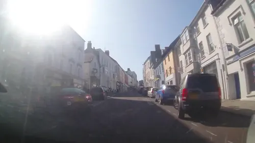
- Street-level photo, brianh, CC BY-SA 4.0
- Street-level photo, trigpoint, CC BY-SA 4.0
- Street-level photo, richardc, CC BY-SA 4.0
- Street-level photo, trigpoint, CC BY-SA 4.0
- Street-level photo, trigpoint, CC BY-SA 4.0
- Street-level photo, trigpoint, CC BY-SA 4.0
- Street-level photo, trigpoint, CC BY-SA 4.0
- Street-level photo, richardc, CC BY-SA 4.0
- Street-level photo, trigpoint, CC BY-SA 4.0
- Street-level photo, trigpoint, CC BY-SA 4.0
- Street-level photo, trigpoint, CC BY-SA 4.0
- Street-level photo, trigpoint, CC BY-SA 4.0
- Street-level photo, trigpoint, CC BY-SA 4.0
- Street-level photo, trigpoint, CC BY-SA 4.0
- Street-level photo, brianh, CC BY-SA 4.0
- Street-level photo, brianh, CC BY-SA 4.0
- Street-level photo, richardc, CC BY-SA 4.0
- Street-level photo, richardc, CC BY-SA 4.0
- Street-level photo, trigpoint, CC BY-SA 4.0
- Street-level photo, brianh, CC BY-SA 4.0
- Street-level photo, brianh, CC BY-SA 4.0
- Street-level photo, richardc, CC BY-SA 4.0
Page built November 10, 2026. Spotted a mistake? Tell us or suggest a place.