


Why visit Llanelli
Townapedia lists 14 museums and landmarks, 16 parks and trails, 117 places to eat, 7 places to stay and 2 attractions in and around town.
Highlights include Y Ffwrnes, Llanelly House, Parc Howard Museum and Millennium Coastal Park.
Weather in Llanelli
Forecast from MET Norway (CC BY 4.0). Full forecast
About Llanelli
Llanelli (Welsh for 'St Elli's Parish'; Welsh: [ɬaˈnɛɬi] ) is a market town and community in Carmarthenshire and the preserved county of Dyfed, Wales. It is on the estuary of the River Loughor and is the largest town in the county of Carmarthenshire.
From the Wikipedia article Llanelli (this version), under CC BY-SA 4.0.
Travel tips from other travellers: Llanelli on Wikivoyage (CC BY-SA 4.0).
Photos of Llanelli


Things to do2

Museums and landmarks14


Parc Howard Museum
Museum · 0.5 mi
Museum in Carmarthenshire, Wales, United Kingdom
Felinfoel Road, Llanelli
Th-Su 10:30-15:30

Park Street Congregational Church
Monument and historic site · United Reformed
2 more on the map.
Parks, trails and playgrounds16


WWT Llanelli Wetland Centre
Park · 2.0 mi
Nature reserve in South Wales


Stebonheath Park
Sports field and stadium · 0.6 mi
Evans' Terrace, Llanelli



4 more on the map.
Restaurants and cafes117
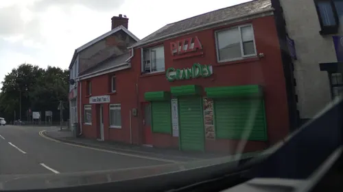
The New Drovers
Bar and pub · British
32-34 Thomas Street, Llanelli
Mo Off; Tu Off; We Off; Th 17:00-23:00; Fr 16:00-24:00; Sa...
Caffi Melyn
Cafe · 1.2 mi
Snacks beverages eat in or take away, toilet. parking, you can see your bike from café.
unit 3 SA15 2DS Foothold Enterprise Village Llanelli
Mo-Fr 09:00-15:30


The Half Moon
Bar and pub
71 Wern Road, Llanelli
Mo-Su 11:00-23:00

Caffi Cwtsh
Cafe
Park Street, Llanelli
Mo-We 09:00-17:00; Th 09:00-20:00; Fr 09:00-17:00; Sa 11:00-18:00; Su off

Jenkins Bakery
Bakery · 0.7 mi
11-13 New Dock Road, Llanelli
Mo-Fr 08:00-16:00; Sa 08:00-13:30; Su Off
Stradey Arms
Bar and pub · 0.6 mi
1 Stradey Road, Llanelli
Mo 12:00-21:00; Tu 12:00-22:00; We-Th 12:00-23:00; Fr-Sa...
The York Palace
Bar and pub
51 Stepney Street, Llanelli
Mo-Th 08:00-24:00; Fr-Sa 08:00-25:00; Su 08:00-24:00
105 more on the map.
History
The beginnings of Llanelli can be found on the lands of present-day Parc Howard. An Iron Age hill fort once stood which was called Bryn-Caerau (hill of the forts). Evidence suggests there were five hill forts from Old Road to the Dimpath. During the Roman conquest of Wales, it is unknown whether the area of Llanelli was part of the Silures tribe or the Demetae tribe. There is evidence of a Roman camp near St Elli shopping centre.
According to the Red Book of Hergest during the Norman invasion of Wales, Rhys Ieuanc and his uncle Maelgwn ap Rhys took the allegiance of all the Welsh of the Kingdom of Dyfed apart from one region. Cemais would not pay allegiance and thus Rhys Ieuanc and his uncle, Maelgwn ap Rhys, attacked and pillaged the area moving on to attack the castles at Narberth and Maenclochog. At this time, Rhys Ieuanc moved against Cedweli and Carnwyllion with his forces besieging and burning Carnwyllion Castle in 1215.
From the History section of Llanelli on Wikipedia, under CC BY-SA 4.0.
More about Llanelli
Economy
In 1991, Llanelli was a distinct travel to work area, but a 2001-based revision has merged it into a wider one of Swansea Bay.
Several firms, including Tata Steel Europe tinplate at Trostre and Dyfed Steels, are based in the Llanelli area and service the automotive industry. The Technium Performance Engineering Centre was developed at Llanelli Gate as a business incubator for businesses in the automotive, motor sport and aerospace sectors.
The traditional industries of Llanelli have gradually declined in recent decades. Local government has responded by seeking to attract tourism with developments such as the Machynys Golf Course, retail parks at Trostre and Pemberton, and the Millennium Coastal Park. The core shopping area has now moved largely from the town centre to the Trostre/Pemberton area.
The longstanding Felinfoel Brewery is in Felinfoel, just outside the town.
Arts and culture
Llanelli hosted the National Eisteddfod six times between 1895 and 2014.
In the mid-20th century, Llanelli was the world's largest town in which more than half the inhabitants spoke a Celtic language. It is ranked as the seventh largest urban area in Wales. According to the 2011 UK Census returns, 23.7 per cent of Llanelli town residents habitually spoke Welsh. However, the area around Llanelli is a Welsh stronghold, in which 56 per cent do so in communities such as Llwynhendy and Burry Port.
During the 1950s, Trefor and Eileen Beasley campaigned to get Llanelli Rural Council to distribute tax papers in Welsh by refusing to pay taxes until their demand was met. The council reacted by sending in the bailiffs and selling their furniture to recover the money owed. The Beasleys finally won their campaign in 1960 when the council published bilingual rate demands.
Education
The first Welsh-medium primary school, Ysgol Gymraeg Dewi Sant, was founded in Llanelli in 1947. The English-medium secondary schools are St John Lloyd, Bryngwyn and Coedcae; the only Welsh medium secondary school is Ysgol y Strade. St Michael's School is a private school for ages 3–18. Ysgol Heol Goffa is a special school for pupils with disabilities.
Coleg Sir Gâr (Carmarthenshire College), with its main campus at Graig near Pwll, provides a college education for most of the town's further education students and some vocational undergraduate degrees through the University of Wales. There are sixth form colleges at Ysgol Gyfun y Strade (Welsh medium) and St Michael's (English medium).
Prince Philip Hospital has a postgraduate centre for medical training run by Cardiff University's School of Postgraduate Medical and Dental Education.
From the Wikipedia article Llanelli, under CC BY-SA 4.0.
Notable people from Llanelli
 Rachel RobertsBritish actress (1927-1980)Photo: ABC Network, Public domain
 Terry GriffithsWelsh snooker player (1947–2024)Photo: Ger Loeffen, CC BY-SA 4.0
 Keith AllenWelsh actorPhoto: Paul Hudson from United Kingdom, CC BY 2.0
 Amy Robertsracing cyclistPhoto: Jérémy-Günther-Heinz Jähnick, CC BY-SA 3.0
 Emyr HuwsBritish footballer (born 1993)Photo: Steindy ( talk ) 16:14, 10 November..., CC BY-SA 3.0
 Nigel OwensWelsh rugby union refereePhoto: Stefano Delfrate, CC BY-SA 2.0
 James Dickson InnesBritish painter (1887-1914)Photo: Unknown author Unknown author, Public domain
- Dai GreeneWelsh 400 hurdler
- Robert BucklandBritish politician (born 1968)
- Byron StevensonWelsh footballer (1956-2007)
- Jamie ClarkeWelsh snooker player
- Jeffrey ThomasWelsh-born New Zealand actor (1945- )
Born in Llanelli, according to Wikidata (CC0). Each name links to its Wikipedia article.
Where to stay7
Churches and places of worship38
Elim Pentecostal Church
Church · Pentecostal · 0.4 mi
22 Myrtle Terrace, Llanelli
Shopping29
Gas and EV charging4
Schools, colleges and libraries21
Healthcare11
Map of Llanelli
250 places. The map loads OpenStreetMap tiles when you open it.
Getting there and nearby towns
Swansea Airport (SWS) is the nearest airport with scheduled flights listed in OpenStreetMap, 7 miles away.
- Swansea 10 mi southeast, about 17 min by car
- Neath 15 mi east, about 25 min by car
- Ystalyfera 17 mi east, about 28 min by car
- Maesteg 22 mi east, about 36 min by car
- Pyle 23 mi southeast, about 37 min by car
- Porthcawl 24 mi southeast, about 39 min by car
- Rhondda 31 mi east, about 49 min by car
- Ilfracombe 33 mi south, about 53 min by car
- Merthyr Tydfil 34 mi east, about 55 min by car
- Pontypridd 36 mi east, about 57 min by car
Drive times are estimates from straight-line distance, not routes.
Towns near Llanelli


Keep exploring
Local news
Headlines from INDB.
Reviews, tips and questions
Loading what members have shared...
Sources and licences
- GeoNames (CC BY 4.0): population, coordinates, regions and time zone
- Mapillary (see each image): photos
- OpenStreetMap contributors (ODbL 1.0): places, airports, map data
- Wikidata (CC0 1.0): elevation, founding date, time zone, website, landmarks and historic places
- Wikimedia Commons (see each image): photos
- Wikipedia (CC BY-SA 4.0): overview and history text
Photo credits
- Llanelli-church, Dara Jasumani, CC BY-SA 2.0
- Llanelli Library front wall plaque commemorating the preaching of John Wesley, Ken Day, CC BY-SA 4.0
- Llanelli Library front, Ken Day, CC BY-SA 4.0
- Llanelli Town Hall with gates and posts, Ken Day, CC BY-SA 4.0
- Millennium Coastal Path Lla, Wiccasha, Public domain
- LlanelliLB02, Lesbardd, CC BY-SA 4.0
- Plas Llanelly 01, Ham, CC BY-SA 3.0
- Llyfrgell Llanelli, Ham, CC BY-SA 3.0
- Parc y Scarlets interior March 2025, PeeJay, CC BY-SA 4.0
- South Wales Transport 714 (RCY 356), James Davies, CC0
- Llangennech Football Club 1903-04, Unknown author, Public domain
- South Wales Transport 786 (154 FCY), James Davies, CC0
- Street-level photo, southglos, CC BY-SA 4.0
- Street-level photo, southglos, CC BY-SA 4.0
- Street-level photo, southglos, CC BY-SA 4.0
- Street-level photo, southglos, CC BY-SA 4.0
- Street-level photo, southglos, CC BY-SA 4.0
- Street-level photo, southglos, CC BY-SA 4.0


Page built November 10, 2026. Spotted a mistake? Tell us or suggest a place.