
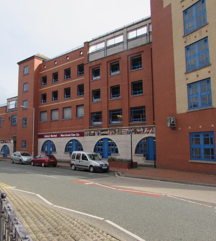


Why visit Wrexham
Townapedia lists 23 museums and landmarks, 23 parks and trails, 162 places to eat, 4 places to stay and 5 attractions in and around town.
Highlights include Hippodrome, Grove Park Theatre, Erddig Hall and Tŷ Pawb.
Weather in Wrexham
Forecast from MET Norway (CC BY 4.0). Full forecast
About Wrexham
Wrexham ( REK-səm; Welsh: Wrecsam [ˈrɛksam]) is a city in the north-east of Wales. It lies between the Welsh mountains and the lower Dee Valley, near the border with Cheshire in England. Historically in the county of Denbighshire, it became part of the new county of Clwyd in 1974. It has been the principal settlement and administrative centre of Wrexham County Borough since 1996.
From the Wikipedia article Wrexham (this version), under CC BY-SA 4.0.
Travel tips from other travellers: Wrexham on Wikivoyage (CC BY-SA 4.0).
Photos of Wrexham


Things to do5

Hippodrome
Cinema and theater
Former theatre and cinema in Wrexham, Wales

Museums and landmarks23


Football Museum of Wales and Wrexham Museum
Museum
Proposed museum in Wrexham, Wales

Wrexham County Borough Museum
Museum
Museum in Wrexham, Wales, United Kingdom




11 more on the map.
Parks, trails and playgrounds23


Racecourse Ground
Sports field and stadium · 0.6 mi
The home of football club Wrexham AFC and selected Wales national team matches; the stadium is the oldest international stadium to still...
Mold Road, Wrexham

Banana Ben's Play Centre and Cafe
Playground · 0.5 mi
Central Retail Park, Wrexham
Mo, Tu, Th 10:00-20:00; We, Fr 10:00-18:00; Sa 09:00-18:00; Su 11:00-17:00

Moss Valley
Park · 2.0 mi
Area and country park in Wrexham County Borough, Wales, UK
Ryan Rodney Reynolds Memorial Park
Park
Proposed park in Wrexham, Wales

Queensway Stadium
Sports field and stadium · 0.6 mi
Queensway, Wrexham
The Venture ICC Wrexham
Playground · 0.6 mi
An ICC or Integrated Children's Centre in Wynnstay, Caia Park, Wrexham. Formerly Wrexham Adventure Playground
11 more on the map.
Restaurants and cafes162


Ayat Curry House
Restaurant · Indian · 0.4 mi
39-41 Pen Y Bryn, Wrexham
Su-Th 16:30-22:00; Fr-Sa 16:30-22:30


Levant Kitchen and Bar Wrexham
Bar and pub
49-52 Chester Street, Wrexham
Mo-Th 12:00-00:00; Fr 00:00-01:00, 12:00-00:00; Sa 00:00-01:00, 12:00-00:00
Brew Corner
Cafe · Coffee Shop · 0.6 mi
80 Victoria Road, Wrexham
Tue-Sati 09:00 - 15:00
Heaven Coffee Shop
Cafe · Coffee Shop
30 Lord Street, Wrexham
Mo-Th 09:15-16:30; Fr-Sa 09:15-17:00
Kristina's Cafe
Cafe · British, Welsh
56 Chester Street, Wrexham
Mo-Sa 09:00-16:00
150 more on the map.
History
Human activity in the Wrexham area dates back to the Mesolithic period (8000 to 4300 BC), with tools made from flint being found to the east of the city. Two Bronze Age burial mounds are located to the west of the modern city centre and there is evidence that the area had developed into a centre for an innovative metalworking industry by the early Middle Bronze Age. A series of Iron Age hill-forts is located to the west of present-day Wrexham along the upland-lowland line suggesting the presence of an ancient tribal boundary.
At the time of the Roman conquest of Britain, the area which Wrexham formed part of was held by a Celtic tribe called the Cornovii. A Roman civilian settlement was located in the Plas Coch area of Wrexham and excavations have revealed evidence of agriculture and trade with the wider Roman world. Following the end of Roman rule in Britain, Wrexham formed part of the Romano-British Kingdom of Powys.
The Battle of Chester circa 615/616 marked the beginning of a long struggle between the Welsh and English for territory in this part of Wales. During the eighth century, the Anglo-Saxon royal house of Mercia pushed their frontiers westwards and established the earth boundaries of Wat's Dyke and Offa's Dyke to the west of the present city.
Read more of the history
It was probably during this first period of Mercian advance in the eighth century that the settlement of Wrexham was founded on the flat ground above the meadows of the River Gwenfro. The name Wrexham probably comes from the old English for Wryhtel's river meadow. Alternatively, the name may have described a settlement of the Wreocensæte people, who were possibly a continuation of the Cornovii tribe of Roman Britain.
The Mercians fought over north-east Wales during the eighth to tenth centuries but the Welsh Kings of Powys re-conquered the Wrexham area during the 11th century. Following the Welsh reconquest, Wrexham formed an integral part of the Powys lordship of Maelor and so does not appear in the Domesday Book of 1086. The first recorded reference to the town in 1161 is to a castle at 'Wristlesham'.
Stability under the princes of Powys Fadog enabled Wrexham to develop as a trading town and administrative centre of one of the two commotes making up the Lordship. In 1202, Madoc ap Gruffydd Maelor, Lord of Dinas Brân, granted some of his demesne lands in 'Wrechcessham' to the abbey of Valle Crucis and in 1220 the earliest reference to a church in Wrexham is made.
Following the loss of Welsh independence and the death in battle of Prince Llywelyn ap Gruffudd in 1282, Wrexham became part of the semi-independent Marcher lordship of Bromfield and Yale. Wrexham increased in importance throughout the Middle Ages as the lordship's administrative centre, and the then town's position made it a suitable centre for the exchange of the produce of the Dee valley and Denbighshire uplands, whilst iron and lead were also mined locally.
By 1327, Wrexham had become a market town. It became one of the largest settlements in Wales, and a celebrated centre for Welsh craftsmen. The town was particularly well known in the 14th and 15th centuries for the manufacture of Welsh bucklers, as illustrated by the mention in the 1547 Inventory of King Henry VIII of 'wreckesham Buckelers'. In 1391 Wrexham was wealthy enough for a bard, jester, juggler, dancer and goldsmith to earn their living there.
The traditional pattern of Welsh life – law, administration, customs and language – remained undisturbed through the Middle Ages and the pattern was for local English people to rapidly adopt the Welsh-language and to be assimilated into Welsh culture, even to point of adopting Welsh Patronymic surnames.
The local Welsh nobility and peasantry backed the uprising led by Owain Glyndŵr against King Henry IV of England during the early 15th century. Local poet Guto'r Glyn (c. 1412 – c. 1493) heralded Siôn ap Madog, the great-nephew of Owain Glyndŵr, as Alecsander i Wrecsam ('an Alexander for Wrexham') and the poet Hywel Dafi addresses Siôn's heir as Gwregys am ais Gwregsam wyt ('a girdle around the heart of Wrexham').
The Acts of Union passed during the reign of Henry VIII brought the lordship into the full system of English administration and law. It became part of the new shire of Denbighshire in 1536.
In 1584 St Richard Gwyn, a local Recusant, schoolteacher, and poet in the Welsh-language, was convicted of high treason based on his Catholic beliefs by a panel of judges headed by the chief justice of Chester, Sir George Bromley. On 15 October 1584, Gwyn was taken to the Beast Market and hung, drawn and quartered for his faith. He was canonised by Pope Paul VI in 1970 as one of the Forty Martyrs of England and Wales. His Feast Day is 17 October.
The main body of the church of St Giles was rebuilt in the late 15th and early 16th centuries to become one of the finest examples of ecclesiastical architecture in Wales.
The economic character remained predominantly as an agricultural market town into the 17th century but there were workshops of weavers, smiths, nailers as well as dye houses. The 1620 Norden's jury of survey of Wrexham Regis stated that four-fifths of the land-holding classes of Wrexham bore Welsh names and every field except one within the manor bore a Welsh or semi-Welsh name. A grammar school was established in 1603 by Alderman Valentine Broughton of Chester.
During the English Civil War, most of the local Welsh gentry supported King Charles I and in 1642 the king addressed enthusiastic crowds in the town. However, local landlord Sir Thomas Myddelton declared for the Rump Parliament and Parliamentarians occupied the town in 1643 and 1645. Wrexham served as military headquarters for both forces and a quarter of houses were burned down in 1643 during the quartering of troops in the town.
From the History section of Wrexham on Wikipedia, under CC BY-SA 4.0.
More about Wrexham
Geography
Wrexham is not built on a major river, but on a relatively flat plateau between the lower Dee Valley and the Clwydian Range, the easternmost mountains of north-east Wales. This position enabled it to grow as a market town, as a crossroads between England and Wales, and later as an industrial hub – due to its rich natural reserves of iron ore and coal. But three small rivers flow through parts of the city: the Clywedog, Gwenfro and Alyn. Wrexham is also famed for the quality of its underground water reserves, which gave rise to its previous dominance as a major brewing centre.
Originally a market town with surrounding urban villages, Wrexham has now coalesced with a number of urban villages and forms North Wales' largest city. Including adjacent urban areas to Wrexham, such as that of the Gwersyllt, Rhosllanerchrugog, Coedpoeth and Llay totals to a population of over 100,000 residents.
Wrexham is approximately 13 miles (21 km) south of Chester, 30 miles (50 km) north-west of Shrewsbury, 43 miles (69 km) south-west of Manchester, and 140 miles (230 km) north of Cardiff.
Economy
Wrexham's economy has moved away from heavy industry to high tech manufacturing, bio-technology, finance and professional services. The city also has the largest retail sector in North Wales.
In 2007, the then town was ranked fifth in the UK for business start-up success, higher than most larger UK towns and cities.
There are several shopping streets including Hope Street with major retailers such as New Look, TGJones, Waterstones and Claire's, along with Bank Street with many independent small businesses. Plas Coch and Berse retail parks are on the outskirts close to the A483. Central and Island Green retail parks are in the city centre. Eagles Meadow is a shopping and leisure development in the city, and contains branches of major chain stores and an Odeon Cinema; the development is connected to Yorke Street and High Street by a bridge. There are two traditional covered markets (General and Butchers) plus an open-air market on Mondays and further market stalls in Tŷ Pawb.
Wrexham has a Shopmobility service which is free. Much of the Wrexham city centre is pedestrianised.
Wrexham is home to DTCC, which collates and analyses company information for investment banks and financial organisations.
Arts and culture
The Wrexham Community & Culture Trust is leading a bid to make Wrexham the UK City of Culture for 2029, building on the city reaching the final four bids of twenty for the 2025 title.
A company of actors (anterliwtwyr) from Wrexham is recorded as appearing in Shrewsbury in Henry VIII's reign.
The then town is referenced in the late-Jacobean Beaumont and Fletcher play, 'The pilgrim' (1647), in which the stock Welshman declares that "Pendragon was a shentleman, marg you, Sir, and the organs at Rixum were made by revelations".
Wrexham hosted the National Eisteddfod in 1888, 1912, 1933, 1977, 2011 and 2025, as well as an unofficial National Eisteddfod event in 1876. The 2025 festival is thought to have attracted over 150,000 visitors and 6,000 competitors to the site on the eastern outskirts of town. Locally-born actor Mark Lewis Jones served as the event's president.
Wrexham has a number of theatres, including the Grove Park Theatre on Hill Street, and the Yale Studio theatre close to Llwyn Isaf, with others at Wrexham University on Mold Road and at Coleg Cambria. There is a multi-screen Odeon cinema in the Eagles Meadow development.
Education
Wrexham University was formed when the North East Wales Institute (NEWI) was granted full university status in 2008. It consists of Plas Coch campus in the western part of the city and the North Wales School of Art and Design located on Regent Street. The institution was founded in 1887 as the Wrexham School of Science and Art. It was formerly named after the 14th century scholar and last Welsh Prince of Wales, Owain Glyndŵr, as (Wrexham) Glyndŵr University.
Yale College (now part of Coleg Cambria) is the main provider of adult education in Wrexham and is one of the largest colleges in Wales. As a tertiary college it also provides a wide range of higher education courses at its two campuses at Grove Park in the city centre and Bersham Road in southwest Wrexham. It was named after Elihu Yale, best known for being the prime benefactor of Yale University. It was founded in 1950 as a state school on a site at Crispin Lane. In 1973, as part of the conversion of local schools to the comprehensive system, it was renamed as Yale Sixth Form College and the pupils re-located to other schools. The Crispin Lane site was incorporated into NEWI (now Glyndŵr University) after the development of the Grove Park Campus.
From the Wikipedia article Wrexham, under CC BY-SA 4.0.
Notable people from Wrexham
 Mark HughesWelsh football managerPhoto: Chensiyuan, CC BY-SA 4.0
 Danny WardWelsh association football player (born 1993)Photo: md.faisalzaman from Worcester, MA, CC BY 2.0
 Harry WilsonWelsh association football playerPhoto: Timmy96, CC0
 Robbie SavageWelsh association football player (born 1974)Photo: Jonesy702, CC BY 4.0
 Tom LawrenceWelsh footballer (born 1994)Photo: Jon Candy from Cardiff, Wales, CC BY-SA 2.0
 Laura Deasformer equestrian athlete and current skeleton racer from the United KingdomPhoto: 121a0012, CC BY-SA 4.0
 George Jeffreys, 1st Baron JeffreysWelsh judge, aka the Hanging Judge (1645–1689)Photo: John Michael Wright, Public domain
 Andy ScottWelsh musicianPhoto: Frank Schwichtenberg, CC BY-SA 4.0
 Rob JonesEnglish association football player (born 1971)Photo: Jarvin, CC BY 3.0
- Neco WilliamsWelsh association football player
- Stuart WilliamsWelsh footballer (1930-2013)
- Jason KoumasWelsh footballer (born 1979)
Born in Wrexham, according to Wikidata (CC0). Each name links to its Wikipedia article.
Where to stay4
The Wynnstay Arms Hotel - Marston's Inn
Motel and hotel
Yorke Street, Wrexham
Churches and places of worship27
Shopping35
Gas and EV charging7
Schools, colleges and libraries26
St Joseph's Catholic and Anglican Secondary School
School · Catholic & Anglican · 0.7 mi
Sontley Road, Wrexham
Healthcare14
Map of Wrexham
250 places. The map loads OpenStreetMap tiles when you open it.
Getting there and nearby towns
Hawarden Airport (CEG) is the nearest airport with scheduled flights listed in OpenStreetMap, 9 miles away.
- Chester 11 mi north, about 17 min by car
- Blacon 12 mi north, about 19 min by car
- Oswestry 13 mi south, about 21 min by car
- Whitchurch 14 mi southeast, about 22 min by car
- Ellesmere Port Town 16 mi north, about 26 min by car
- Neston 17 mi north, about 27 min by car
- Heswall 20 mi north, about 32 min by car
- Nantwich 20 mi east, about 32 min by car
- Bebington 21 mi north, about 34 min by car
- Birkenhead 24 mi north, about 39 min by car
Drive times are estimates from straight-line distance, not routes.
Towns near Wrexham


Keep exploring
Local news
Headlines from INDB.
Reviews, tips and questions
Loading what members have shared...
Sources and licences
- GeoNames (CC BY 4.0): population, coordinates, regions and time zone
- Mapillary (see each image): photos
- OpenStreetMap contributors (ODbL 1.0): places, airports, map data
- Wikidata (CC0 1.0): elevation, founding date, time zone, website, landmarks and historic places
- Wikimedia Commons (see each image): photos
- Wikipedia (CC BY-SA 4.0): overview and history text
Photo credits
- Indoor Market, Wrexham, Jaggery, CC BY-SA 2.0
- Inside St Giles' Church, Wrexham, Inside St Giles' Church, Wrexham .jpg : Md.altaf.rahman derivative work: Rabanus Flavus, CC BY-SA 3.0
- Windows from inside St Giles' Church, Wrexham, Md.altaf.rahman, CC BY-SA 3.0
- Inside St Giles' Church, Wrexham, Md.altaf.rahman, CC BY-SA 3.0
- Gorymdaith Wrecsam 2 Gorffennaf 2022 - national march for indypendence, Wrexham 2 July 2022 26, Llywelyn2000, CC BY-SA 4.0
- Elfed Williams, Cadeirydd Yes Cymru yng Ngorymdaith Wrecsam 2 Gorffennaf 2022 - national march for indypendence, Wrexham 2 July 2022 30, Llywelyn2000, CC BY-SA 4.0
- Gorymdaith Wrecsam 2 Gorffennaf 2022 - national march for indypendence, Wrexham 2 July 2022 12, Llywelyn2000, CC BY-SA 4.0
- Gorymdaith Wrecsam 2 Gorffennaf 2022 - national march for indypendence, Wrexham 2 July 2022 13, Llywelyn2000, CC BY-SA 4.0
- Gorymdaith Wrecsam 2 Gorffennaf 2022 - national march for indypendence, Wrexham 2 July 2022 17, Llywelyn2000, CC BY-SA 4.0
- Gorymdaith Wrecsam 2 Gorffennaf 2022 - national march for indypendence, Wrexham 2 July 2022 05, Llywelyn2000, CC BY-SA 4.0
- Gorymdaith Wrecsam 2 Gorffennaf 2022 - national march for indypendence, Wrexham 2 July 2022 01, Llywelyn2000, CC BY-SA 4.0
- Elfed Williams, Cadeirydd Yes Cymru yng Ngorymdaith Wrecsam 2 Gorffennaf 2022 - national march for indypendence, Wrexham 2 July 2022 31, Llywelyn2000, CC BY-SA 4.0
- Gorymdaith Wrecsam 2 Gorffennaf 2022 - national march for indypendence, Wrexham 2 July 2022 29, Llywelyn2000, CC BY-SA 4.0
- Llwyn Isaf, Wrexham, Rept0n1x, CC BY-SA 3.0
- Nant Mill visitors park, User:Spicke01, Public domain
- Gresford All Saints, Spicke01, Public domain
- Gresford Methodist Church (1), The wub, CC BY-SA 4.0
- Trinity Presbyterian Church, Wrexham (1), Rept0n1x, CC BY-SA 3.0
- Wrexham Museum and Archives (2), Rept0n1x, CC BY-SA 3.0
- Racecourse Ground, Wrexham (49329447362), John Lord from Edinburgh, Scotland, CC BY 2.0
- The Mansion House across the pond - Erddig, Wrexham, North Wales (24540653874), Glen Bowman from Newcastle, England, CC BY 2.0
- Former Wrexham & East Denbighshire Memorial Hospital (1), Rept0n1x, CC BY-SA 3.0
- Wrexham war memorial (6), Rept0n1x, CC BY-SA 3.0
- Wynnstay Arms Hotel, Wrexham - DSC09411, Rept0n1x, CC BY-SA 3.0
- High Street, Wrexham - Royal Oak pub, RJ Price Davies, CC BY-SA 4.0
- Wrexham Library - DSC09423, Rept0n1x, CC BY-SA 3.0
- Dovecote (5), Unknown author, CC BY-SA 3.0
- Olivet Christadelphian Hall, Rhosrobin (4), Rept0n1x, CC BY-SA 3.0
- Entrance to Wrexham Library, Rept0n1x, CC BY-SA 3.0
- Stgileswrexham, David Powell, CC BY-SA 3.0
- Wrexham Museum and Archives (1), Rept0n1x, CC BY-SA 3.0
- Old Carnegie Library, Wrexham, North Wales, Rosser1954, CC BY-SA 4.0
- Ty Pawb (53143593100), Reading Tom from Reading, UK, CC BY 2.0
- General market - doorway, RJ Price Davies, CC BY-SA 4.0
- Street-level photo, RyanBush, CC BY-SA 4.0
- Street-level photo, sk53_quint, CC BY-SA 4.0
- Street-level photo, RyanBush, CC BY-SA 4.0
- Street-level photo, RyanBush, CC BY-SA 4.0
- Street-level photo, lamaar639, CC BY-SA 4.0


Page built November 10, 2026. Spotted a mistake? Tell us or suggest a place.