


Why visit Hayes
Townapedia lists 5 museums and landmarks, 33 parks and trails, 56 places to eat, 6 places to stay and 6 attractions in and around town.
Highlights include Beck Theatre, Compass Theatre, Down Barns Moated Site and Polish Air Force Memorial.
Weather in Hayes
Forecast from MET Norway (CC BY 4.0). Full forecast
About Hayes
Hayes is a town in west London. Historically situated within the county of Middlesex, it is now part of the London Borough of Hillingdon. The town's population, including its localities Hayes End, Harlington and Yeading, was recorded in the 2021 census as 93,928. It is situated 13 miles (21 km) west of Charing Cross, or 6.5 miles (10.5 km) east of Slough.
From the Wikipedia article Hayes, Hillingdon (this version), under CC BY-SA 4.0.
Things to do6

Beck Theatre
Cinema and theater · 0.4 mi
Theatre in Hayes, London, England

Compass Theatre
Cinema and theater · 3.3 mi
Theatre in Ickenham, Hillingdon, London, England

Windmill Bridge
Bridge · 3.0 mi
Also known as 'The Three Bridges'. Designed by Isambard K Brunel. Road, rail and canal intersect at this bridge.

Open Air Theatre, Barra Hall Park
Cinema and theater
Open-air theatre in Barra Hall Park, Hayes, London, England
Museums and landmarks5

Down Barns Moated Site
Monument and historic site · 2.0 mi
Moated site in Northolt, London Borough of Ealing, England, UK

Polish Air Force Memorial
Monument and historic site · 2.5 mi
War memorial in South Ruislip, London Borough of Hillingdon, United Kingdom

Parks, trails and playgrounds33


Crane Meadows
Park · 2.9 mi
Nature reserve in London, England, United Kingdom


Litten Nature Reserve
Park · 3.3 mi
Nature reserve in London, England


Northala Fields
Park · 2.7 mi
Park located in Northolt, in the London Borough of Ealing

21 more on the map.
Restaurants and cafes56
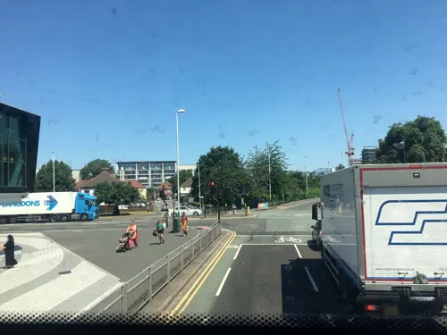
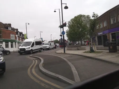


Exln Cafe
Cafe · 1.1 mi
248 Kingshill Avenue, Hayes
Mo-Sa 08:00-15:00

Moonrise
Restaurant · Sri Lankan · 1.5 mi
241 The Broadway, Southall

Johal Wine Stores
Brewery and winery · 1.5 mi
249 The Broadway, Southall
44 more on the map.
History
Hayes is formed of what originally were five separate villages: Botwell, Hayes Town, Hayes End, Wood End and Yeading. The name Hayes Town has come to be applied to the area around Station Road between Coldharbour Lane and Hayes & Harlington railway station, but this was historically the hamlet called Botwell. The original Hayes Town was the area to the east of St Mary's Church, centred around Church Road, Hemmen Lane and Freeman's Lane.
A 2007 archaeological study looks back to earliest times. It describes finds such as flint tools dating to the Paleolithic period (500,000 BC - 10,000 BC) at the sites of Botwell, EMI Company works, and Colbrook Avenue (near Dawley Road) [4.1.2]; more finds dating to the Mesolithic period (10,000 BC - 4,000 BC) at the site of Lake Farm Country Park [4.1.3]. The site of Wyre Grove (off North Hyde Road) produced finds including pottery from the Bronze Age (2,400 BC - 700 BC), Iron Age (700 BC - AD 43), Romano-British period (AD 43 - 410) and early Anglo-Saxon period (AD 410 - 1066) [4.1.6-11]. The report cites an 831 grant as evidence that the Botwell area has existed as a settlement since Anglo-Saxon times [4.1.12].
Read more of the history
For some 700 years up to 1546, Hayes formed part of the Archbishop of Canterbury's estates, ostensibly owing to grants from the Mercian royal family. In that year, the then-Archbishop Thomas Cranmer was forced to surrender his land to King Henry VIII, who subsequently granted the estate to Edward North, 1st Baron North. The area changed hands several times thereafter, but by the eighteenth century, two family-names had established themselves as prominent and long-time landowners: Minet and Shackle.
John Wesley (1703–1791) and Charles Wesley (1707–1788), founders of the evangelical Methodist movement, preached in Hayes on at least ten occasions between 1748 and 1753. The Salvation Army – founded in 1865 in London by William Booth – registered a barracks in Hayes between 1887 and 1896; their hall, or "citadel", at 71 Coldharbour Lane was registered in 1927. The Hayes division served the local community for just short of a century, and in years gone by their own Salvation Army brass band performed around the town's streets. In 2024, the Salvation Army hall closed and was put up for sale.
In the 18th and 19th centuries, Hayes was home to several private boarding schools catering for wealthy families. The former Manor House on Church Road was by the 1820s a boys' school called Radnor House Academy (a.k.a. Manor House Academy); Grove Cottage, Wood End, a school for young men, opened in the 1830s; Belle House School for Boys opened on Botwell Lane in the 1840s (it is now St Mary's Convent); in the first half of the 19th century, the Wood End House School for Young Ladies stood on the site of what is now the Norman Leddy Memorial Gardens; the former Magdalen Hall on Hayes End Road was also a 19th-century private School for Young Ladies.
Wood End House (before 1848, the site of the Wood End House School for Young Ladies) was used – from 1848 to c. 1905 – as an asylum. Notable psychiatrist John Conolly (1794–1866) was one of its licensed proprietors, between 1848 and 1866. The building was demolished in 1961.
Until the end of the nineteenth century, Hayes's key areas of work were agriculture and brickmaking. The Second Industrial Revolution brought change in the late nineteenth century, up to World War I. The town's location on the Grand Junction Canal (later called the Grand Union) and the Great Western Railway – Hayes & Harlington railway station had opened in 1868 – made it well-placed for industry.
The town's favourable location caused the Hayes Development Company to make available sites on the north-side of the railway, adjacent to the canal, and Hayes became a centre for engineering and industry. HDC's company secretary, Alfred Clayton, is commemorated in the name of Clayton Road. Residential districts consisting of dwellings of the garden suburb type were built to house workers after World War I.
In 1904, the parish council created Hayes Urban District (from 1930, Hayes and Harlington Urban District) in order to address the issue of population growth. Hayes and Harlington Urban District continued until 1965 when Hayes became part of the newly established London Borough of Hillingdon. On 1 April 1965 the civil parish was abolished. At the 1951 census (one of the last before the abolition of the parish), Hayes had a population of 49,650.
Barra Hall – Grade II listed since 1974 – was Hayes town hall between 1924 and 1979. Originally a manor house called Grove House, in the late 18th century it was home to Alderman Harvey Combe, Lord Mayor of London in 1799. It became Barra Hall in 1875, after Robert Reid – descendant of the Reid baronets of Barra – became owner. Army Cavalry were stationed at Barra Hall during World War I. After Hayes Urban District Council bought the Hall and its grounds in 1923, the grounds of the new Town Hall were given over to public use as a public park – with playground, tennis courts and paddling pool; it was opened by actress Jessie Matthews. In July 2024, a century on from Hayes Urban District's 1923 purchase, Hillingdon Council sold Barra Hall, to HRUC. Notwithstanding the sale, the Council claimed it would safeguard the building for the future, such that it would remain a key asset to local residents.
From the History section of Hayes, Hillingdon on Wikipedia, under CC BY-SA 4.0.
More about Hayes
Economy
Nearby London Heathrow Airport is the largest single provider of employment. The airport's presence generates numerous associated businesses – retail, international distribution and cargo-handling among them. Hotels – such as the Sheraton Hotel on Bath Road, Hayes – benefit, too, from the town's proximity to the airport.
West London Film Studios – situated on Springfield Road, Hayes – is a film and television studio equipped to accommodate everything from small TV productions to big-budget feature films. The Imitation Game (2014), Bridget Jones's Baby (2016) and Killing Eve are just a few well-known productions filmed at the Hayes studios.
Lombardy Retail Park, UB3 3EX is located near the Uxbridge Road/The Parkway crossing. The park is 220,000 sq ft (20,000 m2) in size with 865 parking spaces. Shops include: Sainsbury's (replaced the popular Pump Lane branch, 1997), Currys, TK Maxx, Next, H&M, Sports Direct, McDonald's, Pizza Hut and Costa. A smaller development to the east, Hayes Bridge Retail Park, has branches of Dreams and Metro Bank.
TMD Technologies (Thorn Microwave Devices) is located in Swallowfield Way, Hayes. The firm dates back to the 1940s and EMI's high-power klystron group. It manufactures transmitters and radar equipment, and employs about 220 people.
Cloud computing company Rackspace operates its U.K. offices from Hyde Park Hayes.
Arts and culture
Hayes's Beck Theatre opened in 1977, and offers a wide range of touring shows. "The Beck" serves as a community theatre, hosting one-night concerts, comedy, drama, films, opera, and pantomime.
The Open Air Theatre, Barra Hall Park originated in 1951 as a community venue for music, theatre and dance. The local community raised funds for a 2005 rebuild.
Hayes's Botwell Green Library is situated in the Leisure Centre (address: East Avenue, UB3 2HW), which in 2010 replaced both the old Hayes Library (opened 1933 on Golden Crescent) and the old swimming baths (opened 1967 on the opposite side of Central Avenue). Following its 2010 closure, the derelict old Hayes Pool building was close to being used as a location for 2012 James Bond film Skyfall, but in late 2012 the Council demolished it, and in 2017 a branch of Lidl opened on the former baths site.
Education
Primary and junior schools in Hayes include: Botwell House Catholic Primary School, Dr Triplett's, Minet, Pinkwell, William Byrd, Hayes Park, Hewens Primary, Grange Park, and Rosedale Primary; Cranford Park Academy, Lake Farm Park Academy, and Wood End Park Academy are part of the Park Federation Academy Trust.
Secondary schools in Hayes include: Barnhill Community High School, Global Academy, Guru Nanak Sikh Academy, Harlington School, Hewens College (formerly Mellow Lane School), Parkside Studio College, and Rosedale College.
Uxbridge College has a Hayes Campus, situated on the former Townfield School site, accessible from Coldharbour Lane.
From the Wikipedia article Hayes, Hillingdon, under CC BY-SA 4.0.
Notable people from Hayes
 Glenn HoddleEnglish footballer and managerPhoto: Doha Stadium Plus Qatar, CC BY 2.0
 Steve PriestBassist for Sweet (1948–2020)Photo: Moonchld, CC BY-SA 4.0
 Jasmine JobsonBritish actressPhoto: Marlene Landu, CC BY-SA 4.0
 Jason LeeBritish field hockey player and coachPhoto: Andy Mabbett, CC BY-SA 4.0
 Frank AllenEnglish bass guitaristPhoto: Michael Coghlan, CC BY-SA 2.0
 Tony LeeBritish comic and novel writerPhoto: Bondbaddie, CC BY-SA 4.0
 David WestlakeBritish singer/songwriterPhoto: Del71, CC BY-SA 4.0
- Greg DykeBritish media executive
- Paul GardinerBritish musician (1958–1984)
- Eric Dunningsociologist
- Larry PageBritish singer and music producer
- Jason CousinsEnglish footballer (born 1970)
Born in Hayes, according to Wikidata (CC0). Each name links to its Wikipedia article.
Where to stay6
Churches and places of worship23
St George’s Interdenominational Chapel, Heathrow Airport
Church · 3.4 mi
Shopping20
Gas and EV charging4
Schools, colleges and libraries34
Healthcare5
Map of Hayes
192 places. The map loads OpenStreetMap tiles when you open it.
Getting there and nearby towns
RAF Northolt (NHT) is the nearest airport with scheduled flights listed in OpenStreetMap, 2 miles away.
- Hillingdon 2 mi northwest, about 3 min by car
- Southall 2 mi east, about 4 min by car
- West Drayton 2 mi southwest, about 3 min by car
- Cranford 3 mi south, about 4 min by car
- Heston 3 mi southeast, about 5 min by car
- Uxbridge 3 mi northwest, about 5 min by car
- Northolt 3 mi northeast, about 5 min by car
- Ickenham 3 mi north, about 6 min by car
- Ruislip 4 mi north, about 6 min by car
- Hounslow 4 mi southeast, about 7 min by car
Drive times are estimates from straight-line distance, not routes.
Towns near Hayes


Keep exploring
Local news
Headlines from INDB.
Reviews, tips and questions
Loading what members have shared...
Sources and licences
- GeoNames (CC BY 4.0): population, coordinates, regions and time zone
- Mapillary (see each image): photos
- OpenStreetMap contributors (ODbL 1.0): places, airports, map data
- Wikidata (CC0 1.0): elevation, founding date, time zone, website, landmarks and historic places
- Wikimedia Commons (see each image): photos
- Wikipedia (CC BY-SA 4.0): overview and history text
Photo credits
- Hayes and Yeading United Football Club Church Road Stadium, David Hawgood, CC BY-SA 2.0
- Hayes, Barra Hall, Nigel Cox, CC BY-SA 2.0
- Compass Theatre, Ickenham - April 2011, Harrison49, CC BY-SA 3.0
- Brunel's road, canal and rail bridge (Three Bridges), Smeashy, CC BY-SA 4.0
- Down Barns Moated Site 2, Dudley Miles, CC BY-SA 3.0
- Ickenham Marsh flooded, Chiswick Chap, CC BY-SA 3.0
- Litten Local Nature Reserve, Dudley Miles, CC BY-SA 3.0
- Small Red-eyed Damselfly (2817634173), Alastair Rae from London, United Kingdom, CC BY-SA 2.0
- Heston Church, Mstimson at English Wikipedia, CC BY-SA 3.0
- St mary hanwell 38, P.g.champion, CC BY 2.0 uk
- Hayes, The Beck Theatre, Nigel Cox, CC BY-SA 2.0
- Hayes (Hillingdon) St Mary from ENE GeoUK 1686342, John Salmon, CC BY-SA 2.0
- Cranebank path, Dudley Miles, CC BY-SA 3.0
- Islip Manor Meadows 6, Dudley Miles, CC BY-SA 3.0
- Gutteridge Wood 5, Dudley Miles, CC BY-SA 3.0
- Yeading Brook in Yeading Brook Meadows 3, Dudley Miles, CC BY-SA 3.0
- Crane Meadows, JoshuaAnthonyGill, CC BY-SA 4.0
- Northala fields northolt london, Romazur, CC BY-SA 3.0
- Street-level photo, southglos, CC BY-SA 4.0
- Street-level photo, southglos, CC BY-SA 4.0
- Street-level photo, southglos, CC BY-SA 4.0
- Street-level photo, RyanBush, CC BY-SA 4.0
- Street-level photo, RyanBush, CC BY-SA 4.0
- Street-level photo, 4004, CC BY-SA 4.0
- Street-level photo, 4004, CC BY-SA 4.0
- Street-level photo, themadcabbie, CC BY-SA 4.0
- Street-level photo, laye, CC BY-SA 4.0
- Street-level photo, southglos, CC BY-SA 4.0
- Street-level photo, southglos, CC BY-SA 4.0
- Street-level photo, southglos, CC BY-SA 4.0
- Street-level photo, southglos, CC BY-SA 4.0
- Street-level photo, southglos, CC BY-SA 4.0
- Street-level photo, southglos, CC BY-SA 4.0
- Street-level photo, RyanBush, CC BY-SA 4.0
- Street-level photo, southglos, CC BY-SA 4.0
- Street-level photo, southglos, CC BY-SA 4.0


Page built November 10, 2026. Spotted a mistake? Tell us or suggest a place.