


Uxbridge, United Kingdom
Uxbridge is a town of 70,000 people in England, United Kingdom.
Why visit Uxbridge
Townapedia lists 7 museums and landmarks, 41 parks and trails, 80 places to eat, 7 places to stay and 5 attractions in and around town.
Highlights include Beck Theatre, Compass Theatre, Battle of Britain Bunker and Battle of Britain Bunker - RAF Uxbridge.
Weather in Uxbridge
Forecast from MET Norway (CC BY 4.0). Full forecast
About Uxbridge
Uxbridge () is a suburban town in west London, England, and the administrative headquarters of the London Borough of Hillingdon, 15.4 miles (24.8 km) northwest of Charing Cross. Uxbridge formed part of the parish of Hillingdon in the county of Middlesex. As part of the suburban growth of London in the 20th century it expanded and increased in population, becoming a municipal borough in 1955, and part of Greater London in 1965.
From the Wikipedia article Uxbridge (this version), under CC BY-SA 4.0.
Photos of Uxbridge


Things to do5

Beck Theatre
Cinema and theater · 3.2 mi
Theatre in Hayes, London, England

Compass Theatre
Cinema and theater · 2.0 mi
Theatre in Ickenham, Hillingdon, London, England

The Chalfont Viaduct
Bridge · 3.2 mi
Railway viaduct in south-east England, built in 1906

Open Air Theatre, Barra Hall Park
Cinema and theater · 3.3 mi
Open-air theatre in Barra Hall Park, Hayes, London, England
Museums and landmarks7


Battle of Britain Bunker - RAF Uxbridge
Museum · 0.9 mi
Wren Avenue, Uxbridge
Mo-Su 10:00-16:30

Memorial to the No. 11 Group Operations Room
Monument and historic site · 0.9 mi
Parks, trails and playgrounds41


Kingcup Meadows and Oldhouse Wood
Park · 1.5 mi
Protected area in Buckinghamshire, England

Denham Country Park
Hiking and trails · 1.5 mi
Park in the United Kingdom
Denham Court Drive, Uxbridge

Barra Hall Park
Park · 3.3 mi
Park in the London Borough of Hillingdon, UK
Colne Valley regional park
Park · 2.1 mi
Area in Hertfordshire and Buckinghamshire
29 more on the map.
Restaurants and cafes80
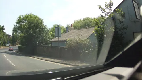
The Malt Shovel
Bar and pub · 1.3 mi
69 Iver Lane, Uxbridge
Mo-Tu 12:00-22:00; We-Fr 12:00-23:00; Sa 09:00-23:00; Su 09:00-22:30

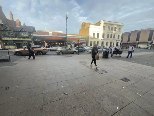


The Crown
Bar and pub · 1.2 mi
High Street, Uxbridge
Mo-Su 12:00-22:00
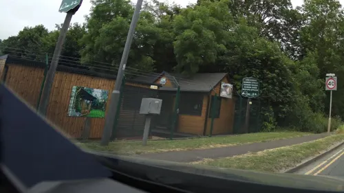


Harris + Hoole
Cafe · Coffee Shop
High Street, Uxbridge
Mo-Fr 07:00-17:00; Sa 08:00-17:00; Su 09:00-17:00

Caffè Nero
Cafe · Coffee Shop
185-186 High Street, Uxbridge
Mo-Fr 06:45-19:00; Sa 07:30-19:00; Su 08:00-18:30

The Fig Tree
Bar and pub
49 Windsor Street, Uxbridge
Mo-Th 11:00-23:00; Fr-Sa 11:00-01:00; Su 12:00-23:00
68 more on the map.
History
The name of the town is derived from "Wixan's Bridge", which was sited near the bottom of Oxford Road where a modern road bridge stands, beside the Swan and Bottle public house. The Wixan were a 7th-century Saxon tribe from Lincolnshire who also began to settle in what became Middlesex. Anglo-Saxons began to settle and farm in the area of Uxbridge in the 5th century, clearing dense woodland. Two other places in Middlesex bore the name of the Wixan: Uxendon ("Wixan's Hill"), a name preserved only in the street names of Uxendon Hill and Crescent in Harrow, and Waxlow ("Wixan's Wood") near Southall.
Archaeologists found Bronze Age remains (before 700 BC) and medieval remains during the construction of The Chimes shopping centre; two miles (3.2 km) away at Denham, Upper Paleolithic remains have been found. Uxbridge is not mentioned in the Domesday Book of the 11th century, but a hundred years later St Margaret's Church, was built. The town appears in records from 1107 as "Woxbrigge", and became part of the Elthorne Hundred with other settlements in the area.
Read more of the history
The Parliamentary Army garrisoned the town upon the outbreak of the English Civil War in 1642 and established their headquarters there in June 1647 on a line from Staines to Watford, although the king passed through Uxbridge in April 1646, resting at the Red Lion public house for several hours. Charles I met with representatives of Parliament at the Crown Inn in Uxbridge in 1645, but negotiations for the end of hostilities were unsuccessful due in part to the king's stubborn attitude. The town had been chosen as it was located between the Royal headquarters at Oxford and the Parliamentary stronghold of London.
The covered market was built in 1788, replacing a building constructed in 1561. In the early 19th century, Uxbridge had an unsavoury reputation; the jurist William Arabin said of its residents "They will steal the very teeth out of your mouth as you walk through the streets. I know it from experience." For about 200 years most of London's flour was produced in the Uxbridge area.
The Grand Junction Canal opened in 1794, linking Uxbridge with Birmingham and the River Thames at Brentford. By 1800 Uxbridge had become one of the most important market towns in Middlesex, helped by its status as the first stopping point for stagecoaches travelling from London to Oxford. The development of Uxbridge declined after the opening of the Great Western Railway in 1838, which passed through West Drayton. A branch line to Uxbridge was opened in 1856, but it was the opening of the Metropolitan Line in 1904 which restarted Uxbridge's growth by giving the town its first direct link to London.
Harman's Brewery was established in Uxbridge by George Harman in 1763, and moved into a new headquarters in Uxbridge High Street in 1875. The eventual owners of the brewery, Courage, closed the headquarters in 1964. It was demolished and replaced by a Budgen's supermarket, which in turn was demolished with the construction of The Chimes shopping centre. The brewery building in George Street remained in place until it was demolished in 1967. The office building Harman House was built on the site in 1985, named after the brewery.
The main enclosures effected in the parish of Hillingdon, by statute in 1819, saw the reduction of Uxbridge Common, which at its largest had been 4 miles (6.4 km) in circumference. It originally straddled Park Road, north of the town centre, and covers 15 acres (6.1 ha).
In 1871 the town's first purpose-built police station was built in Windsor Street. The building included three cells and stables. The Metropolitan Police continued to use the building until 1988, when operations moved to a new site in Harefield Road. The building subsequently became the Old Bill public house in 1996, renamed the Fig Tree in 2006.
In the early 1900s the Uxbridge and District Electricity Supply Company had been established a power station in Waterloo Road, and much of the town was connected by 1902, although some houses still had gas lighting in 1912. A water tower on Uxbridge Common was built in 1906, resembling a church tower, to improve the supply to the town.
Wood panelling from a room in the Crown & Treaty public house was sold in 1924 to an American businessman, who installed it in his office in the Empire State Building in New York. It was returned in 1953 as a gift to the newly crowned Queen Elizabeth II and returned to the house, although the monarch retained ownership.
On 31 August 1935 Uxbridge Lido, an outdoor swimming pool built in the "Moderne" or Art Deco style, was officially opened. Before the opening, many residents swam in a section of the Frays River near Harefield Road, and the Colne. The pool, pavilion building, entrance building and both fountains were designated Grade II listed buildings in 1998. Despite the listing, the pool was closed to the public and the buildings became subject to heavy vandalism. The Uxbridge open-air pool was fully refurbished during 2009 and re-opened in May 2010. Added to the site, renamed Hillingdon Sports and Leisure Complex, was a 50 m indoor competition pool, a leisure pool, a 100-station gym, a wide range of exercise classes, an athletics stadium and track, 3G floodlit pitches, a sports hall, a café and a crèche. The Grade II listed buildings are still standing.
During the Second World War Uxbridge adopted the Royal Navy destroyer HMS Intrepid in 1942, to help towards the ship's costs; Intrepid was lost to enemy action the following year. The town and surrounding areas suffered bombing by the Luftwaffe. V1 flying bombs fell on the town between June 1944 and March 1945. The first recorded bombing using a V1 was on 22 June 1944 at 07:00, when the bomb passed over the top of a bus and hit four houses nearby. Seven people were killed and 25 injured, leaving 46 houses in the area uninhabitable. In all the Uxbridge Urban District suffered 79 civilian deaths through enemy action in the war.
From the History section of Uxbridge on Wikipedia, under CC BY-SA 4.0.
More about Uxbridge
Geography
Uxbridge lies at a mean elevation of 130 feet (40 m) above mean sea level. Like much of the rest of the UK its climate is generally temperate, with few extremes of temperature or weather.
The landscape upon which the settlement of Uxbridge was established is largely unchanged from the Mesolithic era. Much of it was covered by oak and elm trees, which were gradually cleared by early settlers. An archaeological excavation by the Museum of London in the 1990s found evidence of flint items shaped by Mesolithic hunters, as well as various animal bones and traces of charcoal from the remains of campfires.
The River Pinn runs through Uxbridge, passing through the former site of RAF Uxbridge and the grounds of Brunel University. It joins the Frays River, which branches off from the River Colne and acts as the boundary between Uxbridge and the neighbouring county of Buckinghamshire.
Uxbridge is centred 15.4 miles (24.8 km) from Charing Cross in Central London; 3 miles (4.8 km) from Hayes; 3.1 miles (5.0 km) from Ruislip; 4.7 miles (7.6 km) from Northolt; 5.4 miles (8.7 km) from Slough; and 12.8 miles (20.6 km) from High Wycombe.
Economy
As of 2012, Uxbridge had 112,175 square metres (1,207,440 sq ft) of town centre floorspace. Uxbridge has two shopping centres, The Pavilions and The Chimes (formerly Intu Uxbridge). Much of the town centre is pedestrianised. Just off the High Street is Windsor Street, a short street with older shops.
The town centre consists of retail outlets and office buildings, including the main UK and European offices of international companies such as Coca-Cola European Partners, Cadbury, Xerox, General Mills, F. Hinds, PAREXEL, Arri, Bristol Myers Squibb, Monster Energy, APL, Herbalife Europe. Other employers include NetApp, Anixter International, PwC, WMS Gaming, IBB Solicitors and Nexen.
Within the London Borough, 55.1% of residents travel to the Uxbridge North and Uxbridge South wards to work, and only 8% of residents working there who also live within the wards. The 2001 census measured a total of 6,007 (35.9%) of residents leaving the North ward to go to work. Uxbridge South had a figure of 5,666 (26.5%) of residents leaving the ward to work elsewhere.
In 2005 retail footprint research, Uxbridge ranked 9th in terms of retail expenditure in Greater London at £311 million.
Education
Primary schools in Uxbridge include Hermitage Primary School, St Andrew's Church of England Primary School, St Mary's Catholic Primary School, Whitehall Infant School, and Whitehall Junior School. Uxbridge High School is a comprehensive secondary school in the town.
Uxbridge is also home to Brunel University and the Buckinghamshire New University's nursing campus. The main campus of Uxbridge College is also in the town.
From the Wikipedia article Uxbridge, under CC BY-SA 4.0.
Notable people from Uxbridge
 Jane SeymourBritish actressPhoto: Toglenn, CC BY-SA 4.0
 Tony PondRally driver, two-time podium finisher in World Rally Championship events (1945-2002)Photo: Eddi Laumanns aka RX-Guru, CC BY 4.0
 Wentworth WebsterBasque writer (1828-1907)Photo: Unknown author Unknown author, Public domain
 Tomkyns Hilgrove TurnerBritish Army generalPhoto: Man vyi, Public domain
 Nottidge Charles MacnamaraBritish surgeonPhoto: Unknown author, CC BY 4.0
- Christine KeelerEnglish model and showgirl (1942–2017)
- Big Jim SullivanBritish guitarist (1941–2012)
- John StearsBritish special effects expert (1934–1999)
- Glenn FreemantleBritish sound editor and sound designer
- Colin Hillfootballer
- John Dowson19th-century British orientalist
- Rianna DeanEnglish association football player
Born in Uxbridge, according to Wikidata (CC0). Each name links to its Wikipedia article.
Where to stay7
Churches and places of worship22
Hillingdon Pentecostal Church
Church · Pentecostal · 1.5 mi
Kingston Lane, Uxbridge
Shopping17
Gas and EV charging2
Schools, colleges and libraries29
Healthcare7
Map of Uxbridge
217 places. The map loads OpenStreetMap tiles when you open it.
Getting there and nearby towns
RAF Northolt (NHT) is the nearest airport with scheduled flights listed in OpenStreetMap, 2 miles away.
- Hillingdon 2 mi southeast, about 3 min by car
- Ickenham 2 mi northeast, about 3 min by car
- Ruislip 3 mi northeast, about 5 min by car
- West Drayton 3 mi south, about 6 min by car
- Gerrards Cross 4 mi northwest, about 7 min by car
- Northolt 5 mi east, about 8 min by car
- Northwood 5 mi northeast, about 8 min by car
- Chalfont Saint Peter 5 mi northwest, about 8 min by car
- Pinner 5 mi northeast, about 9 min by car
- Slough 6 mi southwest, about 9 min by car
Drive times are estimates from straight-line distance, not routes.
Towns near Uxbridge


Keep exploring
Local news
Headlines from INDB.
Reviews, tips and questions
Loading what members have shared...
Sources and licences
- GeoNames (CC BY 4.0): population, coordinates, regions and time zone
- Mapillary (see each image): photos
- OpenStreetMap contributors (ODbL 1.0): places, airports, map data
- Wikidata (CC0 1.0): elevation, founding date, time zone, website, landmarks and historic places
- Wikimedia Commons (see each image): photos
- Wikipedia (CC BY-SA 4.0): overview and history text
Photo credits
- Electric Lounge, Uxbridge, UB8 (7970434410), Ewan Munro from London, UK, CC BY-SA 2.0
- Feathers, Uxbridge, UB8 (7970433950), Ewan Munro from London, UK, CC BY-SA 2.0
- Kate Fassnidge mural in Uxbridge, London, Lollipoplollipoplollipop, CC0
- Bar Italia, Uxbridge, UB8, Ewan-M, CC BY-SA 4.0
- Nonna Rosa III, Uxbridge, UB8, Ewan-M, CC BY-SA 2.0
- Hayes, The Beck Theatre, Nigel Cox, CC BY-SA 2.0
- Compass Theatre, Ickenham - April 2011, Harrison49, CC BY-SA 3.0
- Uxbridge Alderglade 3, Dudley Miles, CC BY-SA 4.0
- Blackpark Lake, UKgeofan, CC BY-SA 3.0
- Ickenham Marsh flooded, Chiswick Chap, CC BY-SA 3.0
- Kingcup Meadows 4, Dudley Miles, CC BY-SA 4.0
- Hayes (Hillingdon) St Mary from ENE GeoUK 1686342, John Salmon, CC BY-SA 2.0
- St Giles' Church - April 2011, Harrison49, CC BY-SA 3.0
- Plotting Table, Danielstirland at English Wikipedia, CC0
- Denham Lock Wood path, Dudley Miles, CC BY-SA 3.0
- Frays River in Frays Farm Meadows, Dudley Miles, CC BY-SA 3.0
- London Borough of Hillingdon - The Crown - 20240923042208, Suntooooth, CC BY-SA 4.0
- Queens Head, Uxbridge, UB8 (7970436216), Ewan Munro from London, UK, CC BY-SA 2.0
- St John The Baptist Church HDR 26502661366, cchana from London, UK, CC BY-SA 2.0
- St Margaret's Church Old Windsor Street Uxbridge June 2009, Brian Burk from Dallas, United States, CC BY 2.0
- Gutteridge Wood 5, Dudley Miles, CC BY-SA 3.0
- Dews Farm Sand Pits 4, Dudley Miles, CC BY-SA 4.0
- HE1080209 74 And 75 High Street, Katie Chan, CC BY-SA 4.0
- HE1285418 76 High Street (2), Katie Chan, CC BY-SA 4.0
- HE1285418 76 High Street (1), Katie Chan, CC BY-SA 4.0
- HE1358372 The Cedars, Katie Chan, CC BY-SA 4.0
- HE1285383 118 High Street, Katie Chan, CC BY-SA 4.0
- HE1080211 119 High Street, Katie Chan, CC BY-SA 4.0
- HE1080166 (Formerly) The Falcon Public House, Katie Chan, CC BY-SA 4.0
- HE1080210 Wall And Railings Above Former Mill Stream, Katie Chan, CC BY-SA 4.0
- HE1080167 122 And 123 High Street, Katie Chan, CC BY-SA 4.0
- HE1285413 Old Bank House, Katie Chan, CC BY-SA 4.0
- HE1358394 126 And 126A High Street, Katie Chan, CC BY-SA 4.0
- HE1080168 127 And 128 High Street, Katie Chan, CC BY-SA 4.0
- Chalfont Viaduct - Give Helch a Break, Cnbrb, CC0
- Metropolitan, Uxbridge, UB8 (7970437056), Ewan Munro from London, UK, CC BY-SA 2.0
- Street-level photo, southglos, CC BY-SA 4.0
- Street-level photo, gabywasser, CC BY-SA 4.0
- Street-level photo, southglos, CC BY-SA 4.0
- Street-level photo, southglos, CC BY-SA 4.0
- Street-level photo, gabywasser, CC BY-SA 4.0
- Street-level photo, RyanBush, CC BY-SA 4.0
- Street-level photo, domdomegg, CC BY-SA 4.0
- Street-level photo, southglos, CC BY-SA 4.0
- Street-level photo, southglos, CC BY-SA 4.0
- Street-level photo, southglos, CC BY-SA 4.0


Page built November 10, 2026. Spotted a mistake? Tell us or suggest a place.