


Hillingdon, United Kingdom
Hillingdon is a town of 12,403 people in England, United Kingdom.
Why visit Hillingdon
Townapedia lists 7 museums and landmarks, 40 parks and trails, 89 places to eat, 7 places to stay and 4 attractions in and around town.
Highlights include Beck Theatre, Compass Theatre, Down Barns Moated Site and Battle of Britain Bunker.
Weather in Hillingdon
Forecast from MET Norway (CC BY 4.0). Full forecast
About Hillingdon
Hillingdon is an area of Uxbridge within the London Borough of Hillingdon, centred 14.2 miles (22.8 km) west of Charing Cross. It was an ancient parish in Middlesex that included the market town of Uxbridge. During the 1920s the civil parish bore a rapid, planned increase in population and housing, and was absorbed by Uxbridge Urban District in 1929. It has formed part of Greater London since 1965.
From the Wikipedia article Hillingdon (this version), under CC BY-SA 4.0.
Photos of Hillingdon


Things to do4

Beck Theatre
Cinema and theater · 1.5 mi
Theatre in Hayes, London, England

Compass Theatre
Cinema and theater · 2.1 mi
Theatre in Ickenham, Hillingdon, London, England

Open Air Theatre, Barra Hall Park
Cinema and theater · 1.6 mi
Open-air theatre in Barra Hall Park, Hayes, London, England
Museums and landmarks7

Down Barns Moated Site
Monument and historic site · 2.3 mi
Moated site in Northolt, London Borough of Ealing, England, UK


Polish Air Force Memorial
Monument and historic site · 2.5 mi
War memorial in South Ruislip, London Borough of Hillingdon, United Kingdom

Battle of Britain Bunker - RAF Uxbridge
Museum · 0.7 mi
Wren Avenue, Uxbridge
Mo-Su 10:00-16:30
Memorial to the No. 11 Group Operations Room
Monument and historic site · 0.7 mi
Parks, trails and playgrounds40


Kingcup Meadows and Oldhouse Wood
Park · 3.1 mi
Protected area in Buckinghamshire, England

Norman Leddy Memorial Gardens
Park · 1.5 mi
Park in Hayes, United Kingdom

Stockley Park
Park · 1.6 mi
Pioneering suburban business and public park in the United Kingdom


Barra Hall Park
Park · 1.6 mi
Park in the London Borough of Hillingdon, UK
Colne Valley regional park
Park · 3.3 mi
Area in Hertfordshire and Buckinghamshire
28 more on the map.
Restaurants and cafes89
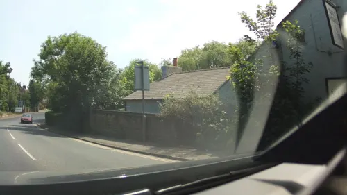
The Malt Shovel
Bar and pub · 1.4 mi
69 Iver Lane, Uxbridge
Mo-Tu 12:00-22:00; We-Fr 12:00-23:00; Sa 09:00-23:00; Su 09:00-22:30


The Crown
Bar and pub · 1.3 mi
High Street, Uxbridge
Mo-Su 12:00-22:00

The Metropolitan
Bar and pub · 1.5 mi
8,9 Windsor Street, Uxbridge
Mo-Fr 10:00-22:00; Sa-Su 12:00-22:00


Harris + Hoole
Cafe · Coffee Shop · 1.5 mi
High Street, Uxbridge
Mo-Fr 07:00-17:00; Sa 08:00-17:00; Su 09:00-17:00

Caffè Nero
Cafe · Coffee Shop · 1.4 mi
185-186 High Street, Uxbridge
Mo-Fr 06:45-19:00; Sa 07:30-19:00; Su 08:00-18:30

The Fig Tree
Bar and pub · 1.5 mi
49 Windsor Street, Uxbridge
Mo-Th 11:00-23:00; Fr-Sa 11:00-01:00; Su 12:00-23:00
77 more on the map.
History
The name Hillingdon appears in the Domesday Book (1086) as Hillendone, possibly meaning "hill of a man named Hille". The name could also mean 'hill of a woman named Hilda'.
Hillingdon was an ancient parish, and had within it the chapelry of Uxbridge, which became a separate civil parish in 1866. When a local board of health was created for Uxbridge, the western part of Hillingdon parish was included within it. Under the Local Government Act 1894, Hillingdon parish was divided in two along the boundary of the board of health district. Hillingdon West became, with Uxbridge, part of the Uxbridge Urban District. Hillingdon East, now governed by the Hillingdon East Parish Council, became part of the Uxbridge Rural District. Uxbridge Rural District and the parish council were abolished in 1928, with the Hillingdon East parish being added to the Uxbridge Urban District. Both Hillingdon East and Hillingdon West parishes were abolished in 1938 and added to Uxbridge parish. In 1965, under the London Government Act 1963, Hillingdon became the name of the westernmost borough of Greater London. At the 1891 census (the last before the abolition of the parish), Hillingdon had a population of 10,797.
Read more of the history
The A40 (Western Avenue) was rerouted in the early 1990s to run slightly north of its original route, thereby allowing traffic to flow without interruption at the junction of Hillingdon Circus. Hillingdon tube station was required to be demolished in order for the new road to be constructed, and a new station was opened further south along the line in 1994, winning the Underground Station of the Year award for that year.
From the History section of Hillingdon on Wikipedia, under CC BY-SA 4.0.
More about Hillingdon
Education
Primary schools in Hillingdon include Oak Farm Juniors, St Bernadette's Roman Catholic Primary School, St Helen's College, Hillingdon Primary and Ryefield Primary.
Secondary schools, ACS Hillingdon, Bishopshalt School, Oak Wood School, Vyners School and Swakeleys School for Girls.
Moorcroft School in Colham Green is a special school, run by the Eden Academy Trust. It was formerly located at Moorcroft Park on Harlington Road, the old Moorcroft House hospital site.
From the Wikipedia article Hillingdon, under CC BY-SA 4.0.
Notable people from Hillingdon
 James CordenEnglish actor, comedian, singer and television host (born 1978)Photo: iDominick, CC BY-SA 2.0
 Ray WilkinsEnglish footballer and manager (1956-2018)Photo: Mattythewhite, CC BY-SA 3.0
 Tariq LampteyGhanaian association football playerPhoto: jamesboyes, CC BY 2.0
 Alfie MawsonEnglish association football player (born 1994)Photo: https://www.flickr.com/photos/cfcunofficial/, CC BY-SA 2.0
 Dane ScarlettEnglish footballerPhoto: Timmy96, CC0
 Alex HalesEnglish cricketerPhoto: Amal316, CC BY-SA 4.0
 Heidi LongBritish rowerPhoto: Ailura, CC BY-SA 3.0 at
 Nathan BishopEnglish association football playerPhoto: Timmy96, CC0
 Gavin FreeEnglish actor, filmmaker, and Internet personalityPhoto: Daniel Benavides, CC BY-SA 2.0
 Claire RichardsBritish singerPhoto: Jordanlloydb, CC BY-SA 4.0
 Michael Anderson, Jr.English actorPhoto: NBC, Public domain
- Henry JackmanEnglish composer (born 1974)
Born in Hillingdon, according to Wikidata (CC0). Each name links to its Wikipedia article.
Where to stay7
Churches and places of worship22
Shopping20
Gas and EV charging4
Schools, colleges and libraries51
Healthcare10
Map of Hillingdon
250 places. The map loads OpenStreetMap tiles when you open it.
Getting there and nearby towns
RAF Northolt (NHT) is the nearest airport with scheduled flights listed in OpenStreetMap, 2 miles away.
- Ickenham 2 mi north, about 4 min by car
- West Drayton 2 mi south, about 4 min by car
- Ruislip 3 mi northeast, about 5 min by car
- Northolt 4 mi east, about 6 min by car
- Pinner 5 mi northeast, about 8 min by car
- Harrow 6 mi northeast, about 10 min by car
- Slough 6 mi west, about 10 min by car
- Stanwell 6 mi south, about 9 min by car
- Northwood 6 mi north, about 9 min by car
- Sudbury 6 mi east, about 9 min by car
Drive times are estimates from straight-line distance, not routes.
Towns near Hillingdon


Keep exploring
Local news
Headlines from INDB.
Reviews, tips and questions
Loading what members have shared...
Sources and licences
- GeoNames (CC BY 4.0): population, coordinates, regions and time zone
- Mapillary (see each image): photos
- OpenStreetMap contributors (ODbL 1.0): places, airports, map data
- Wikidata (CC0 1.0): elevation, founding date, time zone, website, landmarks and historic places
- Wikimedia Commons (see each image): photos
- Wikipedia (CC BY-SA 4.0): overview and history text
Photo credits
- Hillingdon Court Park - Aimee Atkinson, Missy Atko, CC BY 2.0
- Hayes, The Beck Theatre, Nigel Cox, CC BY-SA 2.0
- Compass Theatre, Ickenham - April 2011, Harrison49, CC BY-SA 3.0
- Down Barns Moated Site 2, Dudley Miles, CC BY-SA 3.0
- Ickenham Marsh flooded, Chiswick Chap, CC BY-SA 3.0
- Kingcup Meadows 4, Dudley Miles, CC BY-SA 4.0
- Small Red-eyed Damselfly (2817634173), Alastair Rae from London, United Kingdom, CC BY-SA 2.0
- Yeading Brook in Ten Acre Wood, Dudley Miles, CC BY-SA 3.0
- Hayes (Hillingdon) St Mary from ENE GeoUK 1686342, John Salmon, CC BY-SA 2.0
- St Giles' Church - April 2011, Harrison49, CC BY-SA 3.0
- Plotting Table, Danielstirland at English Wikipedia, CC0
- London Borough of Hillingdon - The Crown - 20240923042208, Suntooooth, CC BY-SA 4.0
- Queens Head, Uxbridge, UB8 (7970436216), Ewan Munro from London, UK, CC BY-SA 2.0
- Three Tuns, Uxbridge, UB8 (7970435198), Ewan Munro from London, UK, CC BY-SA 2.0
- St. Jerome, Dawley, designed by J. Harold Gibbons 1933, in 2013, Rodolph, CC BY-SA 3.0
- Stockley Park 1, Jones44444, CC BY-SA 4.0
- Islip Manor Meadows 6, Dudley Miles, CC BY-SA 3.0
- Gutteridge Wood 5, Dudley Miles, CC BY-SA 3.0
- St John The Baptist Church HDR 26502661366, cchana from London, UK, CC BY-SA 2.0
- London - panoramio (252), Liutauras Dirse, CC BY-SA 3.0
- St John The Baptist Church 23962019553, cchana from London, UK, CC BY-SA 2.0
- Metropolitan, Uxbridge, UB8 (7970437056), Ewan Munro from London, UK, CC BY-SA 2.0
- Street-level photo, southglos, CC BY-SA 4.0
- Street-level photo, RyanBush, CC BY-SA 4.0
- Street-level photo, RyanBush, CC BY-SA 4.0
- Street-level photo, RyanBush, CC BY-SA 4.0
- Street-level photo, southglos, CC BY-SA 4.0
- Street-level photo, southglos, CC BY-SA 4.0
- Street-level photo, RyanBush, CC BY-SA 4.0
- Street-level photo, RyanBush, CC BY-SA 4.0
- Street-level photo, gabywasser, CC BY-SA 4.0
- Street-level photo, laye, CC BY-SA 4.0


Page built November 10, 2026. Spotted a mistake? Tell us or suggest a place.