


Northolt, United Kingdom
Northolt is a town of 26,000 people in England, United Kingdom.
Why visit Northolt
Townapedia lists 8 museums and landmarks, 57 parks and trails, 128 places to eat, 3 places to stay and 5 attractions in and around town.
Highlights include Beck Theatre, Compass Theatre, Down Barns Moated Site and Headstone Manor.
Weather in Northolt
Forecast from MET Norway (CC BY 4.0). Full forecast
About Northolt
Northolt is a town in West London, England, spread across both sides of the A40 trunk road. It is 11 mi (17.7 km) west-northwest of Charing Cross and is one of the seven major towns that make up the London Borough of Ealing. It had a population of 30,304 at the 2011 UK census.
From the Wikipedia article Northolt (this version), under CC BY-SA 4.0.
Photos of Northolt


Things to do5

Beck Theatre
Cinema and theater · 3.0 mi
Theatre in Hayes, London, England

Compass Theatre
Cinema and theater · 3.3 mi
Theatre in Ickenham, Hillingdon, London, England

Grosvenor Theatre
Cinema and theater · 1.8 mi
Former cinema and theatre in Harrow, London, now a Zoroastrian Centre

Windmill Bridge
Bridge · 3.1 mi
Also known as 'The Three Bridges'. Designed by Isambard K Brunel. Road, rail and canal intersect at this bridge.

Open Air Theatre, Barra Hall Park
Cinema and theater · 3.2 mi
Open-air theatre in Barra Hall Park, Hayes, London, England
Museums and landmarks8

Down Barns Moated Site
Monument and historic site · 1.5 mi
Moated site in Northolt, London Borough of Ealing, England, UK

Headstone Manor
Museum · 3.2 mi
Grade I listed manor house in the London Borough of Harrow, England,UK

Headstone Manor and Museum
Museum · 3.2 mi
Museum in London Borough of Harrow, United Kingdom

Heath Robinson Museum
Museum · 3.1 mi
Museum in northwest London, United Kingdom, about W. Heath Robinson



Polish Air Force Memorial
Monument and historic site · 1.4 mi
War memorial in South Ruislip, London Borough of Hillingdon, United Kingdom
Parks, trails and playgrounds57


Grove Farm
Park · 1.2 mi
Local Nature Reserve in the London Borough of Ealing, England, UK


Litten Nature Reserve
Park · 1.4 mi
Nature reserve in London, England

Norman Leddy Memorial Gardens
Park · 3.1 mi
Park in Hayes, United Kingdom


Northala Fields
Park · 0.7 mi
Park located in Northolt, in the London Borough of Ealing
Kensington Road, Northolt
Barra Hall Park
Park · 3.2 mi
Park in the London Borough of Hillingdon, UK

45 more on the map.
Restaurants and cafes128
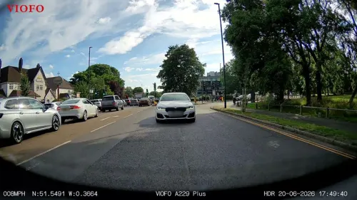
The Mandeville Arms
Diner · American
57-59 Mandeville Road, Northolt
Fr-Sa 09:00-23:00; Su-Th 09:00-22:00
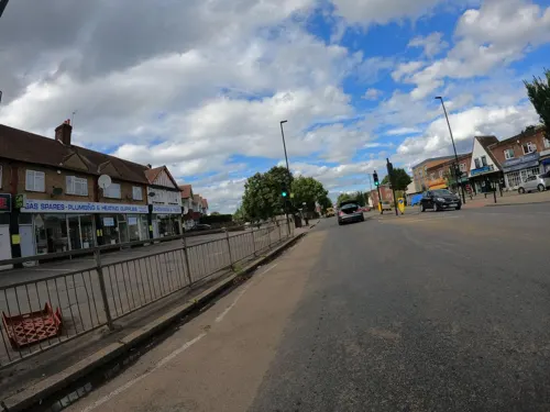
Big Boys Cafe
Cafe · Breakfast · 1.4 mi
329 Greenford Road, Greenford
Mo-Sa 07:00-16:00; Su 09:00-14:30

Starbucks
Cafe · Coffee Shop · 1.1 mi
Tillermans Court, Grenan Square, Greenford
Mo-Sa 07:00-20:00; Su 08:00-19:00

Almahmud Restaurant
Restaurant · Lebanese · 1.4 mi
584 Greenford Road, Greenford

Crispy Dosa
Restaurant · Asian · 1.2 mi
1280 Greenford Road, Greenford
116 more on the map.
History
The earliest record of Northolt is in 872 as the Anglo Saxon norð healum, where norð is North and healum (or hale) is a nook, corner, or retreat,. By 1610, the Name Northolt appears, with in this case, holt having no relationship with 'wood', but an evolution of hala, hale, hal, hall, halle and holt.
Archaeological evidence suggests that the settlement's origin was an 8th-century Saxon village close to Northolt Manor behind the present Court Farm Road. It is mentioned in the Domesday Book as Northala, part of the Elthorne Hundred in the historic county of Middlesex, England. In 1066 the lord was Esger the constable, and in 1086 was Geoffrey de Mandeville. Northolt Manor itself was built in the fourteenth century and provides much of the archeological information of the area from its excavations in the 1950s and onward. A Tudor barn built in 1595 from Smith's farm in Northolt was moved to Chiltern Open Air Museum and is now on display there. In the early part of the 18th century farmland was enclosed in order to provide hay for the City of London, alongside more traditional crops such as peas and beans. Up to late Victorian times, the area was rural with predominantly arable crops being grown.
Read more of the history
1795 saw parliamentary approval for construction of Paddington Arm of the Grand Junction Canal later becoming part of the Grand Union Canal. The route from Hayes to Paddington passes through Northolt, opening on 10 July 1801. The Great Central Railway line (now the Chiltern Line) opened in 1906, passing through Northolt on its way from Marylebone to High Wycombe. However, it wasn't until 1926 that a station opened at Northolt Park. 1906 also saw the Great Western Railway's New North Main Line pass through south of Great Central Railway on its way to Birmingham. The following year Northolt Halt opened on it, eventually becoming Northolt station. In 1948 an extension to the Central line, transformed it into Northolt tube station.
In May 1915 the Royal Flighing Corp established an airfield in neighbouring South Ruislip in the London Borough of Hillingdon, Most early RAF airfields were named after the nearest railway station; in this case Northolt Junction, (now South Ruislip), so it became RAF Northolt.
WW1 also brought an urgent need for more munitions, and in 1915 the Ministry of Munitions created many national munition factories. The National Filling Factory No 7 in Hayes, Middlesex had an explosives magazine at Northolt which was completed late in 1916. This 93-acre site had 20 stores, each able to hold 100 tons of explosives, and was connected by a rail spur at Northolt Junction station. The location was just north-east of the current Ruislip Gardens station, with the rail spur on the south side of Yeading Brook, and the magazines connected by trolleyways on the north side. About 100 tons of explosives per day were sent by rail to Hayes for filling artillery shells - both the Hayes factory and the magazine were removed after the war ended.
Suburban development began in the 1920s. Most of the housing north of the Western Avenue was built in the 1920s–1930s, and is in the private housing sector. Most of the housing built to the south of the Western Avenue was built in the 1960s–1970s, and is in the social housing sectors, particularly along the Kensington and Ruislip Roads.
Two important transport links run through Northolt: the Paddington Arm of the Grand Union Canal and the modern A40 road.
In the 21st century, a new large private housing development was built on the former site of the Taylor Woodrow company, adjacent to the Grand Union Canal. This development is known as "Grand Union Village" and incorporates a new canal boat marina.
From the History section of Northolt on Wikipedia, under CC BY-SA 4.0.
More about Northolt
Geography
Northolt is in the north-western corner of Ealing, bordering the boroughs of Harrow and Hillingdon. The centre of Northolt lies at an elevation of about 130 ft (40 m) above sea level. It is hillier in the north (up to about 200 ft (60 m)) whereas the south is lower, about 115 ft (35 m). The town is mainly suburban, with some industrial land to the east (by the Grand Union Canal), large green parts such as Lime Tree Park and Rectory Park, and semi-rural land to the west
Northolt is located 3.3 mi (5.3 km) from Hayes; 2.4 mi (3.9 km) from Southall; 1.4 mi (2.3 km) from Greenford; 3.1 mi (5.0 km) from Wembley; 2.7 mi (4.3 km) from Harrow; 2.8 mi (4.5 km) from Ruislip; and 4.5 mi (7.2 km) from Uxbridge.
From the Wikipedia article Northolt, under CC BY-SA 4.0.
Notable people from Northolt
- Raymond Harrisonfencer
- Christina BoxerEnglish middle-distance runner
- Danny HutchinsBritish footballer (born 1989)
- Dave PearceEnglish professional footballer (born 1959)
- Peter ShawEnglish footballer (born 1956)
- Mike Trussonfootballer (born 1959)
- Ewan David AlmanBritish actor and rapper
Born in Northolt, according to Wikidata (CC0). Each name links to its Wikipedia article.
Where to stay3
Churches and places of worship44
Saint Gregory The Great
Church · Roman Catholic · 1.5 mi
447 Victoria Road, Ruislip
Shopping39
Gas and EV charging11
Schools, colleges and libraries48
The Edward Betham Church of England Primary School
School · Anglican · 1.2 mi
Oldfield Lane South, Greenford
William Perkin Church of England High School
School · Anglican · 1.0 mi
Oldfield Lane North, Greenford
Healthcare20
Ash Tree Clinic - Harrow CAMHS
Clinic and pharmacy · 1.1 mi
322, 324, 326 Northolt Road, Harrow
Map of Northolt
250 places. The map loads OpenStreetMap tiles when you open it.
Getting there and nearby towns
RAF Northolt (NHT) is the nearest airport with scheduled flights listed in OpenStreetMap, 2 miles away.
- Sudbury 2 mi east, about 3 min by car
- Harrow 3 mi northeast, about 4 min by car
- Ruislip 3 mi northwest, about 5 min by car
- Pinner 3 mi north, about 5 min by car
- Northwood 5 mi northwest, about 8 min by car
- West Drayton 5 mi southwest, about 9 min by car
- Richmond 7 mi southeast, about 11 min by car
- Watford 7 mi north, about 12 min by car
- Rickmansworth 8 mi northwest, about 13 min by car
- London 11 mi east, about 17 min by car
Drive times are estimates from straight-line distance, not routes.
Towns near Northolt


Keep exploring
Local news
Headlines from INDB.
Reviews, tips and questions
Loading what members have shared...
Sources and licences
- GeoNames (CC BY 4.0): population, coordinates, regions and time zone
- Mapillary (see each image): photos
- OpenStreetMap contributors (ODbL 1.0): places, airports, map data
- Wikidata (CC0 1.0): elevation, founding date, time zone, website, landmarks and historic places
- Wikimedia Commons (see each image): photos
- Wikipedia (CC BY-SA 4.0): overview and history text
Photo credits
- Northolt station entrance, R/DV/RS, CC BY 2.0
- Northolt roundel 2008-07-26, R/DV/RS, CC BY 2.0
- Disused, freight and LUL lines at Northolt, R/DV/RS, CC BY 2.0
- Disused and BR freight tracks at Northolt, R/DV/RS, CC BY 2.0
- Raised traffic signals at Northolt, R/DV/RS, CC BY 2.0
- Northolt station (via subway), R/DV/RS, CC BY 2.0
- Underground roundel at Northolt, R/DV/RS, CC BY 2.0
- Northolt station (4495237864), Ewan Munro from London, UK, CC BY-SA 2.0
- Hayes, The Beck Theatre, Nigel Cox, CC BY-SA 2.0
- Compass Theatre, Ickenham - April 2011, Harrison49, CC BY-SA 3.0
- Ace Cinema, Rayners Lane, Bernard Burns, CC BY-SA 3.0
- Brunel's road, canal and rail bridge (Three Bridges), Smeashy, CC BY-SA 4.0
- Down Barns Moated Site 2, Dudley Miles, CC BY-SA 3.0
- Headstone Manor, Bernard Burns, CC BY-SA 3.0
- Harrow Museum Tithe Barn, Bernard Burns, CC BY-SA 3.0
- Heath Robinson Museum exterior 2 by Tom Fish, Sharonpink2, CC BY-SA 4.0
- Grove Farm, Ealing 1, Dudley Miles, CC BY-SA 3.0
- Ickenham Marsh flooded, Chiswick Chap, CC BY-SA 3.0
- Litten Local Nature Reserve, Dudley Miles, CC BY-SA 3.0
- Small Red-eyed Damselfly (2817634173), Alastair Rae from London, United Kingdom, CC BY-SA 2.0
- Northwick Park open space and hospital, David Howard, CC BY 2.0
- St John the Baptist's Church, Pinner, Middlesex (3960273702), Robert Cutts from Bristol, England, UK, CC BY 2.0
- Hayes (Hillingdon) St Mary from ENE GeoUK 1686342, John Salmon, CC BY-SA 2.0
- 1940 1945 Polish War Memorial view from the east, SovalValtos, CC BY-SA 3.0
- Fox Wood, Ealing 1, Dudley Miles, CC BY-SA 3.0
- Islip Manor Meadows 6, Dudley Miles, CC BY-SA 3.0
- Gutteridge Wood 5, Dudley Miles, CC BY-SA 3.0
- Tower crane at Mandeville Road Vent Shaft 2026-01-07, Brett Jordan, CC BY 4.0
- Free Bill Stickers!, R/DV/RS, CC BY 2.0
- Tower crane at Mandeville Road Vent Shaft 2026-11-02, Brett Jordan, CC BY 4.0
- Worksite at Mandeville Road Vent Shaft - 2026-01-07, Brett Jordan, CC BY 4.0
- Worksite at Mandeville Road Vent Shaft 2026-01-07, Brett Jordan, CC BY 4.0
- Tower crane at Mandeville Road Vent Shaft - 2026-01-07, Brett Jordan, CC BY 4.0
- Northolt Manor House site, Dudley Miles, CC BY-SA 3.0
- Street-level photo, RyanBush, CC BY-SA 4.0
- Street-level photo, RyanBush, CC BY-SA 4.0
- Street-level photo, laye, CC BY-SA 4.0
- Street-level photo, RyanBush, CC BY-SA 4.0
- Street-level photo, RyanBush, CC BY-SA 4.0
- Street-level photo, RyanBush, CC BY-SA 4.0
- Street-level photo, firefishy, CC BY-SA 4.0
- Street-level photo, milhouse, CC BY-SA 4.0
- Street-level photo, milhouse, CC BY-SA 4.0
- Street-level photo, gness, CC BY-SA 4.0
- Street-level photo, milhouse, CC BY-SA 4.0
- Street-level photo, laye, CC BY-SA 4.0


Page built November 10, 2026. Spotted a mistake? Tell us or suggest a place.