


West Drayton, United Kingdom
West Drayton is a town of 14,370 people in England, United Kingdom.
Why visit West Drayton
Townapedia lists 13 museums and landmarks, 27 parks and trails, 82 places to eat, 16 places to stay and 2 attractions in and around town.
Highlights include Beck Theatre, Open Air Theatre, Barra Hall Park, Harmondsworth Great Barn and Harlington War Memorial.
Weather in West Drayton
Forecast from MET Norway (CC BY 4.0). Full forecast
About West Drayton
West Drayton is a suburban town in the London Borough of Hillingdon. It was an ancient parish in the county of Middlesex and from 1929 was part of the Yiewsley and West Drayton Urban District, which became part of Greater London in 1965. The settlement is near the Colne Valley Regional Park and its centre lies 1.9 miles (3 km) north of Heathrow Airport.
From the Wikipedia article West Drayton (this version), under CC BY-SA 4.0.
Photos of West Drayton


Things to do2

Beck Theatre
Cinema and theater · 2.4 mi
Theatre in Hayes, London, England

Open Air Theatre, Barra Hall Park
Cinema and theater · 2.3 mi
Open-air theatre in Barra Hall Park, Hayes, London, England
Museums and landmarks13




1 more on the map.
Parks, trails and playgrounds27

Arthur Jacob Nature Reserve
Park · 3.3 mi
Local nature reserve located in Horton

Crane Meadows
Park · 2.9 mi
Nature reserve in London, England, United Kingdom


Norman Leddy Memorial Gardens
Park · 2.4 mi
Park in Hayes, United Kingdom

Stockley Park
Park · 1.2 mi
Pioneering suburban business and public park in the United Kingdom
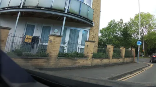


Barra Hall Park
Park · 2.2 mi
Park in the London Borough of Hillingdon, UK

Stockley Country Park
Park · 1.3 mi
Country Park managed by Stockley Park Golf Club including 18 hole Par 72 golf course.
15 more on the map.
Restaurants and cafes82
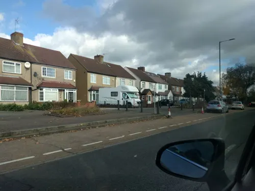

Railway Arms
Bar and pub · 0.7 mi
1 Station Road, West Drayton
Mo-Su 11:00-23:00

The Crown
Bar and pub · 0.9 mi
High Street, West Drayton
Mo-Sa 12:00-23:00; Su 12:00-22:30

The Five Bells
Bar and pub · 0.9 mi
High Street, West Drayton
Mo-Th 12:00-23:00; Fr-Sa 12:00-00:00; Su 12:00-22:30
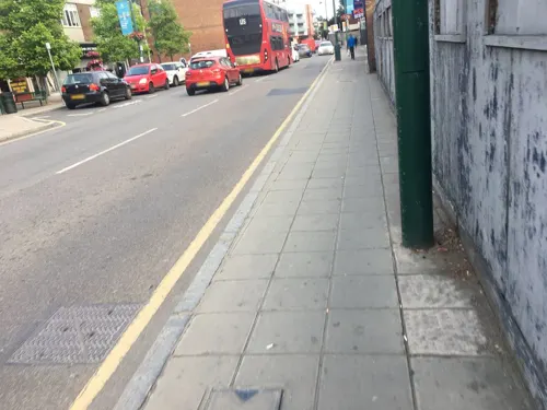

London Hong Kong
Restaurant · Chinese · 1.3 mi
388 Bath Road, West Drayton
Mo-Sa 11:30-23:00; Su 11:30-22:30
Palace Tandoori
Restaurant · Indian · 0.5 mi
113 Station Road, West Drayton
Mo-Su 12:00-14:00, 17:30-23:00
Punjab Sweets & Spices
Restaurant · Indian · 0.7 mi
4 Station Road, West Drayton
Mo-Fr 09:00-22:00; Sa-Su 09:00-23:00
Ravvi Spice
Restaurant · Pakistani · 0.6 mi
39 Station Road, West Drayton
Mo-Fr 11:00-23:00; Sa 10:00-23:00; Su 10:00-22:00
Sipson Tandoori
Restaurant · Indian
5,9 Harmondsworth Road, West Drayton
Mo-Su 12:00-14:00, 17:00-22:30


The Cat & Fiddle
Bar and pub
162 Rowan Road, West Drayton
Mo-Tu 12:00-22:00; We-Th 14:00-22:00; Fr 14:00-00:00; Sa...
70 more on the map.
History
The first record of West Drayton is from 939 when Æthelstan, King of the English, gave the Manor of West Drayton to the Dean and Chapter of Cathedral church of St Pauls, recorded in the Cartularium Saxonicum.
In the 1086 Domesday Book, West Drayton was assessed at ten hides with land suitable for six ploughs. The Parish had 17 landowners which indicated a population of less than 100. In 1461 a separate smaller manor, Drayton and Colham Garden Manor was first recorded, lying between Swan road and Colham Mill road. Both manors shared St Martin's Parish Church. Until 1525 West Drayton Manor was managed on behalf of the Dean and Chapter of St Paul's by an appointment known as a Firmarius who was responsible for the day-to-day running of the estate.
From 1525 St Paul's began leasing West Drayton Manor to tenants. From 1537 the lessee of the manor was William Paget who held high office of state in the court of Henry VIII. On 1 April 1546, the Dean and Chapter of St Paul's released the Manor of West Drayton to the Crown and two weeks later Henry granted the manor to the now knighted Sir William Paget. In the same year Henry granted Paget six manors in his native Staffordshire. Henry died in January 1547. Paget was made a peer of the realm as Lord Paget of Beaudesert by Edward VI in 1549.
Read more of the history
While he was leasing the manor William Paget used the existing building of St Pauls which was situated near St Martin's Parish church. Paget described the building as his "cotage at Drayton". Once owning the manor he built a new manor house, completed by 1549, which occupied the western end of the churchyard. The Manor grounds contained the Church, ornamental gardens, stables, a dovecote and other outbuildings and was enclosed by a high brick wall and two gatehouses. The wall and one of the gatehouses can still be seen today. The construction of the manor house and grounds resulted in the demolition of villagers' homes on Church Road and building on the graves of generations of West Drayton people in the churchyard. In addition to this, Paget enclosed 150 acres of common land to add to his demesne. In 1550 Paget legalised his position by obtaining a royal pardon for his actions. The loss of the Parish churchyard was compensated for by the granting of an alternative burial site which was situated on the eastern side of where Drayton Hall is today. The burial site was used until 1888.
After serving as Lord Privy Seal under Mary I, poor health meant William Paget played little part in public life after the accession of Queen Elizabeth I in 1558, although as a Privy Councillor his advice was often sought. He died in West Drayton on 9 June 1563. He was succeeded by his son Henry, who died five years later without male issue. Henry's brother Thomas became the 3rd Baron Paget in 1568.
Thomas Paget (1544–1590) and his brother Charles were both devout Roman Catholics, and would not conform to the Protestant religion of Queen Elizabeth I.
Aided by Henry Percy, Paget fled to Paris on the uncovering of the Throckmorton Plot in November 1583, joining Charles who had been in exile there since 1581. The failed conspiracy's plan was for an invasion of England by French forces under the command of Henry, Duke of Guise, financed by Philip II of Spain. English Catholics would then rise up and depose Elizabeth, placing Catholic Mary, Queen of Scots on the English throne.
After his flight to France Elizabeth issued a proclamation commanding Thomas Paget to return to England. In June 1584 a formal demand for the surrender of Paget was made to Henry III, King of France through the English ambassador, which was not carried out.
In 1584 or 1585 Philip II made the decision for Spain to invade England and depose Queen Elizabeth. The ground invasion would be led by Alexander Farnese, Duke of Parma with the majority of troops coming from the Spanish Netherlands. Parma commanded the Army of Flanders which was engaged in fighting England's Protestant Dutch allies.
Paget travelled to Spain and was given a pension of 180 crowns per month by Philip II. He then moved to the Spanish Netherlands where he was consulted by Parma in the planning of the invasion. The endeavour of July–August 1588 to stop England's rise as a maritime power and to force the English and Welsh back to Roman Catholicism failed when the Spanish Armada required to support Parma's passage from the Spanish Netherlands to England was scattered after engagements with the English Navy off the coast of Calais and Gravelines. Thomas Paget would die in Brussels in 1590.
In 1587 Thomas Paget had been attainted of treason by act of parliament. His lands including West Drayton were confiscated by the Crown. Elizabeth granted the manor to her Lord Chancellor, Sir Christopher Hatton for life. Hatton died in 1591 and from 1592 the manor was leased to her Lord Chamberlain, George Carey. Carey became 2nd Baron Hunsdon in 1596 and entertained Elizabeth at the West Drayton Manor House in October 1602.
In the next year 1603, both Elizabeth and George Carey died. With Elizabeth's death, James I, son of Mary Queen of Scots acceded to the English throne. In 1604 James restored the Paget family lands and honours to Thomas Paget's son William. William like James I was a Protestant and had taken part in the successful Anglo-Dutch capture of Cádiz (Gades) in 1596 with Admiral Charles Howard, Sir Walter Raleigh and Robert Devereux, 2nd Earl of Essex. It is believed William Paget received possession of West Drayton Manor in 1610. In 1612 William Paget became an 'Adventurer' (shareholder) and member of the Council of the Virginia Company (London Company) and the Somers Isles Company. The Paget Parish and Paget Island in Bermuda are named after him. He died on 29 August 1629 and is buried in the vault of St Martin's church.
From the History section of West Drayton on Wikipedia, under CC BY-SA 4.0.
More about West Drayton
Geography
West Drayton lies to the south of the Great Western Main Line which run east–west, with Yiewsley lying to the north of the railway line. It lies on the north side of the M4 motorway with the village of Harmondsworth to the south, and is northwest of M4 junction 4 (Heathrow Airport spur). This intersects with the A408 (for Stockley Park and Uxbridge) which forms West Drayton's eastern boundary with Hayes until the Heathrow Express railway line forms this boundary at Prologos Park Heathrow. In this area lay the former hamlet of Stockley, known until 1912 as Starveall or Starvhall. On the western side of West Drayton is the county boundary with Buckinghamshire.
West Drayton railway station is served by the Elizabeth line and Great Western Railway (GWR). The Elizabeth line operates a stopping service between Abbey Wood and Reading and GWR operates a stopping service between London Paddington and Didcot Parkway.
West Drayton has five primary schools, West Drayton Academy, Laurel Lane Primary School, St Martin's CE Primary School, St Catherine Catholic Primary School and Cherry Lane Primary School. The community is served by the Park Academy West London secondary school which is located on Park View Road in Yiewsley.
Arts and culture
The Yiewsley and West Drayton Arts Council maintain the Southlands Arts Centre. They oversee events and promote local creativity. There are many exhibitions, music festivals, and creative endeavours from fine arts, photography, film-making and music groups.
Community events and activities are held at the Yiewsley and West Drayton Community centre on Harmondsworth Road.
The Yiewsley and West Drayton Band is a second section brass band established in 1890 and maintains a year-round programme of concerts and community events.
1381 Squadron (West Drayton & Yiewsley) Royal Air Force Air Cadets are based at Summer Drive.
There are two local amateur football clubs, West Drayton FC and Townmead Youth FC.
The Closes public park has a playground, outdoor gym, Tennis courts and a multi use ball court.
The Colne Valley regional park lies on the western side of West Drayton. Here Frays Island and Mabey's Meadow are Sites of Metropolitan Importance for Nature Conservation and are managed by the London Wildlife Trust.
From the Wikipedia article West Drayton, under CC BY-SA 4.0.
Notable people from West Drayton
- Julian Rhind-TuttEnglish actor
- Moore MarriottEnglish character actor (1885-1949)
- Art WoodBritish musician (1937-2006)
- Louise GammanEnglish basketball player (born 1983)
- Thomas Ekins FullerSouth African journalist and politician (1831–1910)
Born in West Drayton, according to Wikidata (CC0). Each name links to its Wikipedia article.
Where to stay16
Staybridge Suites London - Heathrow Bath Road, an IHG Hotel
Motel and hotel · 1.3 mi
276A Bath Road, West Drayton
Holiday Inn London - Heathrow Bath Road, an IHG Hotel
Motel and hotel · 1.3 mi
276 Bath Road, West Drayton
Ibis Styles London Heathrow Airport Hotel
Motel and hotel · 1.5 mi
272 Bath Road, Hayes
Churches and places of worship17
St George’s Interdenominational Chapel, Heathrow Airport
Church · 2.1 mi
Yiewsley Methodist Church
Church · Methodist · 1.0 mi
Fairfield Road, West Drayton
Shopping12
Gas and EV charging9
Schools, colleges and libraries23
Healthcare5
Map of West Drayton
206 places. The map loads OpenStreetMap tiles when you open it.
Getting there and nearby towns
Heathrow Airport (LHR) is the nearest airport with scheduled flights listed in OpenStreetMap, 2 miles away.
- Slough 6 mi west, about 9 min by car
- Windsor 6 mi west, about 9 min by car
- Harrow 8 mi northeast, about 13 min by car
- Weybridge 9 mi south, about 14 min by car
- Watford 11 mi north, about 18 min by car
- Woking 13 mi south, about 21 min by car
- Worcester Park 13 mi southeast, about 20 min by car
- City of Westminster 14 mi east, about 23 min by car
- London 15 mi east, about 24 min by car
- Archway 15 mi east, about 24 min by car
Drive times are estimates from straight-line distance, not routes.
Towns near West Drayton


Keep exploring
Local news
Headlines from INDB.
Reviews, tips and questions
Loading what members have shared...
Sources and licences
- GeoNames (CC BY 4.0): population, coordinates, regions and time zone
- Mapillary (see each image): photos
- OpenStreetMap contributors (ODbL 1.0): places, airports, map data
- Wikidata (CC0 1.0): elevation, founding date, time zone, website, landmarks and historic places
- Wikimedia Commons (see each image): photos
- Wikipedia (CC BY-SA 4.0): overview and history text
Photo credits
- Fox and Pheasant, West Drayton, UB7, Ewan-M, CC BY-SA 2.0
- West Drayton Drayton Hall 2, Jones44444, CC BY-SA 4.0
- Hayes, The Beck Theatre, Nigel Cox, CC BY-SA 2.0
- Arthur Jacob Nature Reserve at Horton, Berkshire, Nathan Harvey, CC BY-SA 4.0
- Small Red-eyed Damselfly (2817634173), Alastair Rae from London, United Kingdom, CC BY-SA 2.0
- Hayes (Hillingdon) St Mary from ENE GeoUK 1686342, John Salmon, CC BY-SA 2.0
- StanwellChurch, Maxwell Hamilton from Greater London, England, UK, CC BY 2.0
- Harmondsworth Great Barn interior looking north, Prioryman, CC BY-SA 3.0
- Crown, Harmondsworth, UB7 (9468017208), Ewan Munro from London, UK, CC BY-SA 2.0
- The Five Bells Pub, Harmondsworth, Jim Linwood, CC BY 2.0
- Railway Arms, West Drayton, UB7 (9465244217), Ewan Munro from London, UK, CC BY-SA 2.0
- St Catherine's Church, West Drayton 2024-11-25, Sludge G, CC BY-SA 2.0
- Church of S. Peter & S. Paul, Harlington & war memorial, late August 2013, Rodolph, CC BY-SA 3.0
- Yiewsley St Matthew's Parish Church 2, Jones44444, CC BY-SA 4.0
- Stockley Park 1, Jones44444, CC BY-SA 4.0
- Harmondsworth Great Barn interior, Jim Bush / Pollards Hill Cyclists, CC BY-SA 2.0
- Cranebank path, Dudley Miles, CC BY-SA 3.0
- Yeading Brook in Yeading Brook Meadows 3, Dudley Miles, CC BY-SA 3.0
- Crane Meadows, JoshuaAnthonyGill, CC BY-SA 4.0
- London heathrow 02, Ad Meskens, CC BY-SA 4.0
- London heathrow 03, Ad Meskens, CC BY-SA 4.0
- London heathrow 01, Ad Meskens, CC BY-SA 4.0
- London heathrow 01 (cropped), Ad Meskens, CC BY-SA 4.0
- Southlands Arts Centre in West Drayton - panoramio, Justin Otto, CC BY-SA 3.0
- Street-level photo, laye, CC BY-SA 4.0
- Street-level photo, 4004, CC BY-SA 4.0
- Street-level photo, 4004, CC BY-SA 4.0
- Street-level photo, 4004, CC BY-SA 4.0
- Street-level photo, ebel, CC BY-SA 4.0
- Street-level photo, ebel, CC BY-SA 4.0
- Street-level photo, 4004, CC BY-SA 4.0
- Street-level photo, RyanBush, CC BY-SA 4.0
- Street-level photo, southglos, CC BY-SA 4.0
- Street-level photo, 4004, CC BY-SA 4.0
- Street-level photo, 4004, CC BY-SA 4.0
- Street-level photo, RyanBush, CC BY-SA 4.0
- Street-level photo, 4004, CC BY-SA 4.0
- Street-level photo, tallguy, CC BY-SA 4.0
- Street-level photo, themadcabbie, CC BY-SA 4.0
- Street-level photo, southglos, CC BY-SA 4.0


Page built November 10, 2026. Spotted a mistake? Tell us or suggest a place.