


Why visit Oldham
Townapedia lists 68 museums and landmarks, 86 parks and trails, 160 places to eat, 14 places to stay and 20 attractions in and around town.
Highlights include Belle Vue Zoological Gardens, Hartshead Pike, Gallery Oldham and Tandle Hill.
Weather in Oldham
Forecast from MET Norway (CC BY 4.0). Full forecast
About Oldham
Oldham () is a town in Greater Manchester, England. It lies amongst the Pennines on elevated ground between the rivers Irk and Medlock, 5 miles (8 km) southeast of Rochdale, and 7 miles (11 km) northeast of Manchester City Centre. It is the administrative centre of the Metropolitan Borough of Oldham, which had a population of 242,003 in 2021.
From the Wikipedia article Oldham (this version), under CC BY-SA 4.0.
Travel tips from other travellers: Oldham on Wikivoyage (CC BY-SA 4.0).
Photos of Oldham


Things to do20

Belle Vue Zoological Gardens
Monument and historic site · 6.0 mi
Former zoo, amusement park, exhibition hall complex and speedway in Manchester, England


Oldham Theatre Workshop
Cinema and theater
Youth theatre group based in the north west of England
Greaves Street, Oldham
Tameside Hippodrome
Cinema and theater · 3.7 mi
Theatre and former cinema in Ashton-under-Lyne, Greater Manchester, England, UK
Alhambra Theatre
Cinema and theater · 5.0 mi
Former theatre and cinema in Openshaw, Manchester, England, later a bingo hall and sports venue
Hope Mill Theatre
Cinema and theater · 5.6 mi
Theatre in Manchester, UK
Oldham Coliseum Theatre
Cinema and theater · 0.4 mi
Theatre and former cinema in Oldham, Greater Manchester, England


8 more on the map.
Museums and landmarks68

Gallery Oldham
Museum · 0.4 mi
Art gallery in Greater Manchester, England, United Kingdom
35 Greaves Street, Oldham
Tu-Sa 10:00-17:00; PH off

Tandle Hill
Monument and historic site · 2.5 mi
Hill and country park in Greater Manchester, England

Brownsfield Mill
Monument and historic site · 6.1 mi
Cotton mill in Manchester, England, UK

Brunswick Mill, Ancoats
Monument and historic site · 5.5 mi
Grade II listed mill in Manchester, United Kingdom

Buckton Castle
Monument and historic site · 4.6 mi
12th-century castle in Mossley, Greater Manchester, England, UK

Daily Express Building
Monument and historic site · 6.0 mi
Building in Manchester, England

Greater Manchester Police Museum and Archives
Museum · 6.2 mi
Museum in Manchester, United Kingdom

Jackson's Warehouse
Monument and historic site · 6.2 mi
Warehouse in Manchester, UK


Castleshaw Roman fort
Monument and historic site · 5.6 mi
Roman fort in Saddleworth, Greater Manchester, England, UK
Ellenroad Ring Mill Engine
Museum · 4.2 mi
Stationary steam engine and museum in Milnrow, Rochdale, Greater Manchester, England, UK
Manchester Art Museum
Museum · 5.9 mi
Art museum in Manchester, England, UK (1877-1953)
56 more on the map.
Parks, trails and playgrounds86

Broadhurst Park
Park · 3.2 mi
Park in Manchester, United Kingdom
330 Lightbowne Road, Manchester

Alexandra Park
Park · 0.7 mi
Park in Oldham, Greater Manchester, England, UK

Boggart Hole Clough
Park · 3.8 mi
Park in Manchester, Greater Manchester, UK



Clayton Vale
Park · 4.1 mi
Valley in Clayton, Manchester, England, UK
Crumpsall Park
Park · 5.0 mi
Park in Manchester, Greater Manchester, England
74 more on the map.
Restaurants and cafes160
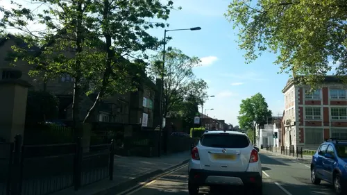
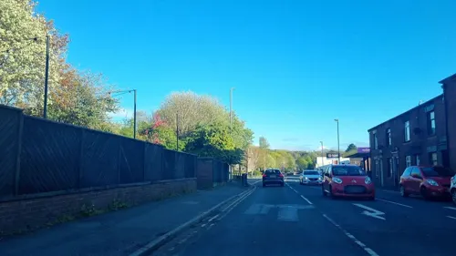
The Courtyard Brewery
Bar and pub · Coffee Shop, Burger, Italian, Chinese, Japanese, Pizza, Asian, Kebab, Sandwich, Mexican, Thai, Chicken · 1.7 mi
Brewpub and function space. rotational street food to eat in or takeaway. 10 rotating beer lines.
1 Shepherd Street, Oldham
Mo-Su 11:00-23:00
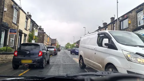
Char Steakhouse
Restaurant · Steak House · 4.2 mi
14 Huddersfield Road, Rochdale
We-Fr 17:00-20:30; Sa 12:30-21:30; Su 13:00-19:00
Desi Lounge
Restaurant · Indian · 3.0 mi
236-238 Oldham Road, Manchester
Mo-Sa 17:00-23:00, Su 17:00-22:00
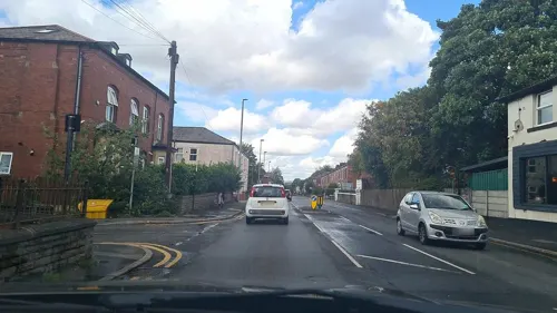
Khau Galli
Restaurant · Indian · 1.1 mi
331 Oldham Road, Oldham
Mo-Th 09:30-22:30; Fr 16:30-22:30; Sa-Su 09:30-22:30
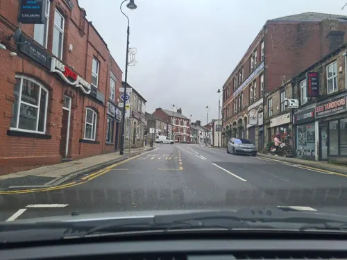
Lees Spice Lounge
Restaurant · Indian · 1.9 mi
73 High Street, Oldham
Mo-Th 17:00-23:00; Fr-Sa 17:00-00:00; Su 15:00-22:00
Pizza Love
Restaurant · Pizza · 4.2 mi
Huddersfield Road, Ashton-under-Lyne
We-Th 04:00-08:00, Fr 16:00-21:00, Sa 12:00-19:00, Su 12:00-20:00
San Rocco
Restaurant · Italian · 1.3 mi
195 Broadway, Oldham
Tu-Fr 12:00-14:30; Tu-Fr 17:00-22:00; Sa-Su 12:00-22:00


Old School Barbecue Bus
Restaurant · American, Barbecue · 1.7 mi
Alford Street, Oldham
We-Th 16:00-22:00; Fr-Sa 12:00-23:00; Su 12:00-22:00

148 more on the map.
History
The toponymy of Oldham seems to imply "old village or place" from Eald (Saxon) signifying oldness or antiquity, and Ham (Saxon) a house, farm or hamlet. Oldham is however known to be a derivative of Aldehulme, undoubtedly an Old Norse name. It is believed by some to be derived from the Old English ald combined with the Old Norse holmi or holmr, meaning "promontory or outcrop", possibly describing the town's hilltop position. It has alternatively been suggested that it may mean "holm or hulme of a farmer named Alda". The name is understood to date from 865, during the period of the Danelaw. Cumbric alt, meaning "steep height, cliff", has also been suggested for the first element.
Read more of the history
The earliest known evidence of a human presence in what is now Oldham is attested by the discovery of Neolithic flint arrow-heads and workings found at Werneth and Besom Hill, implying habitation 7–10,000 years ago. Evidence of later Roman and Celtic activity is confirmed by an ancient Roman road and Bronze Age archaeological relics found at various sites within the town. Placenames of Celtic origin are still to be found in Oldham: Werneth derives from a Celtic personal name identical to the Gaulish vernetum, "alder swamp", and Glodwick may be related to the modern Welsh clawdd, meaning "dyke" or "ditch". Nearby Chadderton is also pre-Anglo-Saxon in origin, from the Old Welsh cadeir, itself deriving from the Latin cathedra meaning "chair". Although Anglo-Saxons occupied territory around the area centuries earlier, Oldham as a permanent, named place of dwelling is believed to date from 865, when Danish invaders established a settlement called Aldehulme.
From its founding in the 9th century until the Industrial Revolution, Oldham is believed to have been little more than a scattering of small and insignificant settlements spread across the moorland and dirt tracks that linked Manchester to York. Although not mentioned in the Domesday Book, Oldham does appear in legal documents from the Middle Ages, invariably recorded as territory under the control of minor ruling families and barons. In the 13th century, Oldham was documented as a manor held from the Crown by a family surnamed Oldham, whose seat was at Werneth Hall. Richard de Oldham was recorded as lord of the manor of Werneth/Oldham (1354). His daughter and heiress, Margery (d.1384), married John de Cudworth (d.1384), from whom descended the Cudworths of Werneth Hall who were successive lords of the manor. A Member of this family was James I's Chaplain, Ralph Cudworth (father of the Cambridge Platonist philosopher Ralph Cudworth). The Cudworths remained lords of the manor until their sale of the estate (1683) to Sir Ralph Assheton of Middleton.
Much of Oldham's history is concerned with textile manufacture during the Industrial Revolution; it has been said that "if ever the Industrial Revolution placed a town firmly and squarely on the map of the world, that town is Oldham." Oldham's soils were too thin and poor to sustain crop growing, and so for decades prior to industrialisation the area was used for grazing sheep, which provided the raw material for a local woollen weaving trade.
By 1756, Oldham had emerged as a centre of the hatting industry in England. The rough felt used in the production process is the origin of the term "Owdham Roughyed" a nickname for people from Oldham. It was not until the last quarter of the 18th century that Oldham changed from being a cottage industry township producing woollen garments via domestic manual labour, to a sprawling industrial metropolis of textile factories. The climate, geology, and topography of Oldham were unrelenting constraints upon the social and economic activities of the human inhabitants. At 700 feet (200 m) above sea level and with no major river or visible natural resources, Oldham had poor geographic attributes compared with other settlements for investors and their engineers. As a result, Oldham played no part in the initial period of the Industrial Revolution, although it did later become seen as obvious territory to industrialise because of its convenient position between the labour forces of Manchester and southwest Yorkshire.
Cotton spinning and milling were introduced to Oldham when its first mill, Lees Hall, was built by William Clegg in about 1778, the beginning of a spiralling process of urbanisation and socioeconomic transformation. Within a year, 11 other mills had been constructed, and by 1818 there were 19 – not a large number in comparison with other local settlements. Oldham's small local population was greatly increased by the mass migration of workers from outlying villages, resulting in a population increase from just over 12,000 in 1801 to 137,000 in 1901. The speed of this urban growth meant that Oldham, with little pre-industrial history to speak of, was effectively born as a factory town.
Oldham became the world's manufacturing centre for cotton spinning in the second half of the 19th century. In 1851, over 30% of Oldham's population was employed within the textile sector, compared to 5% across Great Britain. It overtook the major urban centres of Manchester and Bolton as the result of a mill building boom in the 1860s and 1870s, a period during which Oldham became the most productive cotton-spinning town in the world. In 1871, Oldham had more spindles than any country in the world except the United States, and in 1909, was spinning more cotton than France and Germany combined. By 1911 there were 16.4 million spindles in Oldham, compared with a total of 58 million in the United Kingdom and 143.5 million in the world; in 1928, with the construction of the UK's largest textile factory Oldham reached its manufacturing zenith. At its peak, there were more than 360 mills, operating night and day;
From the History section of Oldham on Wikipedia, under CC BY-SA 4.0.
More about Oldham
Geography
At 53°32′39″N 2°7′0.8″W (53.5444°, −2.1169°), and 164 miles (264 km) north-northwest of London, Oldham stands 700 feet (213 m) above sea level, 6.9 miles (11.1 km) northeast of Manchester city centre, on elevated ground between the rivers Irk and Medlock. Saddleworth and the South Pennines are close to the east, whilst on all other sides, Oldham is bound by other neighbouring towns, including Ashton-under-Lyne, Chadderton, Failsworth, Royton and Shaw and Crompton, with little or no green space between them. Oldham experiences a temperate maritime climate, like much of the British Isles, with relatively cool summers and mild winters. There is regular but generally light precipitation throughout the year. On 23 November 1981, an F1/T2 tornado formed over Hollinwood and later passed over Oldham town centre, causing some damage.
Oldham's topography is characterised by its rugged, elevated Pennine terrain. It has an area of 6.91 square miles (17.90 km2). The geology of Oldham is represented by the Millstone Grit and Coal Measures series of rocks. The River Beal, flowing northwards, forms the boundary between Oldham on one side and Royton and Shaw and Crompton on the other.
Economy
For years Oldham's economy was heavily dependent on manufacturing industry, especially textiles and mechanical engineering. Since the deindustrialisation of Oldham in the mid-20th century, these industries have been replaced by home shopping, publishing, healthcare and food processing sectors, though factory-generated employment retains a significant presence. Many of the modern sectors are low-skill and low-wage.
Oldham's town centre contains the highest concentration of retailing, cultural facilities and employment in the Metropolitan Borough of Oldham. It has been extensively redeveloped during the last few decades, and its two shopping centres, Town Square and the Spindles, now provide one of the largest covered retail areas in Greater Manchester. The Spindles (named with reference to textile spindles) is a modern shopping centre with over 40 retailers, banks, building societies and catering outlets. It houses several of Europe's largest stained glass works, a series of ceilings and skylights created by local artist Brian Clarke in celebration of the life and music of one of Oldham's famous sons, composer and conductor Sir William Walton.
Arts and culture
Oldham, though lacking in leisure and cultural amenities, is historically notable for its theatrical culture. Once having a peak of six "fine" theatres in 1908, Oldham is home to the Oldham Coliseum Theatre and the Oldham Theatre Workshop, which have facilitated the early careers of notable actors and writers, including Eric Sykes, Bernard Cribbins and Anne Kirkbride, daughter of acclaimed cartoonist Jack Kirkbride who worked for the Oldham Evening Chronicle. Oldham Coliseum Theatre is one of Britain's last remaining repertory theatres; Charlie Chaplin and Stan Laurel performed there in the early 20th century, and contemporary actors such as Ralph Fiennes and Minnie Driver, among others, have appeared more recently.
During the 19th century the circus was a popular entertainment in Oldham; Pablo Fanque's circus was a regular visitor, filling a 3,000-seat amphitheatre on Tommyfield in 1869. Formerly criticised for its lack of a cinema, there are plans to develop an "Oldham West End".
Education
Oldham produced someone who is considered to be one of the greatest benefactors of education for the nation, Hugh Oldham, who in 1504 was appointed as Bishop of Exeter, and later went on to found what is now Manchester Grammar School.
University Campus Oldham is a centre for higher education and a sister campus of the University of Huddersfield. It was opened in May 2005 by actor Patrick Stewart, the centre's chancellor. The University Campus Oldham presented actress Shobna Gulati and artist Brian Clarke (both born in Oldham) with an Honorary Doctorate of Letters at the Graduation Ceremony of November 2006, for their achievements and contributions to Oldham and its community.
From the Wikipedia article Oldham, under CC BY-SA 4.0.
Notable people from Oldham
 Brian CoxEnglish physicist and musicianPhoto: Duncan.Hull, CC BY-SA 4.0
 Olivia CookeBritish actress (born 1993)Photo: Patrick.suechan, CC BY-SA 4.0
 William WaltonEnglish composer (1902–1983)Photo: AP Wirephoto, Public domain
 Ian KershawEnglish historian of Nazi Germany (born 1943)Photo: Amrei-Marie, CC BY-SA 3.0
 Carl CoxBritish house and techno DJ producerPhoto: Sergey Kozak, CC BY 2.0
 Bernard CribbinsBritish singer and actor (1928–2022)Photo: Brian Minkoff London Pixels, CC BY-SA 4.0
 Mark OwenEnglish singer-songwriter (born 1972)Photo: Marc E., CC BY 2.0
 Sarah LancashireEnglish actressPhoto: dalekhelen, CC BY-SA 2.0
 Quentin SkinnerBritish historian (1940-)Photo: Peter Stone, CC BY-SA 4.0
 Simon WrightEnglish drummerPhoto: Frank Schwichtenberg, CC BY-SA 4.0
 Warren ClarkeEnglish actor (1947–2014)Photo: Stanley Kubrick, Public domain
- John Julius NorwichBritish historian (1929–2018)
Born in Oldham, according to Wikidata (CC0). Each name links to its Wikipedia article.
Where to stay14
Churches and places of worship79
Shopping75
Gas and EV charging37
Schools, colleges and libraries40
Healthcare36
Map of Oldham
250 places. The map loads OpenStreetMap tiles when you open it.
Getting there and nearby towns
Manchester Airport (MAN) is the nearest airport with scheduled flights listed in OpenStreetMap, 15 miles away.
- Salford 8 mi southwest, about 13 min by car
- Stockport 9 mi south, about 15 min by car
- Wigan 21 mi west, about 34 min by car
- Warrington 22 mi southwest, about 35 min by car
- St Helens 26 mi west, about 42 min by car
- Wakefield 27 mi east, about 44 min by car
- Preston 28 mi northwest, about 46 min by car
- Sheffield 29 mi east, about 47 min by car
- Rotherham 32 mi east, about 52 min by car
- Stoke-on-Trent 37 mi south, about 1 h by car
Drive times are estimates from straight-line distance, not routes.
Towns near Oldham


Keep exploring
Local news
Headlines from INDB.
Reviews, tips and questions
Loading what members have shared...
Sources and licences
- GeoNames (CC BY 4.0): population, coordinates, regions and time zone
- Mapillary (see each image): photos
- OpenStreetMap contributors (ODbL 1.0): places, airports, map data
- Wikidata (CC0 1.0): elevation, founding date, time zone, website, landmarks and historic places
- Wikimedia Commons (see each image): photos
- Wikipedia (CC BY-SA 4.0): overview and history text
Photo credits
- Oldham above Chadderton (2), Matt from Oldham, UK, CC BY 2.0
- Oldham Civic Centre, Tony Grist, CC BY-SA 2.0
- Battery Farm at Easy Fest 2024, Oldham, Greater Manchester, UK, SDWman, CC0
- One Dimensional Creatures at Easy Fest 2024, Oldham, Greater Manchester, UK, SDWman, CC0
- SINKR live at Bank Top Tavern in Oldham 31-08-2024, BKDSte, CC0
- Oldham arms at station, Ian Roberts, CC BY-SA 2.0
- Belle-Vue-guide-circa-late-1800s, Unknown Unknown, Public domain
- Gallery Oldham, SMJ, CC BY-SA 2.0
- Tandal Hill Country Park, michael ely, CC BY-SA 2.0
- Brownfields Mill, Ancoats, Manchester, KJP1, CC BY-SA 3.0
- Brunswick Mill 5217, Photograph by Clem Rutter, Rochester, Kent. ( www.clemrutter.net )., CC BY-SA 3.0
- Buckton Castle (5) (28563211972), Richard Nevell from London, United Kingdom, CC BY-SA 2.0
- Express Building Manchester, Stephen Richards, CC BY-SA 2.0
- Greater Manchester Police Museum, Rept0n1x, CC BY-SA 2.0
- Ancoats-Picadilly Basin Jacksons Warehouse Tariff Street- 4522, Clem Rutter, Rochester, Kent., CC BY-SA 3.0
- Path near Dean Drook Broadhurst Clough, Sophiriel, CC BY-SA 4.0
- Alexandra Park, Peter Hyde, CC BY-SA 2.0
- Boggart hole clough, Boggart hole clough Park and woodland, CC BY-SA 4.0
- River Irk, Chadderton, Roger May, CC BY-SA 2.0
- Manchester Town Hall Colonade, Pimlico Badger, CC BY-SA 2.0
- Albion United Reformed Church, Ashton under Lyne, A. Carty ( talk ), CC BY-SA 3.0
- St Benedict's Church, Ardwick, David Dixon, CC BY-SA 2.0
- Hartshead Pike (1), RandomDan at English Wikipedia, Public domain
- Boundary Park, Original uploader was Narniauk at English Wikipedia, Public domain
- The Witchwood, Ashton-under-Lyne, Alexander P Kapp, CC BY-SA 2.0
- 50card m, Westwood_lad, Public domain
- Christ Church, Chadderton, John Slater, CC BY-SA 2.0
- St John's Church, Hurst, David Dixon, CC BY-SA 2.0
- St Thomas Church Coppice, Paul likes pics, CC BY-SA 3.0
- St Mark's Church, Chadderton, Jeremy Sutcliffe from UK, CC BY-SA 2.0
- First bus (41), Mikey from Wythenshawe, Manchester, UK, CC BY 2.0
- First Manchester bus 60383, Mikey from Wythenshawe, Manchester, UK, CC BY 2.0
- Stannybrook road on daisy nook, Marc A Gibbs, CC BY-SA 4.0
- Street-level photo, adam2, CC BY-SA 4.0
- Street-level photo, mappo2, CC BY-SA 4.0
- Street-level photo, mappo2, CC BY-SA 4.0
- Street-level photo, mappo2, CC BY-SA 4.0
- Street-level photo, mappo2, CC BY-SA 4.0
- Street-level photo, mappo2, CC BY-SA 4.0
- Street-level photo, adam2, CC BY-SA 4.0
- Street-level photo, mappo2, CC BY-SA 4.0
- Street-level photo, mappo2, CC BY-SA 4.0
- Street-level photo, adam2, CC BY-SA 4.0
- Street-level photo, mappo2, CC BY-SA 4.0
- Street-level photo, mappo2, CC BY-SA 4.0
- Street-level photo, mappo2, CC BY-SA 4.0
- Street-level photo, deleted_user, CC BY-SA 4.0
- Street-level photo, adam2, CC BY-SA 4.0
- Street-level photo, mappo2, CC BY-SA 4.0
- Street-level photo, mappo2, CC BY-SA 4.0
- Street-level photo, mappo2, CC BY-SA 4.0
- Street-level photo, mappo2, CC BY-SA 4.0
- Street-level photo, mappo2, CC BY-SA 4.0
- Street-level photo, mappo2, CC BY-SA 4.0
- Street-level photo, mappo2, CC BY-SA 4.0
- Street-level photo, mappo2, CC BY-SA 4.0


Page built November 10, 2026. Spotted a mistake? Tell us or suggest a place.