
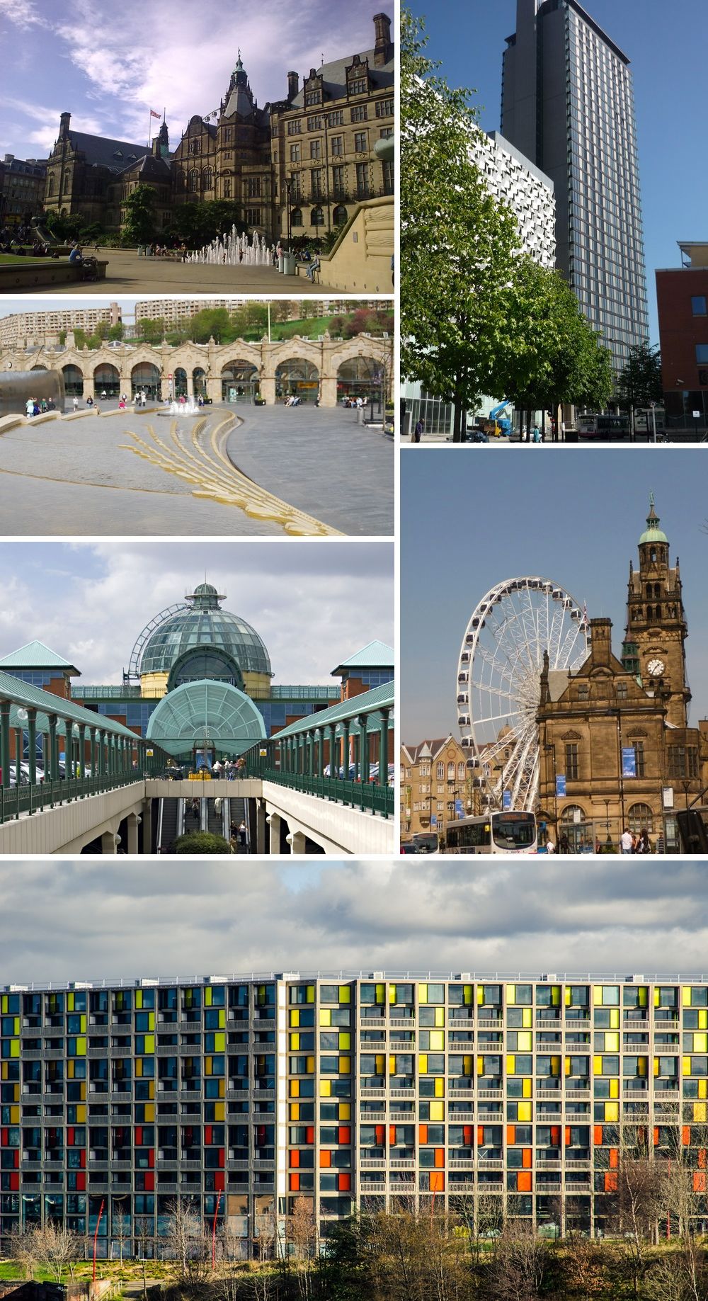


Sheffield, United Kingdom
Sheffield is a city of 556,500 people in England, United Kingdom, founded in 701.
Why visit Sheffield
Townapedia lists 224 museums and landmarks, 180 parks and trails, 337 places to eat, 86 places to stay and 77 attractions in and around town.
Highlights include Showroom Cinema, Cineworld, Bishop's House and Shepherd Wheel.
Weather in Sheffield
Forecast from MET Norway (CC BY 4.0). Full forecast
About Sheffield
Sheffield is a city in South Yorkshire, England, situated 29 miles (47 km) south of Leeds and 32 miles (51 km) east of Manchester. It is the second largest city in Yorkshire and the administrative centre of the larger metropolitan borough of Sheffield, which had an estimated population of 579,517 in 2025.
From the Wikipedia article Sheffield (this version), under CC BY-SA 4.0.
Travel tips from other travellers: Sheffield on Wikivoyage (CC BY-SA 4.0).
Photos of Sheffield


Things to do77

Showroom Cinema
Cinema and theater · 0.4 mi
Mo,Th 10:00-21:00; Tu,We,Fr,Su 11:30-21:00; Sa 10:30-21:00


Stanedge Pole
Monument and historic site · 7.0 mi
Ancient boundary marker dividing Derbyshire and South Yorkshire, England, UK

Crucible Theatre
Cinema and theater
Theatre and event venue in Sheffield, England


Sheffield Theatres
Cinema and theater
Theatre complex in Sheffield, South Yorkshire, England

Abbeydale Picture House
Cinema and theater · 1.7 mi
387 Abbeydale Road, Sheffield



65 more on the map.
Museums and landmarks224


Shepherd Wheel
Museum · 2.7 mi
Former water wheel in Sheffield
Hangingwater Road, Sheffield
Sa,Su 11:00-15:00

Site Gallery
Museum · 0.4 mi
Art gallery in Sheffield, England
1 Brown Street, Sheffield
Tu-Sa 11:00-17:00; Su 11:00-16:00; Mo off

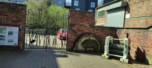
Ken Hawley Collection
Museum · 0.6 mi
Alma Street, Sheffield
Tu-Sa 10:00-16:00; Su 11:00-16:00; Mo off


Yorkshire Natural History Museum
Museum · 2.0 mi
149 Holme Lane, Sheffield
Th-Tu,PH 10:00-16:00; We off

Abbeydale Industrial Hamlet
Museum · 3.9 mi
Hamlet and industrial museum in Sheffield, UK
Th-Sa 10:00-17:00; Su 11:00-16:00
212 more on the map.
Parks, trails and playgrounds180


Millhouses Park
Park · 3.2 mi
Public urban park in Sheffield, England

Oakes Park
Park · 3.4 mi
Privately owned park in Sheffield, South Yorkshire, England, UK

Chelsea Park
Park · 2.2 mi
Park in Nether Edge & Sharrow, United Kingdom
Forge Dam Park
Park · 3.5 mi
Park in Sheffield, South Yorkshire, England
168 more on the map.
Restaurants and cafes337



The Wortley Arms
Bar and pub · 8.0 mi
Halifax Road, Sheffield
We-Th 11:00-22:00; Fr-Sa 10:00-22:00; Su 10:00-19:00



Caffè Nero
Cafe · Coffee Shop
2 High Street, Sheffield
Mo-Fr 06:30-18:30; Sa 07:30-18:30; Su 08:00-18:00
The Cabin
Cafe · Pancake, Waffle, Breakfast, Brunch, Coffee Shop · 0.6 mi
Pancake, waffle and coffee house.
10-12 Fitzwilliam Gate, Sheffield
Mo,We-Su 09:00-16:00; Tu off
The White Lion
Bar and pub · 1.6 mi
615 London Road, Sheffield
Mo-Th 16:00-24:00, Fr,Sa 12:00-01:00, Su 12:00-24:00
The Woodseats Palace
Bar and pub · 2.7 mi
692-696 Chesterfield Road, Sheffield
Su-Th 08:00-24:00, Fr,Sa 08:00-01:00
325 more on the map.
History
The area now occupied by Sheffield is believed to have been inhabited since at least the late Upper Paleolithic, about 12,800 years ago. The earliest evidence of human occupation in the Sheffield area was found at Creswell Crags to the east of the city. In the Iron Age the area became the southernmost territory of the Pennine tribe called the Brigantes. It is this tribe who are thought to have constructed several hillforts in and around Sheffield.
Following the departure of the Romans, the Sheffield area may have been the southern part of the Brittonic kingdom of Elmet, with the rivers Sheaf and Don forming part of the boundary between this kingdom and the kingdom of Mercia. Gradually, Anglian settlers pushed west from the kingdom of Deira. A Britonnic presence within the Sheffield area is evidenced by two settlements called Wales and Waleswood close to Sheffield. The settlements that grew and merged to form Sheffield, however, date from the second half of the first millennium, and are of Anglo-Saxon and Danish origin. In Anglo-Saxon times, the Sheffield area straddled the border between the kingdoms of Mercia and Northumbria. The Anglo-Saxon Chronicle reports that Eanred of Northumbria submitted to Egbert of Wessex at the hamlet of Dore (now a suburb of south west Sheffield) in 829, a key event in the unification of the kingdom of England under the House of Wessex.
Read more of the history
After the Norman conquest of England, insurrection by the populace led to the devastation of the Sheffield area during the Harrying of the North and Sheffield Castle was built to control the ruined local settlements. A small town developed that is the nucleus of the modern city. By 1296, a market had been established at what is now known as Castle Square, and Sheffield subsequently grew into a small market town. In the 14th century, Sheffield was already noted for the production of knives, as mentioned in Geoffrey Chaucer's The Canterbury Tales.
Cardinal Thomas Wolsey stayed at Sheffield Manor for 16–18 days in 1530 when travelling to London to stand trial for high treason. He was hosted by George Talbot, 4th Earl of Shrewsbury. The cardinal was in disgrace about the annulment of Henry VIII and Catherine of Aragon's marriage.
From 1570 to 1584, Mary, Queen of Scots, was imprisoned in Sheffield Castle and Sheffield Manor by George Talbot, 6th Earl of Shrewsbury, the husband of Bess of Hardwick, Countess of Shrewsbury. The Earl is buried in Sheffield Cathedral.
Sheffield by the early 1600s became the main centre of cutlery manufacture in England outside London, overseen by the Company of Cutlers in Hallamshire.
During the 1740s, a form of the crucible steel process was discovered that allowed the manufacture of a better quality of steel than had previously been possible.
In about the same period, a technique was developed for fusing a thin sheet of silver onto a copper ingot to produce silver plating, which became widely known as Sheffield plate. These innovations spurred Sheffield's growth as an industrial town, but the loss of some important export markets led to a recession in the late 18th and early 19th centuries. The resulting poor conditions culminated in a cholera epidemic that killed 402 people in 1832.
The population of the town grew rapidly throughout the 19th century; increasing from 60,095 in 1801 to 451,195 by 1901. The growing population led to the construction of many back-to-back dwellings that, along with severe pollution from the factories, inspired George Orwell in 1937 to write: "Sheffield, I suppose, could justly claim to be called the ugliest town in the Old World". The Sheffield and Rotherham railway was constructed in 1838, connecting the two towns.
The town was incorporated as a borough in 1842, and was granted city status by letters patent in 1893. The influx of people also led to demand for better water supplies, and a number of new reservoirs were constructed on the hills to the west of the town. The collapse of the dam wall of one of these reservoirs in 1864 resulted in the Great Sheffield Flood, which killed 270 people and devastated large parts of the town.
Sheffield has an international reputation for metallurgy and steel-making. The earliest official record of cutlery production, for which Sheffield is particularly well known, is from 1297 when a tax return for 'Robert the Cutler' was submitted. A key reason for Sheffield's success in the production of cutlery lies in its geographic makeup. The abundance of streams in the area provided a source of water power and the geological formations in the Hope Valley, in particular, provided sufficient grit stones for grinding wheels. In the 17th century, the Company of Cutlers in Hallamshire, which oversaw the booming cutlery industry in the area and remains to this day, was established and focused on markets outside the Sheffield area, leading to the gradual establishment of Sheffield as a respected producer of cutlery. This gradually developed from a national reputation into an international one.
Playing a crucial role in the Industrial Revolution, the city became an industrial powerhouse in the 18th century, and was dubbed "Steel City". Many innovations in these fields have been made in Sheffield, for example Benjamin Huntsman discovered the crucible technique in the 1740s at his workshop in Handsworth. This process was rendered obsolete in 1856 by Henry Bessemer's invention of the Bessemer converter. Thomas Boulsover invented Sheffield plate (silver-plated copper) in the early 18th century.
From the History section of Sheffield on Wikipedia, under CC BY-SA 4.0.
More about Sheffield
Geography
Sheffield is located at 53°22′59″N 1°27′57″W. It lies adjacent to Rotherham, from which it is largely separated by the M1 motorway. Although Barnsley Metropolitan Borough also borders Sheffield to the north, the town itself is a few miles further away. The southern and western borders of the city are shared with Derbyshire; in the first half of the 20th century Sheffield extended its borders south into Derbyshire, annexing a number of North Midlands villages, including Totley, Dore and the area now known as Mosborough Townships.
Economy
Millennium Square and St Paul's Place were built in 2010. St Paul's Tower, the tallest building in Sheffield, is in the centre. The St Paul's Place development constitutes a major redevelopment of the area and has attracted numerous large companies to the complex, such as DLA Piper, PwC and Barclays. The Department for Education and the Department for Business, Innovation & Skills have also established a presence within St Paul's Place.
After many years of decline, the Sheffield economy is going through a strong revival. The Sheffield Hallam constituency in 2019 out of 543 parliamentary constituencies came as 536 least deprived, in 2025, 539 making the area one of the most affluent constituencies in England.
A survey by Knight Frank revealed that Sheffield was the fastest-growing city outside London for office and residential space and rents during the second half of 2004.
This is reflected in a surge of redevelopment projects, including the City Lofts Tower and accompanying St Paul's Place, Velocity Living, the Moor redevelopment, the forthcoming New Retail Quarter and the Winter Gardens, Peace Gardens, Millennium Galleries and many projects completed under the Sheffield One redevelopment agency. The Sheffield economy grew from £5.6 billion in 1997 (1997 GVA) to £9.2 billion in 2007 (2007 GVA).
Arts and culture
Sheffield's museums are managed by two distinct organisations. Museums Sheffield manages the Weston Park Museum (a grade II* listed building), Millennium Galleries and Graves Art Gallery. These museums constitute the oldest extant museums in the city, with Graves Art Gallery and Weston Park Museum being gifted to the city by industrialist philanthropists in the 19th and 20th centuries. The Millennium Galleries, being established in the early 2000s, is one of the newest museums and constitutes part of the Heart of the City development, connecting directly to the Winter Garden and Millennium Square. All three museums host a broad range of exhibits which reflect Sheffield's history and numerous other themes, including exhibitions on loan from other major galleries and museums.
Education
Within the city of Sheffield there are two universities, 141 primary schools and 28 secondary schools.
The city's universities are the University of Sheffield and Sheffield Hallam University. The two combined bring about 60,000 students to the city every year. The University of Sheffield is the city's oldest university. It was established in 1897 as University College Sheffield and gained university status in 1905. Its history traces back to Sheffield Medical School found in 1828, Firth College in 1879 and Sheffield Technical School in 1884. The university is one of the original red brick universities and is a member of the Russell Group.
Sheffield Hallam University (SHU) is a university on two sites in Sheffield. City Campus is located in the city centre, close to Sheffield railway station, and Collegiate Crescent Campus is about 2 mi (3.2 km) away, adjacent to Ecclesall Road in south-west Sheffield. Sheffield Hallam University's history goes back to 1843 with the establishment of the Sheffield School of Design. During the 1960s several independent colleges (including the School of Design) joined to become Sheffield Polytechnic (Sheffield City Polytechnic from 1976) and was finally renamed Sheffield Hallam University in 1992.
From the Wikipedia article Sheffield, under CC BY-SA 4.0.
Notable people from Sheffield
 Joe CockerBritish singer (1944–2014)Photo: A & M Records, Public domain
 Harry MaguireEnglish association football player (born 1993)Photo: UK Prime Minister, CC BY 2.0
 Kyle WalkerEnglish association football player (born 1990)Photo: Кирилл Венедиктов, CC BY-SA 3.0
 A. S. ByattBritish writer (1936–2023)Photo: Seamus Kearney, CC BY-SA 3.0
 Dominic WestBritish actorPhoto: Ian Smith from London, England, CC BY-SA 2.0
 Jessica Ennis-HillBritish heptathletePhoto: Barcex, CC BY-SA 4.0
 Simon JohnsonBritish-American economist (born 1963)Photo: John Sears, CC BY-SA 4.0
 Jarvis CockerEnglish singer and musician (born 1963)Photo: Raph_PH, CC BY 2.0
 Margaret DrabbleBritish novelist, biographer, and criticPhoto: summonedbyfells, CC BY 2.0
- Jamie VardyEnglish association football player (born 1987)
- Gordon BanksEnglish association football player (1937–2019)
- Alex TurnerBritish musician (born 1986)
Born in Sheffield, according to Wikidata (CC0). Each name links to its Wikipedia article.
Where to stay86
DoubleTree by Hilton Hotel Sheffield Park
Motel and hotel · 4.1 mi
Chesterfield Road South, Sheffield
Churches and places of worship121
Banner Cross Methodist Church
Church · Methodist · 2.4 mi
12 Ecclesall Road South, Sheffield
Shopping169
Gas and EV charging73
Schools, colleges and libraries87
Emmaus Catholic and CofE Primary School
School · Anglican, Roman Catholic · 1.2 mi
Southend Road, Sheffield
Hathersage St Michael's CofE (Aided) Primary School
School · Anglican · 8.4 mi
School Lane, Hope Valley
Healthcare82
Map of Sheffield
250 places. The map loads OpenStreetMap tiles when you open it.
Getting there and nearby towns
Manchester Airport (MAN) is the nearest airport with scheduled flights listed in OpenStreetMap, 34 miles away.
- Burngreave 1 mi northeast, about 1 min by car
- Fulwood 4 mi southwest, about 7 min by car
- Catcliffe 4 mi east, about 7 min by car
- Rotherham 6 mi northeast, about 9 min by car
- Wakefield 21 mi north, about 33 min by car
- Stockport 29 mi west, about 46 min by car
- Stoke-on-Trent 40 mi southwest, about 1 h by car
- York 43 mi north, about 1 h 15 min by car
- Warrington 46 mi west, about 1 h 15 min by car
- Wigan 49 mi west, about 1 h 15 min by car
Drive times are estimates from straight-line distance, not routes.
Towns near Sheffield


Keep exploring
Local news
Headlines from INDB.
Reviews, tips and questions
Loading what members have shared...
Sources and licences
- GeoNames (CC BY 4.0): population, coordinates, regions and time zone
- Mapillary (see each image): photos
- OpenStreetMap contributors (ODbL 1.0): places, airports, map data
- Wikidata (CC0 1.0): elevation, founding date, time zone, website, landmarks and historic places
- Wikimedia Commons (see each image): photos
- Wikipedia (CC BY-SA 4.0): overview and history text
Photo credits
- Sheffield City, Neil Theasby, CC BY 2.5
- Sheffield Supertram, Castle Square stop, interbeat, CC BY 2.0
- Stanedge Pole and Long Causeway, Mick Knapton, CC BY-SA 3.0
- Sheffield Crucible theatre, St BC at English Wikipedia, CC BY-SA 3.0
- Sheffield Lyceum 18-12-06, Gregory Deryckère, CC BY 2.5
- Bishops House 2011, Chemical Engineer, CC BY-SA 3.0
- Shepherd Wheel, Warofdreams, CC BY-SA 3.0
- Site Gallery, Simon Cobb, CC0
- Crookes Valley Park 1, Mick Knapton, CC BY-SA 3.0
- Endcliffe Park, Sheffield, Shanerounce, CC BY-SA 4.0
- Meersbrook2012, Windeh, CC BY-SA 3.0
- Millhouses Park 040504, Richard Newall, CC BY-SA 2.0
- The Oakes Norton, Harold Armitage, Public domain
- Banner Cross Methodists, Mick Knapton, CC BY-SA 3.0
- Sheffield united bramall lane stadium, Arne Müseler, CC BY-SA 3.0 de
- New York Stadium (23883331196) (2), dom fellowes from UK, CC BY 2.0
- Showroom and Workstation, Sheffield, Warofdreams, CC BY-SA 3.0
- Kelham Island Museum, Steel Ladle, Mick Knapton, CC BY-SA 4.0
- Sheffield Children's Hospital 1, Unknown author, CC BY-SA 3.0
- Sheffield city hall 3, St BC at English Wikipedia, CC BY-SA 3.0
- FireMuseumS3 8PT, Chemical Engineer, Public domain
- St James, Norton, Warofdreams, CC BY-SA 3.0
- St Pauls, Wordsworth Avenue, Mick Knapton, CC BY-SA 3.0
- TurnerMuseum02, Chemical Engineer, Public domain
- Upper Chapel Sheffield, Warofdreams, CC BY-SA 3.0
- Valley Centertainment, St BC at English Wikipedia, CC BY-SA 3.0
- Wentworth Woodhouse 03, Jeff Pearson, CC BY-SA 2.0
- Weston Park Hospital, The original uploader was Lewisskinner at English Wikipedia ., CC BY-SA 3.0
- Wortley Hall 02, Jim Probert, CC BY-SA 2.0
- Holy Cross, Gleadless Valley 2, Mick Knapton, CC BY-SA 3.0
- St marys spinkhill, Steve Fareham, CC BY-SA 2.0
- Notre Dame High School Sheffield, Chris Cole, CC BY-SA 2.0
- Bankers Draft, Warofdreams, CC BY-SA 3.0
- St Joseph, Handsworth, Warofdreams, CC BY-SA 4.0
- 2-12, Division Street, Simon Cobb, CC0
- Holy Trinity, Millhouses, Warofdreams, CC BY-SA 3.0
- 2 and 3 East Parade, Sheffield, Warofdreams, CC BY-SA 3.0
- The Wortley Arms, Graham Hogg, CC BY-SA 2.0
- Kelham Island Museum, Sheffield UK, BCDS, CC BY-SA 4.0
- 2023 08 02 arne mueseler 00138-Verbessert-RR (53106208941), Arne Müseler from Salzburg, AT, CC BY-SA 2.0
- Atkinsons Department Store Sheffield, EffectiveWiki, CC0
- Sheffield Theatres, BCDS, CC BY-SA 4.0
- Abbeydale Picture House (6337110867), Andrew Basterfield, CC BY-SA 2.0
- IceSheffield, BCDS, CC BY-SA 4.0
- Street-level photo, skifans, CC BY-SA 4.0
- Street-level photo, jethro10, CC BY-SA 4.0
- Street-level photo, jethro10, CC BY-SA 4.0
- Street-level photo, sk53_quint, CC BY-SA 4.0
- Street-level photo, jethro10, CC BY-SA 4.0
- Street-level photo, lvl5, CC BY-SA 4.0
- Street-level photo, jethro10, CC BY-SA 4.0
- Street-level photo, skifans, CC BY-SA 4.0
- Street-level photo, skifans, CC BY-SA 4.0
- Street-level photo, jethro10, CC BY-SA 4.0
- Street-level photo, ars22cc, CC BY-SA 4.0
- Street-level photo, lvl5, CC BY-SA 4.0
- Street-level photo, skifans, CC BY-SA 4.0
- Street-level photo, skifans, CC BY-SA 4.0
- Street-level photo, skifans, CC BY-SA 4.0


Page built November 10, 2026. Spotted a mistake? Tell us or suggest a place.