


Why visit Jarrow
Townapedia lists 115 museums and landmarks, 71 parks and trails, 128 places to eat, 32 places to stay and 72 attractions in and around town.
Highlights include Tyne Theatre and Opera House, Live Theatre, BALTIC Centre and Great North Museum: Hancock.
Weather in Jarrow
Forecast from MET Norway (CC BY 4.0). Full forecast
About Jarrow
Jarrow is a town in South Tyneside in the county of Tyne and Wear, England. Historically in County Durham, it is on the south bank of the River Tyne, about three miles (five kilometres) from the east coast. It is home to the southern portal of the Tyne Tunnel and six miles (ten kilometres) North of Sunderland. At the 2021 census the Jarrow built up area as defined by the Office for National Statistics had a population of 29,470.
From the Wikipedia article Jarrow (this version), under CC BY-SA 4.0.
Travel tips from other travellers: Jarrow on Wikivoyage (CC BY-SA 4.0).
Things to do72

Tyne Theatre and Opera House
Cinema and theater · 5.5 mi
Theatre and former cinema in Newcastle, England
117 Westgate Road, Newcastle upon Tyne

Live Theatre
Cinema and theater · 4.8 mi
Theatre in Newcastle upon Tyne, England
Broad Chare, Newcastle upon Tyne


People's Theatre
Cinema and theater · 4.0 mi
Theatre and former cinema in Newcastle upon Tyne, England



60 more on the map.
Museums and landmarks115

BALTIC Centre
Museum · 4.6 mi
An old flour mill. Full title: BALTIC Centre for Contemporary Art
South Shore Road, Gateshead
We-Su 10:00-18:00; Mo,Tu off

Great North Museum: Hancock
Museum · 5.1 mi
Natural history museum in Newcastle upon Tyne, United Kingdom
Barras Bridge, Newcastle upon Tyne
Mo-Fr 10:00-17:00; Sa 10:00-16:00; Su 11:00-16:00

Shipley Art Gallery
Museum · 5.1 mi
Art gallery in Gateshead, United Kingdom
Prince Consort Road, Gateshead
Tu-Fr 10:00-16:00; Sa 10:00-17:00

The Biscuit Factory
Museum · 4.5 mi
Art gallery in Newcastle upon Tyne, England, UK
16 Stoddart Street, Newcastle upon Tyne
Mo-Fr 10:00-17:00; Sa 10:00-18:00; Su 11:00-17:00

Hatton Gallery
Museum · 5.2 mi
Art museum in Newcastle upon Tyne, United Kingdom
King's Road, Newcastle upon Tyne
Mo-Sa 10:00-17:00
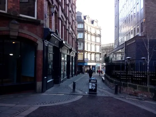
Newcastle Arts Centre
Museum · 5.4 mi
67 Westgate Road, Newcastle upon Tyne
Mo-Fr 09:00-17:30; Sa 09:00-17:00


Laing Art Gallery
Museum · 5.0 mi
Art gallery in Newcastle, United Kingdom
New Bridge Street, Newcastle upon Tyne

The Glasshouse
Museum · 4.8 mi
A music centre rooted deeply in the North, with an international profile. We are for audiences, for artists, for the North and for the long term.
Saint Mary's Square, Gateshead

Tynemouth Priory and Castle
Monument and historic site · 3.7 mi
Pier Road, North Shields
Mar 28-Sep 30 Mo-Su 10:00-18:00; Oct 01-Nov 01 Mo-Su 10:00-16:00;...

Seven Stories
Monument and historic site · 4.3 mi
Museum and visitor centre in Newcastle, United Kingdom
30 Lime Street, Newcastle upon Tyne
103 more on the map.
Parks, trails and playgrounds71


Herrington Country Park
Park · 7.2 mi
Country park in Sunderland, England




Castle Leazes
Park · 5.3 mi
Park in Newcastle upon Tyne, United Kingdom
George Washington Hotel Golf and Spa
Golf course · 4.1 mi
18 hole Par 73
Stone Cellar Road, Washington
Gosforth Central Park
Park · 5.6 mi
Park near to Gosforth High Street in Gosforth, Newcastle upon Tyne, England
Gosforth Park
Park · 6.2 mi
Park in North Gosforth, Tyne and Wear, England, UK
59 more on the map.
Restaurants and cafes128
Caffè Nero
Cafe · Coffee Shop · 2.4 mi
21 King Street, South Shields
Mo-Sa 07:00-18:00; Su 08:30-17:30

Sambuca
Restaurant · Italian · 5.0 mi
57-60 Sandhill, Newcastle upon Tyne
Mo-Sa 12:00-22:00, Su 12:00-21:00

The Cluny
Bar and pub · 4.3 mi
36 Lime Street, Newcastle upon Tyne
Mo-Th 11:00-23:00; Fr,Sa 11:00-24:00; Su 11:00-22:30

The Old George
Bar and pub · 5.1 mi
1 Old George Yard, Newcastle upon Tyne
Su-Th 11:00-23:00; Fr-Sa 11:00-02:00

Bridge Hotel
Bar and pub · 5.1 mi
Castle Garth, Newcastle upon Tyne
Mo-Th 11:30-23:00; Fr,Sa 11:30-24:00; Su 12:00-22:30
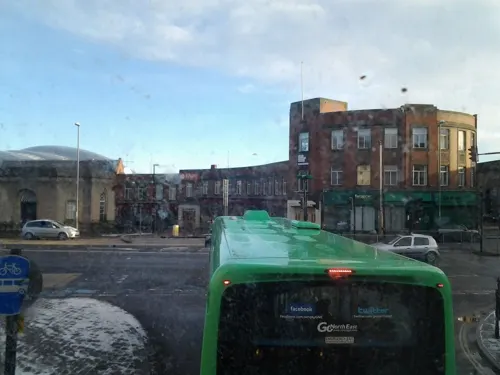
The Central
Bar and pub · 4.9 mi
Half Moon Lane, Gateshead
Mo,Tu 11:30-23:00; We,Th 11:30-23:30; Fr 11:30-24:00; Sa...

The Town Wall
Bar and pub · 5.4 mi
Pink Lane, Newcastle upon Tyne
Mo-Th 12:00-24:00; Fr-Sa 12:00-01:00; Su 12:00-11:00

The Market Lane
Bar and pub · 5.1 mi
72-74 Pilgrim Street, Newcastle upon Tyne
Mo-Th 11:00-23:00; Fr-Sa 11:00-00:00; Su 11:00-22:30
Slug & Lettuce
Bar and pub · 5.2 mi
30 Grainger Street, Newcastle upon Tyne
Mo-Th 12:00-23:00, Fr 12:00-01:00, Sa 10:00-13:00, Su 10:00-23:00

116 more on the map.
History
Jarrow's name is first recorded in the 8th century. It derives from the Gyrwe, an Anglian tribe that lived here. The Gyrwe's name means "fen dwellers", perhaps in reference to Jarrow Slake (a now-drained wetland that lay at the confluence of the Tyne and the Don). The place-name would normally have developed into Yarrow in modern English, but as with Jesmond, Norman influence resulted in the initial becoming .
The Monastery of Paul of Tarsus in Jarrow, part of the twin foundation Monkwearmouth–Jarrow Abbey, was once the home of the Venerable Bede, whose most notable works include Ecclesiastical History of the English People and the translation of the Gospel of John into Old English. Along with the abbey at Wearmouth, Jarrow became a centre of learning and had the largest library north of the Alps, primarily due to the widespread travels of Benedict Biscop, its founder. In 794 Jarrow became the second target in England of the Vikings, who had plundered Lindisfarne in 793. In 875, Vikings under Halfdan Ragnarsson sailed into the River Tyne and sacked monasteries at Tynemouth and Jarrow, before setting up camp at Gateshead
Read more of the history
The monastery was later dissolved by Henry VIII. The ruins of the monastery are now associated with and partly built into the present-day church of St. Paul, which stands on the site. One wall of the church contains the oldest stained glass window in the world, dating from about AD 600. Just beside the monastery is Jarrow Hall, a working museum dedicated to the life and times of Bede. This incorporates Jarrow Hall, a grade II listed building and significant local landmark.
The world's oldest complete Bible, written in Latin to be presented to the then Pope (Gregory II), was produced at this monastery – the Codex Amiatinus. It is currently safeguarded in the Laurentian Library, Florence, Italy.
Originally three copies of the Bible were commissioned by Ceolfrid in 692. This date has been established as the double monastery of Wearmouth-Jarrow secured a grant of additional land to raise the 2000 head of cattle needed to produce the vellum for the Bible's pages. Saint Ceolfrid accompanied one copy (originally intended for Gregory I) on its journey to be presented to Gregory II, but he died en route to Rome. The book later appears in the ninth century in the Abbey of the Saviour, Monte Amiata in Tuscany (hence the description "Amiatinus"), where it remained until 1786 when it passed to the Laurentian Library in Florence.
Jarrow remained a small mid-Tyne town until the introduction of heavy industries such as coal mining and shipbuilding. Charles Mark Palmer established a shipyard – Palmer's Shipbuilding and Iron Company – in 1852 and became the first armour-plate manufacturer in the world. John Bowes, the first iron screw collier, revived the Tyne coal trade, and Palmer's was also responsible for the first modern cargo ship, as well as a number of notable warships. Around 1,000 ships were built at the yard, they also produced small fishing boats to catch eel within the River Tyne, a delicacy at the time.
Palmer's employed as much as 80% of the town's working population until its closure in 1933 following purchase by National Shipbuilders Securities Ltd. (NSS). This organisation had been set up by Stanley Baldwin's Conservative government in the 1920s, but the first public statement had been made in 1930 whilst the Labour Party was in office. The aim of NSS was to reduce capacity within the British shipyards. In fact Palmer's yard was relatively efficient and modern, but had serious financial problems. As from 1935, Olympic, the sister ship of RMS Titanic, was partially demolished at Jarrow, being towed in 1937 to Inverkeithing, Scotland for final scrapping.
The Great Depression brought so much hardship to Jarrow that the town was described by Life as "cursed." The closure of the shipyard was responsible for one of the events for which Jarrow is best known. Jarrow is marked in history as the starting point in 1936 of the Jarrow March to London to protest against unemployment in Britain. Jarrow Member of Parliament (MP) Ellen Wilkinson wrote about these events in her book The Town That Was Murdered (1939). Some doubt has been cast by historians as to how effective events such as the Jarrow March actually were but there is some evidence that they stimulated interest in regenerating 'distressed areas'. 1938 saw the establishment of a ship breaking yard and engineering works in the town, followed by the creation of a steelworks in 1939.
The Jarrow rail disaster was a train collision that occurred on the 17 December 1915 at the Bede junction on a North Eastern Railway line. The collision was caused by a signalman's error and seventeen people died in the collision.
The Second World War revived the town's fortunes as the Royal Navy was in need of ships to be built. After 1945 the shipbuilding industries were nationalised. The last shipyard in the town closed in 1980.
In August 2014 a group of mothers from Darlington organised a march from Jarrow to London to oppose the privatisation of the NHS. The march took place in September 2014 and 3,000–5,000 people participated in the event.
From the History section of Jarrow on Wikipedia, under CC BY-SA 4.0.
More about Jarrow
Education
Jarrow's needs for secondary education are currently served by Jarrow School, formerly Springfield Comprehensive. Springfield was merged with another of Jarrow's secondary schools, Hedworthfield Comprehensive at Fellgate, following a gradual reduction of the number of new pupils for the yearly intake of 11-year-olds to the point where keeping both schools open was no longer viable. As of 2008 plans to revamp Jarrow School have come into action. Building work was completed in 2009 turning the school into a modern learning facility with Specialist Engineering Status. The head teacher at the school plans to improve the school's grade point average, by improving the learning facilities, costing millions of pounds.
From the Wikipedia article Jarrow, under CC BY-SA 4.0.
Notable people from Jarrow
 BedeAnglo-Saxon monk, writer and saint (672/3–735)Photo: http://www.e-codices.unifr.ch/de/bke/0047/1v, Public domain
 John MilesEnglish rock musician and singer (1949–2021)Photo: Sven Mandel, CC BY-SA 4.0
 Mary Kelly FoyBritish politician (born 1968)Photo: David Woolfall, CC BY 3.0
 Bill ThompsonEnglish technology writer, born 1960Photo: Photograph by Mike Peel ( www.mikepeel.net )., CC BY-SA 4.0
 Alan PlaterEnglish screenwriter (1935–2010)Photo: Benbrook, CC BY-SA 4.0
 Carl Finniganfootballer (born 1986)Photo: Alasdair Middleton from Rothesay, Scotland, CC BY 2.0
 Stephen HepburnBritish politician (born 1959)Photo: Chris McAndrew, CC BY 3.0
- Sam BartramEnglish footballer (1914–1981)
- Roger WestmanEnglish architect
- Alan DonnellyBritish politician (born 1957)
- Dick ConnerEnglish footballer (1931-1999)
- David HarneyEnglish professional footballer (1947-2019)
Born in Jarrow, according to Wikidata (CC0). Each name links to its Wikipedia article.
Where to stay32
Churches and places of worship49
Shopping61
Gas and EV charging30
Schools, colleges and libraries35
Central Walker Church of England Primary School
School · Anglican · 2.9 mi
Lancefield Avenue, Newcastle upon Tyne
Holy Trinity Church of England Academy (South Shields)
School · Anglican · 1.9 mi
Brockley Avenue, South Shields
SS Peter and Paul Catholic Primary School
School · Roman Catholic · 1.7 mi
Olive Street, South Shields
St Alban's Catholic Primary School
School · Roman Catholic · 2.6 mi
Westbourne Avenue, Newcastle upon Tyne
Healthcare28
Map of Jarrow
250 places. The map loads OpenStreetMap tiles when you open it.
Getting there and nearby towns
Newcastle International Airport (NCL) is the nearest airport with scheduled flights listed in OpenStreetMap, 9 miles away.
- Newcastle upon Tyne 5 mi west, about 8 min by car
- Sunderland 7 mi southeast, about 11 min by car
- Whickham 8 mi west, about 13 min by car
- Ryhope 9 mi southeast, about 14 min by car
- Seaham 11 mi southeast, about 18 min by car
- Ponteland 11 mi northwest, about 18 min by car
- Prudhoe 15 mi west, about 24 min by car
- Morpeth 15 mi northwest, about 25 min by car
- Peterlee 16 mi south, about 26 min by car
- Spennymoor 20 mi south, about 32 min by car
Drive times are estimates from straight-line distance, not routes.
Towns near Jarrow


Keep exploring
Local news
Headlines from INDB.
Reviews, tips and questions
Loading what members have shared...
Sources and licences
- GeoNames (CC BY 4.0): population, coordinates, regions and time zone
- Mapillary (see each image): photos
- OpenStreetMap contributors (ODbL 1.0): places, airports, map data
- Wikidata (CC0 1.0): elevation, founding date, time zone, website, landmarks and historic places
- Wikimedia Commons (see each image): photos
- Wikipedia (CC BY-SA 4.0): overview and history text
Photo credits
- Newcastle the journal thyne theater, Unknown author, CC BY-SA 3.0
- Live Theatre Newcastle - 2010, John-Paul Stephenson, CC BY-SA 3.0
- Peoples Theatre, Heaton, Newcastle, John-Paul Stephenson, CC BY-SA 3.0
- The Hancock Museum Newcastle September 2009, TubularWorld, CC BY-SA 3.0
- Shipley Art Gallery2, Dposte46, Public domain
- The Biscuit Factory, Frombowen, CC BY-SA 4.0
- Exhibition Park mow, Victuallers, CC BY-SA 4.0
- Penshaw from Herrington Park, Ajguy94, CC BY-SA 4.0
- Leazes Park, Peter Scott, CC BY-SA 4.0
- Bandstand - Mowbray Park, Craigy144 at English Wikipedia, CC BY-SA 3.0
- Jesmond Parish Church, Newcastle upon Tyne, AlixChaytor, CC BY-SA 4.0
- Newcastle upon Tyne, England, The original uploader was Soloist at English Wikipedia ., CC BY-SA 3.0
- The Sage Gateshead, William Nicholson from London / Paris, England / France, CC BY 2.0
- St Thomas Haymarket Newcastle, Chemical Engineer, CC BY-SA 3.0
- Exterior of Fenwicks Department Store, Market Street, Leicester, Love Art Nouveau, CC BY 2.0
- Newcastle Lit & Phil (03), Harry Mitchell, CC BY-SA 3.0
- Newcastle City Hall, John-Paul Stephenson, Public domain
- North Tyneside General Hospital, Stevenfruitsmaak, CC BY 3.0
- Northern Stage, Newcastle University, 5 September 2013 (1), Ultra7, Public domain
- Southtynesidehospital, Xapbpoh, CC BY-SA 3.0
- Thecluny, Bagnelli, CC BY-SA 3.0
- TynemouthCastle-2005-03-08, Chris McKenna ( user:Thryduulf ), CC BY-SA 4.0
- Tyneside Cinema, Feb 2010, The JPS, CC BY 3.0
- Église St Hilda South Shields South Tyneside 4, Chabe01, CC BY-SA 4.0
- Emerson Chambers, Blackett Street, Newcastle (01), Harry Mitchell, CC BY-SA 3.0
- Newcastle upon Tyne (2022-03-28) 004, Simon Cobb, CC0
- Newcastle (2023-10-06) 08, Simon Cobb, CC0
- Bewick House,Bewick Street Newcastle upon Tyne, EsqBlackett (Joseph Eldridge), CC BY-SA 4.0
- Grand Hotel, Tynemouth, Irina Guy, CC BY-SA 4.0
- Hôtel County Newcastle Tyne 3, Chabe01, CC BY-SA 4.0
- Bridge hotel, SunlightPhotography, CC BY-SA 4.0
- North Tyneside - Church of St Edward - 20220910113211, AnnaJHK, CC BY-SA 4.0
- Hampton by Hilton Newcastle, Simon Cobb, CC0
- Empire Newcastle (The Gate), Mankind 2k, CC BY 3.0
- Newcastle upon Tyne (2022-03-28) 008, Simon Cobb, CC0
- Royal Station Hotel, Frombowen, CC BY-SA 4.0
- Theatre Royal, Newcastle upon Tyne, John-Paul Stephenson, CC BY-SA 2.5
- Baltic centre for contemporary art, 06benste, CC BY-SA 3.0
- Newcastle black gate, Unknown author, CC BY-SA 3.0
- Exchange Buildings, Newcastle upon Tyne, AlixChaytor, CC BY-SA 4.0
- Fineartbuildingnewcastle, Xtrememachineuk at English Wikipedia, CC BY 3.0
- Blue Reef Aquarium Tynemouth Tank 01, TheArmchairSoldier, CC BY-SA 4.0
- Roman statue at Segedunum Fort, Wallsend, RandomPsychic, CC BY-SA 4.0
- Newcastle upon Tyne Laing Art Gallery dome, Ymblanter, CC BY-SA 4.0
- Gateshead International Stadium, John Lord, CC BY 4.0
- Street-level photo, livingwithdragons, CC BY-SA 4.0
- Street-level photo, livingwithdragons, CC BY-SA 4.0
- Street-level photo, livingwithdragons, CC BY-SA 4.0
- Street-level photo, livingwithdragons, CC BY-SA 4.0
- Street-level photo, livingwithdragons, CC BY-SA 4.0
- Street-level photo, floatingboater, CC BY-SA 4.0
- Street-level photo, livingwithdragons, CC BY-SA 4.0
- Street-level photo, floatingboater, CC BY-SA 4.0
- Street-level photo, floatingboater, CC BY-SA 4.0
- Street-level photo, floatingboater, CC BY-SA 4.0
- Street-level photo, floatingboater, CC BY-SA 4.0
- Street-level photo, floatingboater, CC BY-SA 4.0
- Street-level photo, floatingboater, CC BY-SA 4.0
- Street-level photo, floatingboater, CC BY-SA 4.0
- Street-level photo, floatingboater, CC BY-SA 4.0
- Street-level photo, floatingboater, CC BY-SA 4.0


Page built November 10, 2026. Spotted a mistake? Tell us or suggest a place.