


Kimberley, United Kingdom
Kimberley is a town of 11,273 people in England, United Kingdom.
Why visit Kimberley
Townapedia lists 10 museums and landmarks, 13 parks and trails, 57 places to eat, 4 places to stay and 3 attractions in and around town.
Highlights include Bennerley Viaduct, Giltbrook Viaduct, D.H. Lawrence Birthplace Museum and Erewash Museum.
Weather in Kimberley
Forecast from MET Norway (CC BY 4.0). Full forecast
About Kimberley
Kimberley is a market town and civil parish in the Borough of Broxtowe in Nottinghamshire, England, lying 6 miles (10 km) northwest of Nottingham along the A610.
From the Wikipedia article Kimberley, Nottinghamshire (this version), under CC BY-SA 4.0.
Things to do3

Bennerley Viaduct
Bridge · 1.4 mi
Railway viaduct spanning the Erewash Valley

Giltbrook Viaduct
Bridge · 0.8 mi
Bridge in Greasley and Kimberley, Nottinghamshire

The American Adventure Theme Park
Monument and historic site · 2.9 mi
Former theme park in Ilkeston, Derbyshire, England
Museums and landmarks10

D.H. Lawrence Birthplace Museum
Museum · 3.0 mi
Museum in Nottingham, England, United Kingdom

Erewash Museum
Museum · 1.9 mi
Museum in Ilkeston, Derbyshire, United Kingdom

Wollaton Hall
Museum · 3.4 mi
Country house museum in Nottingham, England
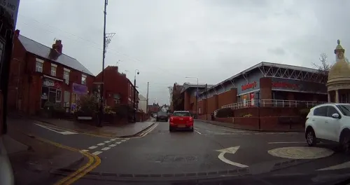
Kimberley School War Memorial
Monument and historic site · 1.2 mi
A small monument consisting of 3 wooden planks stood upright and a metal outline of a soldier remembering those lost during both world wars.
Lt Colonel Brian Duncan Shaw MM BSc PhD DSc (Hon) 1898-1999
Monument and historic site · 1.5 mi
Parks, trails and playgrounds13



1 more on the map.
Restaurants and cafes57
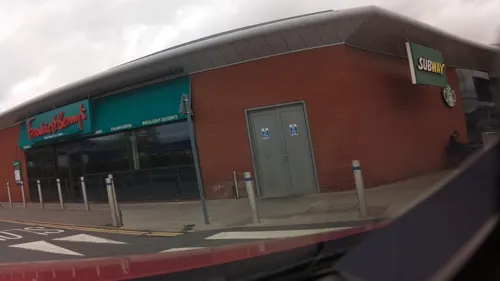
Frankie & Benny's
Diner · American · 1.5 mi
Ikea Way, Nottingham
Mo-Th 09:00-21:30; Fr-Sa 09:00-22:30; Su 09:00-21:30
Hickory's Smokehouse
Restaurant · Barbecue, American · 1.5 mi
Mornington Crescent, Nottingham
24/7 closed "Temporary"



Ilkeston Junction Cafe
Cafe · 1.2 mi
15 Station Street, Ilkeston
Tu-Fr 08:30-14:30; Sa 08:30-14:00; Su,Mo off

45 more on the map.
History
The name Kimberley derives from the Old English Cynemǣrlēah meaning 'Cynemǣr's wood or clearing'.
Kimberley is referred to as Chinemarelie in William the Conqueror's Domesday Book. With the accession of William to the throne Kimberley came into the possession of William de Peveril. The Peverils lost control when they supported the losing side in the civil war which preceded the accession of Henry II of England in 1154. The King became the owner of the land. King John of England granted land in the area to Ralph de Greasley in 1212 who took up residence at Greasley Castle and also at around this time to Henry de Grey whose son re-built Codnor Castle on the site of an earlier castle established by William Peveril.
Ralph de Greasley's land passed by inheritance and marriage to Nicholas de Cantelupe who took part in Edward III of England's Scottish campaigns and also the Battle of Crécy. Nicholas founded Beauvale Priory using part of his Kimberley holding in 1343. That part of Kimberley which had become the property of Beauvale Priory was claimed by King Henry VIII during the Dissolution of the Monasteries in the 16th century.
Read more of the history
The Priory's land was redistributed by the King and came into the possession of Arthur Capell, 1st Baron Capell of Hadham again by inheritance and marriage in 1627. Arthur was beheaded in 1649 having fought for the Royalists in the English Civil War. Arthur's son was created Earl of Essex in 1661.
In 1753 the land was purchased by Sir Matthew Lamb whose grandson William Lamb became Prime Minister in 1834. The Lamb's Kimberley estates passed by marriage to the 5th Earl Cowper in 1805 and on the death of the 7th Earl in 1913 were sold off in pieces.
That part of Kimberley retained by the Cantelupe's passed by inheritance and marriage to John Lord Zouch who died at the Battle of Bosworth with Richard III in 1485. He was posthumously found guilty of high treason with his property forfeited to Henry VII. John Savage (-1491) received this part of Kimberley in gratitude for his efforts on behalf of Henry VII at Bosworth. The Savage family sold this land to the Earl of Rutland in the early 17th century. The Duke of Rutland's Kimberley estates were sold in parcels in the early 19th century.
The town grew as a centre for coal mining, brewing and hosiery manufacturing. The parish had a population 6,033 at the 2021 census.
Kimberley has been home to a lot of industry including: coal mining, brewing and hosiery manufacturing.
All major industry in Kimberley has stopped, the last being Kimberley Brewery which was taken over by Greene King in 2006, another major brewer in a multimillion-pound deal. This marked the end of the traditional Kimberley Ales as ale brewing ceased shortly afterwards and only a distribution centre remained there.
From the History section of Kimberley, Nottinghamshire on Wikipedia, under CC BY-SA 4.0.
Notable people from Kimberley
 Jamie PeckBritish geographerPhoto: Ji-Elle, CC BY-SA 4.0
 Mordecai Sherwincricketer (1851-1910)Photo: Photo by E Hawkins of Brighton, Public domain
- George ChambersEnglish cricketer (1884-1947)
- Harry ClayEnglish footballer (1881-1964)
- Ike BirdFootballer (1895-1984)
- Lloyd Binchcyclist (1931-2016)
- John DruryEnglish cricketer (1874-1919)
- William HarrisEnglish cricketer, born 1864
- William WilkinsonEnglish cricketer, born 1859
- Ben LilleyBritish cricketer (1894-1950)
- Clem Jacksonassociation football player (1886-1960)
- William Bryan(1856-1933)
Born in Kimberley, according to Wikidata (CC0). Each name links to its Wikipedia article.
Where to stay4
Delta Hotels by Marriott Nottingham Belfry
Motel and hotel · 1.3 mi
Mellor's Way, Nottingham
Churches and places of worship19
Church of St. Mary the Virgin and All Souls, Bulwell
Church · 3.2 mi
Shopping14
Gas and EV charging4
Schools, colleges and libraries8
Healthcare4
Kimberley Health Clinic
Clinic and pharmacy · 1.1 mi
Newdigate Street, Nottingham
Map of Kimberley
136 places. The map loads OpenStreetMap tiles when you open it.
Getting there and nearby towns
Nottingham City Airport (NQT) is the nearest airport with scheduled flights listed in OpenStreetMap, 9 miles away.
- Nottingham 5 mi southeast, about 8 min by car
- Stapleford 5 mi south, about 7 min by car
- Ripley 7 mi northwest, about 11 min by car
- Pinxton 8 mi north, about 12 min by car
- Kirkby in Ashfield 8 mi north, about 13 min by car
- Derby 10 mi southwest, about 16 min by car
- Mansfield 11 mi north, about 17 min by car
- Mansfield Woodhouse 13 mi north, about 21 min by car
- Shepshed 15 mi south, about 24 min by car
- Shirebrook 15 mi north, about 25 min by car
Drive times are estimates from straight-line distance, not routes.
Towns near Kimberley


Keep exploring
Local news
Headlines from INDB.
Reviews, tips and questions
Loading what members have shared...
Sources and licences
- GeoNames (CC BY 4.0): population, coordinates, regions and time zone
- Mapillary (see each image): photos
- OpenStreetMap contributors (ODbL 1.0): places, airports, map data
- Wikidata (CC0 1.0): elevation, founding date, time zone, website, landmarks and historic places
- Wikimedia Commons (see each image): photos
- Wikipedia (CC BY-SA 4.0): overview and history text
Photo credits
- Kimberley War Memorial, Nottinghamshire, Tina Cordon at English Wikipedia, CC BY-SA 3.0
- Bennerley Viaduct Ilkeston, Grant Shaw, CC BY-SA 3.0
- Erewash Museum - 20 June 2025, Aethonatic, CC0
- Wollaton Hall, Nottingham (1), Harry Mitchell, CC BY-SA 3.0
- Kirk Hallam Church, Garth Newton, CC BY-SA 2.0
- St Mary's Church, Ilkeston, Derbyshire, Russ Hamer, CC BY-SA 3.0
- Cossall St Catherine's Church, Russ Hamer, CC BY-SA 3.0
- St Margaret's, Aspley Lane by-David-Lally, David Lally, CC BY-SA 2.0
- St. Leonard's Church, Wollaton (5), Enchufla Con Clave, CC BY-SA 4.0
- D. H. Lawrence Birthplace Museum, Graham Hogg, CC BY-SA 2.0
- Street-level photo, tallguy, CC BY-SA 4.0
- Street-level photo, southglos, CC BY-SA 4.0
- Street-level photo, tallguy, CC BY-SA 4.0
- Street-level photo, adam2, CC BY-SA 4.0
- Street-level photo, adam2, CC BY-SA 4.0
- Street-level photo, southglos, CC BY-SA 4.0
- Street-level photo, southglos, CC BY-SA 4.0
- Street-level photo, tallguy, CC BY-SA 4.0
- Street-level photo, tallguy, CC BY-SA 4.0
- Street-level photo, adam2, CC BY-SA 4.0
- Street-level photo, southglos, CC BY-SA 4.0
- Street-level photo, sk53, CC BY-SA 4.0
- Street-level photo, tallguy, CC BY-SA 4.0
- Street-level photo, adam2, CC BY-SA 4.0
- Street-level photo, tallguy, CC BY-SA 4.0
- Street-level photo, tallguy, CC BY-SA 4.0
- Street-level photo, tallguy, CC BY-SA 4.0
- Street-level photo, adam2, CC BY-SA 4.0
- Street-level photo, tallguy, CC BY-SA 4.0
- Street-level photo, tallguy, CC BY-SA 4.0
- Street-level photo, southglos, CC BY-SA 4.0
- Street-level photo, tallguy, CC BY-SA 4.0
- Street-level photo, mappo2, CC BY-SA 4.0


Page built November 10, 2026. Spotted a mistake? Tell us or suggest a place.