


Why visit Pinxton
Townapedia lists 6 museums and landmarks, 2 parks and trails, 45 places to eat and 2 places to stay in and around town.
Highlights include War Memorial and Railings, Carnfield Hall and Brierley Forest Park.
Weather in Pinxton
Forecast from MET Norway (CC BY 4.0). Full forecast
About Pinxton
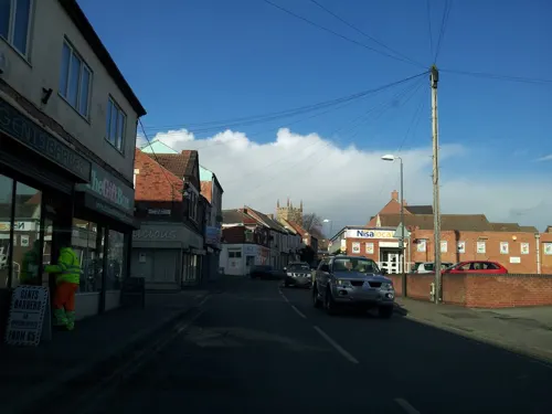
Pinxton is a village and civil parish in Derbyshire on the western boundary of Nottinghamshire, England, just south of the Pinxton Interchange at Junction 28 of the M1 motorway where the A38 road meets the M1. Pinxton is part of the Bolsover District and at the 2021 Census had a population of 5,652.
From the Wikipedia article Pinxton (this version), under CC BY-SA 4.0.
Photos of Pinxton


Museums and landmarks6

War Memorial and Railings
Monument and historic site · 3.1 mi
War memorial in Alfreton, Amber Valley, Derbyshire, England, UK

Carnfield Hall
Museum · 2.1 mi
Country house in Derbyshire, England, UK

Brookhill Hall
Monument and historic site · 0.7 mi
Brookhill Hall was used by King James I as well as King Charles II as a hunting lodge, before becoming home to the Coke for some 450...
Brookhill Lane, Nottingham
Parks, trails and playgrounds2


Restaurants and cafes45
Market Tavern
Bar and pub · 1.5 mi
41 High Street, Alfreton
Tu-Th 12:00-22:00; Fr 12:00-23:00; Sa 11:00-23:00; Su 11:00-22:00


The Hawthorns
Bar and pub · 1.4 mi
Alfreton Road, Alfreton
12:00-23:00
33 more on the map.
Where to stay2

History
In Anglo-Saxon times, Pinxton was a small agricultural community, thought to have been recorded in the Domesday Book of 1086 as "Esnotrewic." It is also thought that it was known as "Snodeswic," given by Wulfric Spott to Burton Abbey.
In Norman times, it was under the control of William Peveril, for whom it was held by Drogo fitz Pons. It is thought that he renamed the manor "Ponceston" and it gradually changed to Penekeston and then to Pinxton.
Since 1800 BC, coal had been extracted in the area. In 1794 the Cromford Canal encouraged this trade. By the beginning of the next century there were a number of deep coal mines. Trade increased with the growth of the Industrial Revolution. There were also four lime kilns and a china works producing quality ware. Pinxton's prosperity increased further as the terminus of the Mansfield and Pinxton Railway, opened in 1819.
From the profits of his colliery at Pinxton, D'Ewes Coke (1747-1811) of Brookhill Hall, a clergyman colliery master, founded a local school and an educational charity. The collieries and coking ovens have been replaced by an industrial estate, and the old colliery village has all but disappeared.
Read more of the history
John King is the inventor of a mining safety device, a detaching hook, which successfully completed trials in 1873 at Pinxton No.1 colliery. The detaching hook prevents a cage raising miners from a shaft from being raised up and over the headstock pulley when raised from a mine shaft. A mining museum in Pinxton honoring John King and commemorating the invention of the detaching hook was closed in 2014 and its contents distributed to other museums and heritage centres.
In Pinxton today, there remains the John King mining wheel which was used in the days when mining was available. Now the John King wheel is a historical model for the public to see. John King is also named after an infant school in Pinxton. The horse gin, or whim from Pinxton Green Colliery has been re-erected at Nottingham Industrial Museum. Pinxton signal box, which once controlled access to Bentinck Colliery has been relocated to Barrow Hill Engine Shed.
On 12 August 1940, a stick of bombs was dropped on Pinxton. One council house was hit, killing one person.
From the History section of Pinxton on Wikipedia, under CC BY-SA 4.0.
More about Pinxton
Education
There are four schools in Pinxton; John King Infant Academy situated on Church St W, Longwood Infant Academy on Wharf Rd, Kirkstead Junior Academy on Kirkstead Rd, and Pinxton Nursery School on Kirkstead Rd.
From the Wikipedia article Pinxton, under CC BY-SA 4.0.
Notable people from Pinxton
 Aden FlintEnglish association football player (born 1989)Photo: Timmy96, CC0
- Roger Sacheverell CokeEnglish composer and pianist
- John O'ConnorEnglish cricketer (1867-1936)
- Stanley WalkerEnglish cricketer (1908-1993)
- Wally RadfordEnglish footballer (1886-1943)
- Ivan HollettEnglish footballer (born 1940)
- Leslie ButlerEnglish professional footballer (1908-1985)
- Cyril StocksEnglish footballer
Born in Pinxton, according to Wikidata (CC0). Each name links to its Wikipedia article.
Churches and places of worship18
Shopping14
Gas and EV charging3
Schools, colleges and libraries10
Selston Church of England Infant and Nursery School
School · Anglican · 1.4 mi
Nottingham Road, Nottingham
Healthcare5
Map of Pinxton
105 places. The map loads OpenStreetMap tiles when you open it.
Getting there and nearby towns
Nottingham City Airport (NQT) is the nearest airport with scheduled flights listed in OpenStreetMap, 16 miles away.
- Ripley 5 mi southwest, about 8 min by car
- Mansfield 6 mi northeast, about 9 min by car
- Shirebrook 9 mi northeast, about 14 min by car
- Nottingham 12 mi southeast, about 19 min by car
- Chesterfield 12 mi north, about 19 min by car
- Staveley 12 mi north, about 20 min by car
- Stapleford 12 mi south, about 20 min by car
- Derby 13 mi southwest, about 21 min by car
- Sheffield 21 mi north, about 34 min by car
- Rotherham 24 mi north, about 38 min by car
Drive times are estimates from straight-line distance, not routes.
Towns near Pinxton


Keep exploring
Local news
Headlines from INDB.
Reviews, tips and questions
Loading what members have shared...
Sources and licences
- GeoNames (CC BY 4.0): population, coordinates, regions and time zone
- Mapillary (see each image): photos
- OpenStreetMap contributors (ODbL 1.0): places, airports, map data
- Wikidata (CC0 1.0): elevation, founding date, time zone, website, landmarks and historic places
- Wikimedia Commons (see each image): photos
- Wikipedia (CC BY-SA 4.0): overview and history text
Photo credits
- Pinxton Wharf 005710 ef3bc9c9, Nick Leverton, CC BY-SA 2.0
- St Helen's Church, Pinxton, Dave Kelly, CC BY-SA 2.0
- Alfreton war memorial, Kmtextor, CC BY-SA 4.0
- Brierley Forest Park 2, Frombowen, CC BY-SA 4.0
- Annesley Old Church, Nottinghamshire (1), Enchufla Con Clave, CC BY-SA 4.0
- Riddings, Derbys, SW aspect, Russ Hamer, CC BY-SA 3.0
- St Mary's, Westwood, David Lally, CC BY-SA 2.0
- South Normanton 145686 833ec66d, Mike Bardill, CC BY-SA 2.0
- Roman coin die, The Portable Antiquities Scheme, Lisa Brundle, 2021-01-08 09:12:29, CC BY 2.0
- COIN DIE, The Portable Antiquities Scheme, Lisa Brundle, 2021-01-08 09:12:59, CC BY 2.0
- COIN DIE, The Portable Antiquities Scheme, Lisa Brundle, 2021-01-08 09:13:15, CC BY 2.0
- COIN DIE, The Portable Antiquities Scheme, Lisa Brundle, 2021-01-08 09:13:07, CC BY 2.0
- Street-level photo, adam2, CC BY-SA 4.0
- Street-level photo, adam2, CC BY-SA 4.0
- Street-level photo, adam2, CC BY-SA 4.0


Page built November 10, 2026. Spotted a mistake? Tell us or suggest a place.