


Derby, United Kingdom
Derby is a city of 270,468 people in England, United Kingdom, founded in 600.
Why visit Derby
Townapedia lists 99 museums and landmarks, 74 parks and trails, 143 places to eat, 35 places to stay and 18 attractions in and around town.
Highlights include Derby Theatre, Assembly Rooms, Derby Museum and Art Gallery and Kedleston Hall.
Weather in Derby
Forecast from MET Norway (CC BY 4.0). Full forecast
About Derby
Derby is a city and unitary authority area on the River Derwent in Derbyshire, England. Derby was the original county town before the county town status was given to Matlock. As a unitary authority, Derby is administratively independent from Derbyshire County Council. The population of Derby is 275,344 (2025).
From the Wikipedia article Derby (this version), under CC BY-SA 4.0.
Travel tips from other travellers: Derby on Wikivoyage (CC BY-SA 4.0).
Photos of Derby


Things to do18


Assembly Rooms
Cinema and theater
Theatre and multi-purpose venue in Derby, England


Guildhall Theatre
Cinema and theater
Theatre in Derby, Derbyshire, England, UK


Swarkestone Bridge
Bridge · 4.9 mi
Grade I listed bridge in Swarkestone, Derbyshire, England



Grand Theatre
Cinema and theater
Former theatre in Derby, England, now a restaurant
6 more on the map.
Museums and landmarks99

Derby Museum and Art Gallery
Museum
Museum and art gallery in Derby, England, United Kingdom
The Strand, Derby
Tu-Sa 10:00-17:00; Su 12:00-16:00


Midland Railway War Memorial
Monument and historic site · 0.7 mi
War memorial in Derby, England


Dale Abbey
Monument and historic site · 5.5 mi
Monastery ruins in Derbyshire, England, UK


87 more on the map.
Parks, trails and playgrounds74


The Sanctuary
Park · 1.6 mi
Bird and wildlife sanctuary and local nature reserve in Derby, England, UK

Derbyshire County Cricket Club
Sports field and stadium · 0.7 mi
Nottingham Road, Derby

Pride Park Stadium
Sports field and stadium · 1.3 mi
Pride Parkway, Derby



Breadsall Priory Golf Course - Priory Course
Golf course · 3.5 mi
18 hole Par 70 Championship Priory Course
Moor Road, Ilkeston

Railway Technical Centre
Park · 1.2 mi
Former technical headquarters of the British Railways Board; business park
Breadsall Priory Golf Course - Moorland Course
Golf course · 3.9 mi
18 hole Par 70 Moorland Course
Moor Road, Ilkeston
62 more on the map.
Restaurants and cafes143

The Flowerpot
Bar and pub
19-25 King Street, Derby
Mo-We 15:00-22:30; Th 15:00-23:00; Fr-Sa 12:00-00:30; Su 12:00 - 21:00

The Greyhound
Bar and pub · 0.5 mi
75-76 Friar Gate, Derby
Mo-Tu 16:00-22:00; We 12:00-22:00; Th 12:00-23:00; Fr-Sa...


The Harrington Arms
Bar and pub · 4.4 mi
4 Grove Close, Derby
Tu 12:00-22:00; We-Th 12:00-23:00; Fr-Sa 12:00-00:00; Su 12:00-22:00
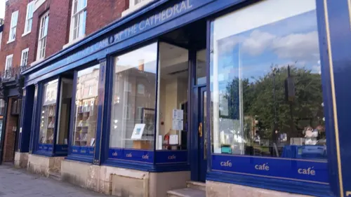
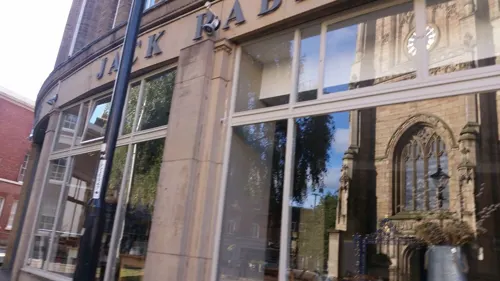
Belvedere
Bar and pub · Polish
2-3 Queen Street, Derby
Th 17:00-21:30; Fr 17:00-21:30; Sa 14:00-21:30; Su 13:00-18:00
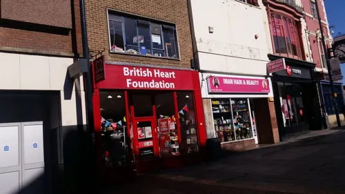
Caffè Nero
Cafe · Coffee Shop
19-23 Corn Market, Derby
Mo-Fr 07:00-18:30; Sa 07:30-18:30; Su 08:30-17:30

The Bubble Inn
Bar and pub · 4.2 mi
Stenson Road, Derby
Mo-Tu 11:00-22:00; We 11:00-22:30; Th 11:00-23:00; Fr-Sa...

Bates at 121
Restaurant · Fine Dining
121 Friar Gate, Derby
We-Th 17:00-22:30; Fr 17:00-23:30; Sa 12:00-23:30; Su 12:00-18:00
Bistrot Pierre
Restaurant · French
18 Friar Gate, Derby
Mo-Th 12:00-22:00; Fr 12:00-22:30; Sa 09:00-22:30; Su 09:00-22:00

Chaiiwala
Cafe · Coffee Shop · 0.8 mi
Normanton Road, Derby
Mo-Tu 08:00-23:00; We 08:00-23:15; Th 08:00-23:00; Fr 08:00-00:00;...
131 more on the map.
History
During the Civil War of 1642–1646, Derby was garrisoned by Parliamentary troops commanded by Sir John Gell, 1st Baronet, who was appointed Governor of Derby in 1643. These troops took part in the defence of nearby Nottingham, the siege of Lichfield, the battle of Hopton Heath and many other engagements in Nottinghamshire, Staffordshire and Cheshire, as well as successfully defending Derbyshire against Royalist armies.
The first civic system of piped water in England was established in Derby in 1692, using wooden pipes, which was common for several centuries. The Derby Waterworks included waterwheel-powered pumps for raising water out of the River Derwent and storage tanks for distribution. This was designed and built by local engineer George Sorocold.
Read more of the history
During the Jacobite rising of 1745, Jacobite Army troops led by Prince Charles Edward Stuart arrived in Derby on 4 December 1745, while on their way to London to attempt to overthrow the reigning House of Hanover. Stuart called at The George Inn on Irongate (where the Duke of Devonshire had set up his headquarters in late November after raising The Derbyshire Blues) and demanded billets for the 9,000 troops under his command. The prince stayed at Exeter House on Full Street, where he held a council of war on 5 December which decided to retreat. Stuart had received misleading information about a government army coming to meet him south of Derby. He abandoned his invasion at Swarkestone Bridge on the River Trent, a few miles south of Derby. The prince, who on the march from Scotland had walked at the front of the column, made the return journey on horseback at the rear of the bedraggled and tired army.
Shrovetide football was played at Derby every year, possibly from as early as the 12th century. The town was split into the St Peter's and All Saints parishes, who fought to bring the ball from the Market Place to a goal within their own parishes. There were several attempts to ban the game, described in 1846 as "the barbarous and disgusting play of Foot-Ball, which for a great number of years has annually disgraced our town". In that year the military were brought in and after the police cut the first ball to pieces, another ball was produced and the town's Mayor was "struck on the shoulder by a brick-bat, hurled by some ferocious ruffian, and severely bruised". The Derby Football was banned in 1846, although it was played once more in 1870.
Derby and Derbyshire were among the centres of Britain's Industrial Revolution. In 1717, Derby was the site of the first water-powered silk mill in Britain, built by John Lombe and George Sorocold, after Lombe had reputedly stolen the secrets of silk-throwing from Piedmont in Italy (he is alleged to have been poisoned by the Piedmontese as revenge in 1722).
In 1759, Jedediah Strutt patented and built a machine called the Derby Rib Attachment that revolutionised the manufacture of hose. This attachment was used on the Rev. Lee's Framework Knitting Machine; it was placed in front of – and worked in unison with – Lee's Frame, to produce ribbed hose (stockings). The partners were Jedediah Strutt, William Woollatt (who had been joined in 1758 by John Bloodworth and Thomas Stafford, all leading hosiers in Derby). The patent was obtained in January 1759. After three years, Bloodworth and Stafford were paid off, and Samuel Need – a hosier of Nottingham – joined the partnership. The firm was known as Need, Strutt and Woollatt. The patent expired in 1773 though the partnership continued until 1781 when Need died.
Messrs Wright, the bankers of Nottingham, recommended that Richard Arkwright apply to Strutt and Need for finance for his cotton spinning mill. The first mill opened in Nottingham in 1770 and was driven by horses. In 1771 Richard Arkwright, Samuel Need and Jedediah Strutt built the world's first commercially successful water-powered cotton spinning mill at Cromford, Derbyshire, developing a form of power that was to be a catalyst for the Industrial Revolution.
This was followed in Derbyshire by Jedediah Strutt's cotton spinning mills at Belper. They were: South Mill, the first, 1775; North Mill, 1784, which was destroyed by fire on 12 January 1803 and then rebuilt, starting work again at the end of 1804; West Mill, 1792, commenced working 1796; Reeling Mill, 1897; Round Mill, which took 10 years to build, from 1803 to 1813, and commenced working in 1816; and Milford Mills, 1778. The Belper and Milford mills were not built in partnership with Arkwright; they were all owned and financed by Strutt.
Other notable 18th-century figures with connections to Derby include the painter Joseph Wright, known as Wright of Derby, who was known for his innovative use of light in his paintings and was an associate of the Royal Academy; and John Whitehurst, a clockmaker and philosopher. Erasmus Darwin, doctor, scientist, philosopher and grandfather of Charles Darwin, moved to Derby in 1782 and founded the Derby Philosophical Society.
Derby's place in the country's philosophical and political life continued with Henry Hutchinson, an active member of the Fabian Society. On his death in 1894, he left the society an amount in his will which was instrumental in founding the London School of Economics.
The beginning of 19th century saw Derby emerging as an engineering centre, with manufacturers such as James Fox, who exported machine tools to Russia.
In 1840, the North Midland Railway set up its works in Derby and when it merged with the Midland Counties Railway and the Birmingham and Derby Junction Railway to form the Midland Railway, Derby became its headquarters. The connection with the railway encouraged others, notably Andrew Handyside, Charles Fox and his son Francis Fox.
A permanent military presence was established in the city with the completion of Normanton Barracks in 1877.
From the History section of Derby on Wikipedia, under CC BY-SA 4.0.
More about Derby
Geography
Derby is in a relatively low-lying area along the lower valley of the River Derwent, where the south-east foothills of the Pennines adjoin the lowlands and valley of the River Trent to the south. The city is bordered by four national character areas, the Trent Valley Washlands to the south, the Nottinghamshire, Derbyshire and Yorkshire Coalfields in the east, the South Derbyshire Claylands in the west, and the Derbyshire Peak Fringe in the north. Most of the flat plains surrounding Derby lie in the Trent Valley Washlands and South Derbyshire Claylands, while the hillier, northern parts of the city lie within the Derbyshire Peak Fringe and the Coalfields.
The city is around 16 miles (26 km) from Coton in the Elms, the farthest place from coastal waters in the United Kingdom.
Economy
Derby's two biggest employers, Rolls-Royce Holdings and Toyota, are engaged in engineering manufacturing. Other companies of note include railway systems engineering firm Alstom, who manufacture railway rolling stock at Derby Litchurch Lane Works; First Source, who deal with much of Sky's telephone support; and Triton Equity, who took over Alstom's manufacturing plant for large power plant boilers and heat exchangers in 2014.
Derby power station on Silkmill Lane supplied electricity to the town and the surrounding area from 1893 until its closure in 1969.
From 1922, Sinfin Lane was the home of the 62-acre (250,000 m2) site of International Combustion, originally manufacturers of machinery for the automatic delivery of pulverised fuel to furnaces and boilers, and later producing steam-generating boilers for use in electrical generating plant such as used in power stations. In the 1990s the firm was bought by Rolls-Royce plc and then sold on again to ABB Group.
Derby was the home of Core Design (originally based on Ashbourne Road), who developed the successful video game Tomb Raider. When Derby's inner ring road was completed in 2010, a section of it was named 'Lara Croft Way' after the game's heroine Lara Croft. Lara also has a Made in Derby star.
One of Derby's longest-established businesses is Royal Crown Derby, which has been producing porcelain since the 1750s.
Arts and culture
On 8 October 2021 it was announced that Derby had been included in the longlist of bids to host UK City of Culture 2025, but in March 2022 it failed to make it onto the shortlist.
Derby is known by many locals as "Derbados"; a portmanteau of Derby and Barbados. Also see List of city nicknames in the United Kingdom.
The indie pop band White Town, fronted by Jyoti Mishra, is from Derby, and his video "Your Woman", features scenes from the city centre. "Your Woman" reached No. 1 on the UK Singles Chart in January 1997.
Founding member and songwriter of Mercury Prize nominated alternative rock band Maxïmo Park and solo artist Duncan Lloyd is from Derby. His band hit the number 2 spot in the U.K. album charts in 2020, with the album Nature Always Wins.
Pop singer Kelli Young (born 7 April 1982) is from Derby. She is best known as a member of the pop group Liberty X.
Lucy Ward is an English singer-songwriter from Derby, England. She performs traditional English folk songs as well as her own material. Three of her albums, Adelphi Has to Fly, Single Flame and I Dreamt I Was a Bird, have been critically acclaimed and have each received four-starred reviews in the British national press.
Education
Like most of the UK, Derby operates a non-selective primary and secondary education system with no middle schools. Pupils attend infant and junior school (often in a combined primary school) before moving onto a secondary school. Many of the secondary schools have sixth forms, allowing pupils to optionally take A Levels after the end of compulsory education. For those who want to stay in education but leave school, the large Derby College provides post-16 courses for school leavers, apprentices and employer-related training. It has two main campuses: the Joseph Wright Centre in the centre of Derby, where its A Level courses are based, and the historical Derby Roundhouse, the college's vocational training hub, providing a centre for apprenticeships such as engineering, catering and hair and beauty. The college also works in partnership with schools across the county to provide vocational training opportunities for students aged 14 upwards. Training for companies is undertaken through its Corporate College.
From the Wikipedia article Derby, under CC BY-SA 4.0.
Notable people from Derby
 Herbert SpencerEnglish philosopher and political theorist (1820–1903)Photo: Smithsonian Institution from United States, No restrictions
 Joseph Wright of Derby18th-century British painter (1734–1797)Photo: Joseph Wright of Derby, Public domain
 Jack O'ConnellBritish actorPhoto: Colleen Sturtevant, CC BY-SA 4.0
 Reg Parnellracecar driverPhoto: Daan Noske / Anefo, CC0
 Mark HateleyEnglish footballer and manager (born 1961)Photo: Unknown author Unknown author, Public domain
 David GilbertEnglish snooker playerPhoto: Benutzer:Bill da Flute, CC BY-SA 3.0
 Keiran LeeBritish pornographic actorPhoto: Toglenn, CC BY-SA 3.0
 William de Wiveleslie AbneyBritish astronomer, chemist and photographer (1843–1920)Photo: Sir George Newnes (1851–1910), CC BY 4.0
 Lee CampNorthern Irish footballerPhoto: en:user:TuborgLight, CC BY-SA 3.0
 Maximilian SciandriItalian-English cyclistPhoto: Eric HOUDAS, CC BY-SA 3.0
- Richard RobertsEnglish biochemist and molecular biologist
- John Atkinson HobsonEnglish economist, social scientist and critic of imperialism (1858-1940)
Born in Derby, according to Wikidata (CC0). Each name links to its Wikipedia article.
Where to stay35
Churches and places of worship89
Shopping66
Gas and EV charging29
Schools, colleges and libraries36
Bishop Lonsdale Church of England Primary School and Nursery
School · Anglican · 1.1 mi
St Albans Road, Derby
Healthcare34
Map of Derby
250 places. The map loads OpenStreetMap tiles when you open it.
Getting there and nearby towns
East Midlands Airport (EMA) is the nearest airport with scheduled flights listed in OpenStreetMap, 9 miles away.
- Nottingham 14 mi east, about 22 min by car
- Mansfield 19 mi northeast, about 30 min by car
- Leicester 24 mi southeast, about 39 min by car
- Sutton Coldfield 28 mi southwest, about 46 min by car
- Stoke-on-Trent 30 mi west, about 48 min by car
- Sheffield 32 mi north, about 51 min by car
- Walsall 32 mi southwest, about 51 min by car
- Newcastle under Lyme 32 mi west, about 51 min by car
- Birmingham 35 mi southwest, about 57 min by car
- Wolverhampton 36 mi southwest, about 57 min by car
Drive times are estimates from straight-line distance, not routes.
Towns near Derby


Keep exploring
Local news
Headlines from INDB.
Reviews, tips and questions
Loading what members have shared...
Sources and licences
- GeoNames (CC BY 4.0): population, coordinates, regions and time zone
- Mapillary (see each image): photos
- OpenStreetMap contributors (ODbL 1.0): places, airports, map data
- Wikidata (CC0 1.0): elevation, founding date, time zone, website, landmarks and historic places
- Wikimedia Commons (see each image): photos
- Wikipedia (CC BY-SA 4.0): overview and history text
Photo credits
- Corn Market, Derby - 20 June 2025, Aethonatic, CC0
- City of Derby - Guildhall Theatre - 20240913102523, Acediscovery, CC BY-SA 4.0
- BBC Radio Derby - on the air - 20 June 2025, Aethonatic, CC0
- Guildhall Theatre, Derby - 20 June 2025, Aethonatic, CC0
- Market Place, Derby - 30 May 2025, Aethonatic, CC0
- Market Place, Derby - 12 October 2022, Aethonatic, CC0
- Corn Market, Derby - 12 October 2022, Aethonatic, CC0
- Derby Theatre, Derby Theatre, CC BY-SA 3.0
- Assembly Rooms Study, Dan Sellers, CC BY-SA 4.0
- Exeter Bridge, Steve Bowen ( talk ), Public domain
- Derby Guildhall, Charlesdrakew, Public domain
- Stanton by Bridge 682646 fd93061e, Jerry Evans, CC BY-SA 2.0
- Derby Museum Flowers 2475926344 d64a8a8f6e o, Janet Roberts from UK, CC BY-SA 2.0
- Kedleston Hall 20080730-03, Hans A. Rosbach, CC BY-SA 3.0
- Derby's Museum of Making, Matt Brown, CC BY 2.0
- Midland Railway War Memorial, Derby 10, Harry Mitchell, CC BY-SA 3.0
- Roman.Britain.campaigns.43.to.60, my work, CC BY-SA 3.0
- Dale Abbey ruins - September 2019, Bulphan, CC BY-SA 4.0
- The Sanctuary (1), G105b, CC BY-SA 3.0
- Derby pride park stadium derby county, Arne Müseler, CC BY-SA 3.0 de
- Derby 41 Friar Gate (Pickford's House) 2012-12-10 (8261629423), sps1955 from UK, CC BY 2.0
- Photo from Racecourse end, Mnnngchris at English Wikipedia, Public domain
- Derby Cathedral England, Nick Moyes, CC BY-SA 3.0
- Allestree Hall, Dommccas, CC BY 3.0
- New County Gaol, South Street, Derby, England, Nigel Aspdin, Derby, England, CC BY-SA 3.0
- DGSFront, Honisoit1, CC BY-SA 3.0
- Modern Derby - panoramio, Tim Tregenza, CC BY-SA 3.0
- St Werburgs Spondon, Russ Hamer, CC BY-SA 3.0
- Saint Marys Catholic Church, Bridge Gate, Derby, Eamon Curry from Derby, England, CC BY 2.0
- St. Peter's Church, Derby, Simon Burchell, CC BY-SA 4.0
- All Saints Church, Breadsall, Richard Croft, CC BY-SA 2.0
- St John the Evangelist Church, Derby (2), Harry Mitchell, CC BY-SA 3.0
- Boulton St Mary's Church 1, Markz55, Public domain
- The Old Bell Hotel, Sadler Gate, Derby, Paul the Archivist, CC BY-SA 4.0
- Greyhound Inn, Friar Gate, Derby, JHMcGloin, CC BY-SA 4.0
- Georgian House Hotel, Derby, Dave.Dunford, CC BY-SA 4.0
- St Alban's Catholic Voluntary Academy, G105b, CC BY-SA 3.0
- Harrington Arms, Thulston, Chris J Dixon, CC BY-SA 2.0
- Flower Pot pub IMG 1466, Mark Shirley, CC BY 2.0
- 2023 08 02 arne mueseler 00196-Verbessert-RR (53106400184), Arne Müseler from Salzburg, AT, CC BY-SA 2.0
- Royal Derby Hospital Facade, Ryan, CC BY-SA 4.0
- Lych Gate of All Saints Parish Church Ockbrook, A R Driver, CC BY-SA 2.0 uk
- Darley Park, OnFire238, CC BY-SA 4.0
- Underside of Friar Gate Bridge, JHMcGloin, CC BY-SA 4.0
- Saint Alkmunds Way Footbridge, TenthEagle Steve Bowen, CC BY-SA 3.0
- Entrance Arcade Derby Arboretum, Monocotylidon, CC BY-SA 4.0
- Street-level photo, matth81, CC BY-SA 4.0
- Street-level photo, matth81, CC BY-SA 4.0
- Street-level photo, matth81, CC BY-SA 4.0
- Street-level photo, matth81, CC BY-SA 4.0
- Street-level photo, matth81, CC BY-SA 4.0
- Street-level photo, matth81, CC BY-SA 4.0
- Street-level photo, matth81, CC BY-SA 4.0
- Street-level photo, matth81, CC BY-SA 4.0
- Street-level photo, matth81, CC BY-SA 4.0
- Street-level photo, matth81, CC BY-SA 4.0
- Street-level photo, matth81, CC BY-SA 4.0
- Street-level photo, matth81, CC BY-SA 4.0
- Street-level photo, matth81, CC BY-SA 4.0
- Street-level photo, matth81, CC BY-SA 4.0
- Street-level photo, matth81, CC BY-SA 4.0
- Street-level photo, matth81, CC BY-SA 4.0
- Street-level photo, matth81, CC BY-SA 4.0
- Street-level photo, southglos, CC BY-SA 4.0
- Street-level photo, matth81, CC BY-SA 4.0
- Street-level photo, tonys999, CC BY-SA 4.0
- Street-level photo, victuallers, CC BY-SA 4.0
- Street-level photo, victuallers, CC BY-SA 4.0
- Street-level photo, southglos, CC BY-SA 4.0
- Street-level photo, southglos, CC BY-SA 4.0
- Street-level photo, southglos, CC BY-SA 4.0
- Street-level photo, Lapscle, CC BY-SA 4.0
- Street-level photo, victuallers, CC BY-SA 4.0
- Street-level photo, Lapscle, CC BY-SA 4.0


Page built November 10, 2026. Spotted a mistake? Tell us or suggest a place.