


Mansfield, United Kingdom
Mansfield is a city of 171,958 people in England, United Kingdom.
Why visit Mansfield
Townapedia lists 14 museums and landmarks, 20 parks and trails, 129 places to eat, 3 places to stay and 2 attractions in and around town.
Highlights include Palace Theatre, Odeon, Mansfield Museum and Carr Bank Park War Memorial.
Weather in Mansfield
Forecast from MET Norway (CC BY 4.0). Full forecast
About Mansfield
Mansfield is a market town and the administrative centre of the Mansfield District, in Nottinghamshire, England. It is the largest town in the wider Mansfield urban area and the second largest settlement in the county, after the city of Nottingham. Henry III granted Mansfield the Royal Charter of a market town in 1227. The town lies in the Maun Valley, 12 miles (19 km) north of Nottingham.
From the Wikipedia article Mansfield (this version), under CC BY-SA 4.0.
Travel tips from other travellers: Mansfield on Wikivoyage (CC BY-SA 4.0).
Photos of Mansfield


Things to do2

Palace Theatre
Cinema and theater · 0.9 mi
Theatre and former cinema in Mansfield, England
Leeming Street, Mansfield

Museums and landmarks14

Mansfield Museum
Museum · 0.9 mi
Local authority museum located in Mansfield, Nottinghamshire, United Kingdom
Tu-Sa 10:00-15:00


St Peter and St Paul's Church War Memorial Cross
Monument and historic site · 0.7 mi


2 more on the map.
Parks, trails and playgrounds20

Berry Hill Park
Park · 1.0 mi
Park in Mansfield, Nottinghamshire, England
Lichfield Lane, Mansfield
24/7

Carr Bank Park
Park · 1.2 mi
Park in Mansfield, Nottinghamshire, England




8 more on the map.
Restaurants and cafes129
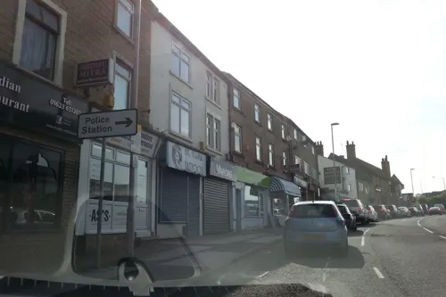
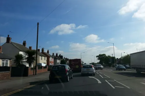
Sir John Cockle
Bar and pub · 0.7 mi
114 Sutton Road, Mansfield
Mo-Th 12:00-23:00; Fr 12:00-00:00; Sa 11:00-00:00; Su 11:00-23:00

Ming's Cuisine
Restaurant · Chinese · 1.0 mi
131 Newgate Lane, Mansfield
16:30-22:00; We off; Fr,Sa 16:30-22:30
Shoknan African Restaurant and Bar
Restaurant · African · 0.8 mi
20 Regent Street, Mansfield
Mo 13:00-22:00; Tu-Th 12:00-22:00; Fr-Sa 12:00-02:00; Su 13:00-22:00

Bella Italia
Restaurant · Italian
Park Lane, Mansfield
Mo-Th 12:00-22:00; Fr-Sa 12:00-23:00; Su 12:00-22:00

117 more on the map.
History
Settlement dates to Roman Britain times between AD 43 to AD 410. Hayman Rooke in 1787 discovered two Roman villas between Mansfield Woodhouse and Pleasley; a cache of denarii (300-400 Roman Silver Coins were found near King's Mill in 1849). A Roman tessellated pavement was found in one of the villas near Mansfield Woodhouse.
In AD 868, the Danes came into the county and they had complete control over the county by AD 877. Their occupation left names on the town, such as Skerry Hill, Ratcliffe Gate and Carr Bank.
The Royal Manor of Mansfield was held by the King. In 1042, Edward the Confessor possessed a manor in Mansfield. During the Norman Conquest in 1066, William the Conqueror made Sherwood Forest a royal forest for hunting.
The town was recorded as being Mammesfeld in the Wapentake of Broxtowe and the land of William the Conqueror in the Domesday Book of 1086. William owned "two carucates, five sochmans and thirty-five villains; twenty borders, with nineteen carucates and a half in demesne, a mill, piscary, twenty-four acres of meadow and pasture" in Mansfield.
Read more of the history
In the time of Henry II of England, the King visited what is now known as Kings Mill, staying at the home of Sir John Cockle for a night having been hunting in Sherwood Forest; Cockle was later known as the Miller of Mansfield. In 1199, the Manor was owned by King John; he used to visit Mansfield frequently between 1200 and 1216, and built a residence here. Later, Edward I held a royal council in the town. The manor, then owned by Henry III, subsequently passed to Henry de Hastings. In 1329, Queen Isabella, mother of Edward III, was the lady of the manor of Mansfield.
Market-petition documents of 1227 spelt Mansfield Maunnesfeld. Richard II signed a warrant in November 1377 to grant tenants the right to hold a four-day fair each year; the spelling had changed to Mannesfeld. Mansfield, Skegby and Sutton in Ashfield were the land of the king in 1086 as stated in the Domesday Book. There are remains of the 12th-century King John's Palace in Kings Clipstone, between Mansfield and Edwinstowe, and it was an area of retreat for royal families and dignitaries through to the 15th century. It was here that William the Lion of Scotland met Richard I of England (Richard the Lionheart) to congratulate him on his return from the crusades. It was also where Queen Eleanor, the first wife of Edward I, was taken ill and moved to Harby. King John and Edward I are reputed to have had impromptu parliaments at the Parliament Oak, near Market Warsop.
St Peter and St Paul's Church is mentioned in the 1086 Doomsday Book and, in 1092, it was passed by William II to Robert Bloet the bishop of Lincoln and Lord Chancellor of England.
Access to the town was by road from the city of Nottingham, on the way to Sheffield. In the town centre, a commemorative plaque was erected in 1988, together with a nearby tree to mark the point thought once to be the centre of Sherwood Forest. The plaque was refurbished in 2005 and moved to a ground plinth.
In 1516, during the reign of Henry VIII, an act of parliament settled the manor to Thomas Howard, 3rd Duke of Norfolk.
Dame Cecily Flogan in 1521, gave extensive land to the parish church and community in Mansfield in her will. The church, at the time, was in the hands of Edward VI.
Travellers in the 16th and 17th centuries had several inns and stable yards, dating from the medieval period, to stop at: the Harte; the Swan, which survives and has a 1490 dating stone; the Talbot; the White Bear; the Ram, with timber from before 1500; and the White Lion.
Several timber-framed cruck buildings were demolished in 1929; in 1973, a local historical society documented another during demolition dated to 1400 or earlier. Other Tudor houses in Stockwell Gate, Bridge Street and Lime Tree Place were also demolished to make way for development before they could be viewed for listing. Most remaining buildings are from the 17th century. The Swan was rebuilt in 1584 and became a coaching inn in the 1820s/30s.
The manor was passed to George Talbot, 6th Earl of Shrewsbury the husband of Bess of Hardwick, Countess of Shrewsbury in 1589, who then passed it to Gilbert Talbot, 7th Earl of Shrewsbury (the 6th Earl's son) until his death in 1616. Bess's daughter Mary Talbot, Countess of Shrewsbury the wife of Gilbert Talbot became the owner. Finally, the Manor was passed to the Dukes of Newcastle and Portland.
Mansfield and surrounding areas in Nottinghamshire became a strong centre for Nonconformism, separating from the Church of England.
In 1647, George Fox, who was originally from Fenny Drayton in Leicestershire, lived in Mansfield and worked as a shoemaker for four years. George lived in a cottage at the site of St Phillip Neri Catholic Church and ground on Chesterfield Road. It was at this time that he started his ministry. George Fox was imprisoned in Nottingham in 1649, for interrupting the service at the church in Mansfield Woodhouse. He became the founder of the Religious Society of Friends, better known as Quakers. Mansfield became the birthplace of the Quaker religion after Fox had a revelation walking past St Peter and St Paul's Church; he felt compelled to preach to others. The revelation is mentioned in his journal to which he states "and as I was walking by the steeplehouse side, in the town of Mansfield the Lord said unto me, that which people do trample upon must be thy food. And as the Lord spoke he opened it to me how that people and professors did trample upon the life, even the life of Christ was trampled upon…" This was during the time of the English Civil War.
There is a Quaker Heritage Trail in the town; the former meeting house was on the current site of the bus station. Fox met Elizabeth Hooton at her home Quaker House in nearby Skegby; she is usually considered to be the first person to accept the doctrines of Quakerism.
From the History section of Mansfield on Wikipedia, under CC BY-SA 4.0.
More about Mansfield
Geography
Mansfield has an average elevation of 117 metres (128 yd), with elements elevated at 190 metres (210 yd). The town lies on the river Maun.
The town is 12 miles (19 km) from Chesterfield, 15 miles (24 km) from Nottingham, 23 miles (37 km) from Derby and 30 miles (48 km) from Sheffield.
Mansfield has a temperate oceanic climate (Köppen: Cfb), with a narrow temperature range, an even spread of rainfall, low levels of sunshine and often breezy conditions throughout the year. The closest weather-station records for Mansfield come from Warsop in Meden Vale, 7 miles (11 km) to the north.
The absolute maximum temperature record for the area stands at 34.6 °C (94.3 °F), recorded in August 1990. In a typical year, the warmest day should reach 28.9 °C (84.0 °F) and 12.72 days should reach 25.1 °C (77.2 °F) or higher.
The absolute minimum temperature record for the area is −19.1 °C (−2.4 °F), recorded in January 1987. There is air frost on an average of 59 nights a year.
Rainfall averages 634 mm (25 in) a year, with 113 days reporting in excess of 1 mm (0.04 in) of rain (observation period 1971–2000).
The weather station is based at Warsop, 7 miles (11.3 km) from Mansfield town centre.
Economy
The areas of Mansfield and Ashfield had a combined Gross Value Added (GVA) in 2023 of £5 billion. In 2023, Mansfield's tourism economy equated to £130.76 million, up from £124.75 million in 2022.
Mansfield has a large market place within its commercial and retail centre; until 2016, there was also market trading at the old Buttercross Market. Among Mansfield's retail outlets is the Four Seasons shopping centre created in 1973–76, with over 50 units occupied by national chains and phone shops. There are other national chains on Stockwell Gate/West Gate, including Marks and Spencer.
Close to the market place is Leeming Street, which houses the Mansfield Museum, Palace Theatre, restaurants, public houses, bars and nightclubs.
There are also three outdoor retail parks, two with adjacent branded food outlets.
Since 2010, there has been a town centre business improvement district (BID), financed by 2% extra on the rateable value of nearby businesses. The BID aims to improve growth, investment and success for businesses.
Other aims of the BID include improving shop frontages, signage, and cleaning operations. The bid also installed a crowd-funded town centre wi-fi internet installation costing £37,000 and arranges for events such as artisan and Christmas markets and the Armed Forces Day.
Arts and culture
The Palace Theatre is the town's prime entertainment venue. Built as a cinema in 1910 and originally known as the Palace Electric Theatre, it was adapted into a live theatre with a proscenium arch. It was known as the Civic Hall and Civic Theatre, before the current name was revived in 1995. With a seating capacity of 534, the theatre is a mid-scale touring venue. It presents a programme of professional and amateur productions and a yearly pantomime.
Mansfield Super Bowl, a 28-lane alley with hospitality, opened in 1991. Facing closure in 2014, it was sold and refurbished in 2015.
The old Carnegie library, founded in 1905 in Leeming Street, became an arts and performance centre in 1976. It houses a recording studio, meeting room and the 100-seat Studio Theatre.
Mansfield also has a large Odeon cinema on a new retail and entertainment park outside the town centre. The previous ABC town centre cinema was used as a snooker centre until closure in 2012; late in 2013 it was converted into a church.
Every summer, Mansfield District Council hosts a Summer in the Streets festival. This consists of various public events held all across the town over many days, such as children's entertainment, fairground rides in the market square and hands-on workshops for crafts and circus skills.
From the Wikipedia article Mansfield, under CC BY-SA 4.0.
Notable people from Mansfield
 Rebecca AdlingtonBritish swimmer, Olympic gold medallistPhoto: Richard Gillin from St Albans, UK, CC BY-SA 2.0
 Ed DaveyBritish politician (born 1965)Photo: ©House of Commons, CC BY 3.0
 Kris CommonsScottish association football player (born 1983)Photo: Memorino, CC BY-SA 3.0
 James CollinsonBritish artist (1825-1881)Photo: James Collinson (1825 - 1881) –..., Public domain
 Holmes HerbertBritish actor (1882–1956)Photo: film screenshot (Universal), Public domain
 Dorothy AtkinsonBritish actress and singerPhoto: W!ZARD Radio Media, CC BY 3.0
 Jo PotterEnglish association football player (born 1984)Photo: Markbriggs, CC BY-SA 3.0
 John Medley WoodSouth African botanist (1827-1915)Photo: The original uploader was Paul..., Public domain
 James GrahamBritish playwright and television writerPhoto: Starhunterfan, CC0
 Ric LeeEnglish musicianPhoto: Stefan Brending ( 2eight ), CC BY-SA 3.0 de
- James PerchEnglish association football player (born 1985)
- William MartinEnglish naturalist and palaeontologist
Born in Mansfield, according to Wikidata (CC0). Each name links to its Wikipedia article.
Where to stay3
Churches and places of worship29
St Michael and All Angels' Church, Sutton-in-Ashfield
Church · 2.3 mi
Shopping30
Gas and EV charging5
Schools, colleges and libraries22
St Philip Neri With St Bede Catholic Voluntary Academy
School · Roman Catholic · 1.1 mi
Rosemary Street, Mansfield
Healthcare8
Kings Mill Hospital
Hospital · 1.4 mi
Mansfield Road, Sutton-in-Ashfield
Map of Mansfield
250 places. The map loads OpenStreetMap tiles when you open it.
Getting there and nearby towns
Nottingham City Airport (NQT) is the nearest airport with scheduled flights listed in OpenStreetMap, 16 miles away.
- Nottingham 13 mi south, about 20 min by car
- Sheffield 20 mi northwest, about 33 min by car
- Rotherham 22 mi north, about 35 min by car
- Wakefield 40 mi north, about 1 h by car
- Stoke-on-Trent 42 mi west, about 1 h by car
- Stockport 44 mi northwest, about 1 h 15 min by car
- Newcastle under Lyme 44 mi west, about 1 h 15 min by car
- Oldham 47 mi northwest, about 1 h 15 min by car
- Sutton Coldfield 47 mi southwest, about 1 h 15 min by car
- Birmingham 54 mi southwest, about 1 h 30 min by car
Drive times are estimates from straight-line distance, not routes.
Towns near Mansfield


Keep exploring
Local news
Headlines from INDB.
Reviews, tips and questions
Loading what members have shared...
Sources and licences
- GeoNames (CC BY 4.0): population, coordinates, regions and time zone
- Mapillary (see each image): photos
- OpenStreetMap contributors (ODbL 1.0): places, airports, map data
- Wikidata (CC0 1.0): elevation, founding date, time zone, website, landmarks and historic places
- Wikimedia Commons (see each image): photos
- Wikipedia (CC BY-SA 4.0): overview and history text
Photo credits
- Mansfield Market Place, Duncan, CC BY 2.0
- The Talbot, Nottingham Road, Mansfield (3), Enchufla Con Clave, CC BY-SA 4.0
- Mansfield Cinema and restaurants, MatthewDavid41, CC0
- Odeon Cinema, Mansfield, Notts, MatthewDavid41, CC BY-SA 4.0
- The Talbot, Nottingham Road, Mansfield (2), Enchufla Con Clave, CC BY-SA 4.0
- Il Rosso, Nottingham Road, Mansfield (2), Enchufla Con Clave, CC BY-SA 4.0
- Il Rosso, Nottingham Road, Mansfield (3), Enchufla Con Clave, CC BY-SA 4.0
- Il Rosso, Nottingham Road, Mansfield (1), Enchufla Con Clave, CC BY-SA 4.0
- Bethel Methodist Church, Nottingham Road, Mansfield (1), Enchufla Con Clave, CC BY-SA 4.0
- Bethel Methodist Church, Nottingham Road, Mansfield (2), Enchufla Con Clave, CC BY-SA 4.0
- Bethel Methodist Church, Nottingham Road, Mansfield (3), Enchufla Con Clave, CC BY-SA 4.0
- Palace Theatre, Leeming Street, Mansfield (Previously the Civic Theatre) (2), Enchufla Con Clave, CC BY-SA 4.0
- Mansfield Museum 1, Nottingham311, CC BY-SA 4.0
- St Marks Mansfield June 2009 02, Oliver1948uk, CC BY-SA 3.0
- All Saints' Church, Mansfield Road, Stanton Hill (5), Enchufla Con Clave, CC BY-SA 4.0
- Church of St Chad, Church Lane, Pleasley Vale, Nottinghamshire (1), Enchufla Con Clave, CC BY-SA 4.0
- Church Of St Edmund, Mansfield Woodhouse (4), Enchufla Con Clave, CC BY-SA 4.0
- Sutton-in-Ashfield - St Michael & All Angels, Dave Bevis, CC BY-SA 2.0
- King's Mill Towers and road junction, Duncan, CC BY 2.0
- St. Peter and St. Paul's Church, Church Street, Mansfield (1), Enchufla Con Clave, CC BY-SA 4.0
- Cavendish Monument And Attached Railings, Market Square, Mansfield, Nottinghamshire, Enchufla Con Clave, CC BY-SA 4.0
- Bridge Street Methodist Church, Bridge Street, Mansfield (1), Enchufla Con Clave, CC BY-SA 4.0
- War Memorial And Railings 1 Metre South Of Church Of St Mark, Nottingham Rd (2), Enchufla Con Clave, CC BY-SA 4.0
- Church Of St Lawrence The Martyr, Skerry Hill, Mansfield (1), Enchufla Con Clave, CC BY-SA 4.0
- Intake Farm School, Armstrong Road, Ladybrook Lane, Mansfield (1), Enchufla Con Clave, CC BY-SA 4.0
- Old Market Cross, Mansfield, Old Market Cross (1), Enchufla Con Clave, CC BY-SA 4.0
- War Memorial On North West Side Of Carr Bank Memorial Park, Windmill Lane, Mansfield (1), Enchufla Con Clave, CC BY-SA 4.0
- War Memorial 5 Metres South Of Church Of St Peter And St Paul, Enchufla Con Clave, CC BY-SA 4.0
- Midland Hotel (6), Enchufla Con Clave, CC BY-SA 4.0
- Hermitage Mill, Hermitage Lane, Mansfield (2), Enchufla Con Clave, CC BY-SA 4.0
- Carr Bank Park, Windmill Lane, Mansfield - Memorial to WW I (2), Enchufla Con Clave, CC BY-SA 4.0
- Kings Mill Hospital, Sutton in Ashfield, Notts, MatthewDavid41, CC BY-SA 4.0
- One Call Stadium, Rileyandco, CC BY-SA 4.0
- St. Peter and St. Paul's Church, Church Street, Mansfield (3), Enchufla Con Clave, CC BY-SA 4.0
- Carr Bank Park, Windmill Lane, Mansfield (29), Enchufla Con Clave, CC BY-SA 4.0
- The athletics track Berry Hill Park, MatthewDavid41, CC BY-SA 4.0
- Street-level photo, adam2, CC BY-SA 4.0
- Street-level photo, adam2, CC BY-SA 4.0
- Street-level photo, adam2, CC BY-SA 4.0
- Street-level photo, adam2, CC BY-SA 4.0
- Street-level photo, adam2, CC BY-SA 4.0
- Street-level photo, adam2, CC BY-SA 4.0


Page built November 10, 2026. Spotted a mistake? Tell us or suggest a place.