


Why visit Kippax
Townapedia lists 5 museums and landmarks, 13 parks and trails, 36 places to eat and 4 attractions in and around town.
Highlights include Tickle Cock Bridge, Crawshaw Woods (Shippen House Farm) Bridge, Hul4/20, Lagentium and Queen's Mill.
Weather in Kippax
Forecast from MET Norway (CC BY 4.0). Full forecast
About Kippax
Kippax is a town and civil parish in the City of Leeds, West Yorkshire, England. It is situated to the east of the city, near to Garforth and Great Preston.
From the Wikipedia article Kippax, West Yorkshire (this version), under CC BY-SA 4.0.
Things to do4

Tickle Cock Bridge
Bridge · 3.0 mi
Pedestrian underpass in Castleford, West Yorkshire, England

Crawshaw Woods (Shippen House Farm) Bridge, Hul4/20
Bridge · 3.0 mi
Bridge in Leeds, West Yorkshire, England, UK


Museums and landmarks5
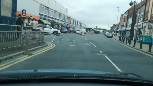
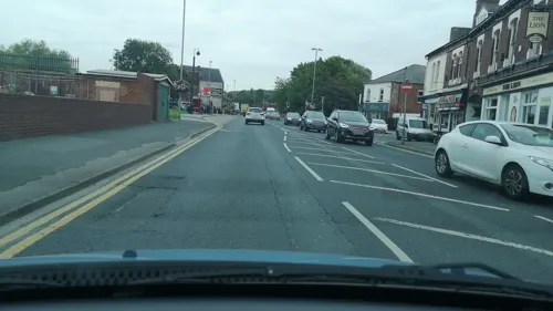
Queen's Mill
Museum · 2.8 mi
Historic flour mill in Castleford, West Yorkshire, UK
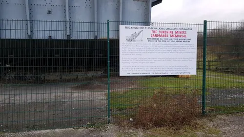

Allerton Bywater War Memorial
Monument and historic site · 1.5 mi
War memorial for all those that served and died from Allerton Bywater in the World Wars
Parks, trails and playgrounds13

St Aidan's
Park · 2.0 mi
Country Park and RSPB reserve between Leeds and Castleford in West Yorkshire, England

Fairburn Ings RSPB reserve
Park · 2.7 mi
RSPB nature reserve in the United Kingdom


1 more on the map.
Restaurants and cafes36


Carlton View Sandwich Bar and Cafe
Cafe · Sandwich · 1.1 mi
100 Leeds Road, Castleford

24 more on the map.
History
The name Kippax is of Anglo-Saxon origin and is first attested as Chipesch in the Domesday Book of 1086, and as "Kippeys" in charters from the 1090s to the 1270s, and Kypask and Kypax from the 13th century onwards. The placename seems to be composed of an Anglo-Saxon personal name Cippa (with initial [tʃ-], suggested by the Domesday Book form) or Cyppa (with initial [k-]) + æsc [æʃ] 'ash-tree'. This suggests that the village was first established in a wooded area of ash trees. The pronunciation of the name seems to show Scandinavian influence, perhaps in the change from initial [tʃ-] to [k-], and more clearly in the change of [-æʃ] to [-ask] (and thereafter [-aks]).
Locational surnames such as Kippax developed when former inhabitants of a place moved to another area, usually to seek work, and were best identified by the name of their birthplace. The surname first appears in the late-14th century and other early recordings include: Johannes de Kypax, Johanna Kepas, and Johannes de Kepax, who were all recorded in the Poll Tax Records for Yorkshire in 1379.
Read more of the history
The village's historical roots are evidenced by the presence of an originally Anglo-Saxon church which underwent significant modification in Norman times. Typical Saxon herring-bone masonry can be seen in the church tower. Despite being an administrative centre for hundreds of years, the population remained small and it was mostly agricultural until the late-18th century when coal mining began on a small scale in bell pits. The advent of deeper mining and the discovery of coal seams in Allerton Bywater saw Kippax undergo a rapid expansion into a typical northern mining community in the 19th century.
Exploitation of the coal led to a railway being built between Garforth and Castleford in 1873. The single line had two intermediate stations at Kippax and Ledston. It was closed to passengers in 1951. The decline in deep mining saw Allerton Bywater pit close in the 1990s having been in decline since the 1970s.
Kippax adjusted to its new status as a commuter village. Its proximity to the A1/M1/M62 means that many residents now commute to Leeds, Castleford, London, Wakefield or York. The high street has a mix of independent butchers, grocers and newsagents and a small co-op store.
From the History section of Kippax, West Yorkshire on Wikipedia, under CC BY-SA 4.0.
Notable people from Kippax
 James GullenBritish bicycle racerPhoto: Aaron Hemsley, CC BY-SA 4.0
 Robert HarveyEnglish singer, musician, DJ and songwriterPhoto: Raph_PH, CC BY 2.0
 Gordon PresgraveEnglish footballer (1907-1976)Photo: MadeLedger*, CC BY-SA 4.0
- Mike AstburyEnglish footballer (born 1964)
- Andi WatsonBritish cartoonist
- Harold MosbyEnglish footballer (1926-2007)
- Trevor BriggsEnglish rugby league footballer (1948-?)
- Alan AckroydEnglish rugby league footballer
Born in Kippax, according to Wikidata (CC0). Each name links to its Wikipedia article.
Churches and places of worship11
Shopping2
Gas and EV charging1
Schools, colleges and libraries10
Lady Elizabeth Hastings Church of England Primary School
School · Anglican · 1.4 mi
Green Lane, Castleford
Healthcare4
Map of Kippax
86 places. The map loads OpenStreetMap tiles when you open it.
Getting there and nearby towns
Leeds Bradford Airport (LBA) is the nearest airport with scheduled flights listed in OpenStreetMap, 14 miles away.
- Lofthouse 6 mi southwest, about 9 min by car
- Knottingley 6 mi southeast, about 10 min by car
- Leeds 8 mi west, about 12 min by car
- Wakefield 8 mi southwest, about 12 min by car
- Ossett 10 mi southwest, about 17 min by car
- Wetherby 11 mi north, about 18 min by car
- Pudsey 12 mi west, about 19 min by car
- Selby 12 mi east, about 20 min by car
- South Elmsall 12 mi south, about 20 min by car
- Bradford 16 mi west, about 25 min by car
Drive times are estimates from straight-line distance, not routes.
Towns near Kippax


Keep exploring
Local news
Headlines from INDB.
Reviews, tips and questions
Loading what members have shared...
Sources and licences
- GeoNames (CC BY 4.0): population, coordinates, regions and time zone
- Mapillary (see each image): photos
- OpenStreetMap contributors (ODbL 1.0): places, airports, map data
- Wikidata (CC0 1.0): elevation, founding date, time zone, website, landmarks and historic places
- Wikimedia Commons (see each image): photos
- Wikipedia (CC BY-SA 4.0): overview and history text
Photo credits
- Tickle Cock Bridge April 2017, Chemical Engineer, CC BY-SA 4.0
- St Aidan's Nature Reserve1, Richard Avery, CC BY-SA 4.0
- All Saints, Castleford (27394684630), Tim Green from Bradford, CC BY 2.0
- St. Mary's Church, Garforth, Rcsprinter123, CC BY 3.0
- Church of St Mary Swillington, Wdhill2, CC BY-SA 3.0
- Brigshaw High School by donkeykong, donkeykong, CC BY-SA 2.0
- Street-level photo, cuttlebug, CC BY-SA 4.0
- Street-level photo, cuttlebug, CC BY-SA 4.0
- Street-level photo, cuttlebug, CC BY-SA 4.0
- Street-level photo, lvl5, CC BY-SA 4.0
- Street-level photo, humez, CC BY-SA 4.0
Page built November 10, 2026. Spotted a mistake? Tell us or suggest a place.