


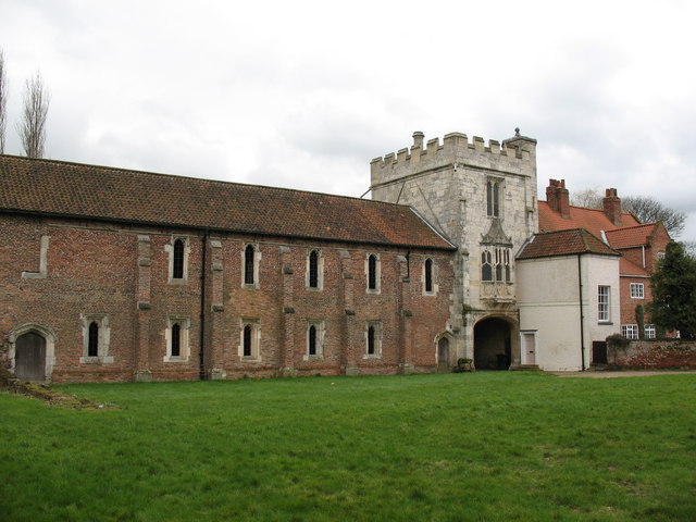

Why visit Selby
Townapedia lists 6 museums and landmarks, 21 parks and trails, 103 places to eat, 19 places to stay and 6 attractions in and around town.
Highlights include River Ouse swing bridge, Cawood Bridge, Wressle Castle and Cawood Castle.
Weather in Selby
Forecast from MET Norway (CC BY 4.0). Full forecast
About Selby
Selby is a market town and civil parish in North Yorkshire, England, 12 miles (19.3 km) south of York on the River Ouse. At the 2021 Census, it had a population of 17,193.
From the Wikipedia article Selby (this version), under CC BY-SA 4.0.
Travel tips from other travellers: Selby on Wikivoyage (CC BY-SA 4.0).
Photos of Selby


Things to do6
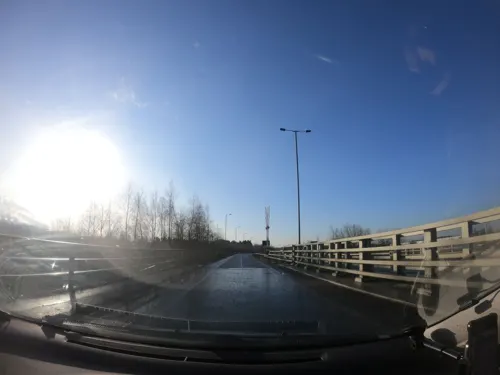
River Ouse swing bridge
Bridge · 1.3 mi
Rad Bridge over the River Ouse, Yorkshire, England




Museums and landmarks6

Wressle Castle
Monument and historic site · 5.6 mi
Late 14th-century quadrangular castle in East Yorkshire, England, UK



Drax Priory
Monument and historic site · 4.1 mi
"In 1868 it was reported that traces of the priory could still be found[2] but field work in the 1980s and 1990s has failed to find any...
Parks, trails and playgrounds21

Skipwith Common
Park · 4.2 mi
Nature reserve in North Yorkshire, England




9 more on the map.
Restaurants and cafes103



Barco Lounge
Restaurant · British
Market Cross Shopping Centre, Selby
Su-Th 09:00-22:00; Fr,Sa 09:00-23:00

Pickled @ Riccal
Cafe · Regional · 3.6 mi
53 Main Street, Riccall
Mo-Fr 09:00-17:00; Sa 09:00-14:30, Su closed

Regency
Restaurant · Chinese
James Street, Selby
Tu-Th 14:00-23:00, Fr,Sa 14:00-24:00, Su 14:00-23:00
91 more on the map.
History
Archaeological investigations in Selby have revealed extensive remains, including waterlogged deposits in the core of the town dating from the Roman period onwards. It is believed that Selby originated as a settlement called Seletun, which was referred to in the Anglo-Saxon Chronicle of AD 779.
The place name 'Selby' is first attested in a Yorkshire charter c. 1030, where it appears as Seleby. It appears as Selbi c. 1050. The name is thought to be a Scandinavian form of Seletun, meaning 'sallow tree settlement'.
The town of Selby is on the main route north from the Midlands and is the traditional birthplace of King Henry I, fourth son of William the Conqueror, in 1068/69; the connection is supported by William and his wife Matilda's unique joint charter of Selby Abbey, far to the north of their usual circuit of activities, which was founded for Benedict of Auxerre in 1069 and subsequently supported by the de Lacy family. King Henry I is reputed to have been born there in c. 1068. A notable feature of the abbey is the 14th-century Washington Window, featuring the heraldic arms of the ancestors of George Washington, the first president of the United States. The design is often cited as an influence for the Stars and Stripes flag.
Read more of the history
It is said that the abbey was founded when Benedict saw three swans on a lake in Selby, which he took as a sign of the Father, Son and Holy Ghost, and that is why the official crest of Selby Abbey is three swans. Selby Abbey was closed in 1539 as part of the Dissolution of the Monasteries under Henry VIII and the majority of the buildings have since been demolished. The central nave of the abbey church survived and in 1618 it became the parish church of Selby.
During the English Civil War the Royalist garrison of Selby was captured by Parliamentarians in the Battle of Selby on 11 April 1644. There are other historical sites, such as the cholera burial ground on the north side of the abbey, Selby Market Cross and the local school, Selby High School. The Market Place has existed since the early 14th century, when the market was moved away from the monastery churchyard. The Crescent which curves eastwards from James Street, was planned in the early 19th century by a local man, John Audus, after he saw Lansdown Crescent in Bath, Somerset.
Selby is expanding. New houses and shops are being built on the outskirts as far as the bypass, which has resulted in the loss of some trade from the town centre. Meanwhile, the riverfront is being revamped with modern housing and fashionable flats.
The 2001 Great Heck rail crash is also often referred to as the Selby rail crash. It happened a few miles south of Selby, at the village of Great Heck near the M62 motorway, and Selby was the closest major town to the accident site. On 28 February 2001 a vehicle crashed off the M62 down an embankment onto a railway track, where it was struck by a passenger train heading to London. The accident was then compounded by a second collision involving an oncoming goods train.
Selby and its surrounding area again came to national prominence through another tragedy on 18 July 2004, this time through four exceptionally violent murders carried out by Mark Hobson, a former refuse collector. Hobson, 34 at the time, killed his girlfriend, Claire Sanderson, 27, and her sister Diane at a flat in the nearby village of Camblesforth. He subsequently murdered an elderly couple, James and Joan Britton, at their home in the village of Strensall, near York. Hobson was later sentenced to life imprisonment, with the trial judge recommending that he should never be released; the High Court later agreed with this recommendation.
From the History section of Selby on Wikipedia, under CC BY-SA 4.0.
More about Selby
Geography
Selby lies on the tidal River Ouse, in a natural area of Yorkshire known as the Humberhead Levels, a flat, low-lying agricultural plain shaped by glacial lake sediments and river alluvium, crossed by ditches and drains that discharge to the Ouse and its tributaries.
The surrounding ground is very low-lying, mostly between about 5 and 8 metres above sea level, with extensive alluvial deposits along the river corridor.
The main roads that cross at Selby are the A63 from Leeds to Hull and the A19 from Doncaster to York, though the A19 and A63 have no longer met in Selby itself since the opening of the Selby Bypass in 2004.
The River Ouse is navigable upstream as far as York, so the old toll bridge had to allow for this. For many years the swing bridge in Selby was a notorious local bottleneck, but since the opening of the Selby bypass, congestion in the town has been relieved.
The importance of Selby as a market town has declined in recent decades and its short-lived prominence as the centre of the Selby Coalfield has also waned. Selby is close to both York and Leeds. Its popularity as a tourist destination, owing to Selby Abbey, has led to a large amount of development and renovation in the town and surrounding area.
Economy
Much of the historical wealth of the town is based on its position on the banks of the tidal River Ouse. Selby used to have a large shipbuilding industry, and was an important port on the Selby Canal, which brought trade from Leeds. The Selby Canal links the River Ouse at Selby to the River Aire at Haddlesey. The replacement Greenpeace craft (1989–2011), bearing the name Rainbow Warrior, was built in Selby in 1957 as a fishing boat.
Arts and culture
Selby Abbey is the town’s main landmark. The abbey church is Grade I listed and retains significant medieval and later fabric. Inside is the so-called Washington Window, a fourteenth-century pane depicting the arms of the Washington family. The design has been linked to the later design of the flag of the United States.
On Water Lane the Abbot's Staith Buildings, a medieval warehouse complex associated with the abbey’s administration of trade, are listed at Grade II*. In the Market Place the nineteenth-century Market Cross is a local landmark and is Grade II listed.
The Selby Railway Swing Bridge, dating back to the late nineteenth-century, carries the railway across the River Ouse and holds Grade II listed status. It’s particularly noted for its distinctive wrought-iron structure and the original hydraulic machinery that still forms part of its engineering character.
Selby Town Hall has been running a music venue since 2003, with regular performances of music, dance, drama and comedy and local band nights, with an annual Battle Of The Bands final, which in 2009 sold out in 12 hours, seeing local band Leonard's Revenge crowned victors.
There have been four cinemas in Selby, with the last one closing in the early 1980s. In 2009 a community group established a cinema project called Selby Globe.
Education
Primary education is provided by several schools in and around the town, including Selby Abbey Church of England Voluntary Controlled Primary School on New Lane.
Secondary education is provided locally by Selby High School and Brayton Academy.
Further and higher education, apprenticeships and adult learning are offered by Selby College on Abbot’s Road. On 1 March 2022 Selby College and Wakefield College merged to form the Heart of Yorkshire Education Group, which oversees campuses in Selby, Castleford and Wakefield.
From the Wikipedia article Selby, under CC BY-SA 4.0.
Notable people from Selby
 Smithson TennantBritish chemist (1761-1815)Photo: en:User:Sakhrat, CC BY-SA 3.0
 Jonathan HutchinsonEnglish surgeon, ophthalmologist, dermatologist, venereologist, and pathologist (1823-1913)Photo: Unknown author Unknown author, CC BY 4.0
 Thomas JohnsonEnglish botanist and Royalist soldier of the English Civil WarPhoto: Engraving: unknown; publication:..., Public domain
- Henry I of EnglandKing of England from 1100 to 1135 (1068–1135)
- James StephensonBritish-American actor (1889-1941)
- John SherwoodBritish hurdler
- Robert of SelbyEnglish courtier in Sicily
- Eden Taylor-DraperBritish actress
- Jack ByersEnglish footballer (1897-1931)
- Harry BrighamFootballer (1914-1978)
- Dave Donaldsonassociation football player (1911-1974)
- Steve SherwoodEnglish footballer (born 1953)
Born in Selby, according to Wikidata (CC0). Each name links to its Wikipedia article.
Where to stay19
Dairymans Cottage Bed and Breakfast
Motel and hotel · 3.5 mi
14 Kelfield Road, York
Churches and places of worship57
Shopping15
Gas and EV charging5
Schools, colleges and libraries31
Cawood Church of England Voluntary Aided Primary School
School · Anglican · 4.2 mi
Broad Lane, Cawood
Hambleton Church of England Voluntary Controlled Primary School
School · Anglican · 4.0 mi
Gateforth Lane, Selby
Healthcare8
Map of Selby
250 places. The map loads OpenStreetMap tiles when you open it.
Getting there and nearby towns
Burn Gliding Club is the nearest airport with scheduled flights listed in OpenStreetMap, 2 miles away.
- York 12 mi north, about 19 min by car
- Thorne 13 mi south, about 20 min by car
- South Elmsall 16 mi southwest, about 25 min by car
- Wetherby 16 mi northwest, about 26 min by car
- Doncaster 18 mi south, about 29 min by car
- Wakefield 19 mi west, about 30 min by car
- Leeds 20 mi west, about 32 min by car
- Wath upon Dearne 22 mi southwest, about 36 min by car
- Wombwell 23 mi southwest, about 36 min by car
- Bradford 28 mi west, about 45 min by car
Drive times are estimates from straight-line distance, not routes.
Towns near Selby


Keep exploring
Local news
Headlines from INDB.
Reviews, tips and questions
Loading what members have shared...
Sources and licences
- GeoNames (CC BY 4.0): population, coordinates, regions and time zone
- Mapillary (see each image): photos
- OpenStreetMap contributors (ODbL 1.0): places, airports, map data
- Wikidata (CC0 1.0): elevation, founding date, time zone, website, landmarks and historic places
- Wikimedia Commons (see each image): photos
- Wikipedia (CC BY-SA 4.0): overview and history text
Photo credits
- Railings of Selby Abbey, Warofdreams, CC BY-SA 4.0
- Wressle-Castle-29042011, Dupont Circle, CC BY-SA 3.0
- All Saints Church Bubwith, Peter Church, CC BY-SA 2.0
- Selby - Abbey - 07, Benjamin Smith, CC BY-SA 4.0
- Cawood Castle, Gordon Hatton, CC BY-SA 2.0
- Cricketers Arms, Market Place, Selby (Taken by Flickr user 31st January 2015), Flickr user:Tim Green aka atoach, CC BY 2.0
- The Giant Bellflower, Gowthorpe, Selby, North Yorkshire (29th November 2022), Mtaylor848, CC BY-SA 4.0
- Path autumn skipwith common nature reserve woods 2, Benjamin Shaw, CC BY-SA 4.0
- Wall, piers, gate and railings, 6 The Crescent, Warofdreams, CC BY-SA 4.0
- 14–24 Park Street and The Lodge, Warofdreams, CC BY-SA 4.0
- 7-14 The Crescent, Warofdreams, CC BY-SA 4.0
- RAF Riccall War Memorial, Benjamin Shaw, CC BY-SA 3.0
- Smithson Tennant 12 Finkle Street Selby North Yorkshire YO8 4DS, Spudgun67, CC0
- Street-level photo, lamaar639, CC BY-SA 4.0
- Street-level photo, victuallers, CC BY-SA 4.0
- Street-level photo, cuttlebug, CC BY-SA 4.0
- Street-level photo, lamaar639, CC BY-SA 4.0
Page built November 10, 2026. Spotted a mistake? Tell us or suggest a place.