


Knottingley, United Kingdom
Knottingley is a town of 13,804 people in England, United Kingdom.
Why visit Knottingley
Townapedia lists 10 museums and landmarks, 9 parks and trails, 56 places to eat, 2 places to stay and 1 attraction in and around town.
Highlights include Ferry Bridge, Pontefract Castle and Pontefract Museum.
Weather in Knottingley
Forecast from MET Norway (CC BY 4.0). Full forecast
About Knottingley
Knottingley is a town in the City of Wakefield, West Yorkshire, England. It lies on the river Aire and the old A1 road before it was bypassed as the A1(M). Historically part of the West Riding of Yorkshire, it has a population of 13,503, increasing to 13,710 for the City of Wakefield ward at the 2011 Census. It makes up the majority of the Knottingley ward represented on Wakefield Council.
From the Wikipedia article Knottingley (this version), under CC BY-SA 4.0.
Things to do1
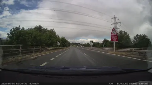
Ferry Bridge
Bridge · 0.8 mi
Grade I listed bridge in Ferrybridge, West Yorkshire, England
Museums and landmarks10

Pontefract Castle
Museum · 2.1 mi
Castle in West Yorkshire, England, UK
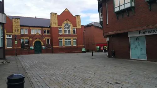
Pontefract Museum
Museum · 2.5 mi
Museum in Pontefract, West Yorkshire, United Kingdom
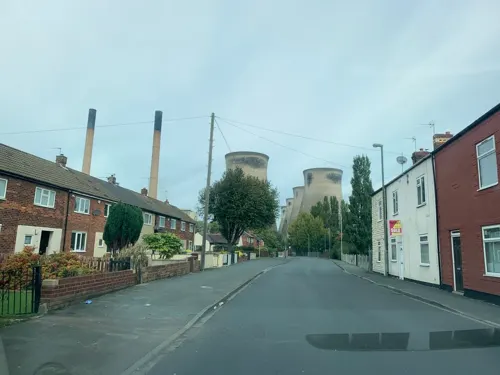
Battle of Ferrybrige
Monument and historic site · 0.8 mi
Part of the Wars of the Roses; preliminary to the Battle of Towton; indecisive


Parks, trails and playgrounds9


Restaurants and cafes56
The Turnpike
Bar and pub · British · 0.8 mi
Pontefract Road, Knottingley



44 more on the map.
History
During the three Sieges of Pontefract Castle, Oliver Cromwell took residence in the town of Knottingley, believed to be in Wildbore House. The house was later demolished, when its land was mined as a quarry for the limestone underneath.
Knottingley, inextricably linked with Ferrybridge, is a West Yorkshire town whose history is tied to river travel and industry. It has managed to retain certain elements of that industrial history as thriving enterprises today, providing employment for many of its combined population of some 17,000. It was originally an Anglo-Saxon settlement, though the ancient monument of Ferrybridge Henge shows it had significant indigenous habitation long before then.
The crossing over the Aire at Ferrybridge was of importance for many centuries. A bridge was built there in 1198, and another to replace it two centuries later. Located on the Great North Road linking London with York and Edinburgh beyond that, the town became an important staging place for the coach traffic on that route.
Until 1699, it was an important inland river port, of some note. It was long the last navigable point on the Aire, until the Aire and Calder Navigation, built in 1704 and widened in 1826, enabled barges to make it to Leeds. Its shipyards built and maintained both inland and seagoing vessels.
Read more of the history
Pottery was a significant industry for the town from the 19th century until as late as the 1940s, when the Australian Pottery, opened to cater to that country's needs, finally closed. Knottingley continued as a centre for boat building into the 20th century.
After 1870, the town became known for glass manufacturing. In 1887, Bagley's Glassworks purchased the rights to the first bottle-making machine, invented by a Ferrybridge postmaster. There is a Bagley's Glass gallery in Pontefract Museum. Glass manufacturing continues to be important.
The town had Kellingley Colliery operating until December 2015; the demand for coal was largely driven by Ferrybridge Power Station. Whilst most of the coal bound for Ferrybridge left by the railway, some was transported up river using barges, the last of which was delivered in December 2002. The last miners, their families and many former miners marched from Knottingley Town Hall to the Social Club in December 2015.
From the History section of Knottingley on Wikipedia, under CC BY-SA 4.0.
More about Knottingley
Education
The town has several primary schools: England Lane Academy, Willow Green Academy, Knottingley St Botolph's C of E Academy, The Vale Primary Academy and Simpson's Lane Academy.
There is one high school, De Lacy Academy, formerly known as Knottingley High School and Sports College.
Sixth-form colleges are located in nearby Pontefract, Wakefield and Selby.
From the Wikipedia article Knottingley, under CC BY-SA 4.0.
Notable people from Knottingley
 Ben ThompsonAmerican gunman, gambler, and lawman (1843-1884)Photo: Unknown author Unknown author, Public domain
 Austin TateBritish computer scientistPhoto: Unknown author, CC BY-SA 4.0
- Mike AddyEnglish footballer (born 1943)
- Henry Lascelles Carrbusinessman
- Billy ThompsonAmerican gunman
- Graham SteadmanEnglish rugby league footballer and coach
- Percy BentleyBritish Army officer and auctioneer
- Bill HortonEnglish rugby league footballer
Born in Knottingley, according to Wikidata (CC0). Each name links to its Wikipedia article.
Where to stay2
Churches and places of worship17
Pontefract Kingdom Hall of Jehovah's Witnesses
Church · Jehovahs Witness · 1.5 mi
Orchard Head Lane, Pontefract
Shopping3
Gas and EV charging6
Schools, colleges and libraries8
Healthcare3
Map of Knottingley
115 places. The map loads OpenStreetMap tiles when you open it.
Getting there and nearby towns
Leeds Bradford Airport (LBA) is the nearest airport with scheduled flights listed in OpenStreetMap, 20 miles away.
- South Elmsall 8 mi south, about 12 min by car
- Selby 9 mi northeast, about 15 min by car
- Wakefield 10 mi west, about 16 min by car
- Lofthouse 10 mi west, about 16 min by car
- Leeds 13 mi northwest, about 22 min by car
- Ossett 13 mi west, about 22 min by car
- Doncaster 14 mi south, about 22 min by car
- Thorne 14 mi southeast, about 22 min by car
- Wombwell 14 mi southwest, about 23 min by car
- Wath upon Dearne 15 mi south, about 24 min by car
Drive times are estimates from straight-line distance, not routes.
Towns near Knottingley


Keep exploring
Local news
Headlines from INDB.
Reviews, tips and questions
Loading what members have shared...
Sources and licences
- GeoNames (CC BY 4.0): population, coordinates, regions and time zone
- Mapillary (see each image): photos
- OpenStreetMap contributors (ODbL 1.0): places, airports, map data
- Wikidata (CC0 1.0): elevation, founding date, time zone, website, landmarks and historic places
- Wikimedia Commons (see each image): photos
- Wikipedia (CC BY-SA 4.0): overview and history text
Photo credits
- Pontefract Castle, Unknown author, Public domain
- All Saints, Pontefract (27364027412), Tim Green from Bradford, CC BY 2.0
- Micklegate Methodist Church, Pontefract (1), Rept0n1x, CC BY-SA 3.0
- St Botolph, Knottingley, Tim Green, CC BY 2.0
- 60026 6M09, The Nikon User, CC BY 2.0
- Street-level photo, gmc, CC BY-SA 4.0
- Street-level photo, humez, CC BY-SA 4.0
- Street-level photo, gmc, CC BY-SA 4.0
- Street-level photo, cuttlebug, CC BY-SA 4.0
- Street-level photo, cuttlebug, CC BY-SA 4.0
- Street-level photo, cuttlebug, CC BY-SA 4.0
- Street-level photo, gmc, CC BY-SA 4.0
- Street-level photo, gmc, CC BY-SA 4.0
- Street-level photo, cuttlebug, CC BY-SA 4.0
- Street-level photo, cuttlebug, CC BY-SA 4.0
- Street-level photo, gmc, CC BY-SA 4.0
- Street-level photo, cuttlebug, CC BY-SA 4.0
- Street-level photo, humez, CC BY-SA 4.0
- Street-level photo, humez, CC BY-SA 4.0
- Street-level photo, rskedgell, CC BY-SA 4.0
- Street-level photo, cuttlebug, CC BY-SA 4.0
- Street-level photo, cuttlebug, CC BY-SA 4.0
- Street-level photo, inspec1951, CC BY-SA 4.0
- Street-level photo, cuttlebug, CC BY-SA 4.0
- Street-level photo, cuttlebug, CC BY-SA 4.0
- Street-level photo, cuttlebug, CC BY-SA 4.0
Page built November 10, 2026. Spotted a mistake? Tell us or suggest a place.