


Why visit Ossett
Townapedia lists 8 museums and landmarks, 10 parks and trails, 96 places to eat, 6 places to stay and 1 attraction in and around town.
Highlights include Theatre Royal, Wakefield, The Art House, Wakefield Museum and Crow Nest Park.
Weather in Ossett
Forecast from MET Norway (CC BY 4.0). Full forecast
About Ossett
Ossett is a market and residential town in the Wakefield district, in the county of West Yorkshire, England. Historically part of the West Riding of Yorkshire, it is situated between Dewsbury, Horbury and Wakefield. At the 2021 census, the town had a population of 21,861. Ossett forms part of the Heavy Woollen District.
From the Wikipedia article Ossett (this version), under CC BY-SA 4.0.
Photos of Ossett


Things to do1

Theatre Royal, Wakefield
Cinema and theater · 3.2 mi
Theatre in Wakefield, England
Museums and landmarks8


Wakefield Museum
Museum · 3.1 mi
Museum in Wakefield, West Yorkshire, United Kingdom

National Coal Mining Museum for England
Museum · 3.0 mi
Coal mining museum in Yorkshire, England, United Kingdom

Parks, trails and playgrounds10

Crow Nest Park
Park · 2.9 mi
Green Flag public park in Yorkshire, England, UK

Thornes Park
Park · 2.9 mi
Park in Wakefield, West Yorkshire, England, UK


Restaurants and cafes96
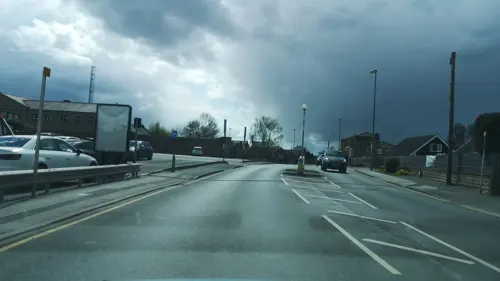
The Carpenters Arms
Bar and pub · Grill, Burger, Local, Dessert
Recently refurbished and reopened under new owners.
22 Bank Street, Ossett
Mo-Th 10:00-22:00; Fr-Sa 10:00-00:00; Su 10:00-22:00
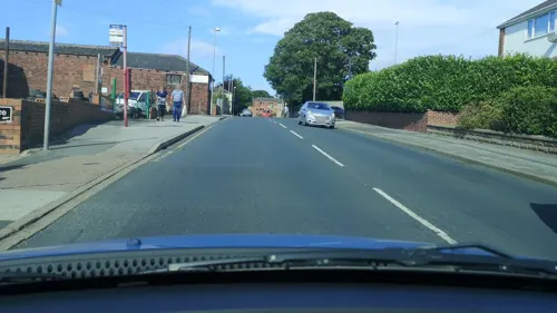
The Thorn Tree Pub & Kitchen
Bar and pub · Western, Tapas, Breakfast, Fish And Chips, Grill, Burger, Regional
15 Queen Street, Ossett
Tu-Th 12:00-23:00, Fr-Sa 12:00-00:00, Su 12:00-23:00
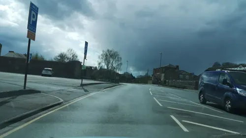
Bank Street Kitchen
Restaurant · Steak House, Burger, Chicken, Wings
3 Bank Street, Ossett
Tu-Th 12:00-21:00; Fr-Sa 12:00-22:00; Su 12:00-20:00
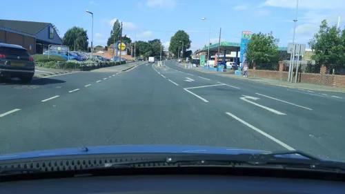
Kingsway Cafe
Cafe · Breakfast, Sandwich, Panini, Jacket Potato, Coffee, Tea, Burger, Regional, Dessert
13 Kingsway, Ossett
Tu-Fr 07:00-13:00; Sa-Su 07:00-12:00

The Horse & Jockey
Bar and pub
Grade II Listed Building Mobile Phones banned inside the pub
18 Dale Street, Ossett
Mo-Sa 11:00-23:00; Su 12:00-22:30

Cafe Vie The Bistro
Cafe · French, British, English
Thompsons Yard, New Street, Ossett
Mo-Su 09:00-15:00
Gracie's
Cafe · Sandwich, Salad, Breakfast, Coffee Shop
29 Bank Street, Ossett
Tu-Fr 08:30-15:00; Sa 09:00-14:00

Cafe Latte
Cafe · Coffee Shop, Tea, Dessert, Breakfast, Sandwich, Jacket Potato
2-3 Dale Street, Ossett
Mo-Tu 08:00-14:00; Th-Fr 08:00-14:00; Sa-Su 08:00-13:00

84 more on the map.
History
The name Ossett derives from the Old English and is thought to be either "the fold of a man named Osla" or " a fold frequented by blackbirds".
Ossett is sometimes misspelled as "Osset". In Ellis' On Early English Pronunciation, one of the founding works of British linguistics, the incorrect spelling is used. The British Library has an online dialect study that uses the spelling. One new alternative theory is that it is the place where King Osbehrt died after receiving fatal wounds when fighting the Great Heathen Army of the Vikings at York on 21 March 867. An exceedingly rare clustering of high status Anglian graves, one bearing the Anglian royal symbol of the dragon and the name Osbehrt, was found in the churchyard at Thornhill Parish Church, visible directly across the valley Ossett.
Ossett appears in the 1086 Domesday Book as "Osleset" in the Manor of Wakefield. The Domesday Book was compiled for William the Conqueror in 1086. "Osleset" was recorded as three and a half carucates which is the land needed to be ploughed by three teams of eight oxen. Woodland pasture measured "half a league long as much broad" (roughly six furlongs by six furlongs). Four villeins and three bordars lived in Osleset.
Read more of the history
Ossett was, for a brief period in the 19th century, a spa town, having been founded by a local stonemason who was inspired by Harrogate and Cheltenham. The waters were popular with those seeking relief from certain skin diseases in the early 19th century, but it remained a small spa during this period. In the 1870s, a plan to transform Ossett into a "second Harrogate" ended in failure, and the spa closed as a result. The south-east of the town is still known as "Ossett Spa".
Coal-mining was, up to the late 1960s, Ossett's second industry in terms of people employed and the first in terms of males employed. Coal has been mined since the 14th century and there were a large number of pits in Ossett during the 19th century. The pits included Old Roundwood, opened in 1851 mining the Gawthorpe seam. The Haigh Moor seam opened in 1860 and the Silkstone seam opened in 1893. Pildacre pit shut due to flooding in 1875 but remained as a source of water for Ossett. Westfield shut in the early 1900s. The Chidswell riot in 1893 was caused by striking miners trying to reach Westfield to stop other miners working. Another pit down Healey Road was also the scene of tension between police and striking miners. Low Laithes pit shut in 1926, however the seams later flooded and were responsible for the Lofthouse Colliery disaster in 1973. Greatfield shut in the 1950s, Old Roundwood shut in 1966 and Shaw Cross, on the Ossett/Dewsbury border near the current Dewsbury Rugby League stadium, closed in 1968.
Author and local resident Stan Barstow said that Ossett and Horbury were the "border country" where the north-west of the coalfield merged with the south-east of the wool towns. Local historian John Goodchild said, "The place was essentially one of small mines and small mills". The town was once a thriving centre of the "shoddy" industry; recycling woollen garments. Whilst some mill towns employed mostly females in its textile sector, Ossett's mills always had roughly equal numbers of men and women. The town's mills were generally small, but they had a reputation as high-quality producers. Whitehead's Mill used to have a carnival float that said "We Export to the World" at the Gawthorpe May Pole parade.
During the 1970s, Woodhead Manufacturing employed 1,500 people on this site in its two premises fronting Church Street and Kingsway. The shock absorber business was the last part of the site operations to close in the early 1990s. The site is now a housing estate and Woodhead's exists in name only and is run from an industrial estate in Leeds.
There is however, a large old 'mill type' building situated on Church Street, which, prior to its refurbishment, had shown Woodhead signage in large blue lettering on the buildings' facade. The building was for many years left in a very derelict and dangerous state, largely due to vandalism. Arson in particular inflicted significant damage, leaving the buildings' roof black and charred. Building work was attempted many times until the building was eventually renovated and converted into flats in 2016.
The yard and building has a large stone wall and locked iron gates to the front, which edges right up to the pavement on Church Street, and high metal fencing to the rear, which edges up to a grassed area next to the large housing estate. The housing estate situated at the rear, is fairly large and has a selection of mixed style and sized modern houses and four-storey flats, occupied by singletons, couples and families.
In the Second World War, Ossett was accidentally bombed on 16 September 1940. Ten High Explosive bombs were dropped. No one was killed, but a number of chickens and several properties were damaged. Later in the war a V-1's engine was reportedly heard to cut out, and came down at Grange Moor, to the west of the town.
From the History section of Ossett on Wikipedia, under CC BY-SA 4.0.
More about Ossett
Geography
South Ossett constitutes the southern part of the town. The northern part is known as 'Ossett and Gawthorpe'.
South Ossett is just north of Horbury with its main road being Storrs Hill Road. Much of the new building growth in Ossett has been concentrated in the South Ossett area. The area is close to countryside and is part of the Wakefield constituency and "Horbury and South Ossett" ward for elections.
Ossett experiences an oceanic climate (Köppen climate classification Cfb) similar to almost all of the United Kingdom.
Economy
There are four operational textile mills in the town: Ings Mill, on Dale Street, deals in recycled textiles; Burmatex Ltd, based at Victoria Mills on the Green produce carpet tiles; Edward Clay & Son Ltd, Wesley Street, manufactures felts for the mattress making and horticultural industries and Wilson Briggs & Son by the River Calder off Healey Road deals with textile mill waste and remnant processing. Other have been converted into units, some of the most prominent being Royd's Mill on the Leeds Road roundabout and the large congregation of mills in the Healey area. Some mills remain derelict.
Ossett is home to two real ale breweries. Ossett Brewery, located in Healey, and Bob's Brewing Company, formerly the Red Lion Brewery.
Arts and culture
Local news and television programmes are provided by BBC Yorkshire and ITV Yorkshire. Television signals are received from the Emley Moor TV transmitter.
Local radio stations are BBC Radio Leeds, Heart Yorkshire, Capital Yorkshire, Hits Radio West Yorkshire, Greatest Hits Radio Yorkshire, and Rhubarb Radio, a community based station.
The Wakefield Express and the Dewsbury Reporter report local news. The Wakefield Express publishes an Ossett Edition, and also contains an Ossett and district section. Ossett has a free magazine The Ossett Review established in July 2005. The Ossett Civic Trust produce a quarterly newsletter Ossett Times. The Horbury Ossett Community News, which is a free local weekly paper printed and distributed throughout the town and Horbury.
Gawthorpe hosts the annual World Coal-Carrying Championships (Easter Monday) and an annual Maypole parade in May. Ossett Beercart takes place on the first weekend of June. Ossett Gala takes place in July. The turning on of the Christmas lights is another focal point for the community, along with the fire station's bonfire on the Friday evening nearest to 5 November. The Ossett Beer Festival takes place annually at the Brewers' Pride pub, Healey Road, Ossett over the August bank holiday weekend.
The town is mentioned in the song It's Grim Up North by The KLF.
Education
Until the late 1960s, Ossett had its own Grammar School. Founded in 1735 it grew out of the activity of the National Society for Promoting Education of the Poor, and its local committee formed in 1727. When sufficient funds had been raised, a small classroom was erected on waste land facing the chapel-of-ease in Ossett. The area given to the school increased throughout the 18th and 19th centuries, and the education it offered was initially largely linked with the church. In 1904, the old Grammar School had to move from the centre of Ossett, to make way for the construction of the new Town Hall.
From the Wikipedia article Ossett, under CC BY-SA 4.0.
Notable people from Ossett
 David PeaceEnglish novelistPhoto: Krimidoedel Dr. Jost Hindersmann, CC BY-SA 3.0
 Colin SturgessEnglish cyclistPhoto: Cs-wolves, CC BY-SA 4.0
 Richard WoodEnglish association football playerPhoto: Timmy96, CC0
 Jay PittsEnglish rugby league footballerPhoto: Fleets, CC BY-SA 4.0
- Cyril V. Jacksonastronomer (1903-1988)
- Barry WoodEnglish Test and county cricketer (born 1942)
- Ronald WoodEnglish county cricketer (1929-1990)
- Cyril Tylercricketer (1911-1996)
- Benjamin InghamAmerican missionary
- Eli Marsden WilsonEnglish artist (1877-1965)
- Michael Taylorindividual from the British town of Ossett
- Nick WoodEnglish footballer (born 1990)
Born in Ossett, according to Wikidata (CC0). Each name links to its Wikipedia article.
Where to stay6
Churches and places of worship19
Shopping10
Gas and EV charging4
Schools, colleges and libraries17
Horbury Bridge Church of England Junior and Infant Academy
School · Anglican · 1.5 mi
Bridge Road, Wakefield
Ossett Southdale Church of England Voluntary Controlled Junior School
School · Anglican
Southdale Road, Ossett
Healthcare7
Map of Ossett
178 places. The map loads OpenStreetMap tiles when you open it.
Getting there and nearby towns
Leeds Bradford Airport (LBA) is the nearest airport with scheduled flights listed in OpenStreetMap, 13 miles away.
- Wakefield 3 mi east, about 5 min by car
- Leeds 8 mi north, about 13 min by car
- Huddersfield 9 mi west, about 14 min by car
- Pudsey 9 mi northwest, about 14 min by car
- Bradford 11 mi northwest, about 17 min by car
- Penistone 11 mi south, about 17 min by car
- Shipley 13 mi northwest, about 21 min by car
- Wombwell 13 mi southeast, about 21 min by car
- South Elmsall 14 mi southeast, about 22 min by car
- Stocksbridge 14 mi south, about 22 min by car
Drive times are estimates from straight-line distance, not routes.
Towns near Ossett


Keep exploring
Local news
Headlines from INDB.
Reviews, tips and questions
Loading what members have shared...
Sources and licences
- GeoNames (CC BY 4.0): population, coordinates, regions and time zone
- Mapillary (see each image): photos
- OpenStreetMap contributors (ODbL 1.0): places, airports, map data
- Wikidata (CC0 1.0): elevation, founding date, time zone, website, landmarks and historic places
- Wikimedia Commons (see each image): photos
- Wikipedia (CC BY-SA 4.0): overview and history text
Photo credits
- Ossett Town Hall - 2, Tim Green, CC BY 2.0
- Ossett Town Hall, Betty Longbottom, CC BY-SA 2.0
- RIMG11316, Stan walker, CC BY-SA 3.0
- Former Public Library, Wakefield, Anne Burgess, CC BY-SA 2.0
- Wakefield Museum 2015, Jill Jennings, CC BY-SA 4.0
- RIMG11191 1, Stan walker, CC BY-SA 3.0
- St John Calder Grove 005, Storye book, CC BY 3.0
- Holy Trinity, Ossett, Tim Green, CC BY 2.0
- " Queens Golden Jubilee 2002 " (6253617318), Tony oldroyd from west yorkshire, united kingdom, CC BY-SA 2.0
- " Queens Golden Jubilee 2002 " (6253091103), Tony oldroyd from west yorkshire, united kingdom, CC BY-SA 2.0
- Keith Chegwin at a stage 1980s, Tony Oldroyd, CC BY-SA 2.0
- Keith Chegwin with someone, Tony Oldroyd, CC BY-SA 2.0
- The Eagle has Landed 1- in Crow Nest Park (8060315604), Tim Green from Bradford, CC BY 2.0
- Street-level photo, cuttlebug, CC BY-SA 4.0
- Street-level photo, cuttlebug, CC BY-SA 4.0
- Street-level photo, cuttlebug, CC BY-SA 4.0
- Street-level photo, cuttlebug, CC BY-SA 4.0
- Street-level photo, cuttlebug, CC BY-SA 4.0
- Street-level photo, cuttlebug, CC BY-SA 4.0
- Street-level photo, cuttlebug, CC BY-SA 4.0
- Street-level photo, cuttlebug, CC BY-SA 4.0
- Street-level photo, cuttlebug, CC BY-SA 4.0
- Street-level photo, cuttlebug, CC BY-SA 4.0
- Street-level photo, cuttlebug, CC BY-SA 4.0
- Street-level photo, cuttlebug, CC BY-SA 4.0
- Street-level photo, cuttlebug, CC BY-SA 4.0


Page built November 10, 2026. Spotted a mistake? Tell us or suggest a place.