


Knaresborough, United Kingdom
Knaresborough is a town of 14,740 people in England, United Kingdom.
Why visit Knaresborough
Townapedia lists 50 museums and landmarks, 28 parks and trails, 66 places to eat, 4 places to stay and 9 attractions in and around town.
Highlights include Mother Shipton's Cave, Harrogate Theatre, Knaresborough Castle and Old Mother Shipton's Cave Park.
Weather in Knaresborough
Forecast from MET Norway (CC BY 4.0). Full forecast
About Knaresborough
Knaresborough is a market and spa town and civil parish on the River Nidd in North Yorkshire, England. It is three miles (five kilometres) east of Harrogate and was in the Borough of Harrogate until April 2023.
From the Wikipedia article Knaresborough (this version), under CC BY-SA 4.0.
Travel tips from other travellers: Knaresborough on Wikivoyage (CC BY-SA 4.0).
Photos of Knaresborough


Things to do9


Harrogate Theatre
Cinema and theater · 3.1 mi
Theatre in Harrogate, North Yorkshire, England, UK

High Bridge
Bridge
Road bridge in Knaresborough, Harrogate, North Yorkshire, England, UK

Royal Hall
Cinema and theater · 3.2 mi
Theatre and performance hall in Harrogate, North Yorkshire, England, UK

Mansfield House
Cinema and theater · 2.5 mi
Former theatre in Harrogate, England (1788-1830), later converted for residential use


Museums and landmarks50

Knaresborough Castle
Monument and historic site
Norman castle, largely dismantled by the Parliamentarians during Civil War
Old Mother Shipton's Cave Park
Monument and historic site
Riverside park and wood surrounding Mother Shipton's Cave attraction

Jubilee Memorial
Monument and historic site · 3.1 mi
Memorial in Harrogate, North Yorkshire, England, UK

Knaresborough Trinitarian priory
Monument and historic site · 1.0 mi
Former Trinitarian priory in North Yorkshire, England

Mercer Art Gallery
Museum · 3.3 mi
Art gallery in Harrogate, England, United Kingdom
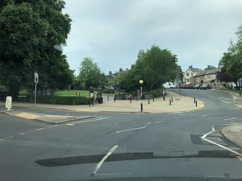
Royal Pump Room Museum
Museum · 3.4 mi
Former spa water pump, now a museum in Harrogate, Yorkshire, England, UK

St Robert's Cave
Monument and historic site · 1.0 mi
Cave cut from the limestone gorge of the Nidd; C. 13 hermitage of Robert Flower, venerated locally as a saint.




38 more on the map.
Parks, trails and playgrounds28

The Stray
Park · 2.7 mi
Open parkland in Harrogate, North Yorkshire, England



16 more on the map.
Restaurants and cafes66

Caffè Nero
Cafe · Coffee Shop
8,10 Market Place, Knaresborough
Mo-Fr 07:00-18:30; Sa 07:30-18:30; Su 08:00-18:00


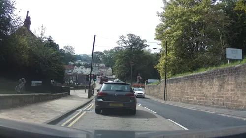
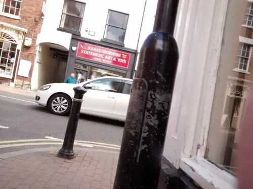
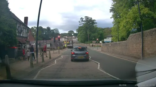

The Black Mulberry
Cafe · Coffee Shop
29 Waterside, Knaresborough
Mo-Th, Sa-Su 09:30-16:00; Fr 09:30-21:00

54 more on the map.
History
The Knaresborough Hoard, the largest hoard of Romano-British copper-alloy vessels discovered to date in Britain, dates to the 4th century and indicates wealthy Roman presence in the area.
It was probably discovered near Farnham near where two important Roman roads ran: Cade's Road on the eastern side and Dere Street to the west, a major route to York and Hadrian's Wall. There were a number of wealthy Roman villas in the area and the hoard may have come from one of these.
Knaresborough is mentioned in the Domesday Book of 1086 as Chenaresburg, meaning Cenheard's fortress. This obscure, male, Anglo-Saxon given name is sometimes written as Cěnheard or Cēnheard. It was located in the wapentake of Burghshire, renamed Claro Wapentake in the 12th century. Knaresborough Castle is Norman; around 1100, the town began to grow. It provided a market and attracted traders to service the castle. The parish church, St John's, was established around this time. The earliest identified Lord of Knaresborough is around 1115 when Serlo de Burgh held the Honour of Knaresborough from the King.
Read more of the history
Hugh de Morville was granted the Honour of Knaresborough in 1158. He was constable of Knaresborough and leader of the group of four knights who murdered Archbishop Thomas Becket at Canterbury Cathedral on 29 December 1170. The four knights fled to Knaresborough and hid at the castle. Hugh de Morville forfeited the lands in 1173, not for his implication in the murder of Thomas Becket, but for "complicity in the rebellion of Henry the Young King", according to the Early Yorkshire Charters.
The Honour of Knaresborough then passed to the Stuteville family. When the Stuteville line was broken with the death of Robert the 4th (son of Robert 3rd) in 1205, King John effectively took the Honour of Knaresborough for himself. The first Maundy Money was distributed in Knaresborough by King John on 15 April 1210. Knaresborough Forest, which extended far to the south of the town, is reputed to have been one of King John's favourite hunting grounds.
Although a market was first mentioned in 1206, the town was not granted a Royal Charter to hold a market until 1310, by Edward II. A market is still held every Wednesday in the market square. In Edward II's reign, the castle was occupied by rebels and the curtain walls were breached by a siege engine. Later, Scots invaders burned much of the town and the parish church. In 1328, as part of the marriage settlement, Queen Philippa was granted "the Castle, Town, Forest and Honour of Knaresborough" by Edward III and the parish church was restored. After her death in 1369, the Honour was granted by Edward to their younger son, John of Gaunt, the Duke of Lancaster and since then the castle has belonged to the Duchy of Lancaster. After the accession of Henry IV the castle lost much of its importance in national affairs, but remained a key site in regional administration for another century.
In the English Civil War, following the Battle of Marston Moor in 1644, the castle was besieged by Parliamentary forces. The castle eventually fell and in 1646 an order was made by Parliament for its destruction (but not carried out till 1648). The destruction was mainly done by citizens looting the stone. Many town centre buildings are built of castle stone.
The railway age began in Knaresborough in 1848 with the opening of a railway station on Hay Park Lane; this was replaced with the current one three years later in 1851. The town had a railway line to Boroughbridge until it closed to passengers in 1950; it was dismantled in 1964.
Historically in the West Riding of Yorkshire, Knaresborough became part of North Yorkshire in 1974.
From the History section of Knaresborough on Wikipedia, under CC BY-SA 4.0.
More about Knaresborough
Economy
Knaresborough is mostly a commuter town but it also serves as a local centre for the surrounding rural villages. The town has a small tourism industry and service sector. There is a small industrial estate on Manse Lane in the east of the town. Knaresborough has a local weekly newspaper; the Knaresborough Post, although it borrows content heavily from neighbouring publications. Flying Colours Flagmakers, who hold a Royal Warrant to supply flags to the Royal Household, are based in Knaresborough.
The town has a large supermarket, Lidl, which is located on the site of a former Co-Op store in Chain Lane, as well as smaller supermarkets in the town centre. The St James retail park on the outskirts of the town, off Wetherby Road, has retail chain units. The town has fifteen public houses, a wine bar, two working men's clubs and several restaurants. There are a number of national retailers with branches in the town centre, mostly around the High Street, Market Place and Castle Courtyard (a shopping arcade in the old Town Hall). The town has a public swimming pool.
Arts and culture
Knaresborough House on the town's High Street houses Knaresborough Town Council and the Yorkshire Federation of Young Farmers' Clubs.
Knaresborough hosts an annual Bed Race, organised by the Knaresborough Lions Club. It is held on the second Saturday of June and was first held in 1966.
An annual, town centre arts summer festival, the Festival of Entertainment and Visual Arts, has been staged since 2001.
Since May 2019, a parkrun takes place every Saturday at Conyngham Hall.
Knaresbrough appeared in the first episode, opening election sequence of the ITV comedy series The New Statesman. Other exterior shots for the series were also filmed around the town. Knaresbrough was a principal location for the 2019 American television film A Very British Christmas.
Education
Knaresborough has five primary schools and one secondary school; King James' School. There is a further education college in nearby Harrogate and universities in Leeds and York. The town has a two-storey library in the Market Place.
From the Wikipedia article Knaresborough, under CC BY-SA 4.0.
Notable people from Knaresborough
 Mother ShiptonEnglish soothsayerPhoto: Unknown author, CC BY 4.0
 William StubbsBritish historian and Anglican bishop (1825–1901)Photo: Hubert von Herkomer, Public domain
 John SmithEnglish banker and vegetarianism activist (c. 1795–1870)Photo: Unknown author Unknown author, Public domain
 Charles Farrar ForsterAnglican priestPhoto: Unknown. No photographer name..., Public domain
 Augustus Frederick Adolphus GreevesAustralian politician (1806-1874)Photo: H. S Sadd (Henry Samuel), engraver,..., Public domain
 Greg MinikinEnglish rugby league footballerPhoto: Fleets, CC BY-SA 4.0
- Darren ManningBritish racing driver
- Philip Inman, 1st Baron InmanLord Privy Seal (1892–1979)
- Tim KellettEnglish musician, songwriter and record producer
- Gordon BurnistonEnglish footballer (1885-?)
- Francis Prenticecricketer (1912-1978)
- John MetcalfEnglish civil engineer and road builder
Born in Knaresborough, according to Wikidata (CC0). Each name links to its Wikipedia article.
Where to stay4
Churches and places of worship29
Shopping18
Gas and EV charging2
Schools, colleges and libraries12
Knaresborough St John's Church of England Primary School
School · Anglican
Stockwell Road, Knaresborough
Healthcare3
Map of Knaresborough
221 places. The map loads OpenStreetMap tiles when you open it.
Getting there and nearby towns
Leeds Bradford Airport (LBA) is the nearest airport with scheduled flights listed in OpenStreetMap, 12 miles away.
- Wetherby 6 mi southeast, about 10 min by car
- Ripon 9 mi north, about 15 min by car
- Otley 12 mi southwest, about 19 min by car
- Leeds 15 mi south, about 24 min by car
- York 16 mi east, about 26 min by car
- Pudsey 17 mi southwest, about 27 min by car
- Shipley 17 mi southwest, about 28 min by car
- Bradford 19 mi southwest, about 30 min by car
- Lofthouse 19 mi south, about 31 min by car
- Wakefield 23 mi south, about 36 min by car
Drive times are estimates from straight-line distance, not routes.
Towns near Knaresborough


Keep exploring
Local news
Headlines from INDB.
Reviews, tips and questions
Loading what members have shared...
Sources and licences
- GeoNames (CC BY 4.0): population, coordinates, regions and time zone
- Mapillary (see each image): photos
- OpenStreetMap contributors (ODbL 1.0): places, airports, map data
- Wikidata (CC0 1.0): elevation, founding date, time zone, website, landmarks and historic places
- Wikimedia Commons (see each image): photos
- Wikipedia (CC BY-SA 4.0): overview and history text
Photo credits
- Knaresborough view, The original uploader was Markdarb at English Wikipedia ., CC BY 2.0
- Harrogate Theatre - Oxford Street Harrogate HG1 1QF, Spudgun67, CC BY-SA 4.0
- High Bridge, Simon Cobb, CC0
- Knaresborough Castle ruins, Redvers, CC BY 2.0
- Jubilee Memorial 1887 Harrogate 16 July 2021 (30), Storye book, CC BY-SA 4.0
- The history of the castle, town and forest of Knaresbrough, with Harrogate, and it's medicinal springs (1809) (14579704317), Internet Archive Book Images, No restrictions
- Mercer Art Gallery (20a), Storye book, CC BY-SA 4.0
- Chapel of Our Lady of the Crag, Redvers, CC BY 2.0
- St John the Baptist, Knaresborough, Tim Green, CC BY 2.0
- St. Joseph and St James Church, Follifoot (24th December 2013) 002, Mtaylor848, CC BY-SA 3.0
- St. John the Evangelist Church, Bilton, Harrogate (25th January 2014) 001, Mtaylor848, CC BY-SA 3.0
- St Andrew's Church 2, User:Mel Stubbs, Public domain
- Mother Shipton's Cave, Simon Cobb, CC0
- King James' School, Knaresborough (19th March 2013) 001, Mtaylor848, CC BY-SA 3.0
- Holy Cross chapel, Knaresborough, Yorkshire, England, Rosser1954, CC BY-SA 4.0
- The Old Royal Oak Between Nos 7 And 9, Simon Cobb, CC0
- Knaresborough Museum, Supergolden, CC BY-SA 3.0
- The Crown Inn, High Street, Knaresborough closed due to the COVID-19 pandemic (21st May 2020), Mtaylor848, CC BY-SA 4.0
- 8,10, Market Place, Simon Cobb, CC0
- St Robert's Cave, Knaresborough, Yorkshire, England, Rosser1954, CC BY-SA 4.0
- Finkle Street (4854831578), Tim Green from Bradford, CC BY 2.0
- North Yorkshire - Royal Hall - 2025-09-13 20-00-09 003, PuddenTane17, CC BY-SA 4.0
- John Metcalf (1717–1810, Blind Jack of Knaresborough) was the first of the professional road builders during the Industrial Revolution. - panoramio, Immanuel Giel, CC BY 3.0
- Street-level photo, locator, CC BY-SA 4.0
- Street-level photo, southglos, CC BY-SA 4.0
- Street-level photo, aidan573, CC BY-SA 4.0
- Street-level photo, locator, CC BY-SA 4.0
- Street-level photo, southglos, CC BY-SA 4.0
- Street-level photo, locator, CC BY-SA 4.0
- Street-level photo, hobgoblin, CC BY-SA 4.0
- Street-level photo, southglos, CC BY-SA 4.0
- Street-level photo, southglos, CC BY-SA 4.0
- Street-level photo, southglos, CC BY-SA 4.0
- Street-level photo, aidan573, CC BY-SA 4.0
- Street-level photo, ljasq, CC BY-SA 4.0
- Street-level photo, southglos, CC BY-SA 4.0
- Street-level photo, aidan573, CC BY-SA 4.0
- Street-level photo, southglos, CC BY-SA 4.0
- Street-level photo, locator, CC BY-SA 4.0
- Street-level photo, locator, CC BY-SA 4.0


Page built November 10, 2026. Spotted a mistake? Tell us or suggest a place.