


Why visit Larbert
Townapedia lists 51 museums and landmarks, 9 parks and trails, 61 places to eat and 4 places to stay in and around town.
Highlights include Arthur's O'on temple, Callendar House, Bantaskine and Falkirk Tryst Golf Club.
Weather in Larbert
Forecast from MET Norway (CC BY 4.0). Full forecast
About Larbert
Larbert (Scottish Gaelic: Leth-Pheairt, Scots: Lairbert) is a town in the Falkirk council area of Scotland. The town lies in the Forth Valley above the River Carron which flows from the west. Larbert is three miles (five kilometres) from the shoreline of the Firth of Forth and 2+1⁄2 miles (4 kilometres) northwest of Falkirk. Stenhousemuir lies directly east of Larbert, with both settlements being contiguous and sharing certain public amenities with one another.
From the Wikipedia article Larbert (this version), under CC BY-SA 4.0.
Photos of Larbert


Museums and landmarks51

Arthur's O'on temple
Monument and historic site · 1.1 mi
Probable Roman temple near Falkirk, Scotland, destroyed in 1743


Tappoch Broch
Monument and historic site · 2.3 mi
Iron-age broch located near Falkirk, Scotland
39 more on the map.
Parks, trails and playgrounds9



Restaurants and cafes61
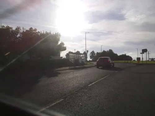
Boardwalk
Restaurant · Greek, Mediterranean, Italian, Breakfast · 1.2 mi
1 Millennium Wheel Drive, Falkirk
Mo-Th,Su 09:00-23:00; Fr-Sa 09:00-24:00
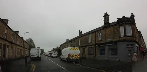
Gulnar Tandoori Restaurant
Restaurant · Tandoori, Indian
60 Main Street, Larbert
Fr-Sa 16:00-24:00; Su-Th 16:00-23:00
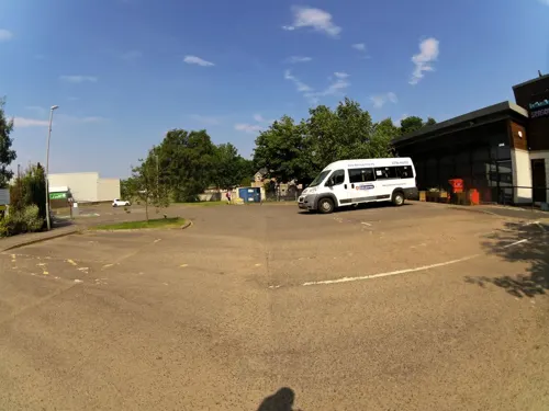
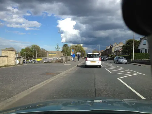
Mariner Bar
Bar and pub · 1.3 mi
90 Glasgow Road, Camelon
Mo-Th 10:00-23:45; Fr-Sa 10:00-24:45; Su 11:00-23:45
Tim Hortons
Cafe · Coffee Shop · 0.6 mi
44 Tryst Road, Stenhousemuir
Mo-Su 06:00-22:00

The Tea House
Restaurant · Chinese
2 Stirling Road, Larbert
Mo-Th 12:00-14:00,17:00-22:00; Fr-Sa 12:00-22:30; Su 15:00-22:00

Cafe O The Toon
Cafe · Coffee Shop · 0.6 mi
553 Main Street
Mo-Sa 09:00-16:00; Su 09:00-15:00

49 more on the map.
Where to stay4

History
The origins of the name Larbert are uncertain. Historically, the name was variously written as Lairbert scheills or Laithbert scheills which signifies the scheills, or huts, of a man named Lairbert or Laithbert.
Historians believe that the origin of Larbert dates back to the Middle Ages when Scotland was beginning to emerge as a nation. The area in which Larbert lies was heavily forested at this time.
The lands to the south of Larbert and Camelon, in the area traversed by the Antonine Wall, were strategically important to the Romans. The crossing point on the River Carron at Larbert was an important transportation route for the Romans on the road they constructed from Watling Lodge on the Antonine Wall to Stirling. Early Ordnance Survey maps showed Larbert located on an old Roman Road between Camelon and Stirling, with the site of a Roman camp close by. An early Christian community, with a chapel, is believed to have existed close to the crossing point on the Carron around 1160.
Read more of the history
By the 1750s, Larbert constituted a small settlement on the main road between Falkirk and Stirling, which was turnpiked by an Act of Parliament in 1752. At this time, Larbert had at three mills powered by water from the nearby River Carron. These mills shut down in the 1980s and since then salmon and sea trout have returned in good numbers. The surrounding population, largely scattered, engaged in agriculture and took part in the important Falkirk Tryst (cattle market) held annually in nearby Stenhousemuir. In the 1950s, archaeological excavations to the north of present-day Larbert uncovered remains of a substantial pottery works with eight kilns dating from the 15th or 16th centuries (Hall and Hunter 2001).
Larbert's later growth is tied to the industrial development in the village itself as well as the wider parish. The pivotal event was the opening of the Carron Iron Works to the east of Stenhousemuir, in 1759, which produced a range of cast-iron goods and the Carronade, a naval cannon. The development of the iron works shifted the centre of the parish eastwards as people moved to closer to the Carron Ironworks for employment.
Fortunes changed in the 1840s with the building of the Scottish Central Railway which was a catalyst for economic expansion in Larbert itself. Improved transportation led to Dobbie, Forbes and Company establishing a foundry in Larbert in 1872 which manufactured stoves, ranges and light castings. Three years later, James Jones, a local businessman, opened a sawmill on land adjacent to the Dobbie Forbes and Company foundry, which grew rapidly manufacturing timber frames. By the turn of the 20th century, Dobbie Forbes had a payroll of more than 200 employees. In 1888, a joint venture between Jones and the cashier of Dobbie, Forbes and Company, Dermont Campbell, produced the Jones and Campbell foundry on land close to the railway, which further cemented Larbert's position as a centre of heavy industry. By 1891, the parish of Larbert had a population of 900.
The 19th century also witnessed the establishment of the Scottish National Institution for the Education of Imbecile Children on land to the north of present-day Larbert. The institution, opened in 1863 at a cost of £13,000, provided care for minors between the age of 5 and 21. In 1948 the facility became known as the Royal Scottish National Hospital (RSNH). On adjacent land, the Stirling District Lunatic Asylum, opened in 1869 at a cost of £20,000, engaged in the treatment of those with mental illness. The asylum later became known as Bellsdyke Hospital.
The arrival of the tram in October 1905 improved transport between Larbert and many of its surrounding neighbours. The service followed a circular route through Larbert, Stenhousemuir, past the Carron Iron Works, through Bainsford and to Falkirk. Larbert's new closeness to surrounding communities raised concerns about the loss of village independence. A consortium of local industrialists and residents, fearing higher burgh rates, successfully resisted a 1912 proposal to incorporate nearby villages such as Larbert and Stenhousemuir into the larger town of Falkirk.
From the History section of Larbert on Wikipedia, under CC BY-SA 4.0.
More about Larbert
Geography
Larbert lies at an elevation of 30 metres (100 feet) above sea level. The settlement sits on a shelf of land overlooking the River Carron, which flows to the west. The river has its source in the Campsie Fells north of Glasgow, flowing into the Carron Valley Reservoir and past the town of Denny. After passing Larbert, the river flows through Falkirk before emptying into the Firth of Forth at Glensburgh, near Grangemouth.
Larbert has an area of 1+1⁄2 sq mi (4 km2) and is contiguous with the town of Stenhousemuir to the east. Historically, Larbert and Stenhousemuir were united into one parish and consequently shared public amenities. Commonly, Larbert and Stenhousemuir are referred to as being part of the same locality.
The underlying geology of Larbert is primarily characterised by glacial deposits. Elevations above 10 metres (33 feet) are covered by a mixture of glacial till and boulder clay with low-lying areas covered by sandy soils and loams. The origins of much of the unsorted glacial rubble found in the area are eroded debris from the Campsie Fells and Kilsyth Hills to the west.
Economy
Today, Larbert is home to a range of light service industries. In 1992, 19 hectares (190,000 m2) of the former RSNH site, on the northern flank of Larbert close to the A88 road, was developed into a business park. The site became known as 'Central Park'. Its first occupant was the US-based data storage corporation Exabyte, which opened in late 1992 and employed 80 workers. Towards the end of the following year, three more high tech firms arrived, which gave Central Park a combined floorspace of 14,000 square metres (150,000 sq ft).
Central Park was boosted further in 2000 with the creation of 700 jobs by the multi-client Telecom Service Centre (TSC) facility. Other occupants of the park include the travel firm Thomas Cook and the central Scotland baker Mathiesons, which has consolidated all operations onto one site. Glenbervie Business Park was developed next to Central Park with the help of local government and EU structural aid. The 28-hectare (280,000 m2) site is suitable for a range of light industries. Larbert lacks a supermarket, but the main street of the town is home to small retail outlets and a post office.
The Lochlands Industrial area sits south of Larbert. One of the main tenants of the industrial park is Dowding and Mills, an electrical contractor, which opened a factory in 1979.
From the Wikipedia article Larbert, under CC BY-SA 4.0.
Notable people from Larbert
 John BaildonengineerPhoto: Gliwi, CC BY-SA 3.0 pl
 Thomas HardyBritish radical politician (1752-1832)Photo: Das48, CC BY-SA 4.0
 John W. FrameCanadian politicianPhoto: United Farmers Historical Society, CC BY 2.0
- Kai Fotheringhamfootball player
- Willie Gardinerassociation football player (1929-2007)
- John Alexander Harvie-BrownScottish ornithologist and naturalist (1844-1916)
- Billy GrassamBritish footballer
- Leslie SkeneScottish footballer (1882-1959)
- Willie McOustraassociation football player (1881-1953)
- John GillespieScottish footballer for Sunderland
- Alex WeirScottish footballer
- Bob Godfreyassociation football player (1891-)
Born in Larbert, according to Wikidata (CC0). Each name links to its Wikipedia article.
Churches and places of worship13
Tryst Church (Larbert Tryst Parish Church of Scotland)
Church · Church Of Scotland · 0.6 mi
Main Street, Stenhousemuir
Falkirk Free Church
Church · Free Church Of Scotland · 1.4 mi
Carrongrove Avenue, Falkirk
Shopping7
Gas and EV charging4
Schools, colleges and libraries10
Healthcare11
Map of Larbert
170 places. The map loads OpenStreetMap tiles when you open it.
Getting there and nearby towns
Edinburgh Airport (EDI) is the nearest airport with scheduled flights listed in OpenStreetMap, 19 miles away.
- Falkirk 2 mi southeast, about 4 min by car
- Plean 3 mi northwest, about 6 min by car
- Head of Muir 3 mi west, about 6 min by car
- Grangemouth 4 mi east, about 7 min by car
- Dennyloanhead 4 mi southwest, about 6 min by car
- Airth 4 mi northeast, about 6 min by car
- Westquarter 4 mi southeast, about 6 min by car
- Reddingmuirhead 4 mi southeast, about 7 min by car
- Polmont 5 mi southeast, about 8 min by car
- Alloa 7 mi north, about 11 min by car
Drive times are estimates from straight-line distance, not routes.
Towns near Larbert


Keep exploring
Local news
Headlines from INDB.
Reviews, tips and questions
Loading what members have shared...
Sources and licences
- GeoNames (CC BY 4.0): population, coordinates, regions and time zone
- Mapillary (see each image): photos
- OpenStreetMap contributors (ODbL 1.0): places, airports, map data
- Wikidata (CC0 1.0): elevation, founding date, time zone, website, landmarks and historic places
- Wikimedia Commons (see each image): photos
- Wikipedia (CC BY-SA 4.0): overview and history text
Photo credits
- LarbertMainStreet, Kevin Rae, CC BY-SA 2.0
- Larbert, Main Street, Larbert Station, War Memorial, Drkirstyross, CC BY-SA 3.0
- Unidentified Class 47 at Larbert North (3721720404), Phil Sangwell from United Kingdom, CC BY 2.0
- 6233 with the Royal Scot at Larbert - October 2010, B4bees, CC BY-SA 2.0
- Dobbie Hall, Main Street, Larbert, external view, Drkirstyross, CC BY-SA 4.0
- Larbert, Main Street, Dobbie Hall, War Memorial, Drkirstyross, CC BY-SA 4.0
- Larbert, Main Street, Dobbie Hall, War Memorial, landscape view, Drkirstyross, CC BY-SA 4.0
- Larbert, Main Street, Dobbie Hall, War Memorial, rear view, Drkirstyross, CC BY-SA 4.0
- Falkirk Old Parish Church, Texas Radio and The Big Beat, CC BY-SA 2.0
- St Andrew's West Church, Falkirk 05, Auldcathy, CC BY 4.0
- Arthur's oven - Gordon 1726, Unknown author Unknown author, Public domain
- Forth Valley Royal close, jamesnicoll, CC BY-SA 2.0
- Larbert High School, Drkirstyross, CC BY-SA 3.0
- Larbert East Church front of building, Drkirstyross, CC BY-SA 4.0
- Larbert Old Church from the road, Drkirstyross, CC BY-SA 4.0
- Fiona Hyslop MSP and a Roman (Antonine Guard Living History Society) at the Roman vs Picts 5k race, Callendar House, amaldon, CC BY-SA 4.0
- Street-level photo, tallguy, CC BY-SA 4.0
- Street-level photo, smsm1, CC BY-SA 4.0
- Street-level photo, hobgoblin, CC BY-SA 4.0
- Street-level photo, southglos, CC BY-SA 4.0
- Street-level photo, hobgoblin, CC BY-SA 4.0
- Street-level photo, southglos, CC BY-SA 4.0
- Street-level photo, southglos, CC BY-SA 4.0
- Street-level photo, toho, CC BY-SA 4.0
- Street-level photo, hobgoblin, CC BY-SA 4.0
- Street-level photo, hobgoblin, CC BY-SA 4.0
- Street-level photo, hobgoblin, CC BY-SA 4.0
- Street-level photo, smsm1, CC BY-SA 4.0
- Street-level photo, smsm1, CC BY-SA 4.0
- Street-level photo, hobgoblin, CC BY-SA 4.0
- Street-level photo, smsm1, CC BY-SA 4.0
- Street-level photo, hobgoblin, CC BY-SA 4.0
- Street-level photo, floatingboater, CC BY-SA 4.0
- Street-level photo, floatingboater, CC BY-SA 4.0
- Street-level photo, gmc, CC BY-SA 4.0
- Street-level photo, hobgoblin, CC BY-SA 4.0
- Street-level photo, hobgoblin, CC BY-SA 4.0
- Street-level photo, southglos, CC BY-SA 4.0
- Street-level photo, toho, CC BY-SA 4.0


Page built November 10, 2026. Spotted a mistake? Tell us or suggest a place.