


Why visit Polmont
Townapedia lists 12 museums and landmarks, 12 parks and trails, 38 places to eat, 6 places to stay and 2 attractions in and around town.
Highlights include Avon Aqueduct, Avon Viaduct, Callendar House and Westquarter Dovecot.
Weather in Polmont
Forecast from MET Norway (CC BY 4.0). Full forecast
About Polmont
Polmont (Scottish Gaelic: Poll-Mhonadh) is a village in the Falkirk council area of Central Scotland. It lies towards the east of the town of Falkirk, north of the Union Canal, which runs adjacent to the village.
From the Wikipedia article Polmont (this version), under CC BY-SA 4.0.
Travel tips from other travellers: Polmont on Wikivoyage (CC BY-SA 4.0).
Photos of Polmont


Things to do2

Avon Aqueduct
Bridge · 2.7 mi
Navigable aqueduct between Falkirk and West Lothian, Scotland
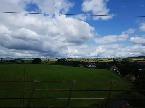
Avon Viaduct
Bridge · 3.1 mi
Railway viaduct in West Lothian, Scotland
Museums and landmarks12


Westquarter Dovecot
Monument and historic site · 1.4 mi
Dovecot Road, Falkirk
Parks, trails and playgrounds12

Muiravonside Country Park
Park · 2.9 mi
Park in Falkirk, Scotland, UK




Restaurants and cafes38
aran
Cafe · Coffee Shop, Sandwich · 0.6 mi
Brookside, Brightons
Mo-Fr 06:30-14:30; Sa 07:30-14:30
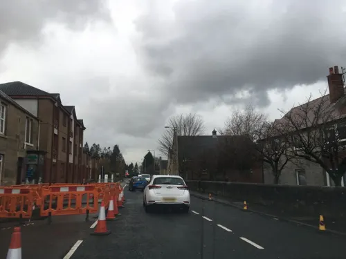
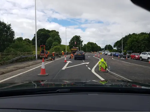
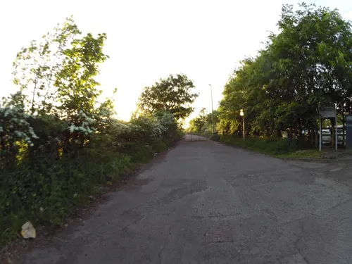
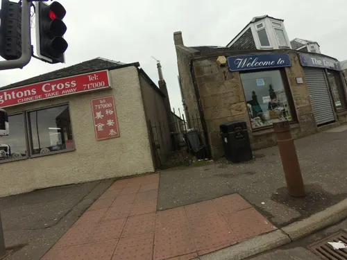


Wongs Restaurant
Restaurant · Chinese · 1.3 mi
38, Grangemouth
Mo,We-Su 17:00-22:00; Tu off


26 more on the map.
History
The name Polmont derives from the Scottish Gaelic term Poll-Mhonadh, which translates into English as "Pool of the Hill".
Old Polmont was situated on a raised beach overlooking the Firth of Forth and the Ochils. There were two Roman temporary marching camps, one on either side of what is now Grangemouth Golf Course: on the western side was Little Kerse, and on the eastern side was Polmont Hill. The Antonine Wall ran through Polmont from Mumrills, the largest fort on the wall, west of Polmont. Remains of the wall can best be seen in Polmont Woods, accessed by a footpath next to the M9 motorway bridge.
The first mention of Polmont was in 1498, relating to the Chapel of the Blessed Virgin Mary. The next mention was in the Statistical Accounts of Scotland. Old Polmont has changed little as can be seen from this 1862 Map but, in 1968, the first section of the M9 motorway cut through farm land between Old and New Polmont.
Polmont was originally included within the parish of Falkirk, but was severed under the authority of the Court of Teinds (teind is the Scots word for tithe), and made an independent parish, in 1724. The parish boundary was from the Firth of Forth up to Muiravonside, and it was later renamed Grangemouth Parish as the port of Grangemouth grew. Nothing of the early history of Polmont has been recorded.
Read more of the history
New Polmont was built along the Great North Road (A9), south of Old Polmont, and was originally called Bennetstown or Bennestone (named after the Laird of Whyteside, Mr Bennet, on whose land it was built. Apart from housing, agricultural workshops and stores, it also had three public houses: The Crown, The Red Lion and The Black Bull, but only The Black Bull remains and dates from before 1745. The village slowly expanded after World War II with housing being built on land of former estates of Millfield, Polmont Park, and Polmont House. From the mid-1970s, the population significantly expanded when housing was built on the Gilston Estate, whereupon the village was re-designated as a dormitory town.
During World War II, the now-demolished St Margaret's School for girls was used for signals training by Polish forces, and soldiers from various Polish units were assigned there.
From the History section of Polmont on Wikipedia, under CC BY-SA 4.0.
More about Polmont
Economy
The economy of Polmont is based mainly upon relatively small scale private enterprise, such as pubs, cafes, hotels, take-aways and convenience stores. The majority of these are based in or around Polmont shopping centre, the focal point of local custom. Agriculture is also a central industry, with arable land consuming a sizeable proportion of the area. Polmont is home to the controversial Avondale Landfill, a large employer on the east of the village.
Due to the proximity to Grangemouth, a number of the population work at the Grangemouth refineries and port. Few of the population work in Polmont itself, leaving it something of a commuter town, largely to Edinburgh and Glasgow.
There are several hotels in the area, with the most well known being the Inchyra Grange, a redevelopment from one of the area's many former mansions.
Arts and culture
Polmont is a parish and its religious community is primarily Christian, being home to a Church of Scotland in Old Polmont. The area also has a Christian denominational presence in the form of the Church of the Brethren and the Religious Society of Friends.
Scottish rock band Glasvegas have a song entitled "Polmont On My Mind" on their debut album, Glasvegas, referring to the prison.
Parkhill House and grounds were used as a location in the fourth season of Outlander (TV series) It was transformed into a graveyard and was filmed over a few evenings
The grounds of the former Millfield House folly still remains including its bowling green with steps at either side which is flanked by two beautiful Canadian redwoods at either side.It also has remains of a Lily pond and wildfowl lake.The burn at the side was also sloped with stone and has trickle waterfalls along its length
Polmont won best small town in Scotland in Bloom awards 2023 for the first time ever.
Education
Polmont has provided primary level education since the 1700s. The original Parish School still stands across from the church; however, in the 1960s Polmont Primary School became overcrowded and relocated to a set of interlinked wooden huts on Greenpark Drive. Polmont Primary's colours are green and silver reflected in the uniform of green blazer, green/silver tie, grey shorts/skirts and white shirts/blouses. Further expansion of Polmont meant that the school again became overcrowded; finally, a permanent structure was built in the south west of Polmont and renamed St Margaret's Primary School. St. Margaret's had been the name of a private school that had stood between 1895 and 1948 on the site of houses that are now on the west side of Stevenson Avenue.
From the Wikipedia article Polmont, under CC BY-SA 4.0.
Notable people from Polmont
 Alex RaisbeckScottish footballer (1878-1949)Photo: Unknown author Unknown author, Public domain
 James BurnsAustralian businessman, shipowner and philanthropist (1846–1923)Photo: Unknown author Unknown author, Public domain
 James Fitz-MorrisBritish WWI flying ace (1897-1918)Photo: Harris & Ewing, photographer, Public domain
- Frank CruickshankScottish footballer (1931-2015)
- Tom TownsleyScottish footballer (1898-1976)
- John BennieScottish footballer (1896-?)
- Ann Small(1857–1945), missionary and educationist
- John SimpsonScotland international rugby union player (1872-1921)
- Norman Munnochrugby player
- Bob Bennie(1873-1945)
- Bobby WallaceScottish footballer
Born in Polmont, according to Wikidata (CC0). Each name links to its Wikipedia article.
Where to stay6
Churches and places of worship9
Shopping3
Gas and EV charging3
Schools, colleges and libraries13
Healthcare5
Map of Polmont
103 places. The map loads OpenStreetMap tiles when you open it.
Getting there and nearby towns
Edinburgh Airport (EDI) is the nearest airport with scheduled flights listed in OpenStreetMap, 14 miles away.
- Westquarter 1 mi west, about 2 min by car
- Grangemouth 2 mi north, about 2 min by car
- Reddingmuirhead 2 mi southwest, about 3 min by car
- Falkirk 3 mi west, about 5 min by car
- Bo’ness 4 mi northeast, about 6 min by car
- Linlithgow 4 mi east, about 7 min by car
- Airth 6 mi northwest, about 10 min by car
- Bathgate 7 mi south, about 11 min by car
- Armadale 7 mi south, about 12 min by car
- Livingston 9 mi southeast, about 15 min by car
Drive times are estimates from straight-line distance, not routes.
Towns near Polmont


Keep exploring
Local news
Headlines from INDB.
Reviews, tips and questions
Loading what members have shared...
Sources and licences
- GeoNames (CC BY 4.0): population, coordinates, regions and time zone
- Mapillary (see each image): photos
- OpenStreetMap contributors (ODbL 1.0): places, airports, map data
- Wikidata (CC0 1.0): elevation, founding date, time zone, website, landmarks and historic places
- Wikimedia Commons (see each image): photos
- Wikipedia (CC BY-SA 4.0): overview and history text
Photo credits
- Polmont, UK - panoramio, douglas sheehan, CC BY-SA 3.0
- Polmont, UK - panoramio (13), douglas sheehan, CC BY-SA 3.0
- Polmont, UK - panoramio (14), douglas sheehan, CC BY-SA 3.0
- Polmont, UK - panoramio (16), douglas sheehan, CC BY-SA 3.0
- Polmont, UK - panoramio (19), douglas sheehan, CC BY-SA 3.0
- Polmont, UK - panoramio (1), douglas sheehan, CC BY-SA 3.0
- Polmont, UK - panoramio (15), douglas sheehan, CC BY-SA 3.0
- Polmont, UK - panoramio (18), douglas sheehan, CC BY-SA 3.0
- Polmont Co-op - panoramio, douglas sheehan, CC BY-SA 3.0
- Polmont, UK - panoramio (17), douglas sheehan, CC BY-SA 3.0
- Polmont old parish church hall - panoramio, douglas sheehan, CC BY-SA 3.0
- Three Muiravonside teasels, Mike Smith, CC BY 2.0
- Falkirk Old Parish Church, Texas Radio and The Big Beat, CC BY-SA 2.0
- St Andrew's West Church, Falkirk 05, Auldcathy, CC BY 4.0
- Brightons Parish Church, Brightons, Tartanqueen21, CC BY-SA 4.0
- Give way - panoramio, douglas sheehan, CC BY-SA 3.0
- Land and Sea Chip Shop - panoramio, douglas sheehan, CC BY-SA 3.0
- The Black Bull - panoramio, douglas sheehan, CC BY-SA 3.0
- Greenpark centre - panoramio, douglas sheehan, CC BY-SA 3.0
- IMGP9063 (52043227914), Matt Buck from London, United Kingdom, CC BY-SA 2.0
- IMGP9165 (52041930972), Matt Buck from London, United Kingdom, CC BY-SA 2.0
- IMGP9180 (52043485490), Matt Buck from London, United Kingdom, CC BY-SA 2.0
- IMGP9246 (52043484230), Matt Buck from London, United Kingdom, CC BY-SA 2.0
- IMGP9177 (52043224794), Matt Buck from London, United Kingdom, CC BY-SA 2.0
- IMGP9124 (52043486725), Matt Buck from London, United Kingdom, CC BY-SA 2.0
- IMGP9031 (52039630702), Matt Buck from London, United Kingdom, CC BY-SA 2.0
- IMGP9092 (52043029488), Matt Buck from London, United Kingdom, CC BY-SA 2.0
- IMGP9103 (52041932467), Matt Buck from London, United Kingdom, CC BY-SA 2.0
- IMGP9113 (52043487635), Matt Buck from London, United Kingdom, CC BY-SA 2.0
- IMGP9033 (52040671026), Matt Buck from London, United Kingdom, CC BY-SA 2.0
- IMGP9082 (52043029678), Matt Buck from London, United Kingdom, CC BY-SA 2.0
- IMGP9116 (52043487525), Matt Buck from London, United Kingdom, CC BY-SA 2.0
- IMGP9239 (52043223679), Matt Buck from London, United Kingdom, CC BY-SA 2.0
- Avon Aqueduct alt1, Gunther Tschuch, CC BY-SA 4.0
- Fiona Hyslop MSP and a Roman (Antonine Guard Living History Society) at the Roman vs Picts 5k race, Callendar House, amaldon, CC BY-SA 4.0
- Street-level photo, hobgoblin, CC BY-SA 4.0
- Street-level photo, hobgoblin, CC BY-SA 4.0
- Street-level photo, hobgoblin, CC BY-SA 4.0
- Street-level photo, hobgoblin, CC BY-SA 4.0
- Street-level photo, pbb, CC BY-SA 4.0
- Street-level photo, hobgoblin, CC BY-SA 4.0
- Street-level photo, hobgoblin, CC BY-SA 4.0
- Street-level photo, ccbb7766, CC BY-SA 4.0
- Street-level photo, IpswichEdits, CC BY-SA 4.0
- Street-level photo, ccbb7766, CC BY-SA 4.0
- Street-level photo, ccbb7766, CC BY-SA 4.0
- Street-level photo, ccbb7766, CC BY-SA 4.0
- Street-level photo, toho, CC BY-SA 4.0
- Street-level photo, toho, CC BY-SA 4.0
- Street-level photo, hobgoblin, CC BY-SA 4.0
- Street-level photo, floatingboater, CC BY-SA 4.0
- Street-level photo, ccbb7766, CC BY-SA 4.0
- Street-level photo, floatingboater, CC BY-SA 4.0
- Street-level photo, hobgoblin, CC BY-SA 4.0
- Street-level photo, hobgoblin, CC BY-SA 4.0
- Street-level photo, hobgoblin, CC BY-SA 4.0
- Street-level photo, smsm1, CC BY-SA 4.0
- Street-level photo, hobgoblin, CC BY-SA 4.0
- Street-level photo, hobgoblin, CC BY-SA 4.0


Page built November 10, 2026. Spotted a mistake? Tell us or suggest a place.