


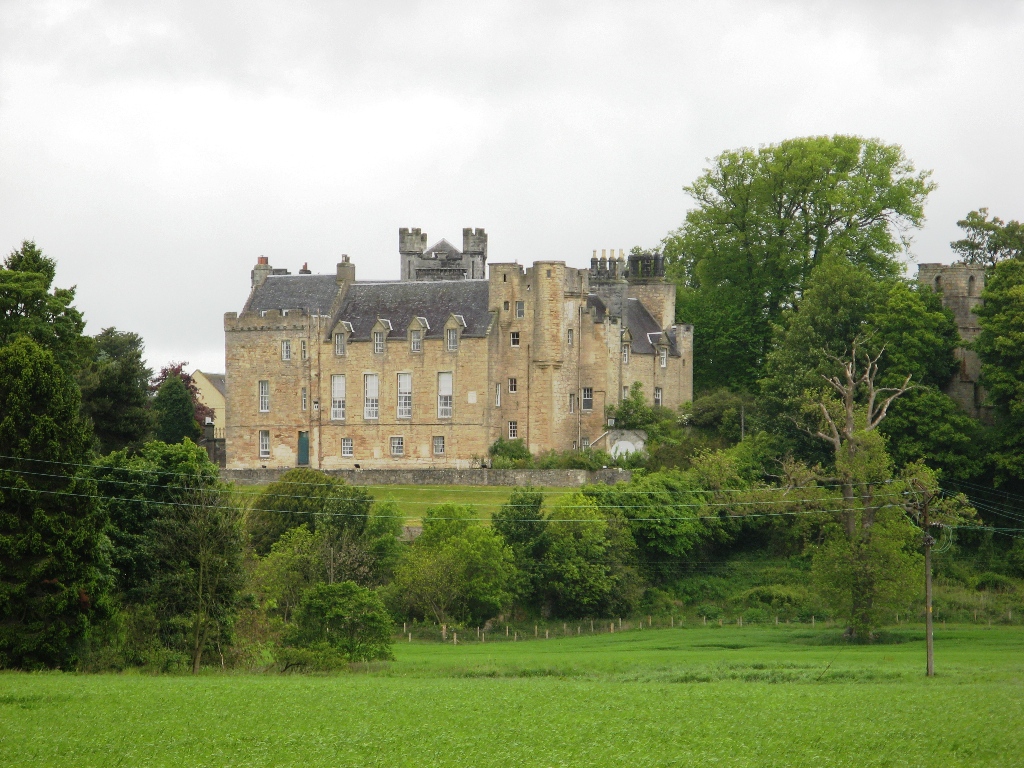
Why visit Alloa
Townapedia lists 22 museums and landmarks, 10 parks and trails, 66 places to eat, 4 places to stay and 5 attractions in and around town.
Highlights include Clackmannanshire Bridge, Tullibody Old Bridge, Alloa Tower and Clach Mhanann.
Weather in Alloa
Forecast from MET Norway (CC BY 4.0). Full forecast
About Alloa
Alloa ( AL-oh-wə; Scottish Gaelic: Alamhagh, possibly meaning "rock plain") is a town in Clackmannanshire in the Central Lowlands of Scotland. It is on the north bank of the Forth at the spot where some say it ceases to be the River Forth and becomes the Firth of Forth. Alloa is south of the Ochil Hills on the western Fife peninsula, six miles (ten kilometres) east of Stirling and 13 miles (21 km) west of Dunfermline; by water Alloa is 25 miles (40 km) from Granton.
From the Wikipedia article Alloa (this version), under CC BY-SA 4.0.
Photos of Alloa

Things to do5

Clackmannanshire Bridge
Bridge · 3.6 mi
Bridge between Falkirk and Fife, Scotland, UK, carries the A876 road across River Forth

Tullibody Old Bridge
Bridge · 2.9 mi
Bridge in Tullibody, Clackmannanshire, Scotland

Alloa Swing Bridge
Bridge · 1.9 mi
Demolished railway swing bridge in Scotland

Museums and landmarks22

Alloa Tower
Museum
Large fortified tower boasts lavish interiors where kings and queens once wandered.
Fr-Mo 12:00-16:00




10 more on the map.
Parks, trails and playgrounds10


Indodrill Stadium
Sports field and stadium · 0.4 mi
Clackmannan Road, Alloa



Greenfield leisure park
Park
The park provides a play area with a range of play equipment to suit all ages including swings, sand play and trampolines. The park can...

Restaurants and cafes66
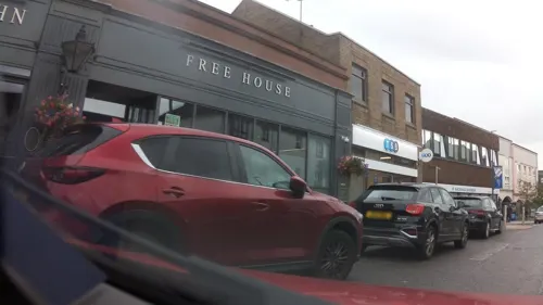



Bar Aldo's
Restaurant · Italian
11 Coalgate, Alloa
Mo-Sa 12:00-14:00; Su 17:00-18:00+

The Legends Traditional Indian Restaurant
Restaurant · Indian · 1.6 mi
Ochilvale Terrace, Fishcross
54 more on the map.
History
Alloa grew up under the protection of Alloa Tower which may have been built before 1300 AD. The name of the town has had different spelling at different periods. In the charter granted by King Robert the Bruce in the year 1315, to Thomas de Erskyne, it is called Alway; in some subsequent ones, Aulway, Auleway; and more recently Alloway. Dr Jamieson stated that the most probable etymology of the name was from Aull Waeg – the way to the sea.
Sir Robert Erskine was granted the lands of Alloa and its environs in 1368 for services to King David II and he and his descendants were good stewards, developing the estates and innovating.
One of the earliest maps of the area was made by surveyor and cartographer John Adair in 1681.
John Erskine, the 6th Earl of Mar oversaw many far-reaching developments including substantial harbour improvements, a customs house, a "New Town" area of housing, and commissioning the building of the Gartmorn Dam, which was designed by George Sorocold. Erskine owned many of the coal mines, and Robert Bald, a local mining engineer, was contracted to provide water power from the Gartmorn Dam to operate the mines and other industries. Good water supplies and the availability of barley from the carselands encouraged George Younger to set up a brewery in the 1760s and he was soon followed by others. Alloa became one of Scotland's premier brewing centres.
Read more of the history
The 6th Earl of Mar was forced to flee the country and forfeit his lands after disastrously backing the Jacobite cause in 1715. However, his brother was allowed to purchase the forfeited lands and future generations continued the tradition of creative industry by launching a glass-works in 1750 and laying Alloa Waggonway, one of Scotland's earliest railways, from the Sauchie mines down to the harbour around 1766.
Before 1775, the colliers were attached to the properties in which they were born and were virtual serfs or slaves, supported by the master. After the Colliers and Salters (Scotland) Act 1775 abolished the system, the colliers could move between collieries at will, and they were supported in their needs by the Alloa Colliers' Fund or Friendly Society which was founded in 1775.
Traces of the waggonway and the Gartmorn Dam can still be seen today, and although the dam is no longer used for energy production or water supply, it is well used for fishing and leisure purposes. The Clackmannanshire Library was founded at Alloa in 1797 and it contained upwards of 1500 volumes. As the 18th century closed a whisky distillery was established at Carsebridge by John Bald.
In the 18th century the staple business of the port was coal with about 50,000 tons a year exported.
In 1813 the first steamboat started to operate out of Alloa harbour. Rival companies later united into the "Stirling, Alloa and Kincardine Steamboat Company". In 1822 water was brought into the town and in 1828 a gas works was built. While building a road to Alloa Academy in 1828, an ancient burial site was found at Mars Hill, with several finds including two gold armlets. Alloa Academy was built in 1824, being paid for by subscription. The Alloa Swing Bridge was opened to the public on 1 October 1885.
After the improvements were made to the harbour during the 18th century, Alloa thrived as a river port through which the products of Glasgow manufacture were exported to continental Europe. At that time, and until the 1950s, the main industry to the north and east of the town was coal mining.
From the History section of Alloa on Wikipedia, under CC BY-SA 4.0.
More about Alloa
Education
Besides the two high schools of Lornshill Academy and Alloa Academy, the town also has four primary schools: Sunnyside, Redwell, Park, and St Mungos. In addition to these, the New Struan School is an independently run day and residential school catering for children of both primary and high school ages with autistic spectrum disorders. There is also a OneSchool Global UK that is affiliated to the Plymouth Brethren Christian Church.
From the Wikipedia article Alloa, under CC BY-SA 4.0.
Notable people from Alloa
 Alan HansenScottish association football playerPhoto: Hans van Dijk for Anefo, CC0
 David Wilsonadministrator and diplomat from England (born 1935)Photo: Roger Harris, CC BY 3.0
 George Younger, 1st Viscount Younger of LeckieBritish politician (1851-1929)Photo: Agence Rol. Agence photographique..., Public domain
- David AllanScottish painter (1744-1796)
- Willie MorganScottish footballer (born 1944)
- Robert FyfeScottish actor (1930–2021)
- Harcourt Ommundsensport shooter (1878–1915)
- Andrew Hardie, Baron HardieBritish judge (born 1946)
- Kevin BryceScottish rugby union footballer and coach
- Robert Ramsay WrightScottish zoologist (1852–1933)
- James JamesonScottish naturalist and traveller in Africa (1856–1888)
- Charles Erskine, 22nd Earl of MarScottish noble
Born in Alloa, according to Wikidata (CC0). Each name links to its Wikipedia article.
Where to stay4
Churches and places of worship13
St. Mungo's Parish Church
Church · Church Of Scotland
Bedford Place, Alloa
Sauchie and Fishcross United Free Church
Church · United Free Church Of Scotland · 0.7 mi
Shopping9
Gas and EV charging3
Schools, colleges and libraries14
Healthcare3
Map of Alloa
149 places. The map loads OpenStreetMap tiles when you open it.
Getting there and nearby towns
Edinburgh Airport (EDI) is the nearest airport with scheduled flights listed in OpenStreetMap, 20 miles away.
- Stirling 6 mi west, about 9 min by car
- Falkirk 8 mi south, about 13 min by car
- Grangemouth 8 mi south, about 12 min by car
- Bo’ness 10 mi southeast, about 15 min by car
- Linlithgow 12 mi southeast, about 19 min by car
- Dunfermline 13 mi east, about 21 min by car
- Cumbernauld 14 mi southwest, about 23 min by car
- Rosyth 15 mi east, about 24 min by car
- Bathgate 16 mi south, about 25 min by car
- Armadale 16 mi south, about 26 min by car
Drive times are estimates from straight-line distance, not routes.
Towns near Alloa


Keep exploring
Local news
Headlines from INDB.
Reviews, tips and questions
Loading what members have shared...
Sources and licences
- GeoNames (CC BY 4.0): population, coordinates, regions and time zone
- Mapillary (see each image): photos
- OpenStreetMap contributors (ODbL 1.0): places, airports, map data
- Wikidata (CC0 1.0): elevation, founding date, time zone, website, landmarks and historic places
- Wikimedia Commons (see each image): photos
- Wikipedia (CC BY-SA 4.0): overview and history text
Photo credits
- Alloa from Clackmannan Tower, Peter Gordon, CC BY-SA 2.0
- Alloa shopping centre wall sculpture, AllyD, CC0
- Upper Forth Crossing, Paul McIlroy, CC BY-SA 2.0
- TullibodyOldBridgeOctober2011, Craig Omus, CC BY-SA 3.0
- St. Mungo's Parish Church, Alloa (1), DreComm, CC BY-SA 3.0
- Airth Castle, Supergolden, CC BY-SA 3.0
- Tullibody Old Kirk, William Starkey, CC BY-SA 2.0
- Alloa Academy Main Entrance, RayFyfe, CC BY-SA 3.0
- Alloainch, See above., CC BY-SA 2.0
- AlloaTower, AllyD at English Wikipedia, Public domain
- LB21009 SpeirsCentre Alloa, AllyD, CC BY-SA 4.0
- Paterson 2007 agryfp clackmannan-stone-person 010620071941, Andrew Gryf Paterson, CC BY-SA 3.0
- IndodrillAlooa, Andrew Hendo, CC BY-SA 4.0
- Alloa Tower (September 2020), chdphd, CC BY-SA 4.0
- Sauchie Tower, Tartanqueen21, CC BY-SA 4.0
- Street-level photo, southglos, CC BY-SA 4.0
- Street-level photo, southglos, CC BY-SA 4.0
- Street-level photo, southglos, CC BY-SA 4.0
- Street-level photo, southglos, CC BY-SA 4.0
- Street-level photo, smsm1, CC BY-SA 4.0
- Street-level photo, southglos, CC BY-SA 4.0
- Street-level photo, southglos, CC BY-SA 4.0
- Street-level photo, southglos, CC BY-SA 4.0
- Street-level photo, ally447, CC BY-SA 4.0
- Street-level photo, southglos, CC BY-SA 4.0
- Street-level photo, southglos, CC BY-SA 4.0
- Street-level photo, southglos, CC BY-SA 4.0
- Street-level photo, southglos, CC BY-SA 4.0


Page built November 10, 2026. Spotted a mistake? Tell us or suggest a place.