


Why visit Lavenham
Townapedia lists 4 museums and landmarks, 1 park or trail, 15 places to eat and 2 places to stay in and around town.
Highlights include Kentwell Hall, Guildhall of Corpus Christi and The Railway Walks.
Weather in Lavenham
Forecast from MET Norway (CC BY 4.0). Full forecast
About Lavenham
Lavenham () is a village, civil parish and electoral ward in the Babergh district, in the county of Suffolk, England. It is noted for its Guildhall, Little Hall, 15th-century church, half-timbered medieval cottages and circular walks. In the medieval period it was among the twenty wealthiest settlements in England. In 2011 the parish had a population of 1722.
From the Wikipedia article Lavenham (this version), under CC BY-SA 4.0.
Travel tips from other travellers: Lavenham on Wikivoyage (CC BY-SA 4.0).
Museums and landmarks4

Kentwell Hall
Museum · 3.4 mi
Grade I listed manor house in Long Melford, Babergh, Suffolk, England, UK


Parks, trails and playgrounds1

The Railway Walks
Park · 0.6 mi
Local nature reserve in Suffolk, England
Restaurants and cafes15



3 more on the map.
Where to stay2

History
Before the Norman Conquest of England, the manor of Lavenham had been held by the thegn Ulwin or Wulwine. In 1086 the estate was in the possession of Aubrey de Vere I, ancestor of the Earls of Oxford. He had already had a vineyard planted there. The Vere family continued to hold the estate until 1604, when it was sold to Sir Thomas Skinner.
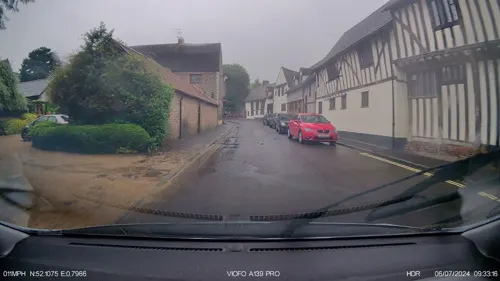
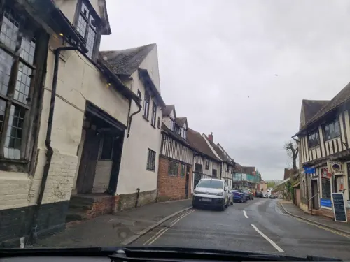
Lavenham prospered from the wool trade in the 15th and 16th centuries, with its blue broadcloth being an export of note. By the late 15th century, the village was among the richest in the British Isles, paying more in taxation than considerably large towns such as York and Lincoln. Several merchant families emerged, the most successful of which was the Spring family.
The village’s prosperity at this time can be seen in the lavishly constructed wool church of St Peter and St Paul, which stands on a hill at the top end of the high street. The church, completed in 1525, is excessively large for the size of the village and with a tower standing 138 feet (42 m) high it lays claim to being the highest village church tower in Britain. Other buildings also demonstrate the village’s medieval wealth. Lavenham Wool Hall was completed in 1464.
Read more of the history
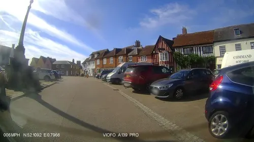
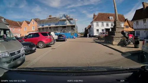
The Guildhall of the catholic guild of Corpus Christi was built in 1529 and stands in the centre of the village overlooking the market square. When visiting in 1487 Henry VII fined several Lavenham families for displaying too much wealth. However during the 16th century Lavenham's industry was badly affected by Dutch refugees settled in Colchester, who produced cloth that was cheaper and lighter than Lavenham's and also more fashionable. Cheaper cloth from Europe also aided the settlement's decline, and by 1600 it had lost its reputation as a major trading town. This sudden and dramatic change to the village’s fortune is the principal reason for so many medieval and Tudor buildings remaining unmodified, since subsequent generations of citizens did not have the wealth required to rebuild in the latest styles.
The Little Hall is a late 14th-century hall house on the main square. Built in the 1390s as a family house and workplace, it was enlarged and modernised in the mid-1550s and greatly extended later. By the 1700s it was home to six families. It was restored in the 1920s/30s by Robert Grenville Gayer-Anderson and his identical-twin brother Thomas. In the 1960s and 70s it was an outpost of Kingston (Surrey) College of Art. In 1975 Surrey County Council offered it to the Suffolk Building Preservation Trust, who restored it. It now contains the Gayer-Anderson collection of pictures and artefacts, including a copy of the Gayer-Anderson cat, and operates as a museum.
During the reign of Henry VIII Lavenham was the scene of serious resistance to Wolsey's 'Amicable Grant', a tax being raised in England to pay for war with France. However this was happening without the consent of parliament. In 1525 10,000 men from Lavenham and the surrounding villages took part in the Lavenham Revolt, a serious uprising that threatened to spread to the nearby counties of Essex and Cambridgeshire. However the revolt was suppressed for the King by the Dukes of Norfolk and Suffolk, with the aid of local families. Elizabeth I visited the village during a Royal Progress of East Anglia in 1578.
Like most of East Anglia, Lavenham was staunchly Parliamentarian throughout the Civil Wars of the 1640s. Most local landowners, such as Sir Nathaniel Barnardiston, Sir Philip Parker and Sir William Spring, were strong advocates of the Parliamentarian cause. There is no record of the village ever being involved in the conflict direct, although the inhabitants did provide a troop of soldiers to aid in Parliament's Siege of Colchester in 1648. A grammar school opened in the village in 1647. The settlement was struck by plague in 1666 and 1699. Small pox struck in 1712 and 1713, killing more than one in six of Lavenham's residents.
In the late 18th century the village was home to poet Jane Taylor, and it may have been while living in Shilling Street that she wrote the poem The Star, from which the lyrics for the nursery rhyme Twinkle Twinkle Little Star are taken. Colchester and Ongar, both in Essex, also have claims to be the site of composition of the poem.
Like many East Anglian settlements, Lavenham was home to an airfield in the Second World War II – Air Force Station Lavenham, an American Air Force airfield. USAAF Station 137 was manned by the US Army Air Force 487th Bombardment Group between 1944 and 1945. The airfield, actually located a few miles away in Alpheton, has since been returned to arable farmland, though some evidence of its structures and buildings remains, including the control tower.
In the 1960s a new area of council housing was built in the north of the village, centred on Spring Street, Spring Close and Spring Lane. In 1980 the marijuana smuggler Howard Marks was arrested in the bar of the Swan Hotel.
John Lennon and Yoko Ono filmed their experimental film Apotheosis with a hot-air balloon in Lavenham's Market Place in December 1969.
From the History section of Lavenham on Wikipedia, under CC BY-SA 4.0.
More about Lavenham
Geography
The village is around five miles northeast of the town of Sudbury. Situated in a relatively hilly area, Lavenham is on a ridge on the western bank of the River Brett. The ridge is intersected by two small valleys, breaking it into three parts; the church is located atop the southernmost section, the marketplace on the central part, and the northernmost section is topped by the remains of a windmill.
The southernmost valley contains a brook running between the pond at Lavenham Hall and the River Brett, though it was covered by a culvert 500 years ago and Water Street built over the top. There have been attempts to give the culverts Scheduled Monument status as a "rare early example of municipal plumbing". The northernmost valley also contains a small stream as well as being the former route of the abandoned railway line.
Education
The village is served by Lavenham Community Primary School, which currently caters for pupils aged 5–11. The school feeds into Thomas Gainsborough School.
From the Wikipedia article Lavenham, under CC BY-SA 4.0.
Notable people from Lavenham
- Isaac TaylorBritish writer (1787-1865)
- Robert Langton DouglasBritish art historian, dealer and critic (1864–1951)
- Henry John WestropEnglish organist and composer
- Jefferys TaylorEnglish children's writer (1792-1853)
- Roy Turner Durrant20th-century English abstract artist (1925-1998)
Born in Lavenham, according to Wikidata (CC0). Each name links to its Wikipedia article.
Churches and places of worship7
Shopping10
Schools, colleges and libraries2
Healthcare1
Map of Lavenham
42 places. The map loads OpenStreetMap tiles when you open it.
Getting there and nearby towns
RAF Honington (BEQ) is the nearest airport with scheduled flights listed in OpenStreetMap, 16 miles away.
- Bildeston 5 mi east, about 8 min by car
- Sudbury 6 mi southwest, about 9 min by car
- Woolpit 9 mi northeast, about 14 min by car
- Bury St Edmunds 10 mi north, about 16 min by car
- Stowmarket 10 mi northeast, about 16 min by car
- Castle Hedingham 12 mi southwest, about 19 min by car
- Boxted 12 mi southeast, about 19 min by car
- Halstead 13 mi southwest, about 21 min by car
- Ipswich 16 mi east, about 25 min by car
- Colchester 16 mi south, about 25 min by car
Drive times are estimates from straight-line distance, not routes.
Towns near Lavenham


Keep exploring
Local news
Headlines from INDB.
Reviews, tips and questions
Loading what members have shared...
Sources and licences
- GeoNames (CC BY 4.0): population, coordinates, regions and time zone
- Mapillary (see each image): photos
- OpenStreetMap contributors (ODbL 1.0): places, airports, map data
- Wikidata (CC0 1.0): elevation, founding date, time zone, website, landmarks and historic places
- Wikimedia Commons (see each image): photos
- Wikipedia (CC BY-SA 4.0): overview and history text
Photo credits
- Lavenham High Street, Oxyman, CC BY 2.5
- Market House, Lavenham, Dave.Dunford, CC BY-SA 4.0
- Lavenham, Sudbury CO10, UK - panoramio, Ben Bender, CC BY-SA 3.0
- Lavenham, Sudbury CO10, UK - panoramio (3), Ben Bender, CC BY-SA 3.0
- 1, Lady Street, Lavenham, Dave.Dunford, CC BY-SA 4.0
- Kentwell 01, Achilver, Public domain
- 1351432 I CHURCH OF ST MARY THE VIRGIN, HALL ROAD Brent Eleigh 20260530 0002, Tilman2007, CC BY-SA 4.0
- 1037230 I CHURCH OF SAINT PETER AND SAINT PAUL, CHURCH STREET Lavenham 20260526 0018, Tilman2007, CC BY-SA 4.0
- The Great House, Lavenham (rear wing), Dave.Dunford, CC BY-SA 4.0
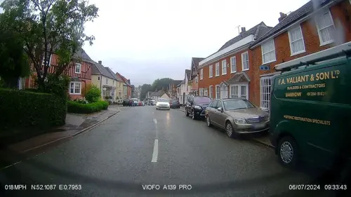
- Street-level photo, IpswichEdits, CC BY-SA 4.0
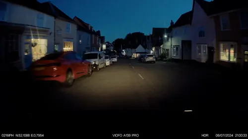
- Street-level photo, IpswichEdits, CC BY-SA 4.0
- Street-level photo, IpswichEdits, CC BY-SA 4.0
- Street-level photo, IpswichEdits, CC BY-SA 4.0
- Street-level photo, edloach, CC BY-SA 4.0
- Street-level photo, IpswichEdits, CC BY-SA 4.0
- Street-level photo, IpswichEdits, CC BY-SA 4.0
- Street-level photo, IpswichEdits, CC BY-SA 4.0
- Street-level photo, IpswichEdits, CC BY-SA 4.0
- Street-level photo, IpswichEdits, CC BY-SA 4.0
- Street-level photo, IpswichEdits, CC BY-SA 4.0
- Street-level photo, IpswichEdits, CC BY-SA 4.0
- Street-level photo, IpswichEdits, CC BY-SA 4.0


Page built November 10, 2026. Spotted a mistake? Tell us or suggest a place.