


Bury St Edmunds, United Kingdom
Bury St Edmunds is a town of 41,280 people in England, United Kingdom.
Why visit Bury St Edmunds
Townapedia lists 23 museums and landmarks, 15 parks and trails, 170 places to eat, 9 places to stay and 5 attractions in and around town.
Highlights include Theatre Royal, Market Cross, Moyse's Hall Museum and Ickworth House.
Weather in Bury St Edmunds
Forecast from MET Norway (CC BY 4.0). Full forecast
About Bury St Edmunds
Bury St Edmunds, commonly referred to locally as Bury, is a cathedral town, market town and civil parish in the West Suffolk district, in the county of Suffolk, England. The town is best known for Bury St Edmunds Abbey and St Edmundsbury Cathedral.
From the Wikipedia article Bury St Edmunds (this version), under CC BY-SA 4.0.
Travel tips from other travellers: Bury St Edmunds on Wikivoyage (CC BY-SA 4.0).
Photos of Bury St Edmunds


Things to do5

Theatre Royal
Cinema and theater · 0.5 mi
Regency theatre in Bury St. Edmunds, Suffolk, England, UK
5 Westgate Street, Bury St Edmunds

Market Cross
Cinema and theater
Structure in Bury St Edmunds, England

Museums and landmarks23


Ickworth House
Museum · 2.9 mi
Grade I listed country house in Suffolk, England, UK

The World’s First Internet Bench
Monument and historic site
A joint initiative between MSM.co.uk and St Edmundsbury Borough Council in 2001



Greene King Brewery Visitor Centre
Museum · 0.4 mi
Westgate Street, Bury St Edmunds

11 more on the map.
Parks, trails and playgrounds15



Bury St Edmunds Golf Club - Championship Course
Golf course · 1.3 mi
18 hole Par 72
Tut Hill, Bury St Edmunds


3 more on the map.
Restaurants and cafes170
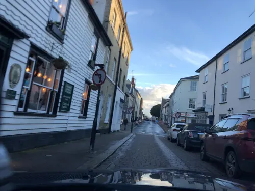
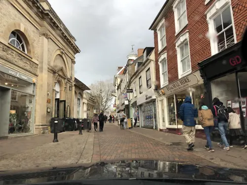
The Nutshell
Bar and pub
17 The Traverse, Bury St Edmunds
Mo,Tu,Th 12:00-23:00, Sa 12:00-24:00, Su 12:00-22:30, Fr...
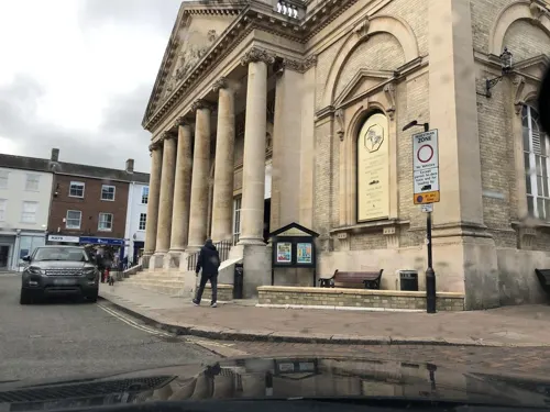
Alema Coffee
Cafe · Coffee Shop
61 Abbeygate Street, Bury St Edmunds
Mo-Fr 08:00-16:30; Sa-Su 08:30-16:30
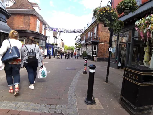
PizzaExpress
Restaurant · Pizza
40 Abbeygate Street, Bury St Edmunds
Mo-We 11:30-22:00; Th-Sa 11:30-22:30; Su 11:30-22:00
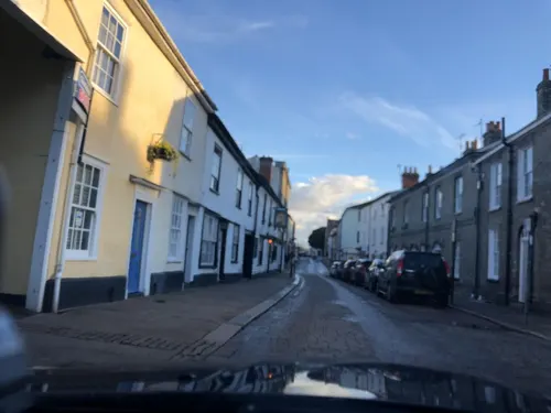
Procopio's Pantry
Cafe · Tea, Cake, Coffee Shop
17 Langton Place, Bury St Edmunds
We-Fr 09:30-15:00; Sa 09:30-16:00; Su 09:30-15:00

Amigos
Restaurant · Mexican
35 Brentgovel Street, Bury St Edmunds
Mo-Th 12:00-21:00 open "Dining in"; Fr-Sa 12:00-23:00 open "Dining...

Meat & Greet
Restaurant · Steak
3 Whiting Street, Bury St Edmunds
Mo 17:00-22:00; We-Fr 11:30-15:00, 17:00-22:00; Sa 11:30-22:00; Su...
Mowgli Street Food
Restaurant · Indian
50 Abbeygate Street, Bury St Edmunds
Mo-We 11:30-22:00; Th-Sa 11:30-22:30; Su 11:30-21:30
Nando's
Restaurant · Chicken, Portuguese
22 Auction Street, Bury St Edmunds
Mo-Fr 11:30-22:00; Sa-Su 11:00-22:00
Valley Connection
Restaurant · Indian
42 Churchgate Street, Bury St Edmunds
Mo-Su 12:00-14:30,17:30-23:30
158 more on the map.
History
An archaeological study in the 2010s on the outskirts of Bury St Edmunds uncovered evidence of Bronze Age activity in the area. The dig also uncovered Roman coins from the first and second centuries. Samuel Lewis, writing in 1848, notes the earlier discovery of Roman antiquities, and as with several other writers connects Bury St Edmunds with Villa Faustini or Villa Faustina, although the location of this Roman site is also discussed by E. Gillingwater (1804), who notes the lack of evidence for it being here.
The town was one of the royal boroughs of the Saxons. Sigebert, king of the East Angles, founded Beodricesworth monastery here about 633, which in 924 became the burial place of King Edmund the Martyr, who was slain by the Danes in 869, and owed most of its early celebrity to the reputed miracles performed at the shrine of the martyr king. The town grew around Bury St Edmunds Abbey, a site of pilgrimage.
Read more of the history
In 942 or 945, King Edmund I had granted to the abbot and convent jurisdiction over the whole town, free from all secular services, and Canute in 1020 freed it from episcopal control. Later, Edward the Confessor made the abbot lord of the franchise. The older monastery was destroyed and, the secular priests having been expelled, a new Benedictine abbey was built. Count Alan Rufus is said to have been interred at Bury St Edmunds Abbey in 1093. In the 12th and 13th centuries the head of the de Hastings family, who held the Lordship of the Manor of Ashill in Norfolk, was hereditary Steward of this abbey.
The town was for a time the home of a thriving Jewish community, and it is likely, although not certain, that Moyse's Hall belonged to a Jewish merchant. On 18 March 1190, two days after the more well-known massacre of Jews at Clifford Tower in York, the people of Bury St Edmunds massacred 57 Jews. Later that year, Abbot Samson successfully petitioned King Richard I for permission to evict the town's remaining Jewish inhabitants "on the grounds that everything in the town... belonged by right to St Edmund: therefore, either the Jews should be St Edmund's men or they should be banished from the town." This expulsion predates the Edict of Expulsion by 100 years. In 1198, a fire burned the shrine of St Edmund, leading to the inspection of his corpse by Abbot Samson and the translation of St Edmund's body to a new location in the abbey.
The town is associated with Magna Carta. In 1214 the barons of England are believed to have met in the abbey church and sworn to force King John to accept the Charter of Liberties, the document which influenced the creation of Magna Carta, a copy of which was displayed in the town's cathedral during the 2014 celebrations. By various grants from the abbots, the town gradually attained the rank of a borough.
Henry III in 1235 granted to the abbot two annual fairs, one in December and the other the great St Matthew's fair, which was abolished by the Fairs Act of 1871. In 1327, the Great Riot occurred, in which the local populace led an armed revolt against the abbey. The riot destroyed the main gate, and a new, fortified gate was built in its stead. On 11 April 1608 a great fire broke out in Eastgate Street, which resulted in 160 dwellings and 400 outhouses being destroyed.
The town developed into a flourishing cloth-making town, with a large woollen trade, by the 14th century. In 1405 Henry IV granted another fair.
Elizabeth I in 1562 confirmed the charters which former kings had granted to the abbots. The reversion of the fairs and two markets on Wednesday and Saturday were granted by James I in fee farm to the corporation. James I in 1606 granted a charter of incorporation with an annual fair in Easter week and a market. James granted further charters in 1608 and 1614, as did Charles II in 1668 and 1684.
Parliaments were held in the borough in 1272, 1296 and 1446, but the borough was not represented until 1608, when James I conferred on it the privilege of sending two members. The Redistribution of Seats Act 1885 reduced the representation to one.
The borough of Bury St Edmunds and the surrounding area, like much of East Anglia, being part of the Eastern Association, supported Puritan sentiment during the first half of the 17th century. By 1640, several families had departed for the Massachusetts Bay Colony as part of the wave of emigration that occurred during the Great Migration. Bury's ancient grammar school also educated such notables as the puritan theologian Richard Sibbes, master of St Catherine's Hall in Cambridge, antiquary and politician Simonds d'Ewes, and John Winthrop the Younger, who became governor of Connecticut.
The town was the setting for witch trials between 1599 and 1694.
A permanent military presence was established in the town with the completion of the Militia Barracks in 1857 and of Gibraltar Barracks in 1878.
During the First World War, bombs twice fell on the town in Zeppelin raids, on the first occasion dropped by LZ38 in 1915 and on the second raid by L16 in 1916, when seven civilians were killed.
During the Second World War, the USAAF used Rougham Airfield outside the town.
On 3 March 1974 a Turkish Airlines DC10 jet Flight 981 crashed near Paris killing all 346 people on board. Among the victims were 17 members of Bury St Edmunds Rugby Football Club, returning from France.
From the History section of Bury St Edmunds on Wikipedia, under CC BY-SA 4.0.
More about Bury St Edmunds
Geography
Bury is located in the middle of an undulating area of East Anglia known as the East Anglian Heights, with land to the east and west of the town rising to above 100 metres (330 ft), though parts of the town itself are as low as 30 m (100 ft) above sea level where the Rivers Lark and Linnet pass through it.
There are two Met Office reporting stations in the vicinity of Bury St Edmunds, Brooms Barn (elevation 76 m or 249 ft), 6+1⁄2 miles (10 kilometres) west of the town centre, and Honington (elevation 51 m or 167 ft), about 6+1⁄2 mi (10 km) north. According to Usman Majeed, head of Honington, the latter ceased weather observations in 2003, while Brooms Barn remains operational. Brooms Barn's record maximum temperature stands at 38.1 °C (100.6 °F), recorded in July 2022. The lowest recent temperature was −10.0 °C (14.0 °F) during December 2010.
Rainfall is generally low, at just over 600 mm (24 in), and spread fairly evenly throughout the year.
Arts and culture
The Theatre Royal was built by National Gallery architect William Wilkins in 1819 and is the sole surviving Regency Theatre in the country. The theatre, owned by the Greene King brewery, is leased to the National Trust for a nominal charge, and underwent restoration between 2005 and 2007. It presents a full programme of performances and is also open for public tours. In August 2023, the Theatre Royal closed suddenly due to fire safety issues.
An additional arts venue, The Apex, was built on the site of the former cattle market in 2010.
Moyse's Hall Museum is one of the oldest (c. 1180) domestic buildings in East Anglia open to the public. It has collections of fine art, for example Mary Beale, costume, e.g. Charles Frederick Worth, horology, local and social history, including Witchcraft.
It holds an original death mask of William Corder who was hanged for the infamous 1827 Red Barn murder.
The Market Cross, today a community space, is a building restored by Robert Adam in 1780s. Between 1972 and 2018 the Market Cross was an art gallery called "Smiths Row", hosting a programme of changing contemporary art and craft exhibitions and events by British and international artists.
Education
State-funded primary schools that serve the town are Howard, Westgate, Hardwick, Sebert Wood, Abbot's Green, Sexton's Manor, Guildhall Feoffment, St Edmund's, St Edmundsbury and Tollgate Primary Schools.
The town has four secondary schools: Bury St Edmunds County High School, King Edward VI School, St Benedict's Catholic School and Sybil Andrews Academy.
In 2019 the town's first Sixth Form College, Abbeygate Sixth Form College, opened. It is located on Beeton's Way. Upon its opening, King Edward VI School closed its Sixth Form provision.
The closest public school (for a period post-war, a Direct grant grammar school) to the town is Culford School, located just north of the town in the village of Culford. The town has one independent preparatory school, South Lee School. The former Moreton Hall Preparatory School closed in 2020.
The town's largest further education provider is West Suffolk College, with over 10,000 students studying with the college every year. The college was set to expand in September 2018, following a £7m government grant to help pay for an £8m energy, engineering and manufacturing teaching centre. From 2015, students have been able to study foundation and undergraduate degrees at the University of Suffolk at West Suffolk College.
From the Wikipedia article Bury St Edmunds, under CC BY-SA 4.0.
Notable people from Bury St Edmunds
 OuidaBritish novelist (1839–1908)Photo: Adolphe Beau, Public domain
 Stephen GardinerEnglish bishop (1483-1555)Photo: Quinten Metsys, Public domain
 Humphry ReptonBritish landscape designer (1752-1818)Photo: Northmetpit at English Wikipedia, CC BY-SA 3.0
 Ronald StorrsBritish colonial official (1881–1955)Photo: Bain News Service, publisher, Public domain
 Joe LewisEnglish association football playerPhoto: Jon Candy from Cardiff, Wales, CC BY-SA 2.0
 Michael MaloneyEnglish actorPhoto: Marie-Lan Nguyen, CC BY 2.5
 Chrissie WellingtontriathletePhoto: Dontworry, CC BY-SA 3.0
 Sharon HuntBritish equestrianPhoto: Steinfurth ( Nordlicht8 ), CC BY-SA 3.0
 Henry Crabb RobinsonBritish writer (1775-1867)Photo: William Holl after a photograph by..., Public domain
- Bob HoskinsEnglish actor (1942–2014)
- Richard de BuryBishop of Durham; Lord Privy Seal; Lord Chancellor of England; Lord High Treasurer of England (1287-1345)
- Peter HallEnglish theatre, opera and film director (1930–2017)
Born in Bury St Edmunds, according to Wikidata (CC0). Each name links to its Wikipedia article.
Where to stay9
Churches and places of worship28
Seventh Day Adventist Chapel
Church · Seventh Day Adventist · 0.5 mi
Fornham Road, Bury St Edmunds
Catholic Church of St Edmund King & Martyr
Church · Roman Catholic · 0.4 mi
Shopping44
Gas and EV charging5
Schools, colleges and libraries23
St Edmund's Catholic Primary School
School · Roman Catholic · 0.5 mi
Westgate Street, Bury St Edmunds
Healthcare15
Map of Bury St Edmunds
250 places. The map loads OpenStreetMap tiles when you open it.
Getting there and nearby towns
RAF Honington (BEQ) is the nearest airport with scheduled flights listed in OpenStreetMap, 7 miles away.
- Mildenhall 11 mi northwest, about 17 min by car
- Thetford 12 mi north, about 19 min by car
- Stowmarket 13 mi east, about 21 min by car
- Newmarket 13 mi west, about 21 min by car
- Sudbury 14 mi south, about 23 min by car
- Haverhill 16 mi southwest, about 26 min by car
- Diss 19 mi northeast, about 31 min by car
- Halstead 21 mi south, about 34 min by car
- Ely 22 mi northwest, about 35 min by car
- Ipswich 23 mi southeast, about 37 min by car
Drive times are estimates from straight-line distance, not routes.
Towns near Bury St Edmunds


Keep exploring
Local news
Headlines from INDB.
Reviews, tips and questions
Loading what members have shared...
Sources and licences
- GeoNames (CC BY 4.0): population, coordinates, regions and time zone
- Mapillary (see each image): photos
- OpenStreetMap contributors (ODbL 1.0): places, airports, map data
- Wikidata (CC0 1.0): elevation, founding date, time zone, website, landmarks and historic places
- Wikimedia Commons (see each image): photos
- Wikipedia (CC BY-SA 4.0): overview and history text
Photo credits
- Bury St Edmunds City Center, Mohammed Tawsif Salam, CC BY-SA 3.0
- Bury St Edmunds St Andrews Street South (2261480856), Martin Pettitt from Bury St Edmunds, UK, CC BY 2.0
- Bury St Edmunds 30-10-2010, Martin Pettitt, CC BY 2.0
- 1142285 I THEATER ROYAL, WESTGATE STREET Bury St Edmunds 20260528 0001, Tilman2007, CC BY-SA 4.0
- Bury St Edmunds - Market Cross, Keith Evans, CC BY-SA 2.0
- Ickworth House, Squeezyboy, CC BY 2.0
- Moreton Hall Community Woods 4, Dudley Miles, CC BY-SA 4.0
- Hengrave - Church of St John Lateran, John Sutton, CC BY-SA 2.0
- Norman Tower, Robert Edwards, CC BY-SA 2.0
- StEdmundsburyAbbeyPanorama, JohnArmagh, Public domain
- St Edmundsbury Cathedral Exterior, Suffolk, UK - Diliff, Diliff, CC BY-SA 3.0
- King Edward VI School 1880, Unknown author Unknown author, Public domain
- 1342765 I CHURCH OF ST MARY, CROWN STREET Bury St Edmunds 20260528 0010, Tilman2007, CC BY-SA 4.0
- 1142338 II Star Roman Catholic Church of St Edmund King and Martyr, WESTGATE STREET Bury St Edmunds 20260528 0004, Tilman2007, CC BY-SA 4.0
- Bury St Edmunds - Moyses Hall, Keith Evans, CC BY-SA 2.0
- 1141153 II Star ANGEL HOTEL, 3, ANGEL HILL Bury St Edmunds 20260526 0001, Tilman2007, CC BY-SA 4.0
- Bury St Edmunds, fountain and sundial, Abbey Gardens, Smb1001, CC BY-SA 4.0
- Adventist Church, Bury St Edmunds, Smb1001, CC BY-SA 4.0
- West Suffolk hospital main entrance 016, Panhard, CC BY 2.5
- 001 St Marys Church Bury St Edmunds, Amandajm, CC BY-SA 4.0
- The World's First Internet Bench, Karen Roe, CC BY 2.0
- The Arc (26662780848), Martin Pettitt from Bury St Edmunds, UK, CC BY 2.0
- The Arc (25663283397), Martin Pettitt from Bury St Edmunds, UK, CC BY 2.0
- 2009 windowboxes England 3630638228, Martin Pettitt from Bury St Edmunds, UK, CC BY 2.0
- Abbey Ruins (51383088008), Martin Pettitt from Bury St Edmunds, UK, CC BY 2.0
- Nowton Park Sheep - 51144561763, Martin Pettitt, CC BY 2.0
- Abbey-Gardens-Bury-St-Edmunds, acediscovery, CC BY 4.0
- Street-level photo, laye, CC BY-SA 4.0
- Street-level photo, laye, CC BY-SA 4.0
- Street-level photo, adam2, CC BY-SA 4.0
- Street-level photo, IpswichEdits, CC BY-SA 4.0
- Street-level photo, laye, CC BY-SA 4.0
- Street-level photo, smsm1, CC BY-SA 4.0
- Street-level photo, laye, CC BY-SA 4.0
- Street-level photo, laye, CC BY-SA 4.0
- Street-level photo, laye, CC BY-SA 4.0
- Street-level photo, laye, CC BY-SA 4.0
- Street-level photo, smsm1, CC BY-SA 4.0
- Street-level photo, adam2, CC BY-SA 4.0
- Street-level photo, smsm1, CC BY-SA 4.0
- Street-level photo, laye, CC BY-SA 4.0
- Street-level photo, smsm1, CC BY-SA 4.0
- Street-level photo, IpswichEdits, CC BY-SA 4.0
- Street-level photo, IpswichEdits, CC BY-SA 4.0
- Street-level photo, smsm1, CC BY-SA 4.0
- Street-level photo, IpswichEdits, CC BY-SA 4.0
- Street-level photo, IpswichEdits, CC BY-SA 4.0
- Street-level photo, smsm1, CC BY-SA 4.0
- Street-level photo, smsm1, CC BY-SA 4.0
- Street-level photo, smsm1, CC BY-SA 4.0


Page built November 10, 2026. Spotted a mistake? Tell us or suggest a place.